
TR: San Luis (14,014') 5-28-2007
goldenboy, jcwhite, mtnbikerskierchick
After hitting Sunshine and Redcloud on Saturday and Handies on Sunday, we packed up our camp and headed down to Lake City to stay with jcwhite's grandparents who were visiting from Texas, staying in their family cabin. Things in Lake City were pretty slow with their season just starting. At least it wasn't as bad as when we came here in April and couldn't find a restaurant that was open!
The wake-up call was at 3 am on this Monday morning. We drove toward Creede, which took us about an hour from Lake City. We went over some amazing passes, but I was barely even awake to noticeWe arrived at Creede. still in the dark. But as we began taking a dirt road that goes up about 7 miles to the Equity Mine, the light of the day slowly brought us back to life.
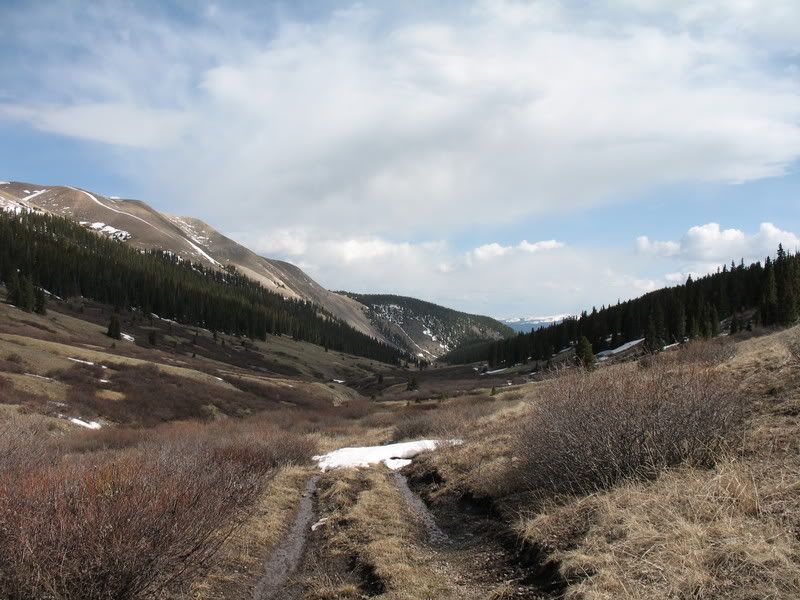
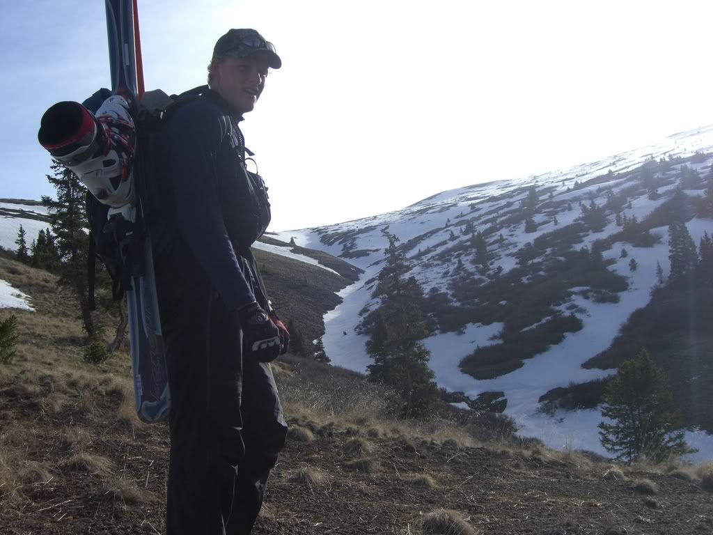
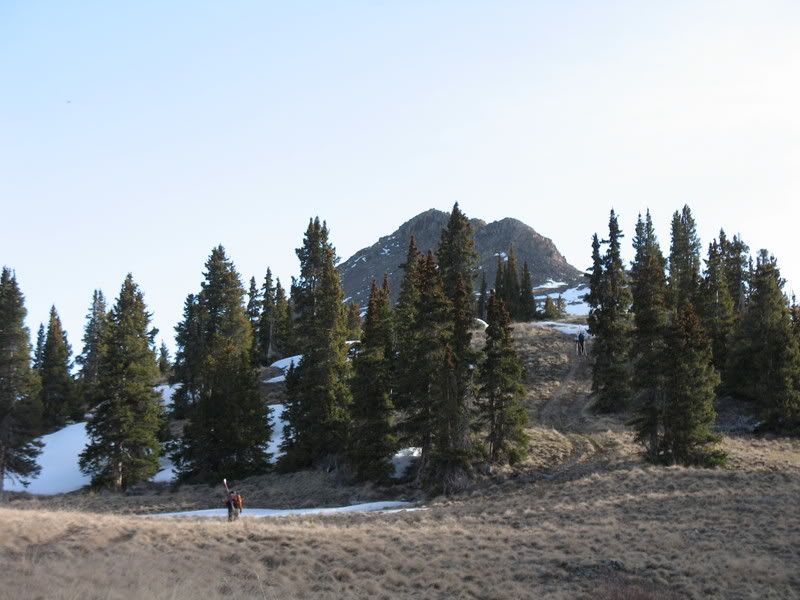
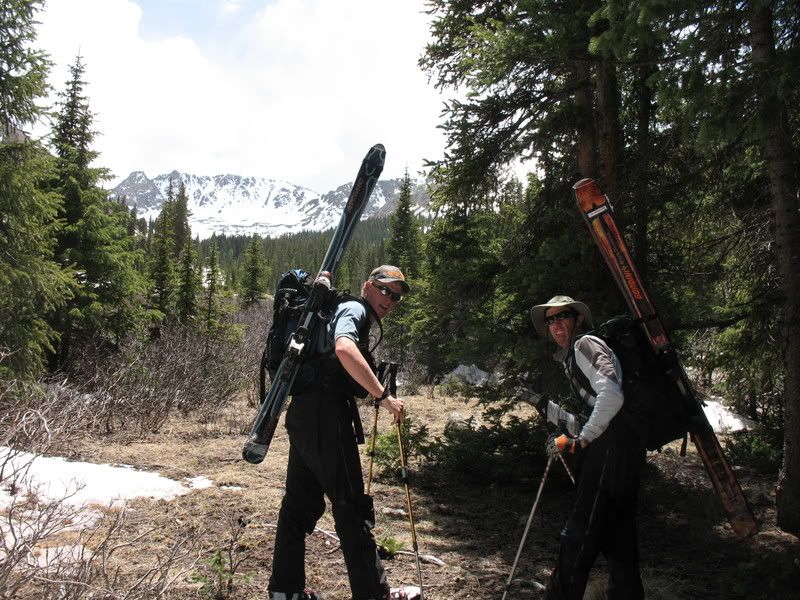
After messing around with our packs for awhile, we began hiking around 6:15 am. We followed the Willow Creek road north from the Equity Mine (at 11,090') for a couple of miles. When hiking through the willowed area of the valley I saw lots of evidence of moose. I didn't think that moose lived in the San Juans- I usually think about them being more north toward Fraser and Steamboat, but evidently they were reintroduced here. I think they are doing pretty well here as there were moose droppings and tracks everywhere.
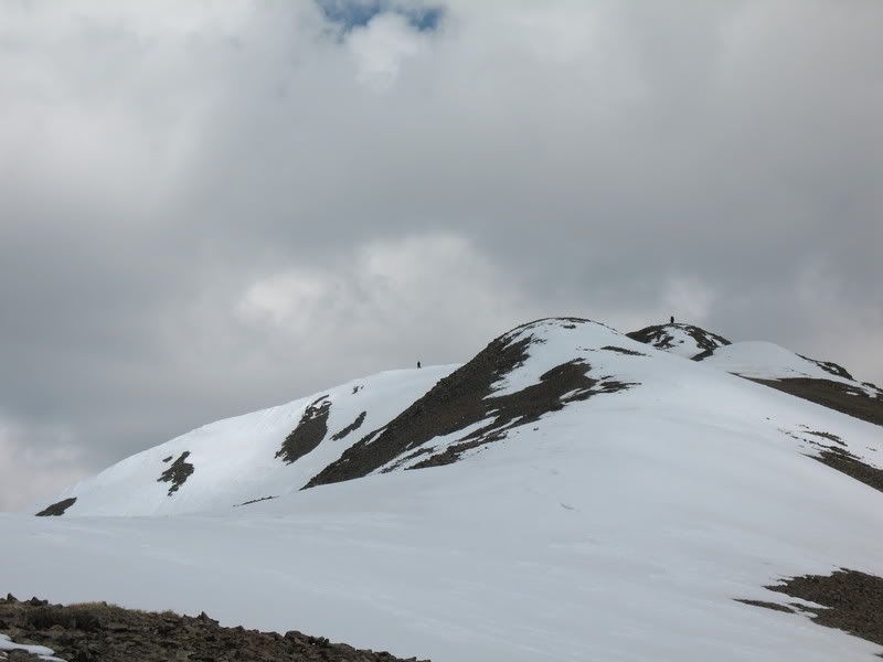
We then took a right turn NE heading toward a saddle
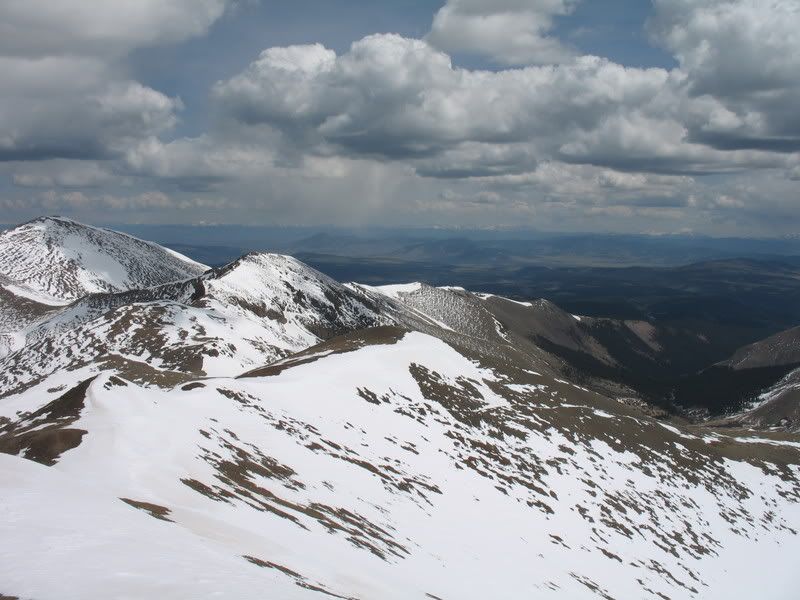
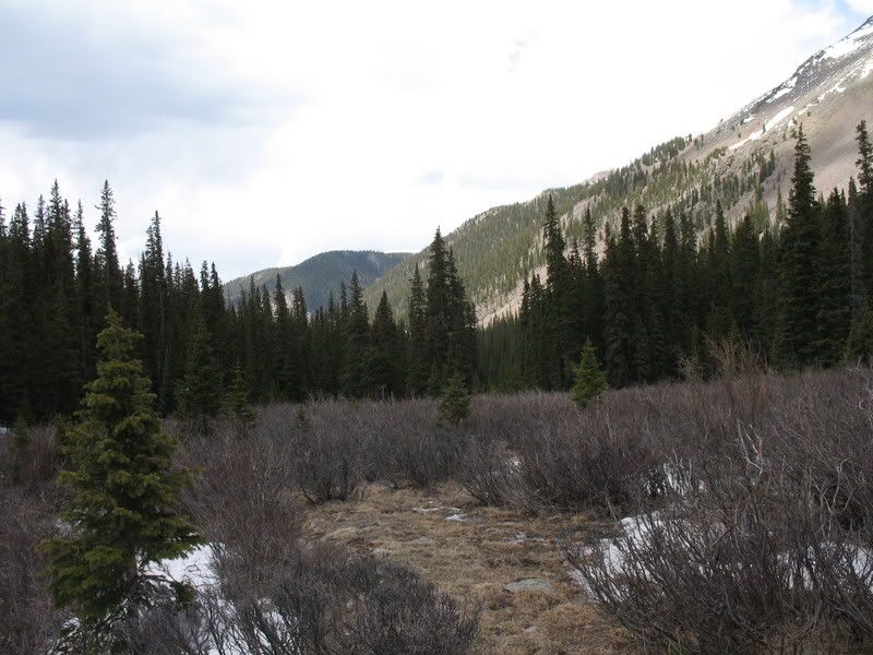
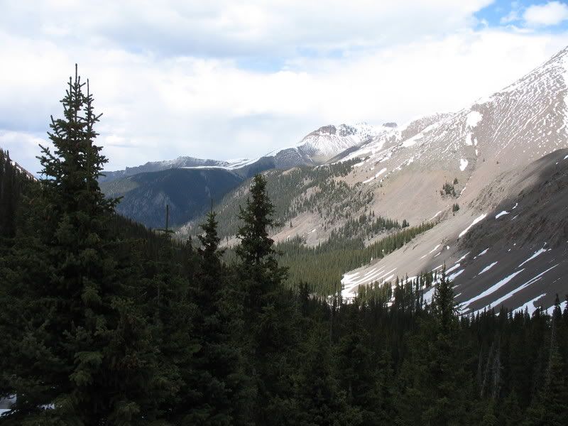
Looking back down at Willow Creek valley.
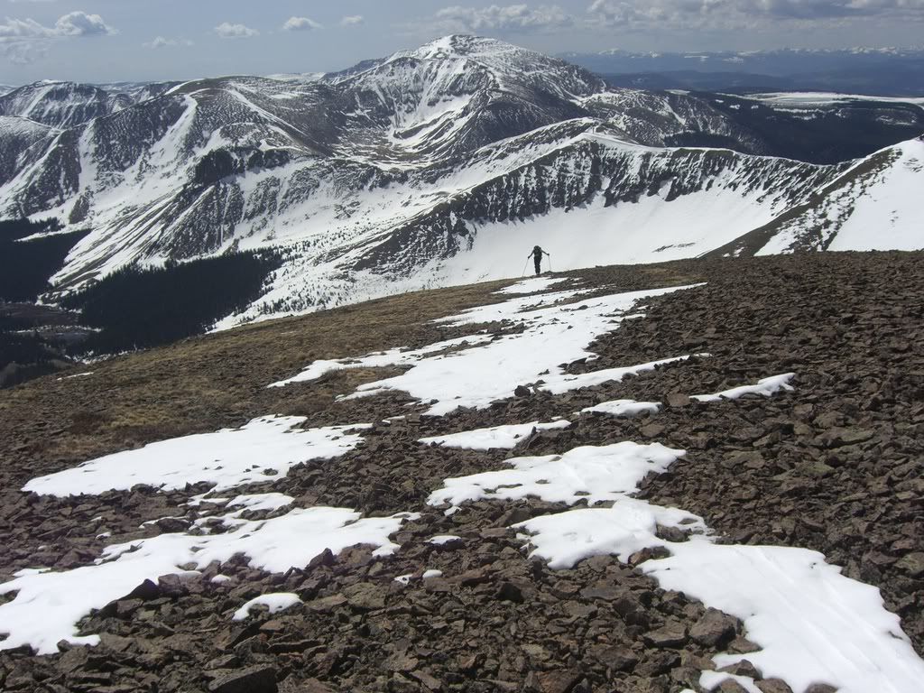
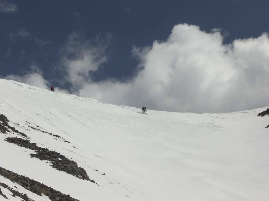
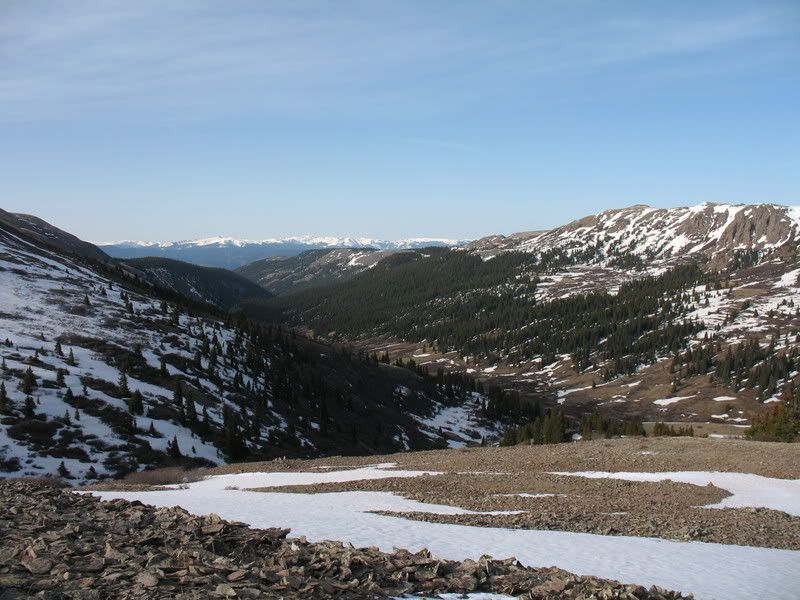
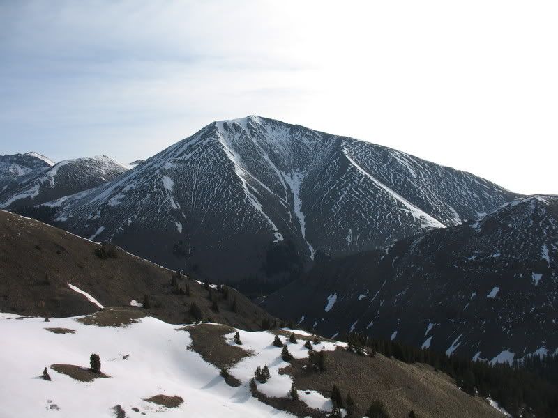
I was moving slow. I was so tired from too many mornings of waking up early, lack of sleep and being sick earlier in the week. Finally we reached the saddle at 12,300 ft. and got a good view of San Luis.
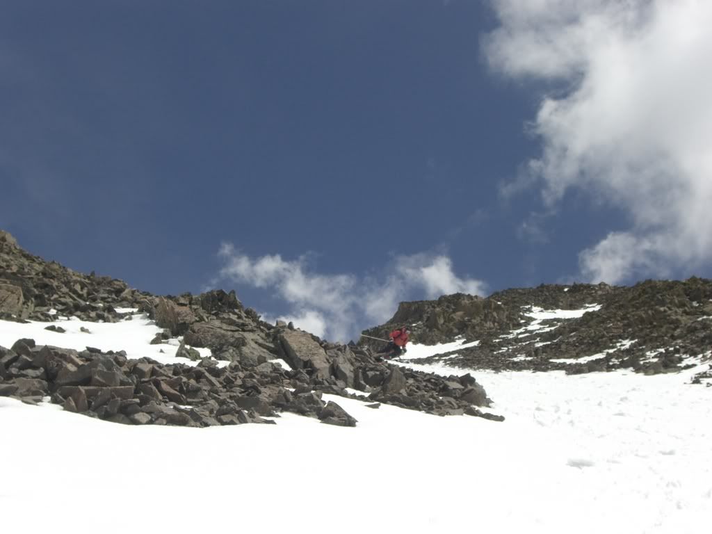
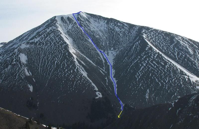
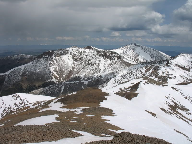
A closer look revealed that our intented line, the Yawner Gullies, were indeed filled with snow.
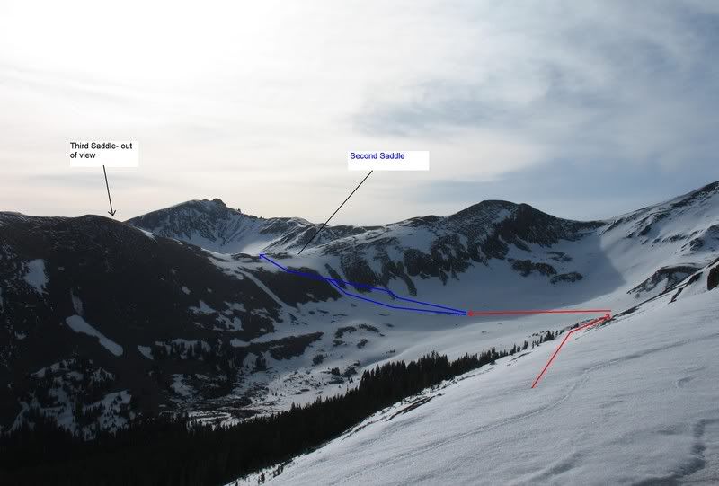
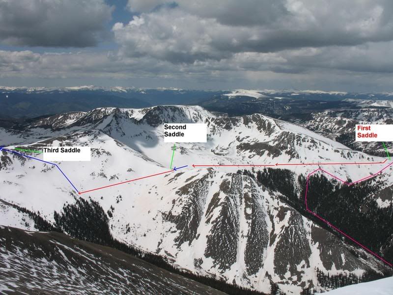
But closer look also revealed to what we were going to do to have to get there. We were going to have to traverse across the basin on skis, loosing some elevation, then work our way up to the second saddle at 12,400 ft. Then we would go down that saddle, traverse across the next basin to the third saddle at 12,600 ft. That saddle would bring us to the southern ridge of San Luis and we could follow that ridge to the summit.
I looked at goldenboy and said, "It's going to be a LONG day". Okay, time to wake up, I thought to myself!
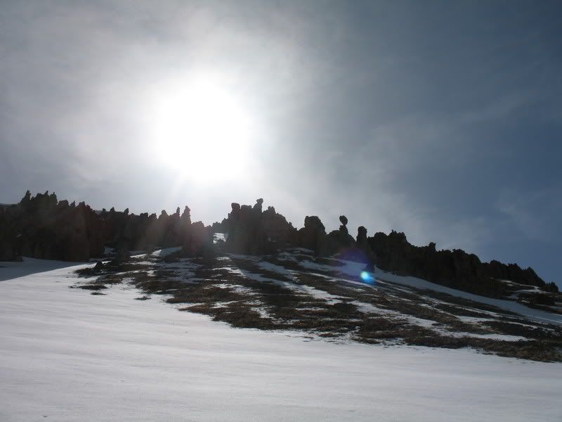
We put on our skis (we had hiking boots on before this point) dropped about 450 ft from the first saddle, boot packed up to the second saddle and dropped another 250 ft, and began skinning up to the 3rd saddle. There were some neat rock formations on the third saddle we admired on the way up.
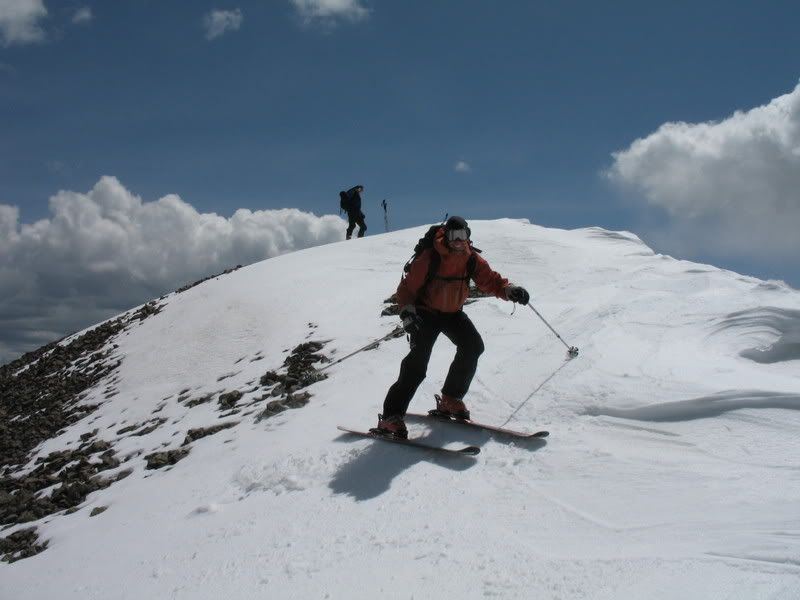
From there the route was pretty easy. We were able to skin the whole way along the ridge to the summit.
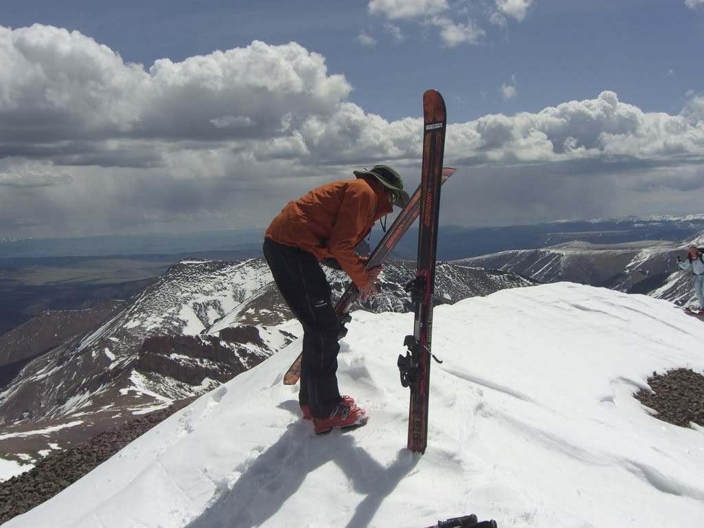
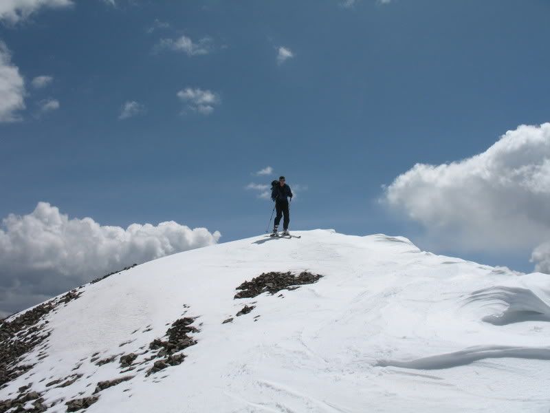
jcwhite and goldenboy at the summit.
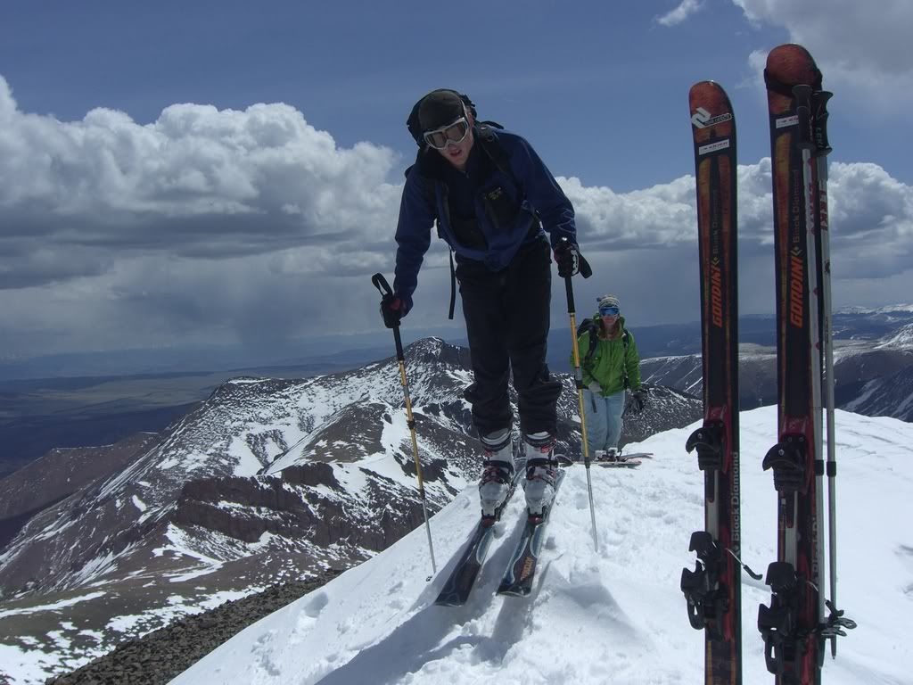
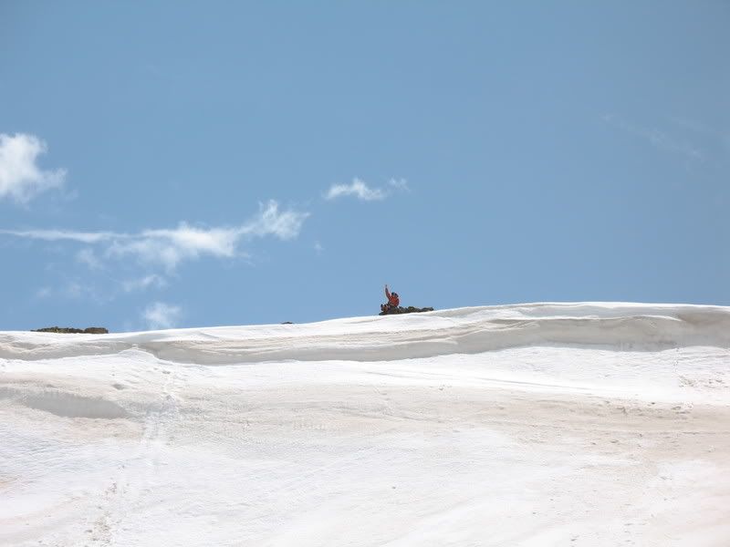
Yay, I'm close to the summit!
jcwhite summited around 10:45, goldenboy shortly after, and I summited around 11 am. Despite the length of the route, it only took us about 4.5 hours to reach the summit.
Looking back at the ridge we followed to the summit.
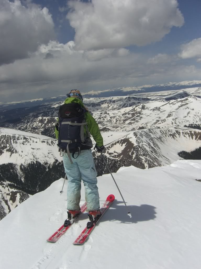
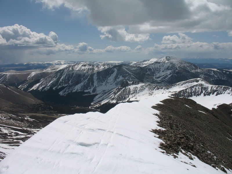
Uncompahgre and Wetterhorn
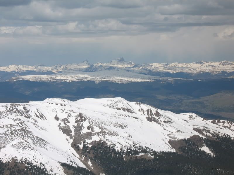
Looking east
Looking north
Looking west, back at our ascent route. Red lines show traverses done on skis. Blue shows climbing up either on skins or boot packing. Pink marks part of our eventual return route where we skinned back up to the first saddle.
We could see clouds moving in. While they didn't seem like they would bring thunder or lightning, we did think they might bring rain. So we hurried off the summit.
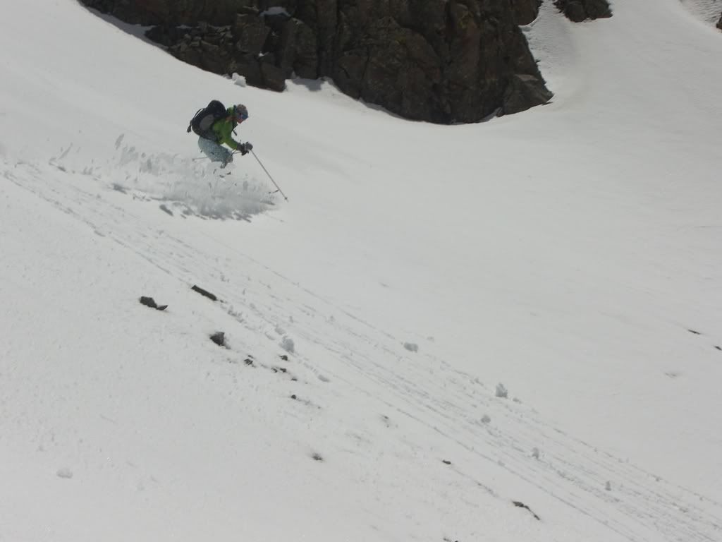
goldenboy acting like a gaper off the summit
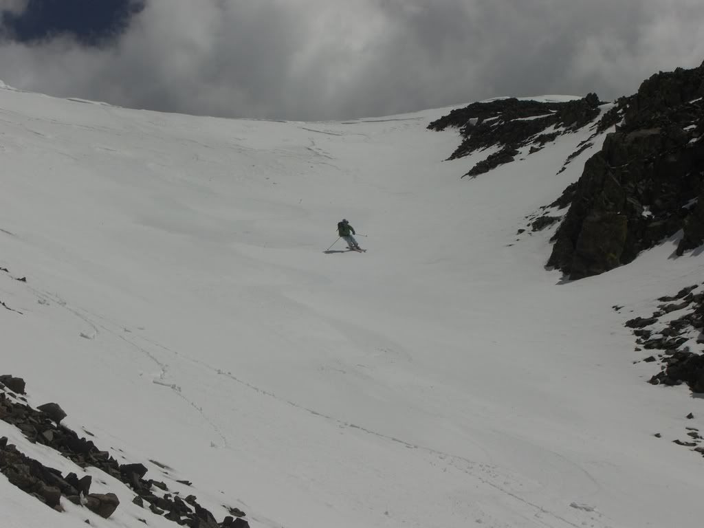
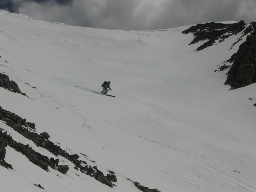
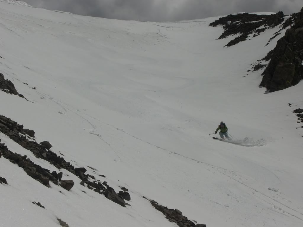
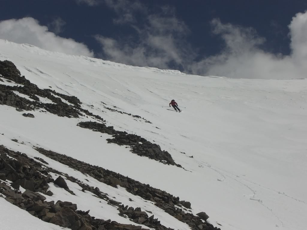
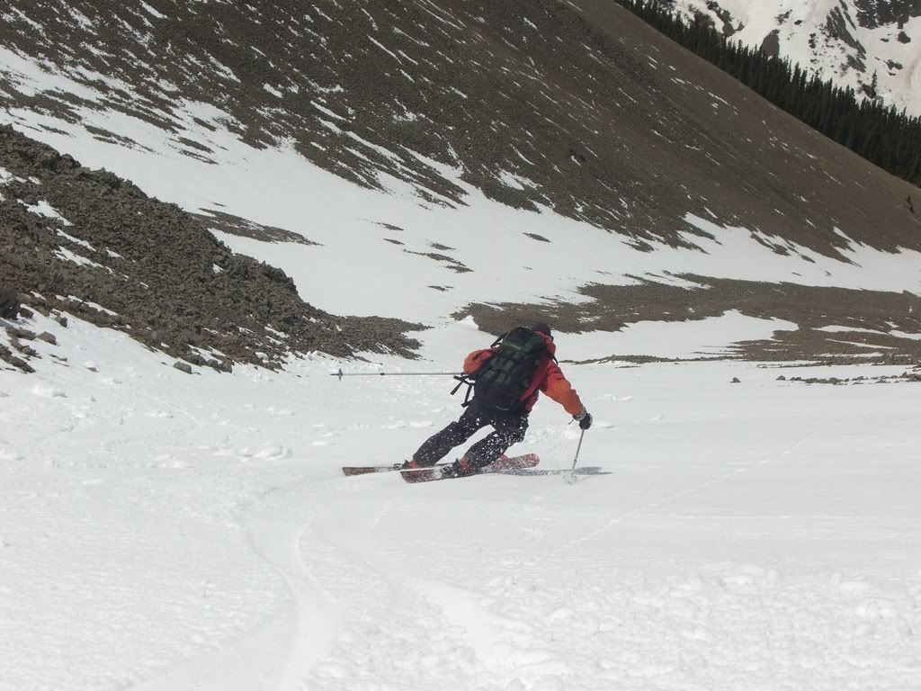
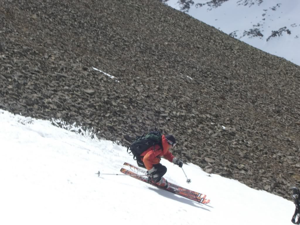
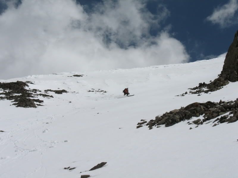
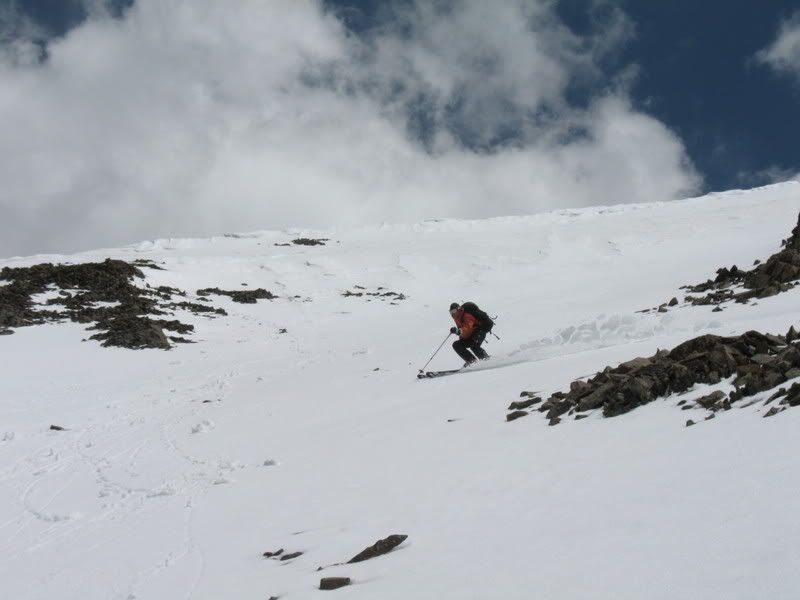
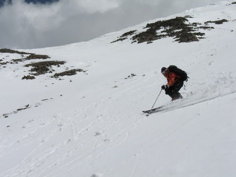
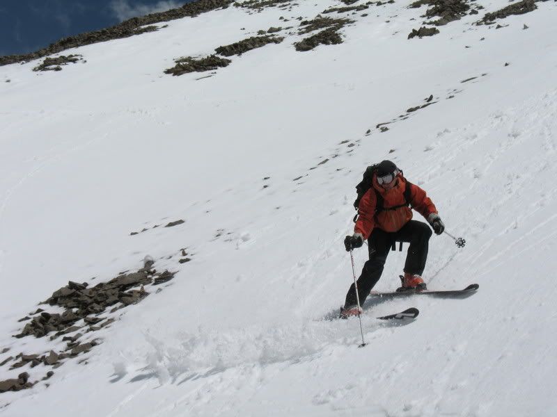
jcwhite skiing off the summit
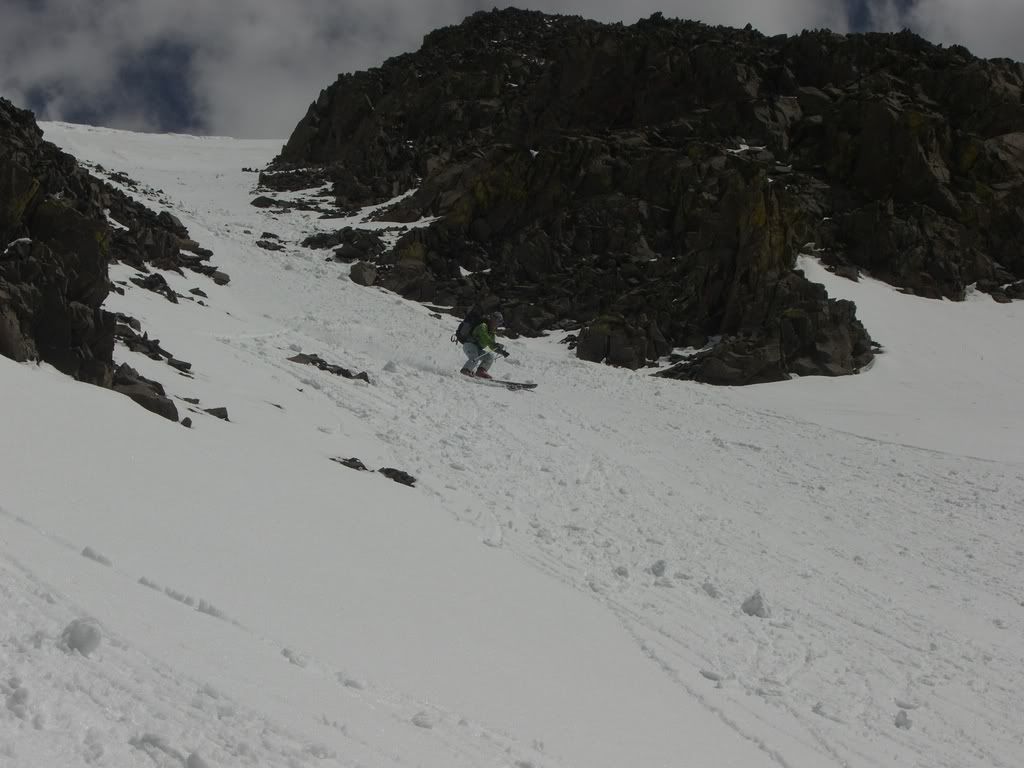
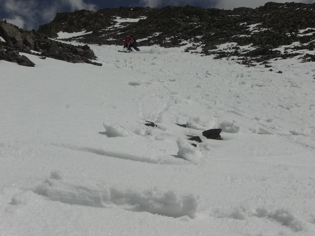
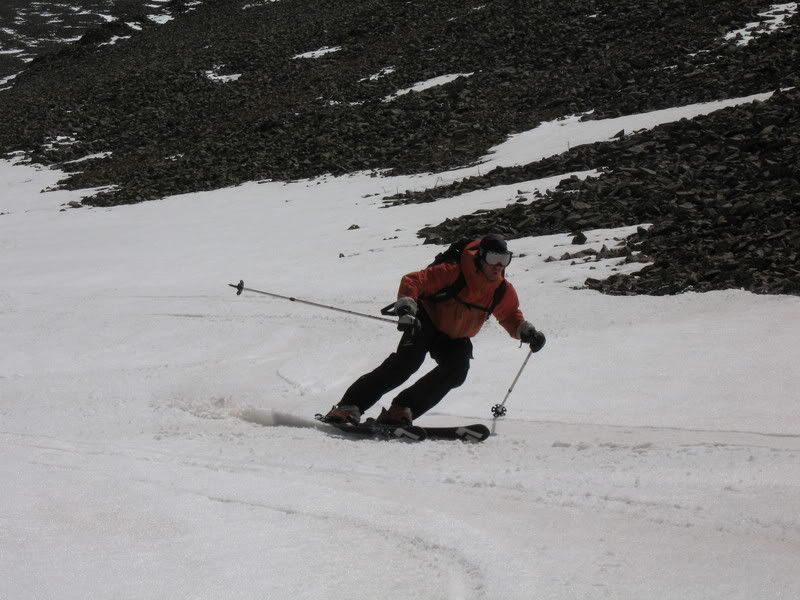
goldenboy shreds it down the Yawner Gully
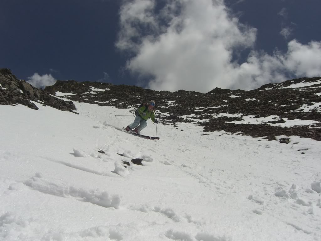
I wish I had more pics of jcwhite, but I seemed to have contracted goldenboy's disease for taking blurry pictures
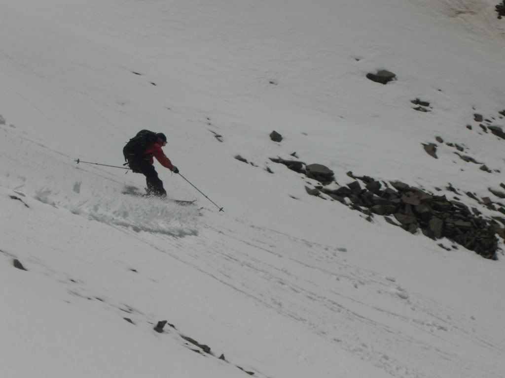
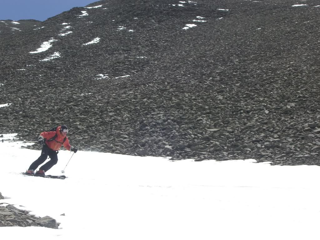
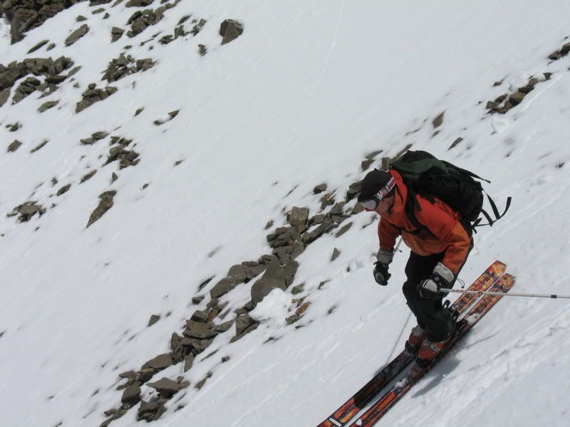
Here's one of him skiing down the lower part of the Yawner Gully.
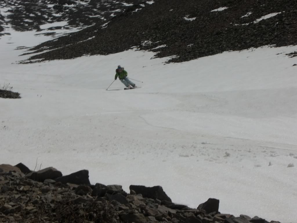
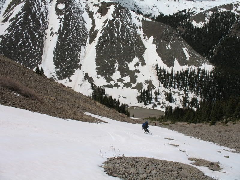
We were able to ski down 2,200 ft to about 11,800 ft. From there we had to walk a couple hundred vert down to the valley over scree. We then followed the valley down for a bit, with intentions of following it down to where it intersected with another valley, which we had to go up to reach the first saddle. But moving through this valley was slow. The snow was collapsable, fallen logs everywhere, and we seemed to be going no where fast. Eventually we worked our way up the ridge, and then went back down the other side into the valley. We found much of the same conditions in that valley-- collapsable snow, fallen logs. We tried to stick as close to the creek as possible on narrow strips of snow, in order to avoid these obstacles.
Then the valley opened up into this:
A valley of willows- my worst enemy. Now, jcwhite doesn't have such a problem with willows because he's so dang tall. He's a foot and 2 inches taller than me. goldenboy seems to adore willows- afterall, he's so dang skinny he can fit easily between them. Me, on the other hand.... well, I'm munchkin-sized and I'm not exactly skinny, so me and willows-- we are not friends.
Goldenboy and jcwhite posing, during a break in the willows
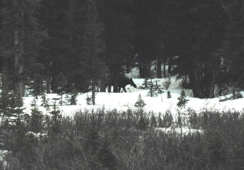
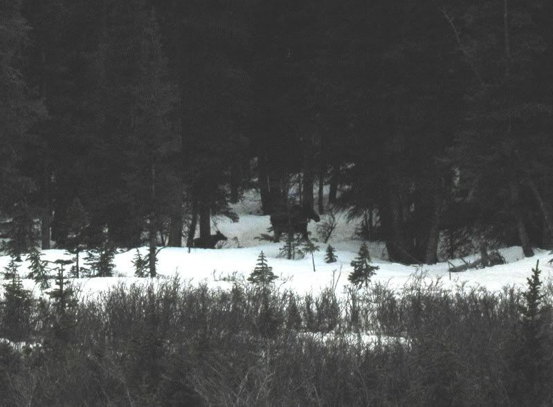
Like the willows on the other side of the ridge, there was lots of evidence of moose. We wondered if we would be so lucky as to see one. And then we did.
And she had a little one with her too!
The moose were a bright light in a thicket of darkness. It was good to see them. But we still had a long ways to go! It seemed like forever that we skinned up this valley, and finally we took a right, heading up toward the first saddle.
Looking back down the valley we skinned up.
goldenboy waiting for us on the first saddle.
From the first saddle, we were able to ski down a SW-facing gully for about 700 ft. until it met up with the Willow Creek rd. From there we changed back over to shoes.
(More coming!)
Results 1 to 21 of 21
Thread: TR: San Luis (14,014') 5-28-2007
-
05-31-2007, 08:32 PM #1

 I belong with the snow...
- Join Date
- Nov 2005
- Location
- Where the Butte is Crested
- Posts
- 3,337
TR: San Luis (14,014') 5-28-2007
Last edited by mtnbikerskierchick; 05-31-2007 at 08:50 PM.
-
14erskiers.com
"Don't be afraid of the spaces between your dreams and reality. If you can dream it, you can make it so." - Belva Davis
"There are only two ways to live your life. One is as though nothing is a miracle. The other is as though everything is a miracle"--Albert Einstein
-
05-31-2007, 08:34 PM #2
I belong with the snow...
- Join Date
- Nov 2005
- Location
- Where the Butte is Crested
- Posts
- 3,337
My AT boots have been causing me much grief this season, causing me unbearable pain under my metatarsils. I feel the worst pain when I take my boots off. The only thing I can equate it to is when your feet freeze really cold and then you take your boots off and they start thawing and they really hurt in the process. This pain is really similar, except it has nothing to do with cold feet. It's far worse when they are warm actually. Anyway, this pain has brought me to tears several times this season when taking my boots off, and this day was no different.
I began hiking down the road, limping from the pain in my feet.
jcwhite offered to take my pack as it was quite heavy. But it was nearly impossible for him to carry 2 packs with skis and ski boots on them. So, he strapped my skis and boots on his pack instead. This was fantastic! My feet still hurt, but with much less weight on my back I was able to walk a more normal pace.
Before we knew it we were back at the Equity Mine. goldenboy and jwhite pass by a mine shack. Note jcwhite is sporting 2 sets of skis!
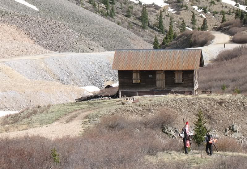
We missed these on the way up, but they amused us on the return.
Anybody missing a pair of skis and poles???
We arrived back at the cars just before 5:15 pm, making it an 11 hour day. Since goldenboy asked, I had to figure out the stats. So here they are. Total vert climbed: 4350 ft. Total vert skied: 2900 ft + 700 ft in traverses.
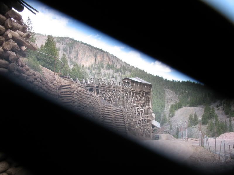
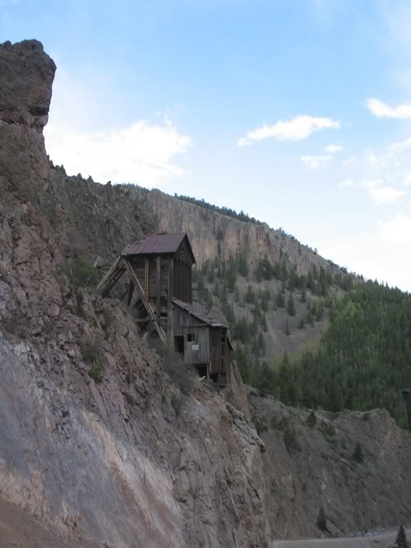
The drive back down the road takes you through some amazing mining ruins. The shutter to my camera wasn't opening all the way for some reason so not all the pics turned out. Here's what I have:
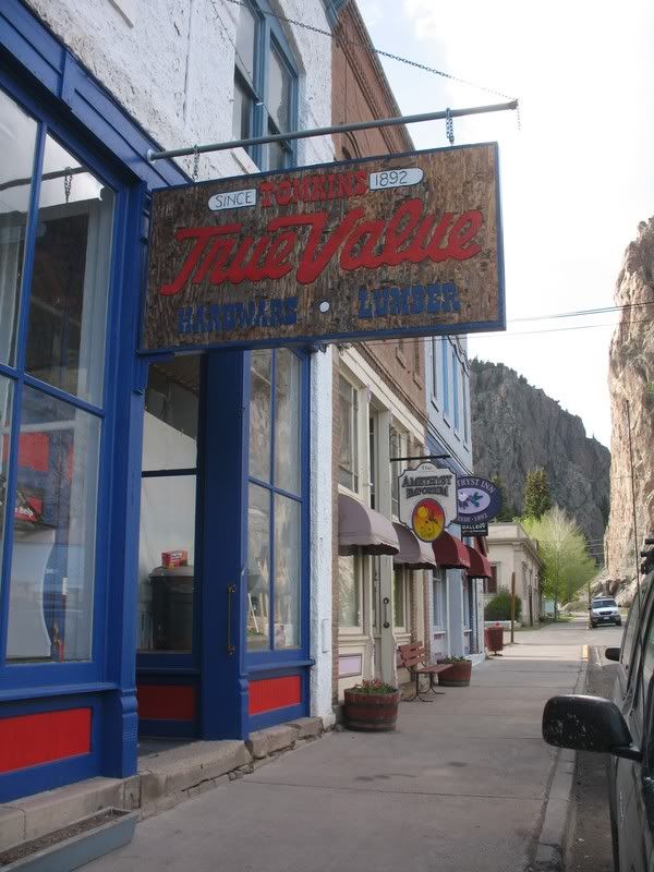
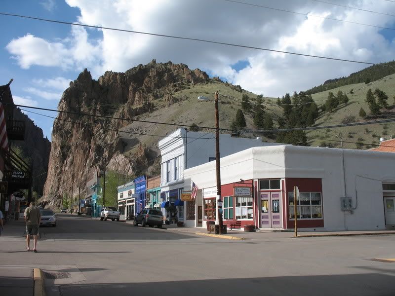
We stopped in Creede for dinner. Creede is a sweet little town, but things were a little slow here on this Memorial Day!
From Creede, goldenboy headed back to Crested Butte via Lake City and Gunnison. jcwhite and I followed the Rio Grande to South Fork, heading toward Denver. What a pretty road it was too!
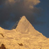
We got great views of the Sangres along the way.
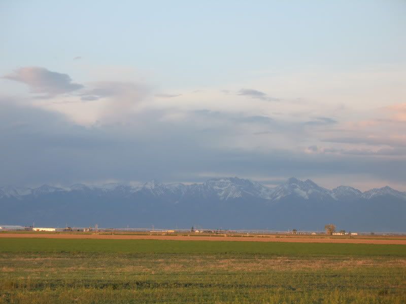
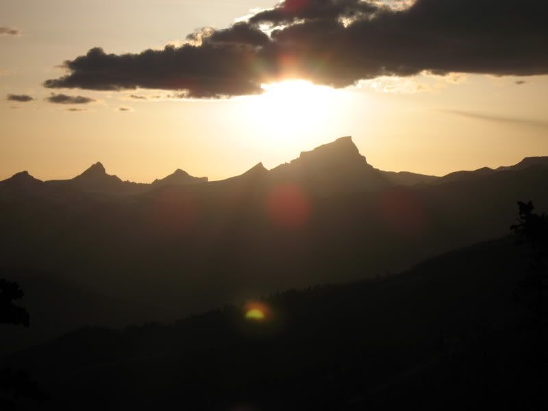
And we had a beautiful sunset.
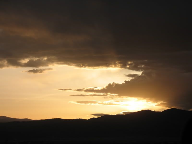
All in all it was a great weekend.
And, of course, weekend totals for goldenboy!
Total vert climbed: 12,900 ft
Total vert skied: 11,300 ft.-
14erskiers.com
"Don't be afraid of the spaces between your dreams and reality. If you can dream it, you can make it so." - Belva Davis
"There are only two ways to live your life. One is as though nothing is a miracle. The other is as though everything is a miracle"--Albert Einstein
-
05-31-2007, 08:42 PM #3
 Small Big Mountain Skier
- Join Date
- Jul 2005
- Location
- Crested Butte
- Posts
- 2,002
You people are fuckin' crazy. What a great weekend. To think, I spent my weekend using a truck to cut the pedaling out of mountain biking and drinking until the point of complete and utter blackout. Different strokes for different folks, i guess. Good work.
Chocolate? This is doodoo, BABY!
-
05-31-2007, 09:30 PM #4
 Carpe Skiem
- Join Date
- Oct 2004
- Location
- Colyrady
- Posts
- 3,780
Quite a weekend.
-
05-31-2007, 09:30 PM #5
I belong with the snow...
- Join Date
- Nov 2005
- Location
- Where the Butte is Crested
- Posts
- 3,337
Well, I did start hallucinating.... but that was from shear lack of sleep, not from too much beer! Heh. We did enjoy our PBR post-ski treat every day! Originally Posted by Dside11-11
 -
-
14erskiers.com
"Don't be afraid of the spaces between your dreams and reality. If you can dream it, you can make it so." - Belva Davis
"There are only two ways to live your life. One is as though nothing is a miracle. The other is as though everything is a miracle"--Albert Einstein
-
05-31-2007, 09:45 PM #6
 it's true, my name sucks
- Join Date
- Jan 2007
- Posts
- 586
I like this TR.
I like the skiing.
I like the moose.
I like the mining ruins.
I like the town.
I like it.
-
05-31-2007, 11:53 PM #7
Registered User
- Join Date
- Mar 2007
- Posts
- 175
Here are some pics:
The climb up:
Had to show this, just to show how desperate we must have been to skin the whole way up the ridge
getting close:

on top:
Skiing off the top
MBSC:

Golden Boy:

-
06-01-2007, 12:28 AM #8
 poor, ugly, happy
- Join Date
- Apr 2006
- Posts
- 1,792
nice work. that's a big day, especially after your previous two. jordan is an animal carrying two sets of skis. you guys are just ticking off those 14ers like crazy.
Ride Fast, Live slow.
We're mountain people. This is what we do, this is how we live. -D.C.
-
06-01-2007, 03:41 AM #9
 Freeheeling flatlander
- Join Date
- Aug 2005
- Location
- Netherlands
- Posts
- 1,393
FKNA
4567890
-
06-01-2007, 05:48 AM #10
 A. K. A. Yank Mojo
- Join Date
- Mar 2006
- Location
- Just outside the bubble
- Posts
- 1,742
Taking care of business, I like it!
Have fun or get hurt bad. "MFT" A.K.A. Dr. Doom
There are but three true sports--bullfighting, mountain climbing, and motor-racing. The rest are merely games. "Ernest Hemingway"
-
06-01-2007, 06:10 AM #11
rain
- Join Date
- Dec 2005
- Location
- Republik Indonesia
- Posts
- 7,288
Loving the mining shots, that's some badass stuff!
-
06-01-2007, 10:33 AM #12
Registered User
- Join Date
- May 2005
- Posts
- 4,002
I'm not sure... but deep down I think I envy your ability to be glutons for punishment. I know for sure I envy the rewards you get.
Thanks!
-
06-01-2007, 12:05 PM #13
Registered User
- Join Date
- Nov 2005
- Posts
- 181
MBSC, that was an awesome suite of sweet TRs, and what a Grand Slam of Originally Posted by mtnbikerskierchick
killer peaks! Thanks for taking the time to document them.
All of you guys are animals; way to stay focused for the entire
weekend...
cheers,
john
-
06-01-2007, 12:18 PM #14
I belong with the snow...
- Join Date
- Nov 2005
- Location
- Where the Butte is Crested
- Posts
- 3,337
Somehow things are less rewarding when they come easy.... kind of funny how that is, isn't it??? Originally Posted by FrankZappa
Thanks all for your kind words.
And thanks to jcwhite for getting his pics up!!!!!!!!!!-
14erskiers.com
"Don't be afraid of the spaces between your dreams and reality. If you can dream it, you can make it so." - Belva Davis
"There are only two ways to live your life. One is as though nothing is a miracle. The other is as though everything is a miracle"--Albert Einstein
-
06-01-2007, 01:32 PM #15
 Seeker of Sastrugi
- Join Date
- Oct 2003
- Location
- The Ranch
- Posts
- 3,792
Awesome TR's, awesome work, awesome weekend. Memorial Day is my favorite weekend of the year, climb2ski and I had a good one too, skiing Columbia, Huron, then Missouri. Unfortunately climb2ski dropped his camera on Columbia where upon it hucked an 80 foot cliff, so we have no pictures. I did total our numbers however. We traveled 28 miles, ascended 13,050 feet, and skied 7700 feet. Columbia from 3 elk creek took the cake, taking 13 hours car to car due to getting off route in the dark several times.
-
06-01-2007, 03:34 PM #16
 Think snow
- Join Date
- Oct 2006
- Location
- Zurich, Switzerland
- Posts
- 1,322
Nice work....... that was a long day.
But the moose is really cool!
-
06-01-2007, 03:57 PM #17
 Caul Fat Dealer
- Join Date
- Sep 2001
- Location
- Alco-Hall of Fame
- Posts
- 2,997
Wow, all three of those were sweet, thank you!
Two thoughts:
I've heard of people using their skis as a ships prow to bust through the willows (strap tips together and run tails through compression straps on your pack).
How new/good are your insoles and how many times have you been to the bootfitter this year?"It is not the result that counts! It is not the result but the spirit! Not what - but how. Not what has been attained - but at what price.
- A. Solzhenitsyn
-
06-01-2007, 04:02 PM #18
I belong with the snow...
- Join Date
- Nov 2005
- Location
- Where the Butte is Crested
- Posts
- 3,337
I've used 3 diff insoles, one pair only made last season for my alpine boots. It doesn't seem to make a difference. Originally Posted by lemon boy
Yes, it's time for me to see Larry, but I can't get ahold of him this time of year. Earlier this season I couldn't afford to go see a boot fitter. I was completely broke, not to mention that I never had time b/c I was working 3 jobs. Now I can, but he's not around, and he's the guy I want to see. I only have a week left this season so I'll have to wait until next year!!! I just need to stick it out for one more week!
-
14erskiers.com
"Don't be afraid of the spaces between your dreams and reality. If you can dream it, you can make it so." - Belva Davis
"There are only two ways to live your life. One is as though nothing is a miracle. The other is as though everything is a miracle"--Albert Einstein
-
06-01-2007, 05:29 PM #19
 Jack's got my back
- Join Date
- Jan 2005
- Location
- cb, co
- Posts
- 5,305
Yeah, this was a fitting way to end a weekend like that (driving home over Slumgullion pass):
Nice work in the sawatch there ireallyliketoski and climb2ski. How was Harvard looking?
mbsc- you better get your boots worked on before the first ski day next year!!
-
06-01-2007, 10:39 PM #20
 TR Junkie
- Join Date
- Mar 2004
- Location
- Reno
- Posts
- 2,434
I think I know why gb is smiling.......by my count he is definately over 40 now!!!

What about you mbsc? how many notches in your belt?
Originally Posted by mtnbikerskierchick
Donjoy to the World!
-
06-05-2007, 03:40 PM #21
I belong with the snow...
- Join Date
- Nov 2005
- Location
- Where the Butte is Crested
- Posts
- 3,337
I have a mere 29 notches done Originally Posted by Huckwheat
I guess I work too much
-
14erskiers.com
"Don't be afraid of the spaces between your dreams and reality. If you can dream it, you can make it so." - Belva Davis
"There are only two ways to live your life. One is as though nothing is a miracle. The other is as though everything is a miracle"--Albert Einstein

 Reply With Quote
Similar Threads
-
Widespread "Herring" Panic
By Fritz in forum MUSIC, BOOKS, MOVIESReplies: 223Last Post: 11-07-2015, 01:53 AM -
TR: Chamonix 4/5-4/6
By jumpturn in forum General Ski / Snowboard DiscussionReplies: 8Last Post: 05-02-2007, 08:14 AM -
TR: Tuckerman Ravine 4/22
By jumpturn in forum General Ski / Snowboard DiscussionReplies: 9Last Post: 04-27-2007, 08:56 PM -
Would you like thousands to watch your video?
By kaseykolak in forum Tech TalkReplies: 0Last Post: 01-19-2007, 10:52 AM

Bookmarks