
Someone else who had this same choice asked me the same question.Originally Posted by grabtindy

I recommended dropping at Iron Pass then climbing over to Powell Pass then descending Tosh Creek to Big Creek the over to Lorna Lake. Grant Creek which runs down from Iron Pass is very bushy and overgrown. Tosh Creek is a better ride. In either case bring ski socks to avoid shins getting whacked.
Results 26 to 49 of 49
Thread: TR - South Chilcotins, etc.
-
07-31-2022, 11:23 PM #26

 Registered User
- Join Date
- Feb 2005
- Location
- North Vancouver/Whistler
- Posts
- 14,442
-
08-02-2022, 08:00 AM #27
 tree junkie
- Join Date
- Dec 2006
- Location
- bestcoast
- Posts
- 2,180
I did Grant via Taseko drop last September labour day weekend. Not sure if they're dropping at the pass or just down a bit outside the boundary, if at the pass, the first new hundred metres of descending is very chunky and only semi-rideable take it cautiously, overall the trail is bushy in places but I didn't find it terrible and that was after rain and snow on the pass and snow in the previous week that lingered on the ground. I would 100% NOT recommend Little Paradise as it's insanely overgrown in places, in 2016 I was doing a trails assessment in the park and that was by far the worst trail, like 5-6 foot high bush for hundreds of metres at a time, riding on trail but not being able to see the trail below you kinda bushy. Some friends rode it last year and sounds like it was not improved.
Not sure if you're day tripping the drop, but if from Iron Pass I saw a trail forks log from the weekend that did full ride back to Tyaughton via Spruce/Gun and it was over 11 hours, so, plan accordingly.
-
08-02-2022, 10:31 AM #28

 Registered User
- Join Date
- Jan 2008
- Location
- Paper St. Soap Co.
- Posts
- 3,608
-
08-02-2022, 11:32 AM #29
tree junkie
- Join Date
- Dec 2006
- Location
- bestcoast
- Posts
- 2,180
I did forget that Tyax cleared Little Paradise from Manson to Little Graveyard in 2020 which apparently drastically improved things there, but probably wouldn't go further down valley towards Relay! Originally Posted by t.odd
-
10-14-2022, 06:21 PM #30
 Registered User
- Join Date
- Nov 2013
- Posts
- 824
TR - South Chilcotins, etc.
Anybuddy have Chilcotin stoke to add from this season?
Here’s hoping they can acquire a beaver and a pilot for next summer….
-
10-18-2022, 01:29 AM #31
 Registered User
- Join Date
- May 2012
- Location
- People's Republic of OB
- Posts
- 5,170
* raises hand *
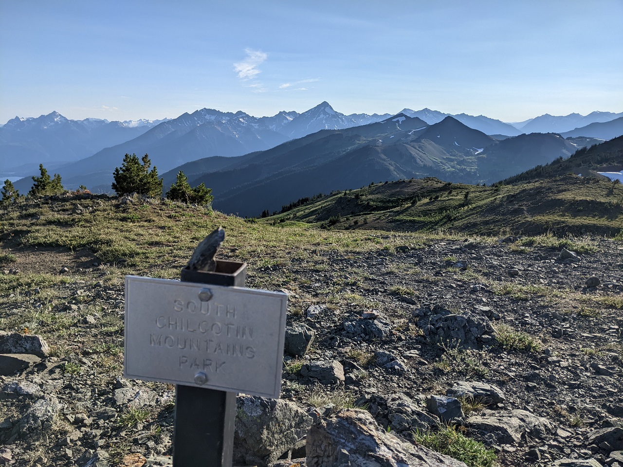
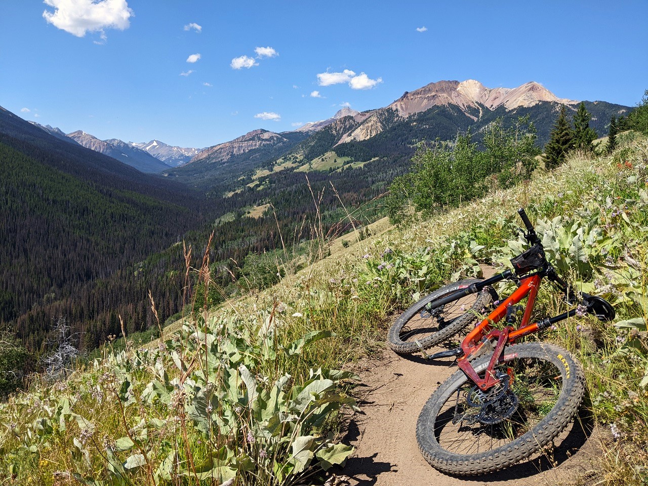
I was able to fit in 3 days riding back in August. Full TR for my trip will come at some point but for now I'll post the Chilcotin rides here.
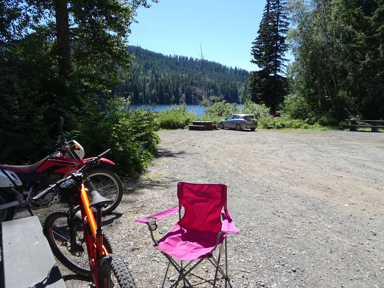
Arrived mid morning and snagged a spot at Frieburg before heading up the High Trail.
The only (human) trail users I'd see all day
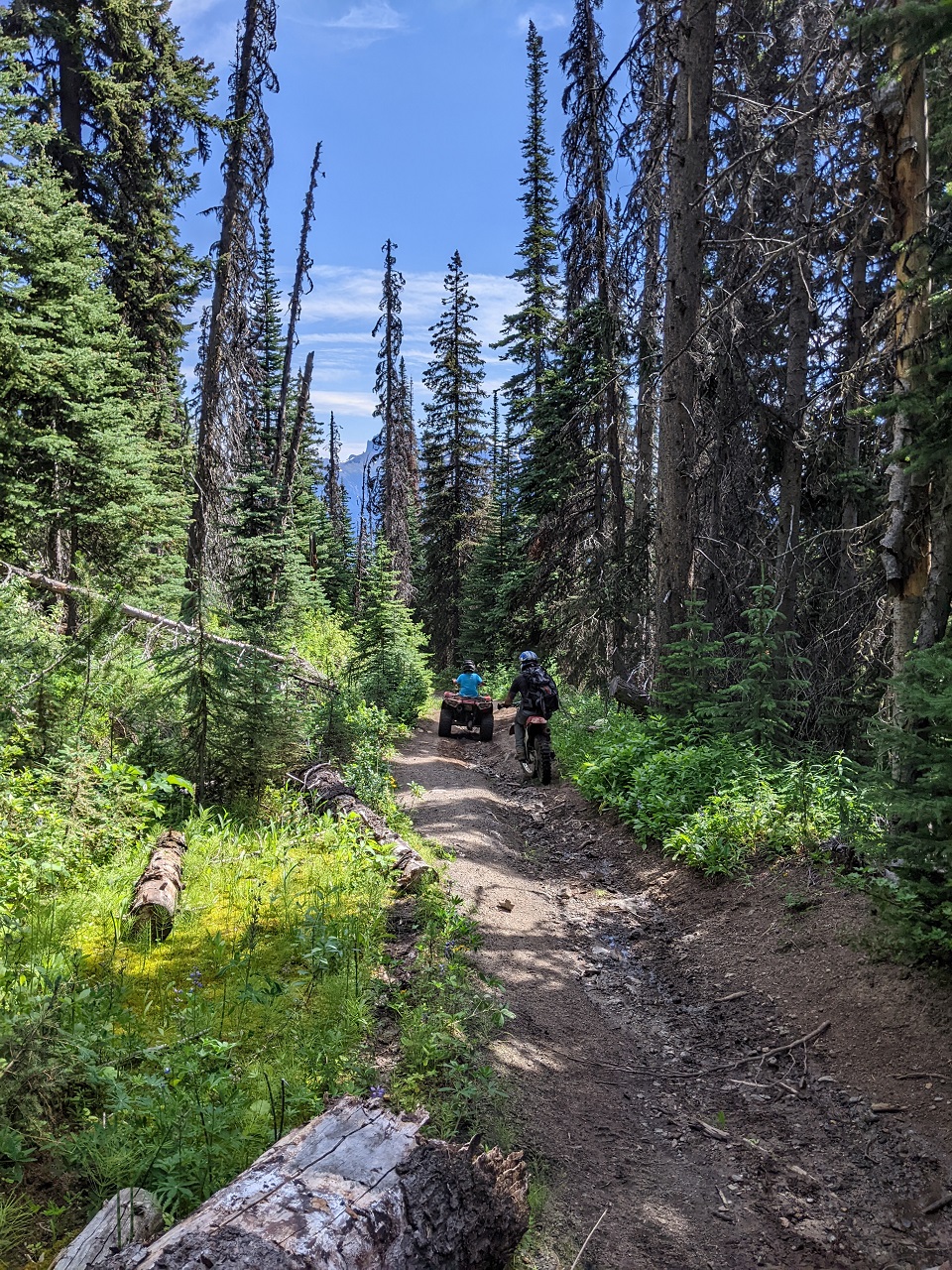
The dirt road portion of High Trail is a slog. It was hot, humid and buggy. Mosquito head net may have made an appearance.
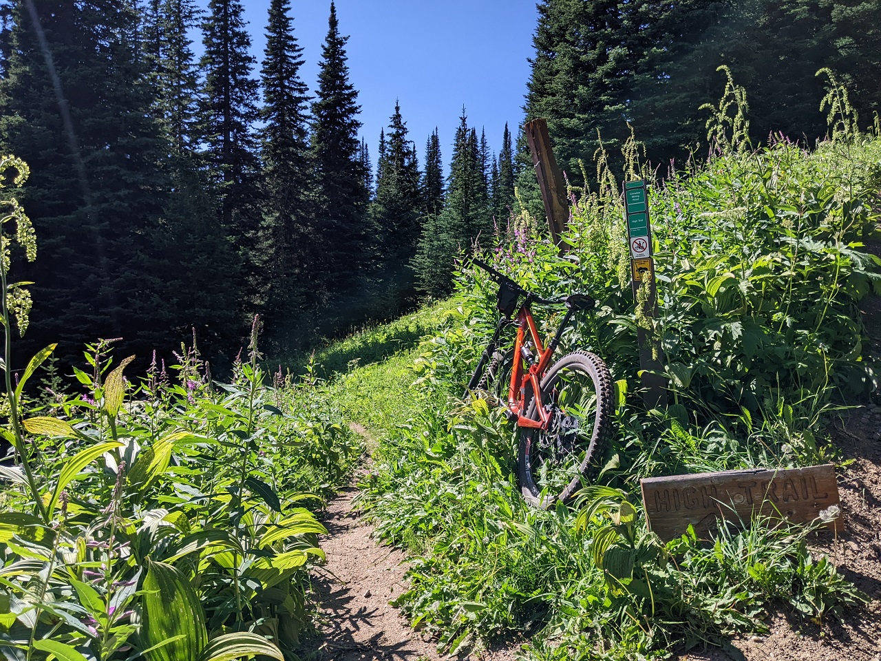
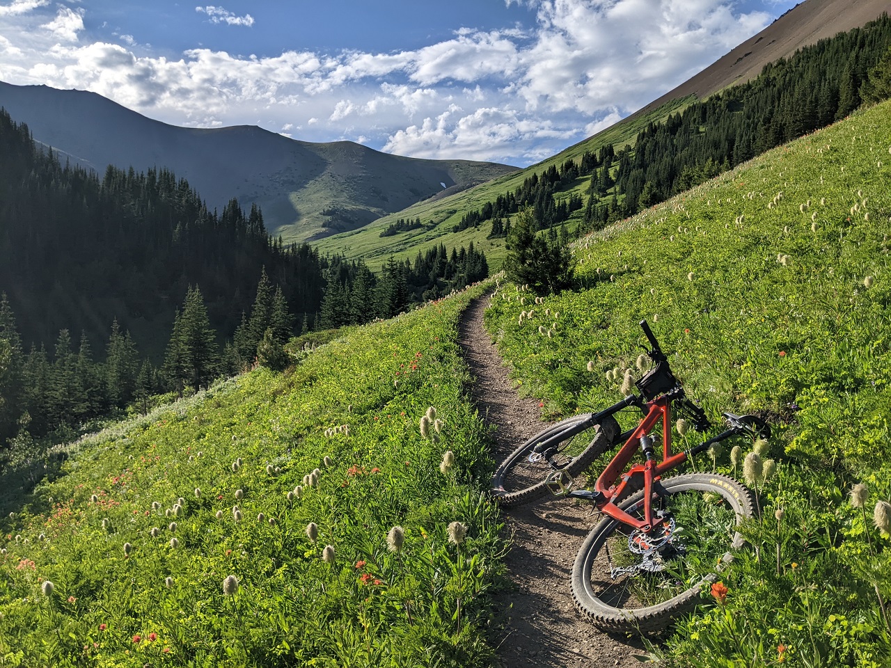
Getting onto singletrack was a relief even if it wasn't much easier. Some pedaling was had before turning uphill to Camel Pass
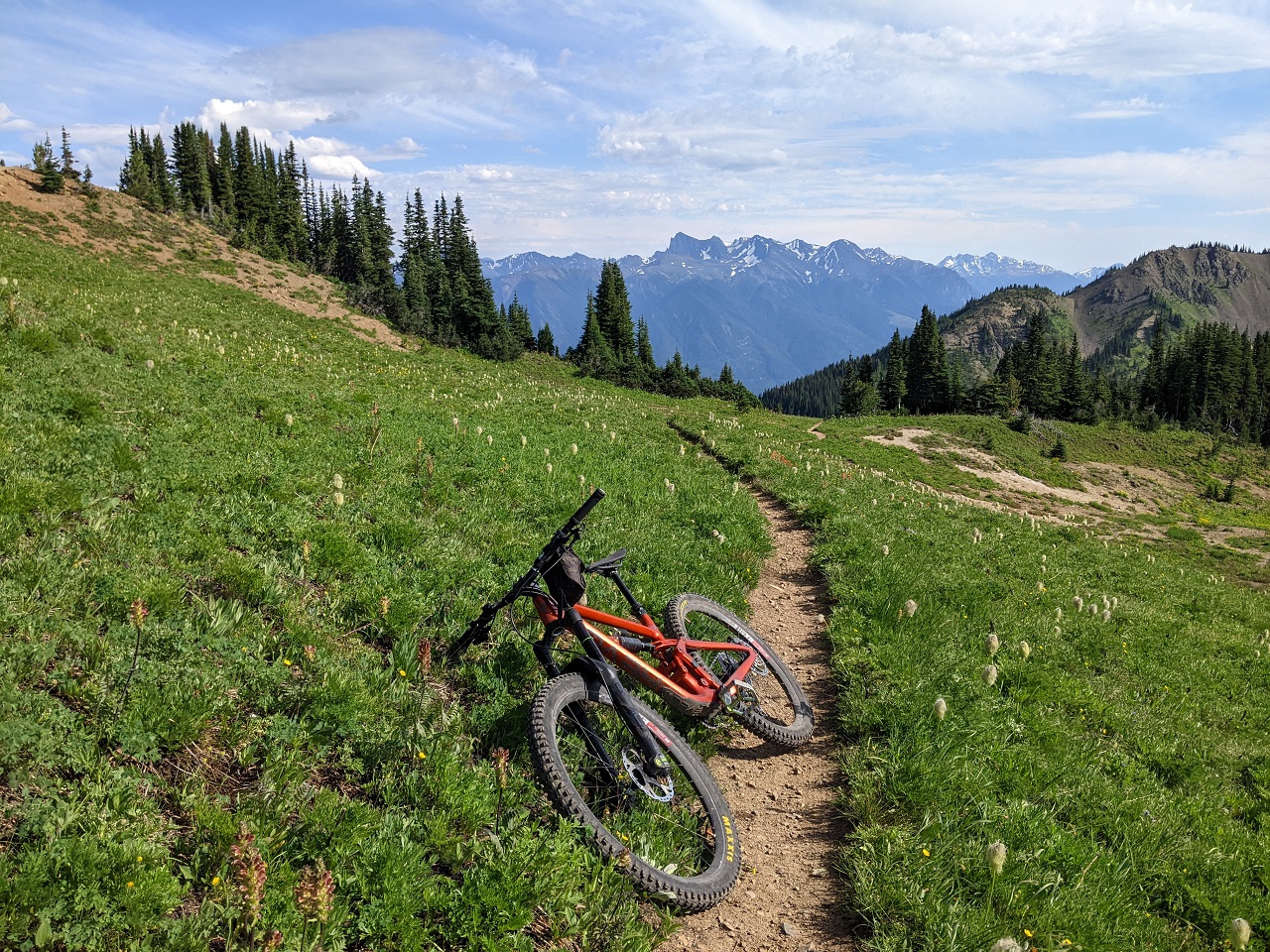
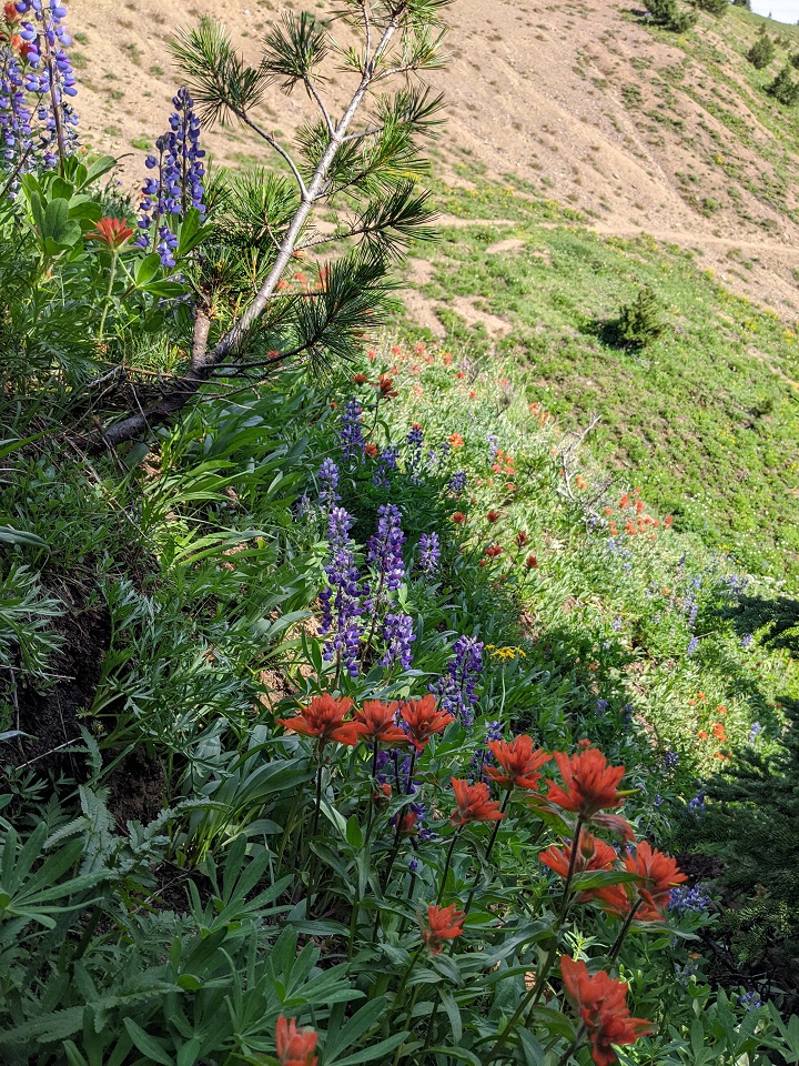
Killer flower displays
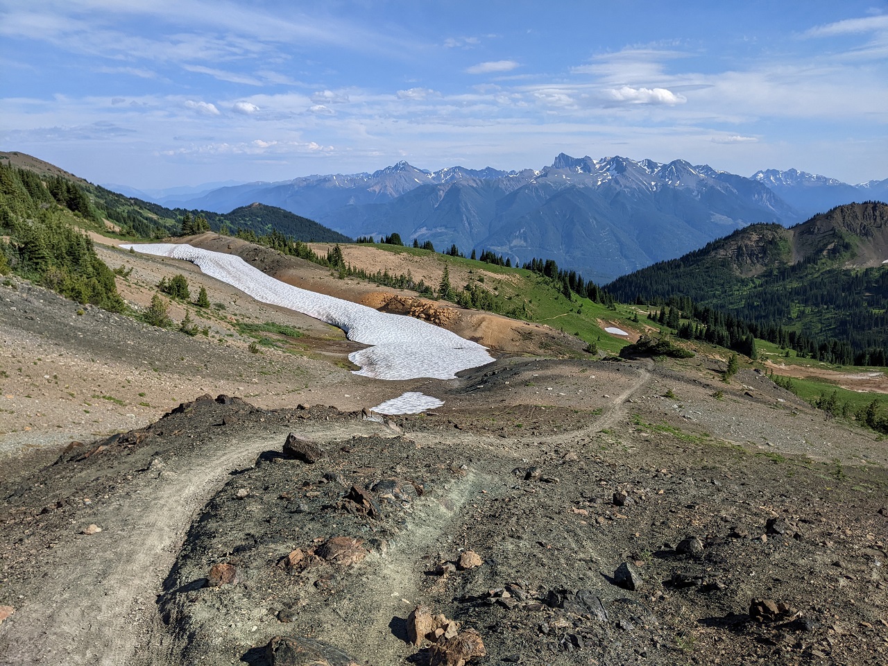
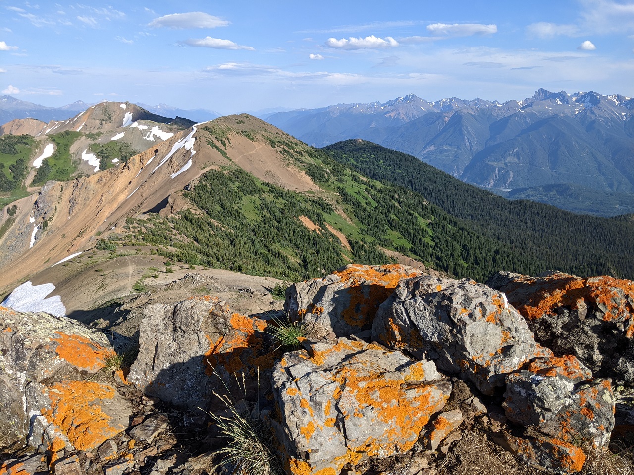
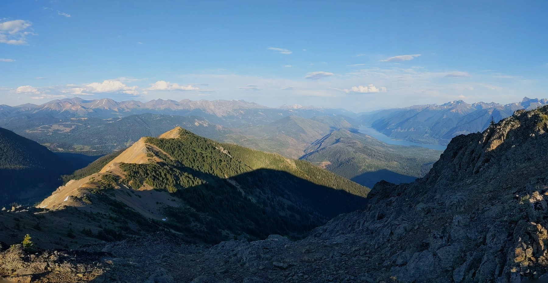
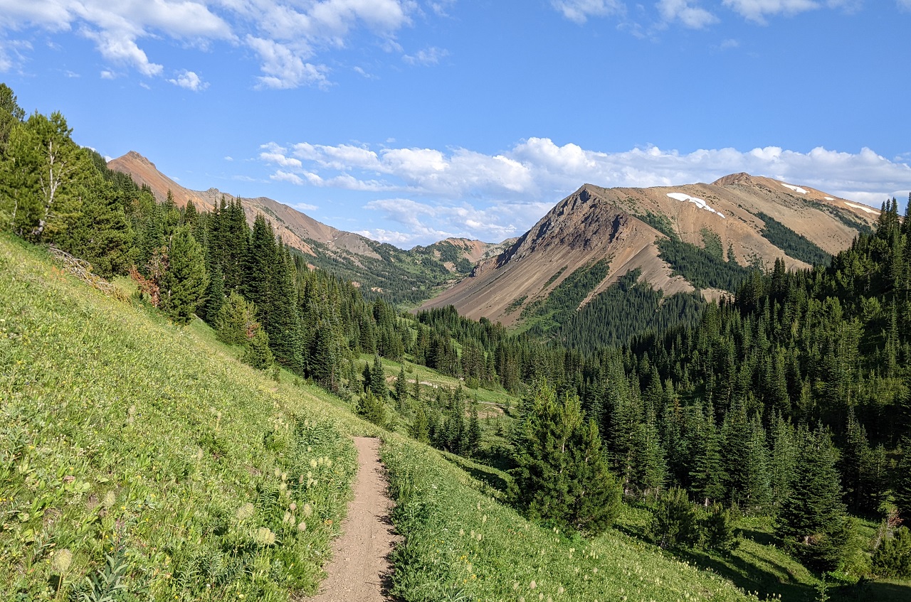
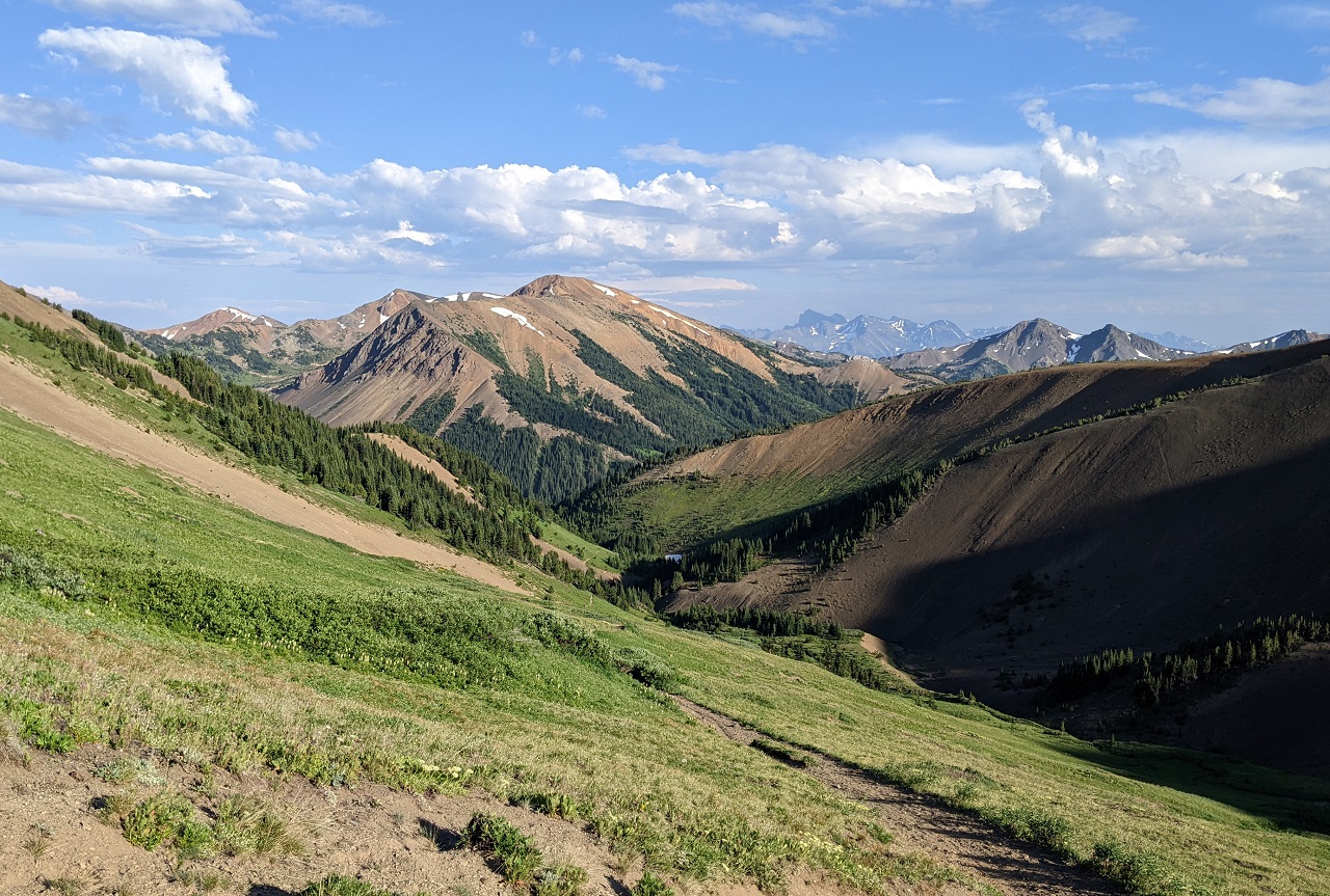
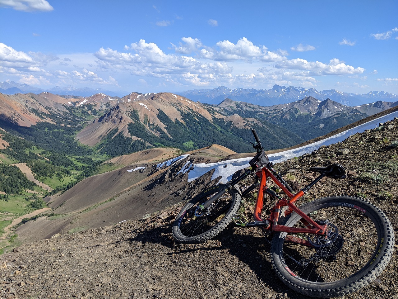
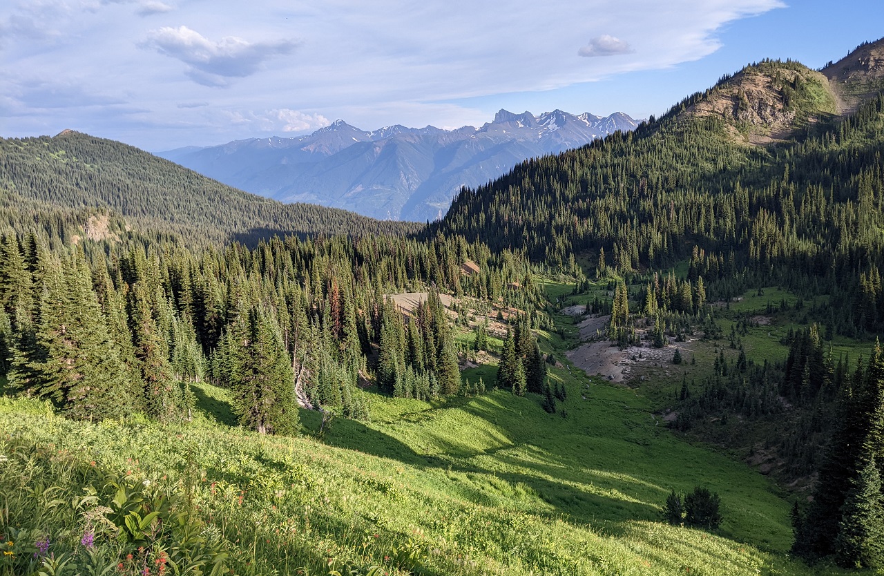
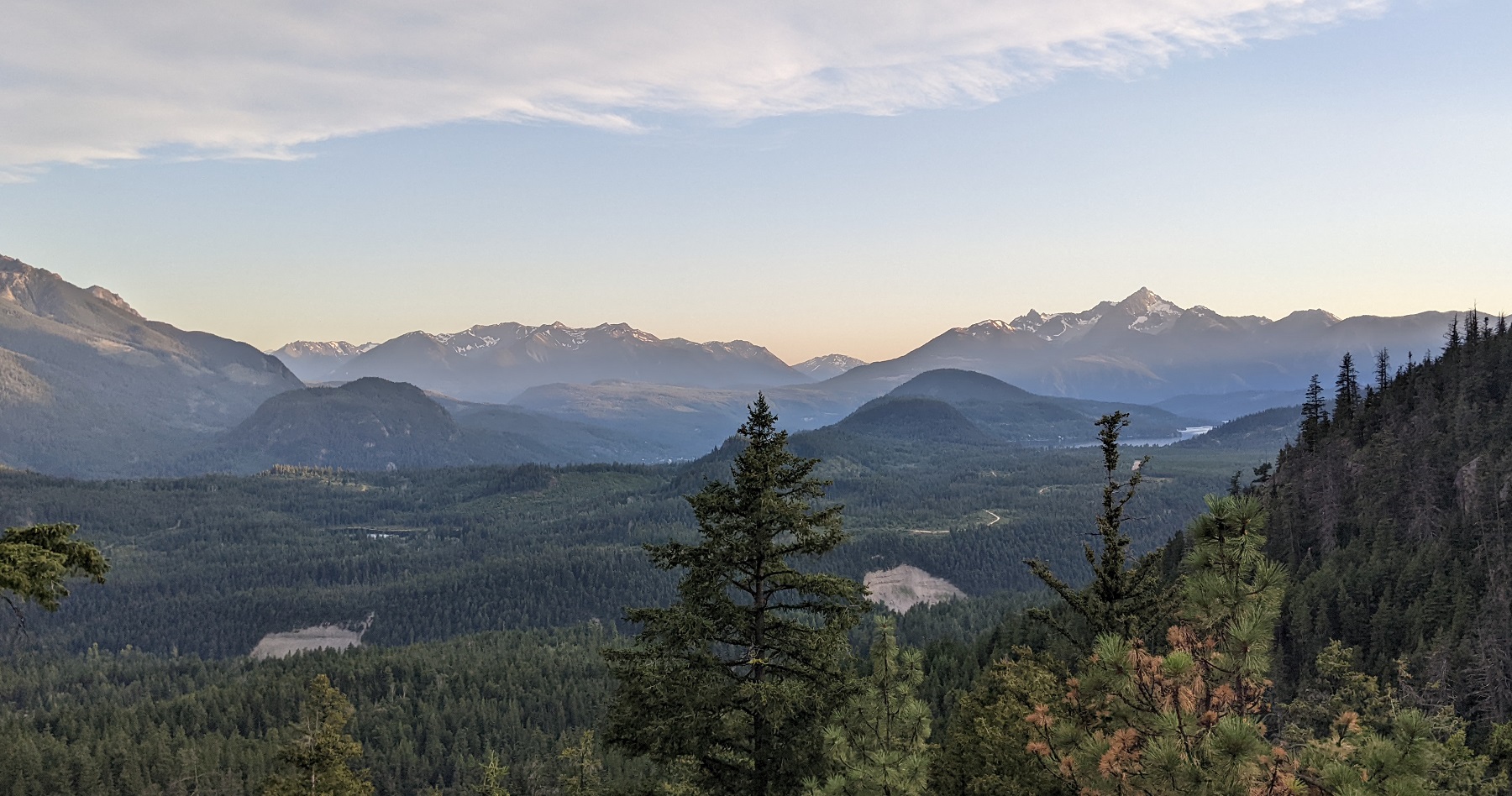
Getting up there. Lots of breaks to enjoy the views
Camel Pass. There used to be a string of prayer flags between the head and hump on the rock formation.
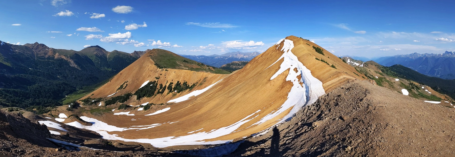
As much as I was tempted to explore down the other side of the pass, Ridge o Rama was calling my name.
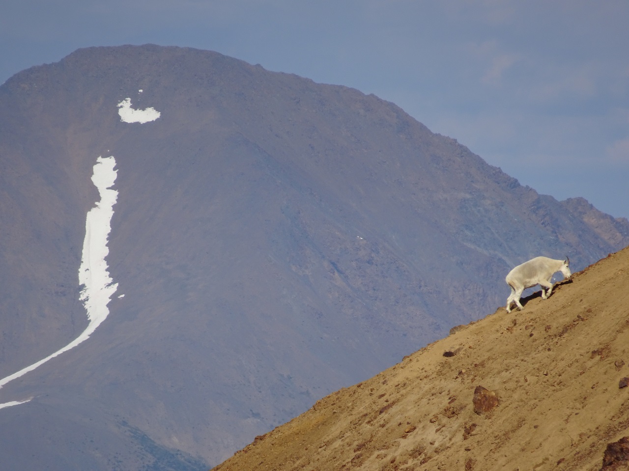
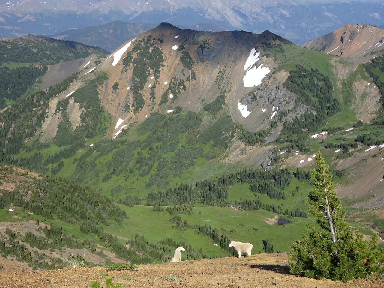
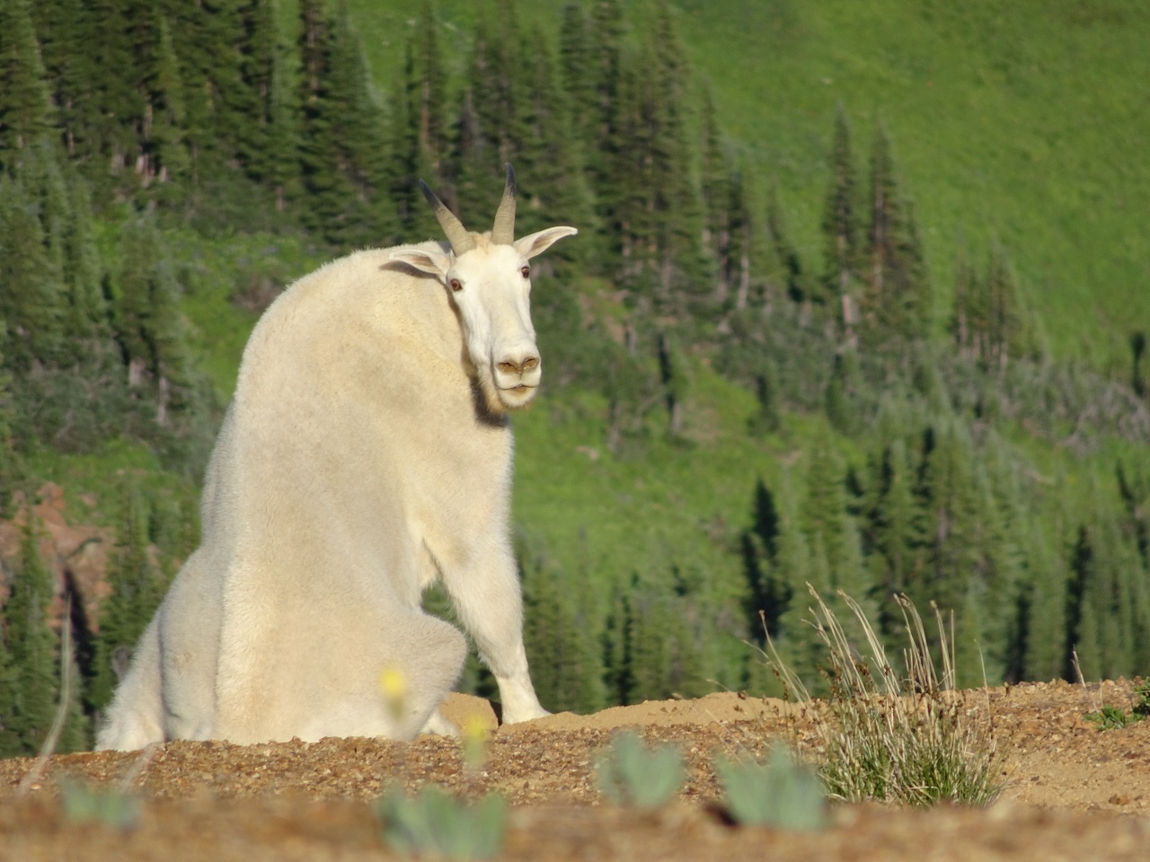
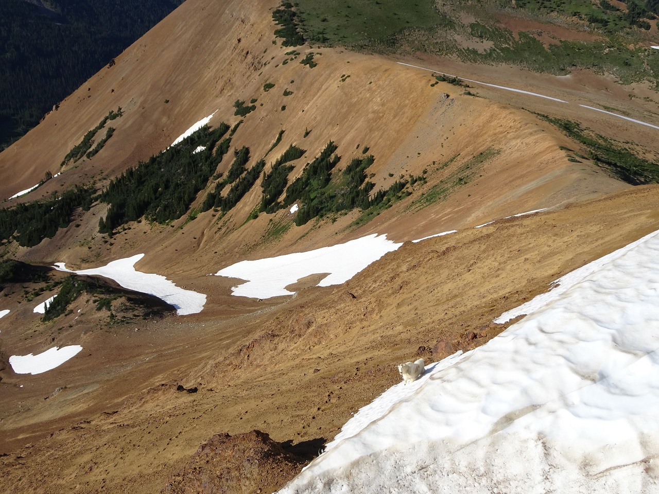
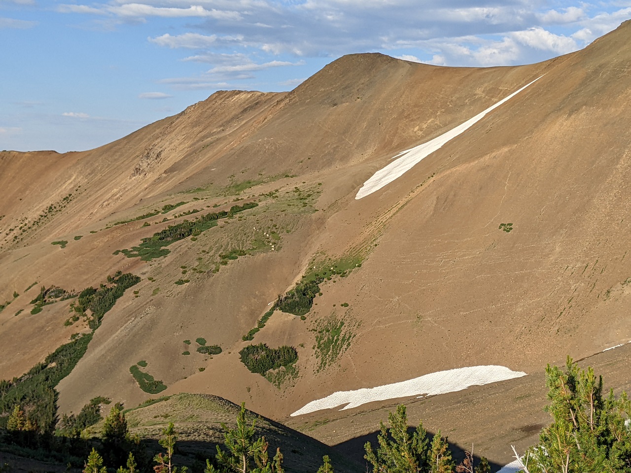
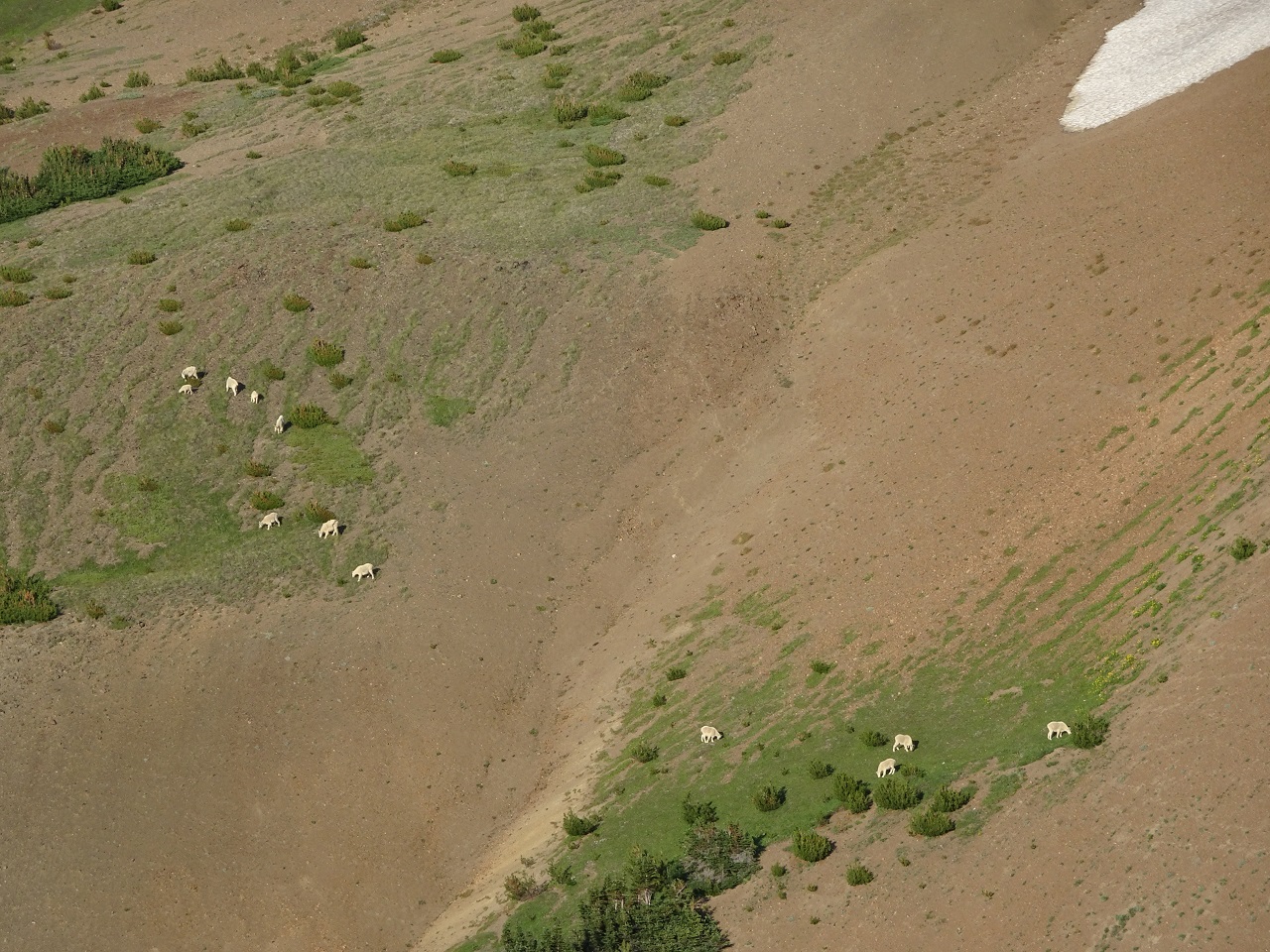
Got distracted on the climb up as I spotted some mountain goats on the distant grassy slope and then another one far along the ridge I was climbing up. Awesome!
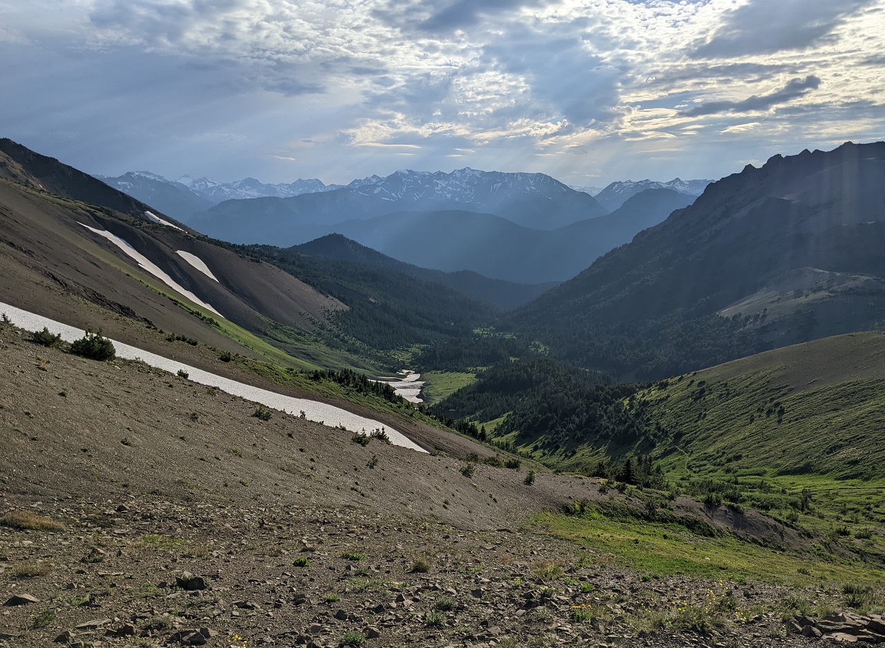
At the far end of the ridge I peeked over the down the slope
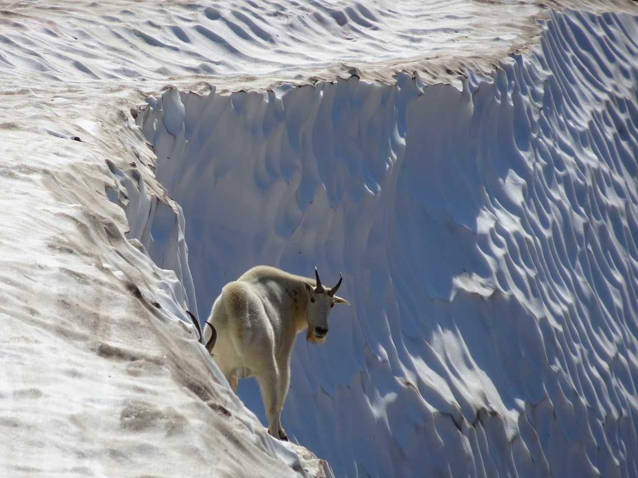
Oh Hi
Watched them for a few minutes and they eventually sauntered off around the ridge below me.
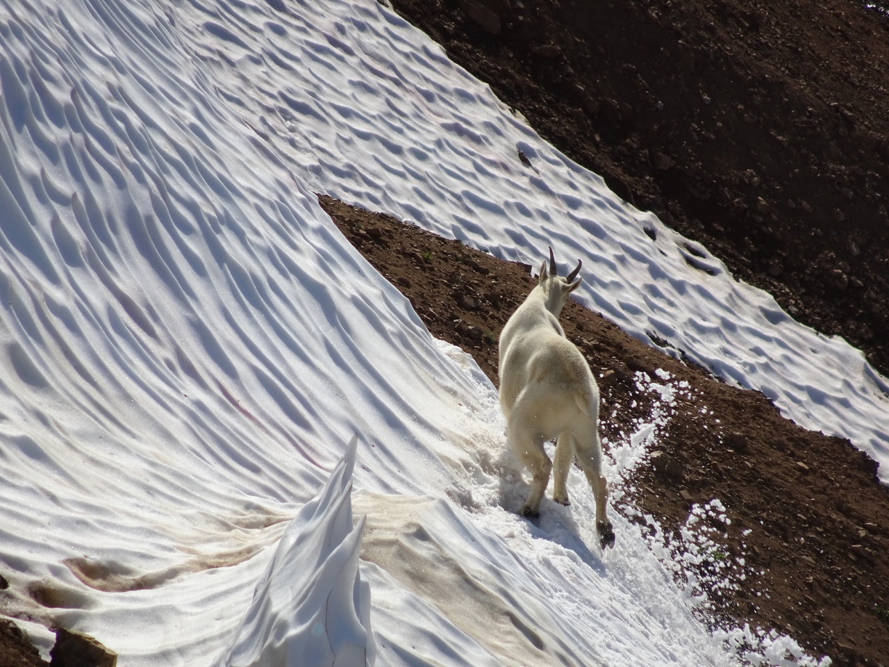
They went out of sight and didn't emerge, and I soon realized they had a snow ledge they were traversing that was out of sight of the ridge top
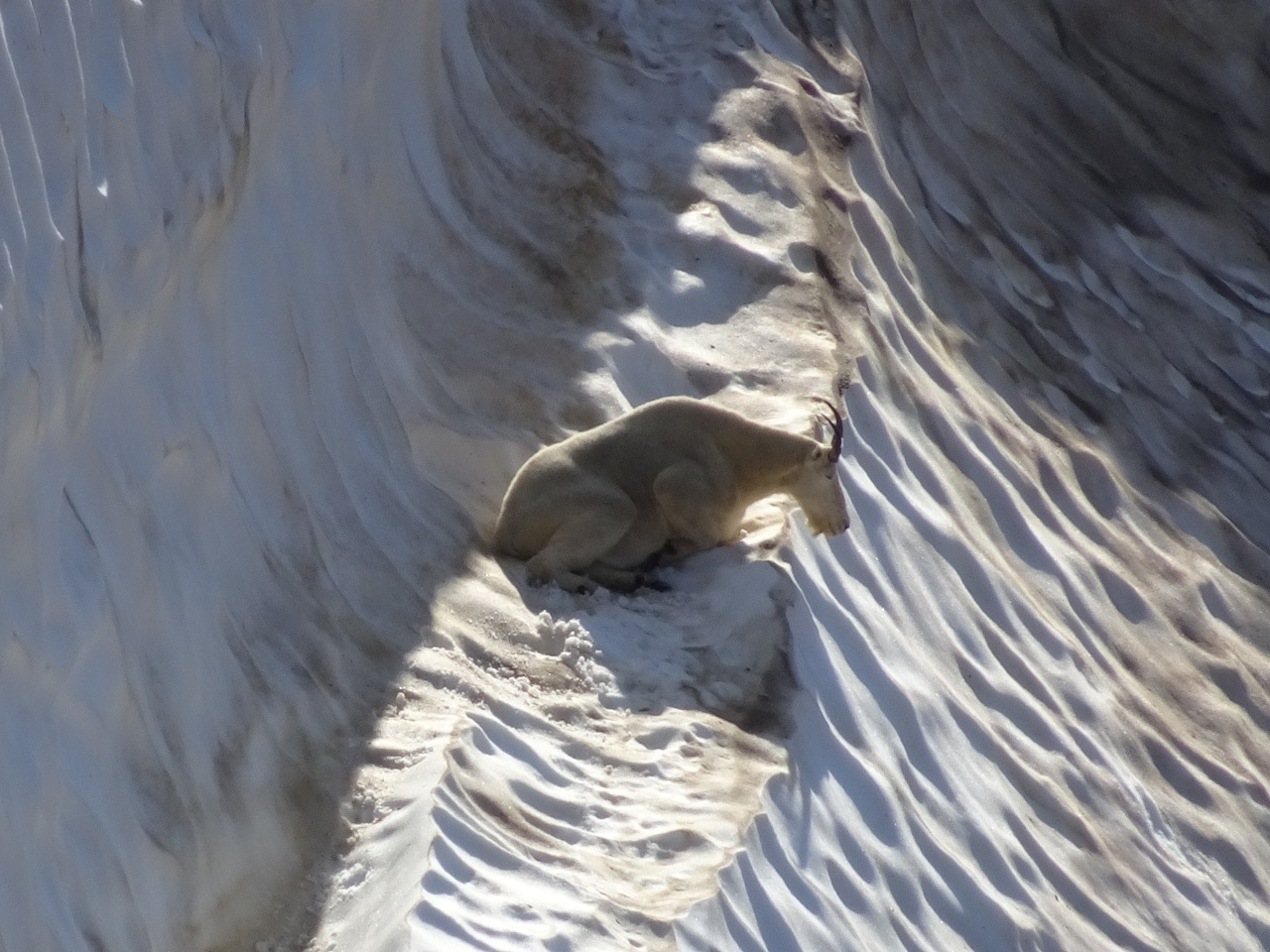
Dropping down

Found a nice spot for nap time further along
Time to hit the ridgeline.
Wish I had known about Ridge o Rama last time we were here. Instead we dropped back down Camel Pass and then went up the steep ass mining road to get to Cinnibar. Rookie mistake
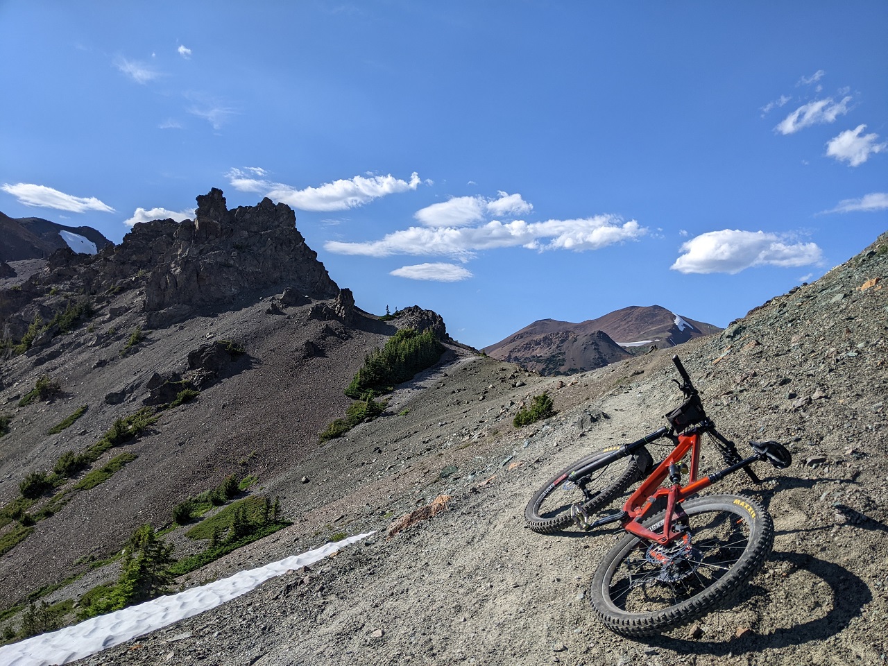
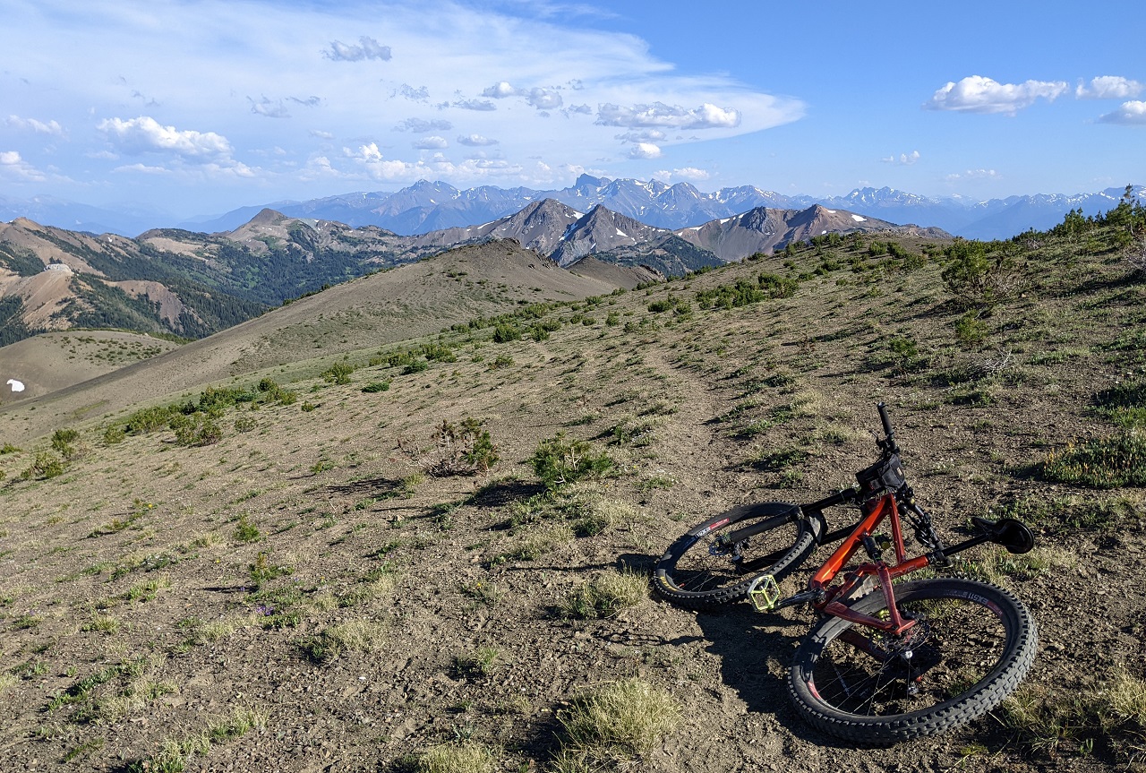
Love trails like this that follow and contour along ridge lines
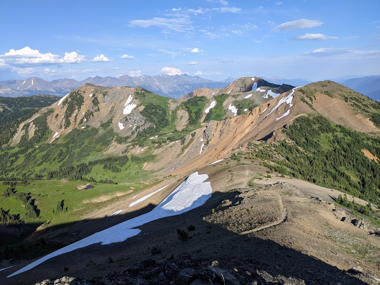
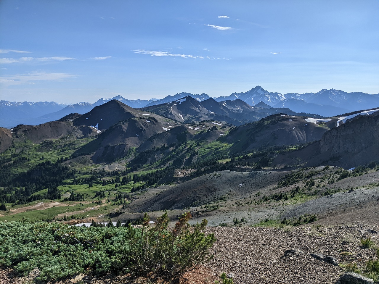
Getting views off the back side
I did the east side of Ridge o Rama too. A few tough spots led to some awesome cliff edge riding, and then a super steep drop down to Cinnibar, which I walked an embarrassing amount of.
Cinnibar was fun but steeper parts definitely getting torn up by motos
Finished the ride with just enough time for a quick swim before dark.Last edited by evdog; 06-28-2024 at 03:55 PM. Reason: fixed links
-
10-18-2022, 08:29 AM #32
tree junkie
- Join Date
- Dec 2006
- Location
- bestcoast
- Posts
- 2,180
ROR is the best bang for your buck alpine ride up there! awesome to see the goats, we saw one on the north side of the ridge too when we were up there in September. Still think it's preferable to just ride up the road and then up Taylor to Camel/ROR rather than going up High Trail.
-
10-18-2022, 08:48 AM #33
Registered User
- Join Date
- Jan 2006
- Posts
- 1,626
Great pics Ev!
-
10-18-2022, 10:27 AM #34
tree junkie
- Join Date
- Dec 2006
- Location
- bestcoast
- Posts
- 2,180
tried to upload some pics, but they all came in upside down and I am impatient so gave up, lol.
-
10-19-2022, 10:53 AM #35
Registered User
- Join Date
- May 2012
- Location
- People's Republic of OB
- Posts
- 5,170
Yup, didn't have time for Taylor though given my late start. High trail sucks to climb but it does get you up there quickly. Was planning to climb Taylor on day 2. Originally Posted by t.odd
Second day
Still not an early start but earlier. Headed up the road to Taylor.
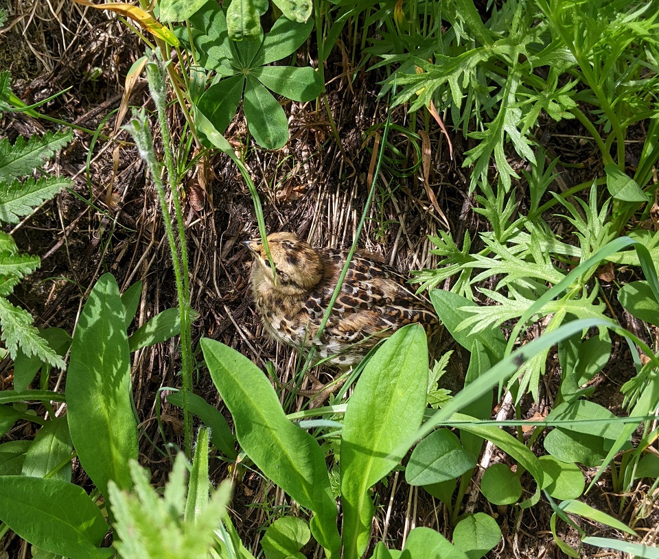
For Boissal....angry grouse making a huge commotion to try and distract me.
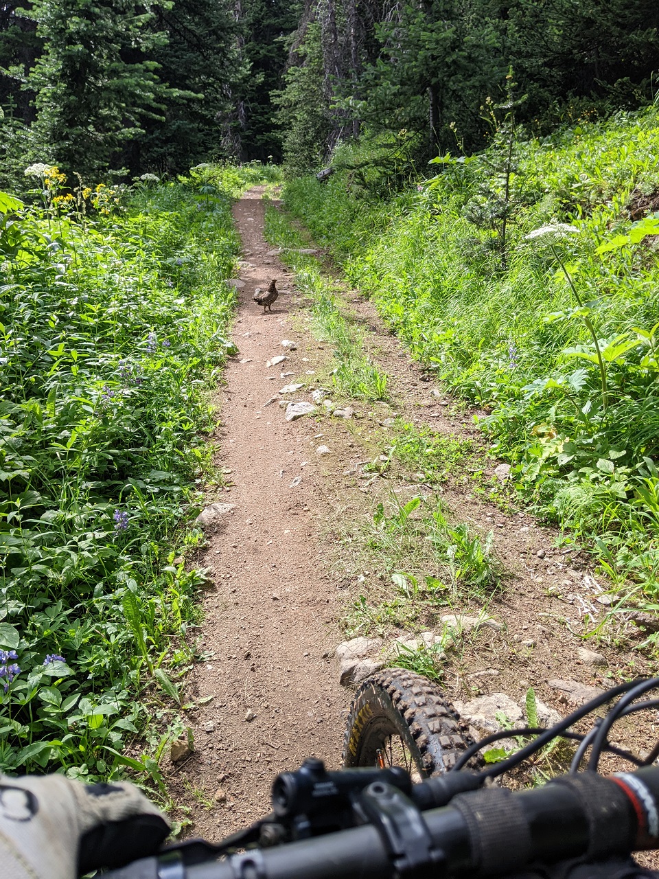
Wasn't fooled though. Spotted baby next to the trail
Taylor was a pretty nice climb. Even the bugs weren't bad (yet).
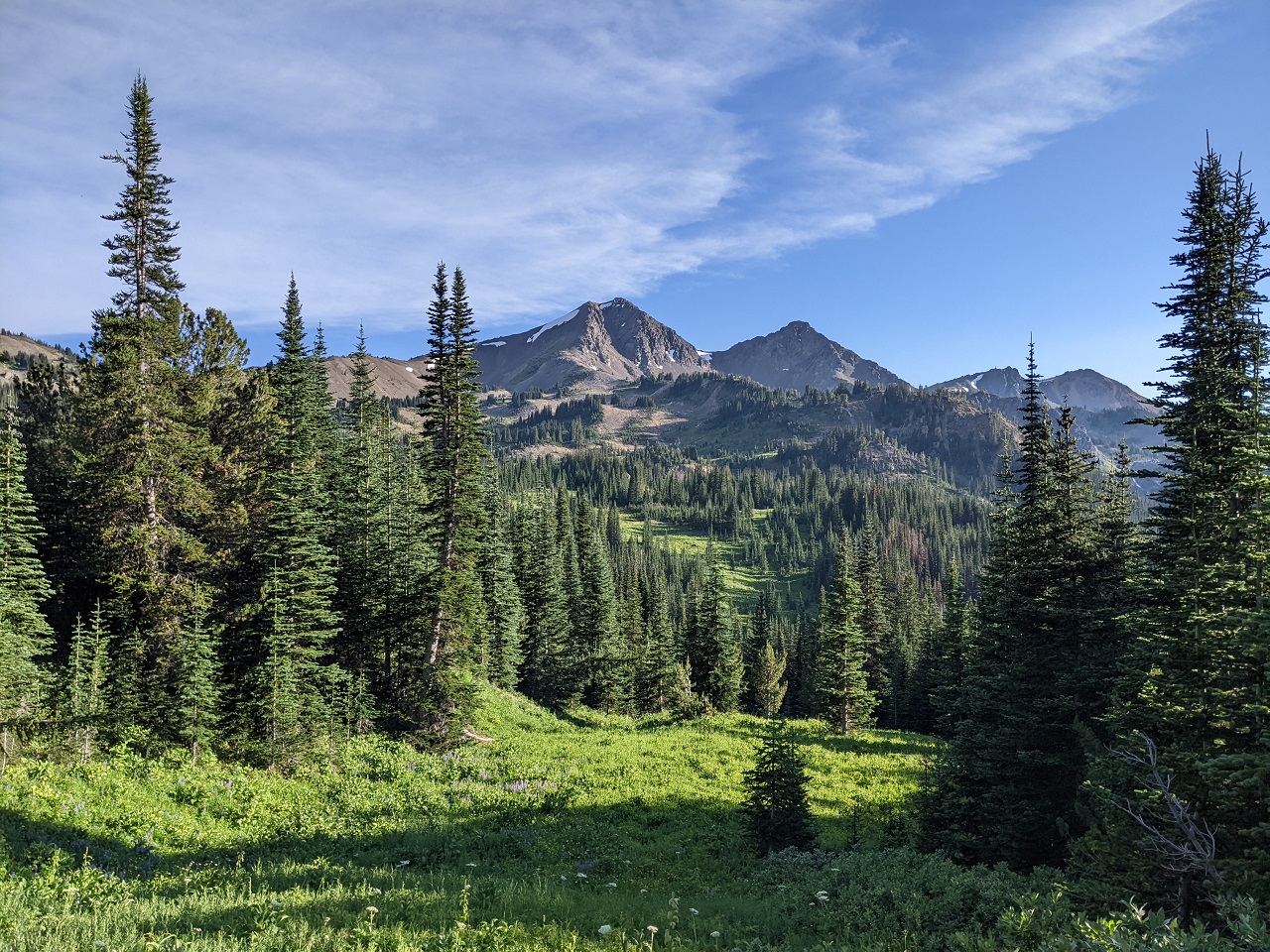
Cool lookin mountain. Wait, I was on top of that yesterday!
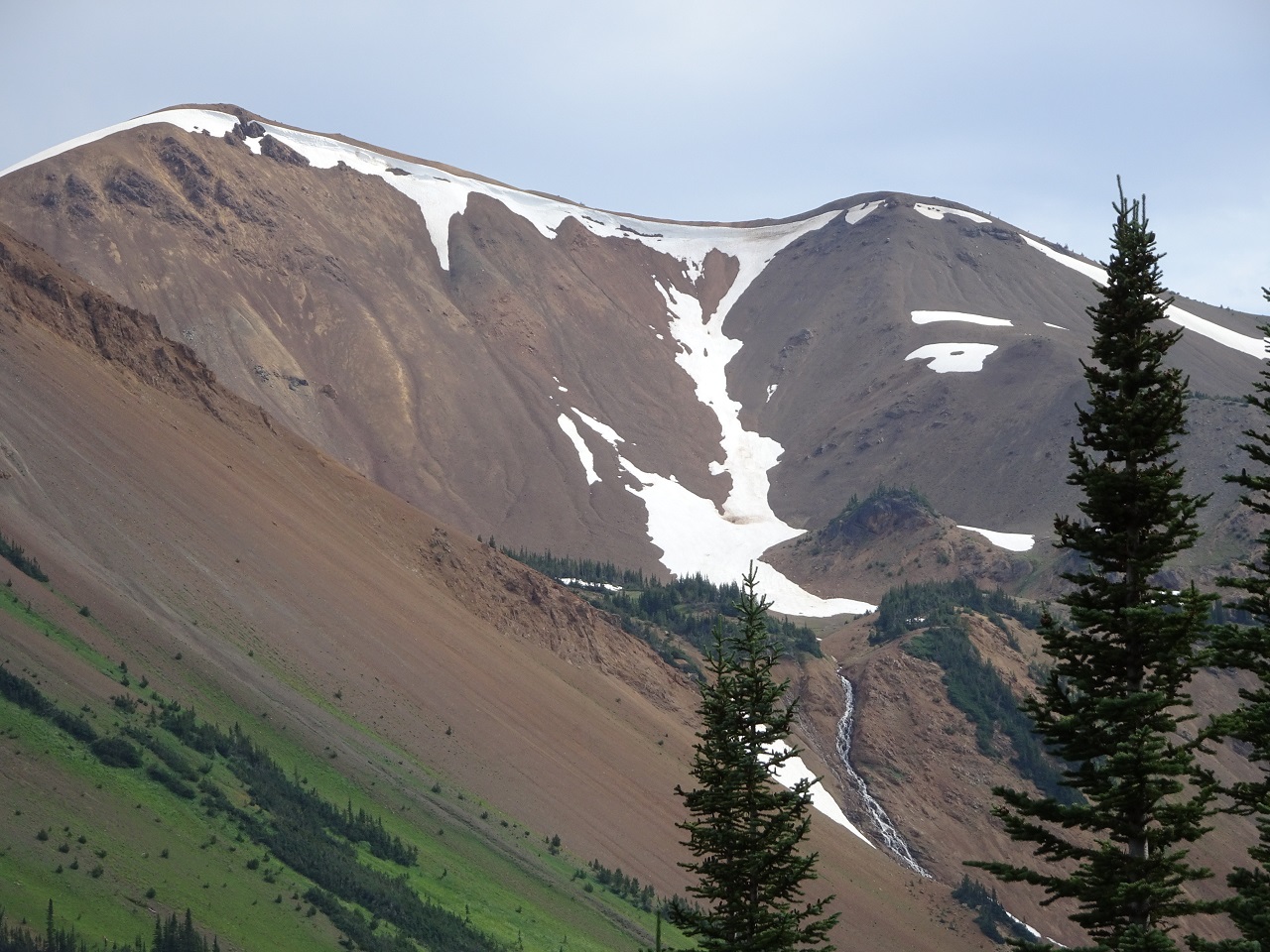
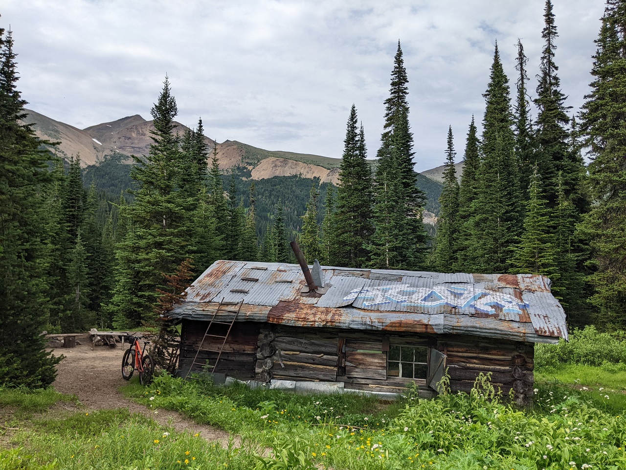
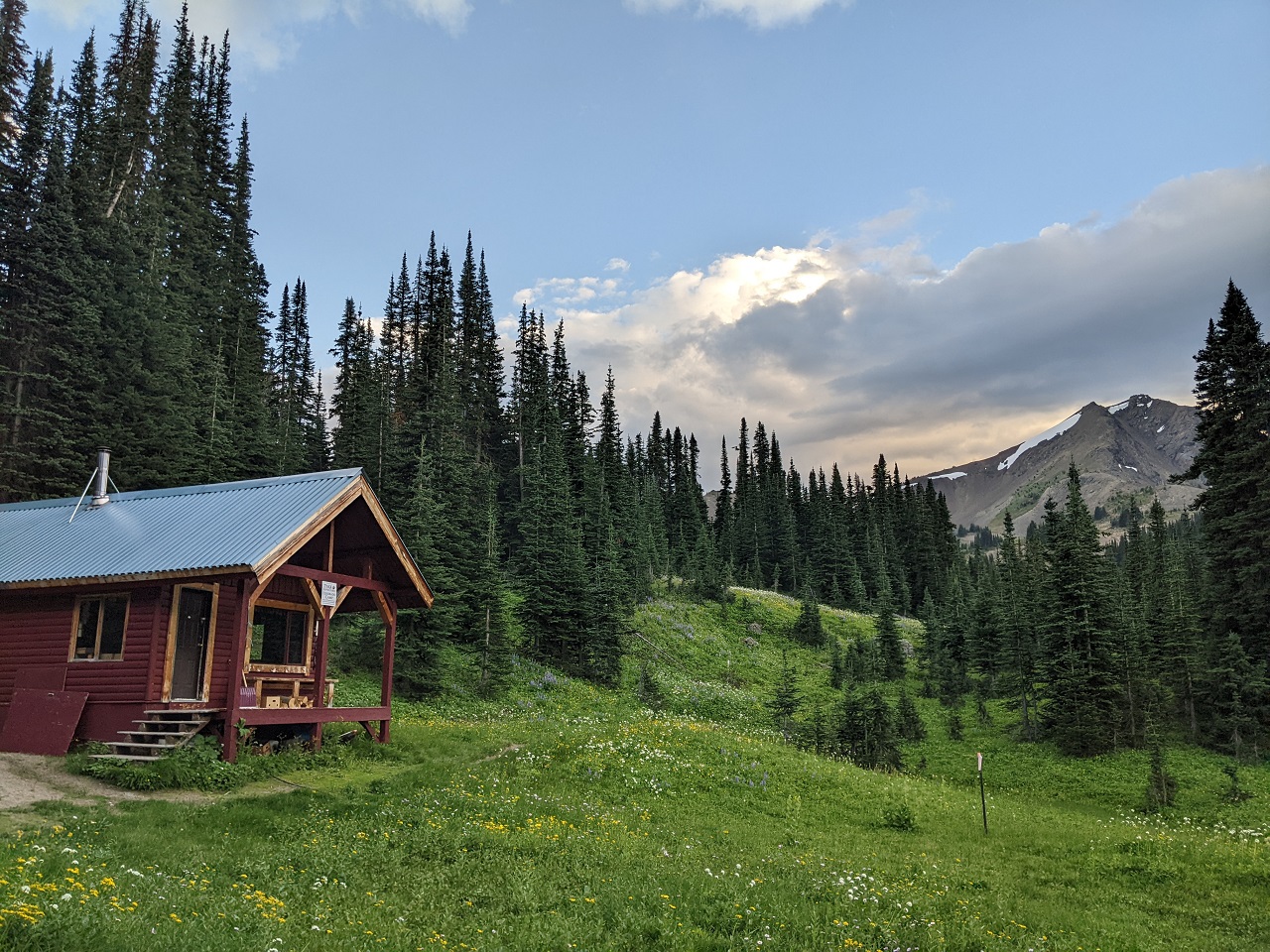
Stopped in at Taylor Cabin
Enjoying the views at the top of the climb
They could have at least stopped to give me a lift, but no dice.
Nice meadows down in the valley
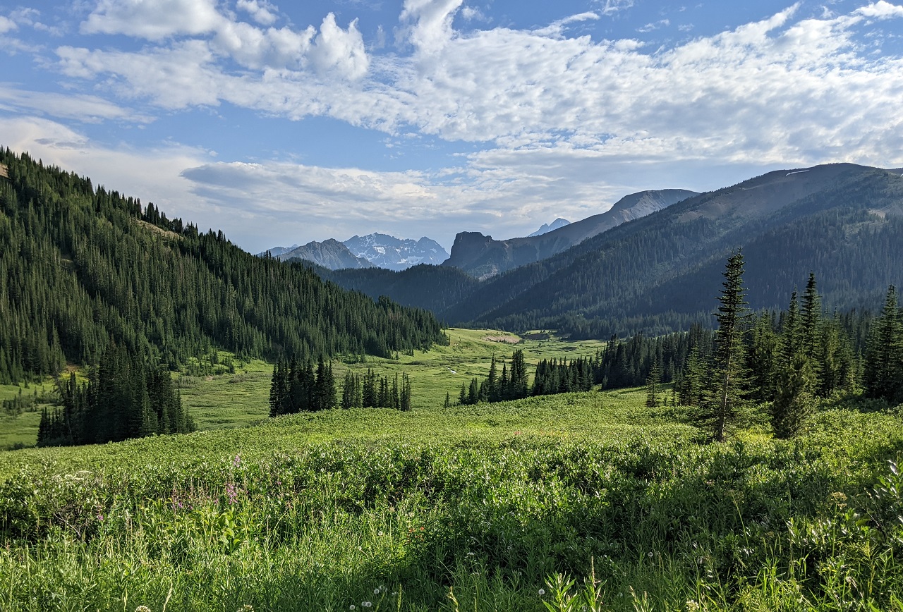
Looking back at the pass where I just was.
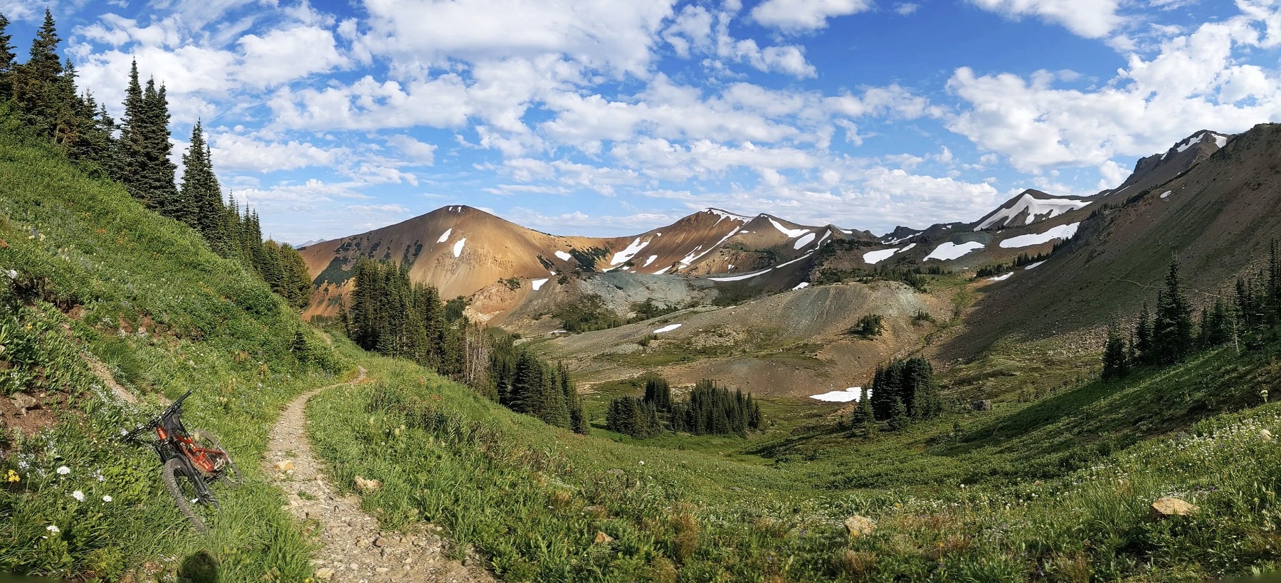
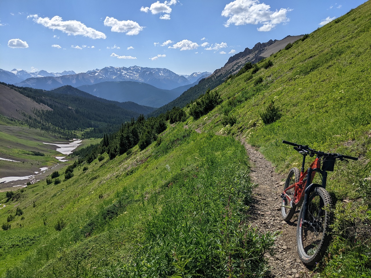
Decided to go up Windy pass. Solid climb coming up.
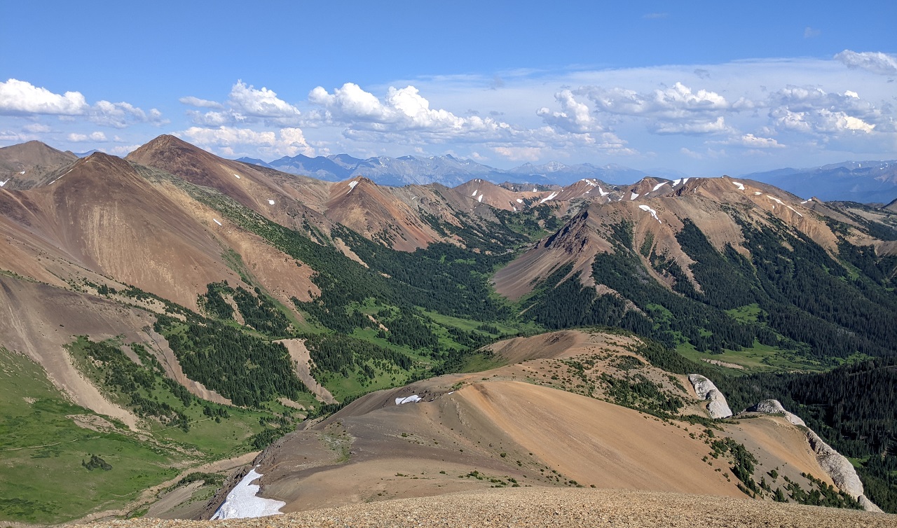
Almost there, views just kept getting better and better
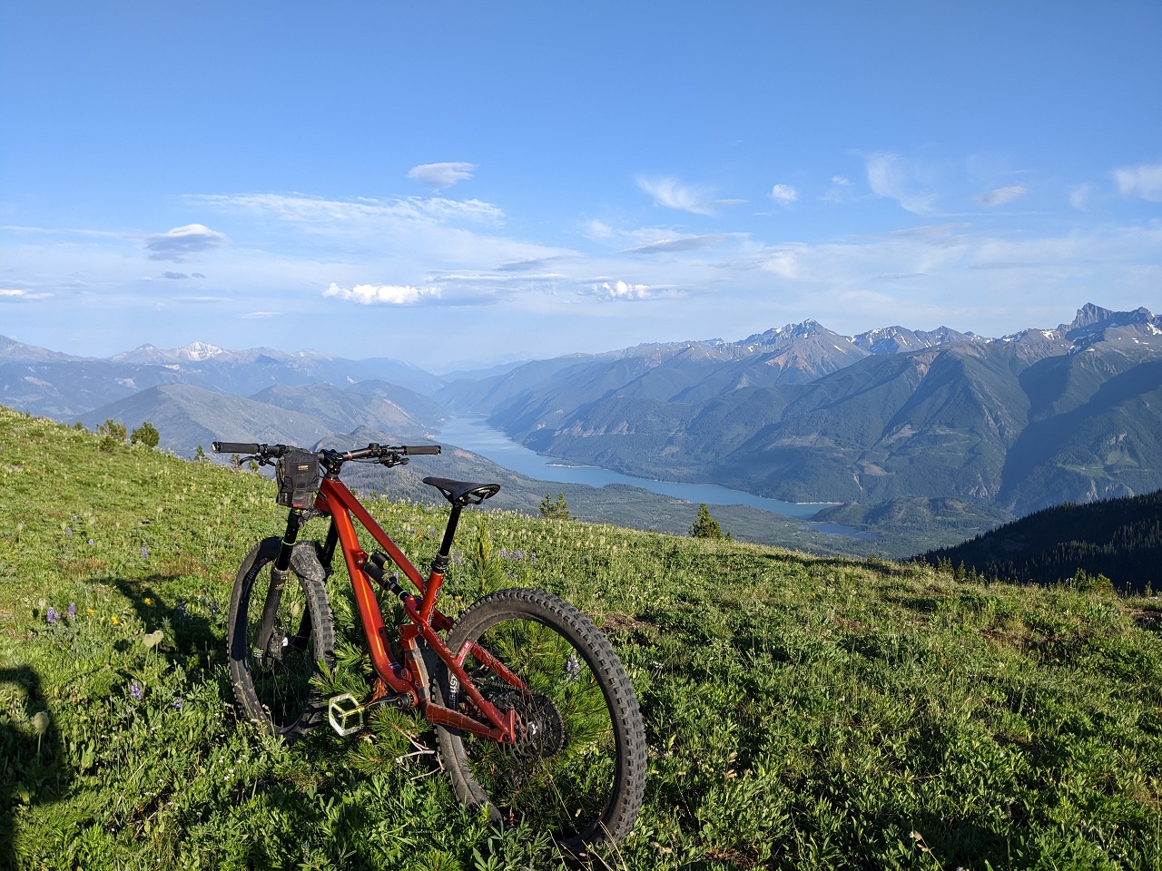
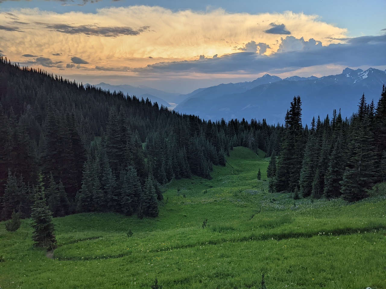
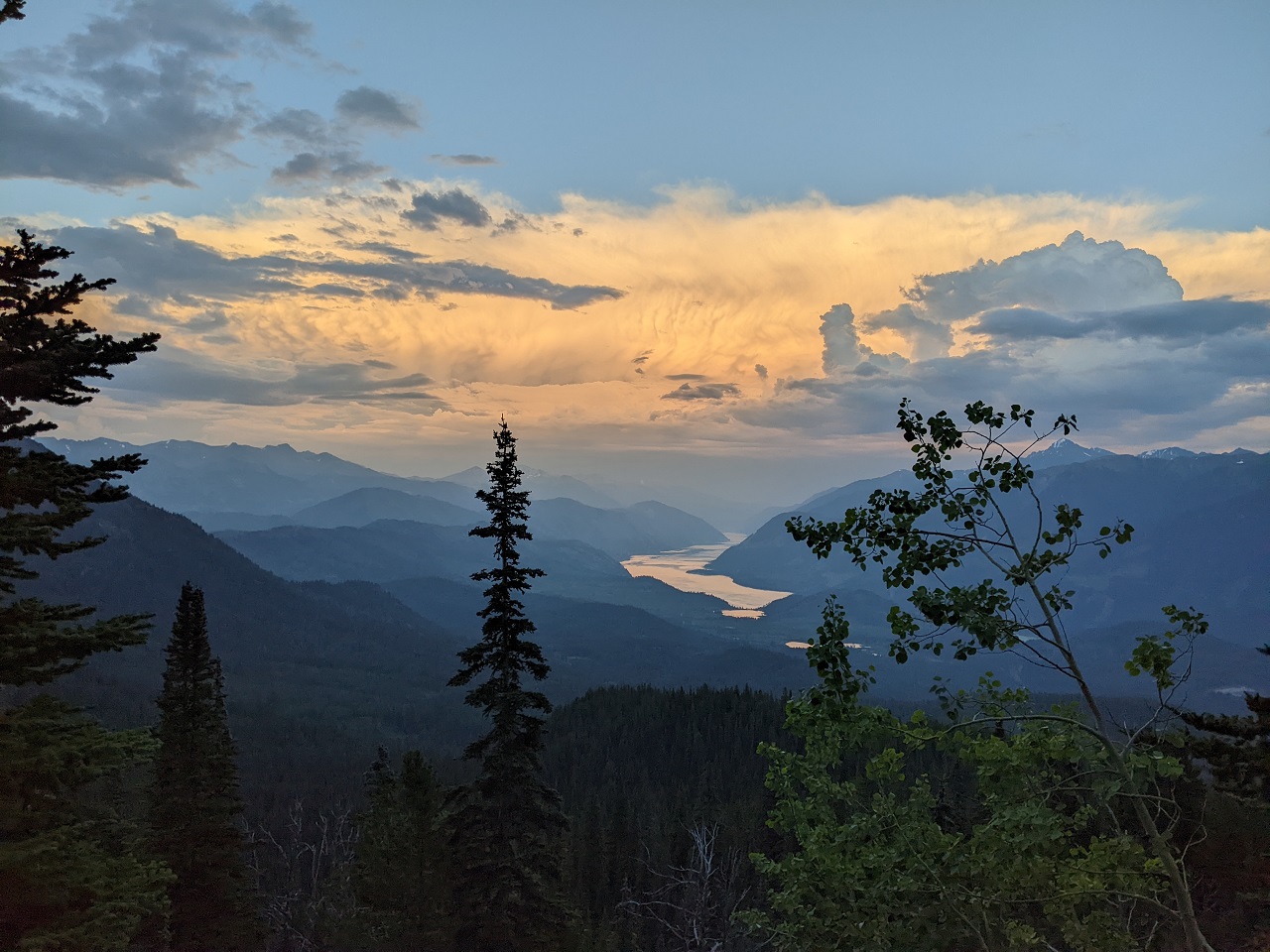
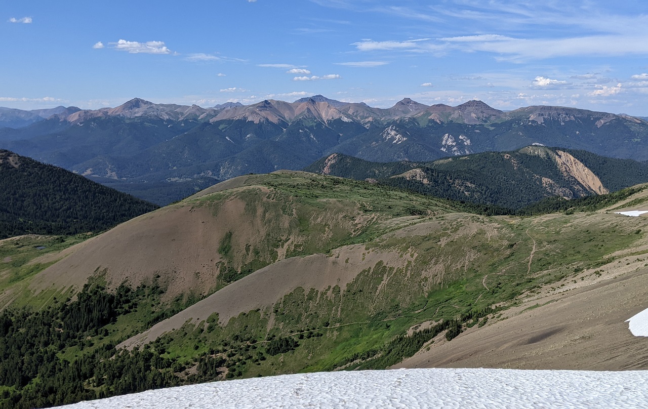
Looking down the far side. Spruce Lake is out of sight down in the valley and around the corner to the right
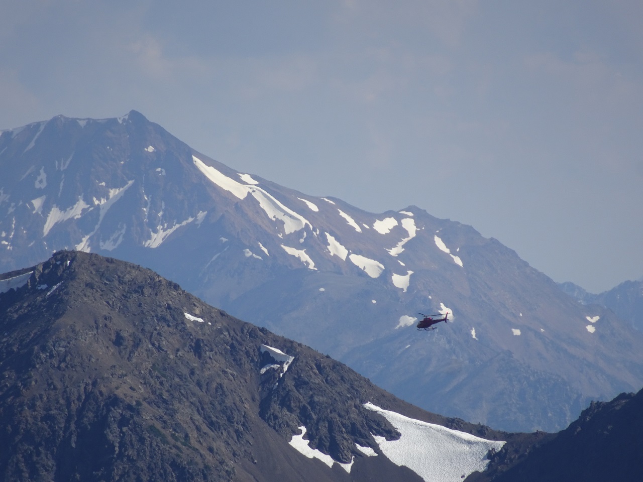
Did a bit of exploring along the ridge tops. Just a bit of white stuff (snow). Also spotted more white (goats).
Cool.
Realized it was getting a bit late, so dropped back down and continued on High Trail. Chasing marmots off Windy pass:
High trail through there is pretty nice...until it turns uphill. Bugs got real bad again. Head net back on.
Eldorado Cabin. No one there to high five or hand me a beer.
Hadn't paid enough attention to the topo map, didn't realize there was a 1k climb to get to the start of Lick Creek descent. Had my lights with me (always carry them on long rides) so no big deal
Lick
Didn't turn lights on until the bottom of Lick. Took the singletracks to shortcut from Gun Creek Rd over to Tyaughton which had an annoying amount of uphill. Maybe an hour in the dark. Fun day.
Last edited by evdog; 06-28-2024 at 03:57 PM.
-
10-19-2022, 11:30 AM #36
Registered User
- Join Date
- Sep 2006
- Posts
- 273
Evdog for President!
looks amazing
-
10-20-2022, 04:58 PM #37
Registered User
- Join Date
- May 2012
- Location
- People's Republic of OB
- Posts
- 5,170
No interest in being president, but thanks!
Third day....
Decided to climb up Gun Creek to avoid duplicating routes from the first two days.
Looking at routes the night before I was considering climbing up to Hummingbird or even Trigger Lake which of course led to the brilliant idea to keep going and climb over Deer Pass then around to Spruce Lake. Laughed when I added up the mileage... 51mi, and that's with a partial shuttle to Jewel bridge. 51mi is a big enough day on normal xc terrain. Chilcotin miles are not normal miles....
Interestingly the couple in the campsite next to me told me they were planning to do a similarly big route... up Taylor, over Windy Pass, over Deer Pass, out Gun Creek and back to camp. This was their first time in the Chilcotins and said the numbers looked doable. I pointed out the Chilcotin miles aspect and how steep the hike a bike could be on some of the passes. They were still in, and were already planning to leave at 4am.
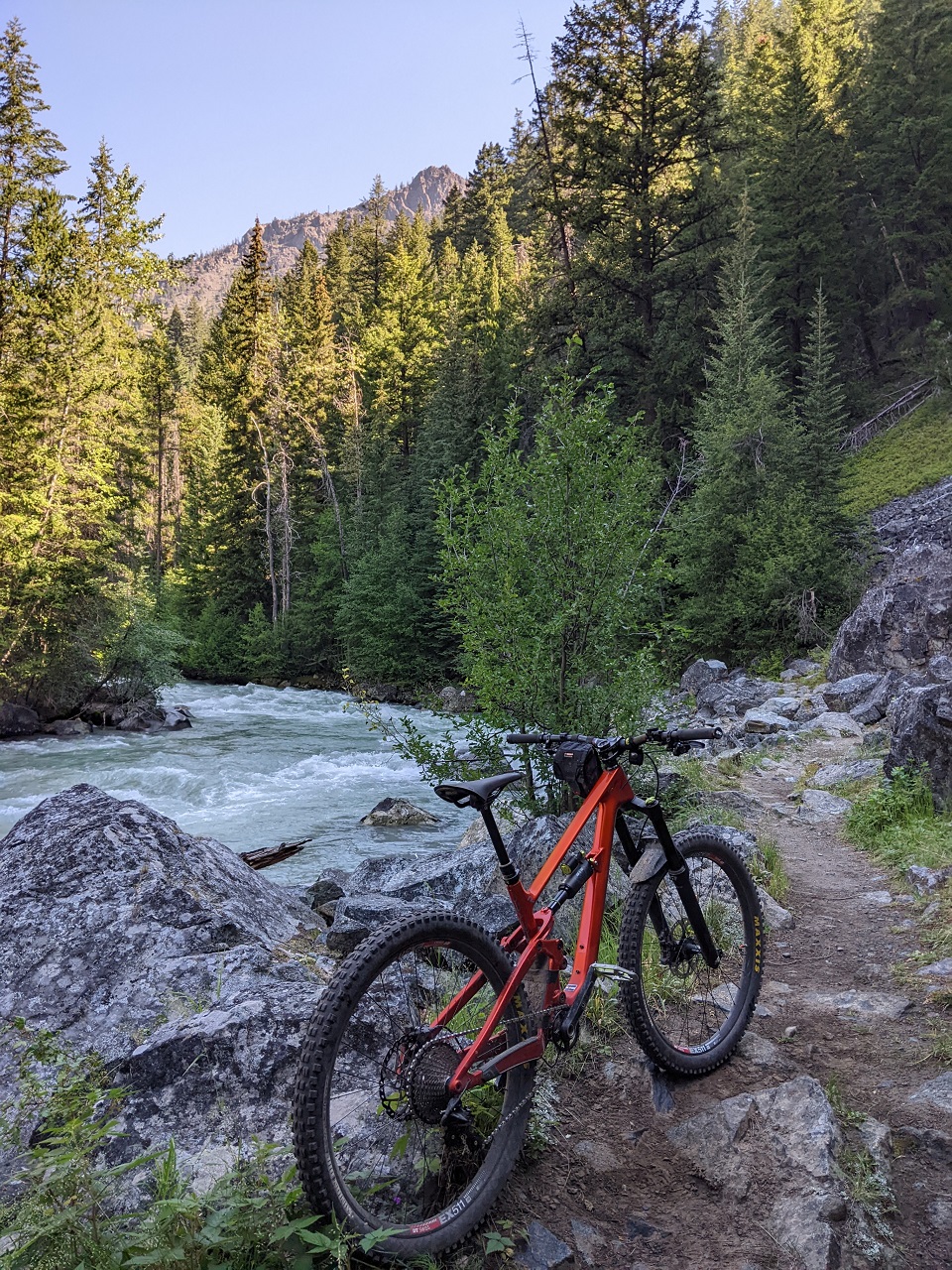
Gun Creek still running fast
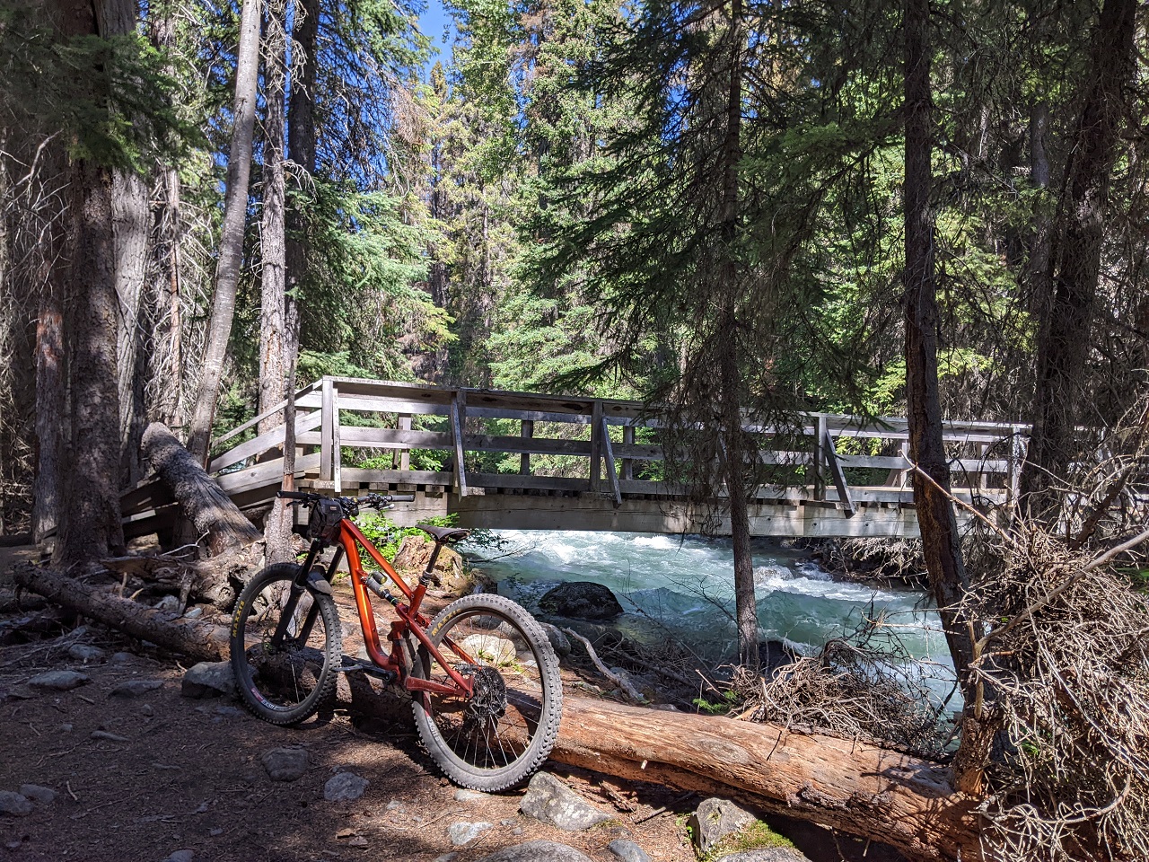
Climb up was uneventful. Cut out a few small downed trees, and was passed by a group of 4 bikepackers on their way out.
With another late-ish start the other lakes would be too far unless I just rode out and back down Gun. So instead I headed over to Spruce Lake. No one was at the first camp though I could hear voices carried from somewhere further along the lake
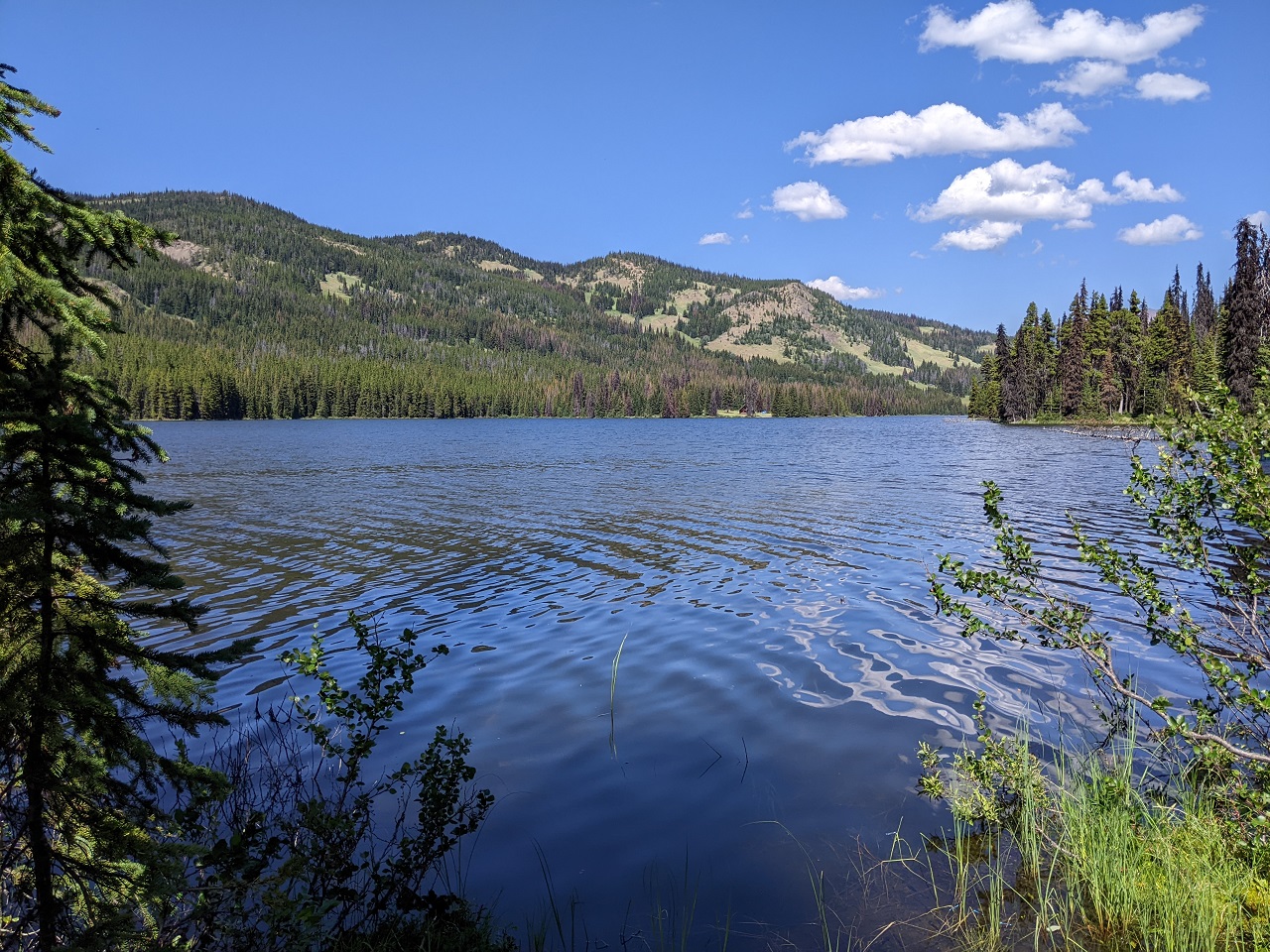
After considering options I decided to go back up Windy Pass and see what sort of trouble I could get into
This sort of trouble. Had been able to confirm the day before there weren't any big snow drifts to contend with
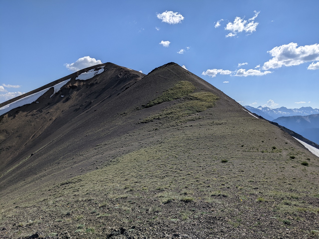
Just some steep loose hike a bike. The views up top were worth it though
There is supposed to be a line down this ridgeline but I couldn't see it, and wasn't interested in having to bushwack out at the bottom
I did see a line going down an adjacent ridge and could visually follow it all the way to treeline. Winner
The ridge line ran about as well as I could have expected. Disappeared in a few spots and was a bit overgrown below treeline, but not bad. Glad I checked it out
Back on the High Trail
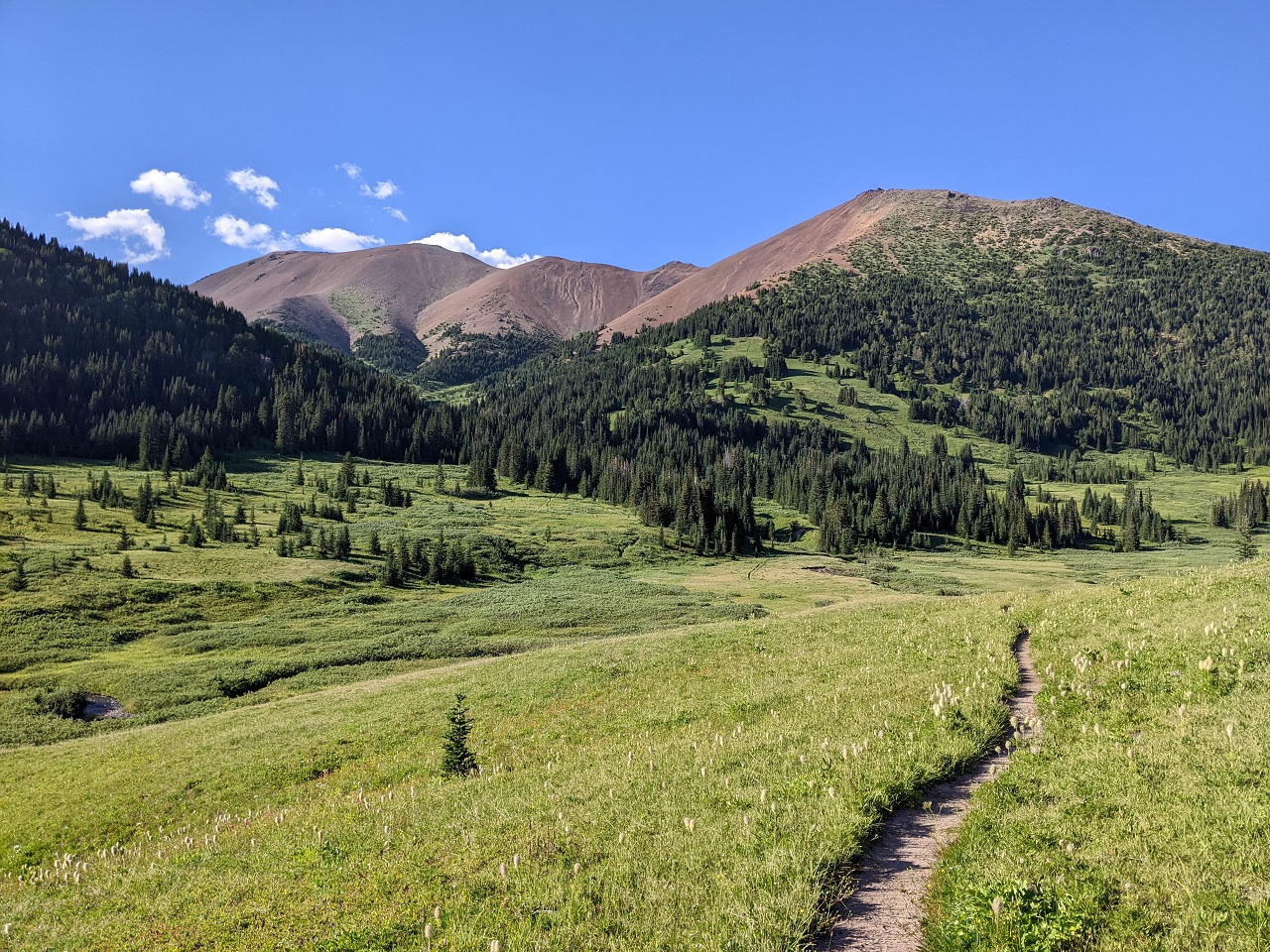
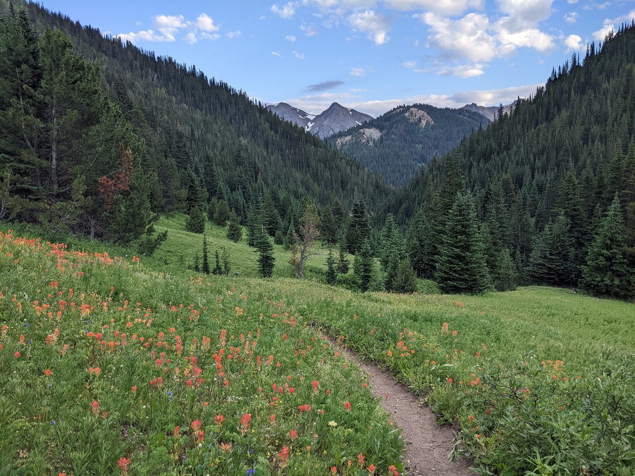
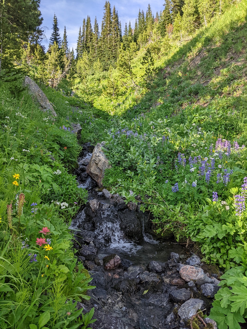
Water and flowers everywhere
Made pretty good time across the High Trail but it would still cut it close with available daylight
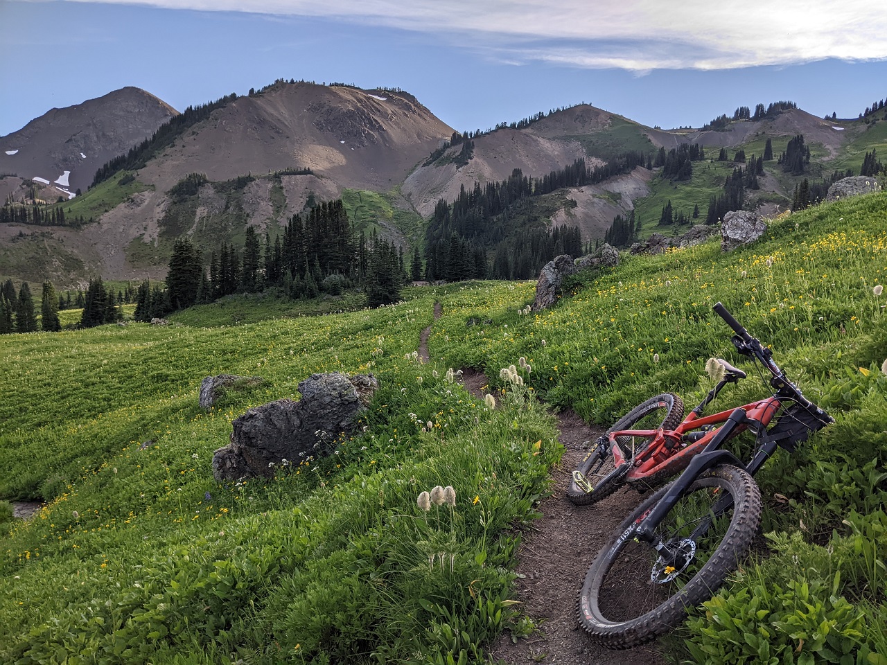
Loved the mix of forest and meadow riding. Awesome views each time you pop out into a meadow.
Aimed for the Molly Dog/Pepper Dog descent. Fortunately where these exit there isn't a ton of climbing to get back to Tyaughton Lake Rd like I'd had the day before. Another fun ride, just enough daylight again for a swim.
Here's some High Trail footage. I'd been planning to do a vid of Molly Dog/Pepper Dog but they look pretty meh on vid even though they're a fun ride.
If I'd planned my trip better I could have done a 3-day bikepack rather than three day rides which would have allowed me to get further out. But either way I was stoked to get back out in this area and check out a bunch of stuff closer to Tyaughton that I'd not been on before.Last edited by evdog; 06-28-2024 at 03:58 PM.
-
10-20-2022, 05:10 PM #38
Registered User
- Join Date
- Jan 2013
- Location
- Northern BC
- Posts
- 2,601
I ended up here via the Wildlife Thread. Solid stuff!!! Plenty o' stoke.
-
10-20-2022, 05:31 PM #39
Registered User
- Join Date
- Jan 2006
- Posts
- 1,626
How about Mayor of the pics thread?
How much of that Chilcotin riding were you able to stay on the bike?
-
10-21-2022, 01:36 AM #40
Registered User
- Join Date
- May 2012
- Location
- People's Republic of OB
- Posts
- 5,170
Guessing 25-30% of each day was pushing and the rest mostly rideable. Chilcotins are mostly old pack trails with a lot of steep fall line trail. The bigger climbs go up passes and you will push most of these. They can get outrageously steep at times. But then you get a fun descent down the far side (if it's not horribly overgrown). You'll do more riding in the valleys but can be on and off the bike a lot for short steep climbs, ruts, mud, overgrowth and creek crossings. Typical little maintained backcountry trail. Originally Posted by panchosdad
Quick math:
Day 1 - pushed 5 miles of 16: 3 miles up the road portion of High Trail, a mile up Camel Pass, another mile on Ridge or Rama including some downhill HAB
Day 2 - 6 miles of 32. 2-3 miles up Taylor, a mile up Windy, a couple to Lick Creek trail, maybe a mile more near the end.
Day 3 - 7 miles of 28. Maybe 2 miles up Gun Creek, 3 miles up Windy, and a couple on High Trail
-
10-21-2022, 08:41 AM #41
tree junkie
- Join Date
- Dec 2006
- Location
- bestcoast
- Posts
- 2,180
yeah Spruce Peak, so good! that first line down L&S bluffs goes, we did the same line as you did second weekend in september, had done it maybe 5-6 years ago too.
-
10-21-2022, 09:45 AM #42
tree junkie
- Join Date
- Dec 2006
- Location
- bestcoast
- Posts
- 2,180
also, definitely a good call to not go up deer from Gun, the descent to Gun Creek is sooooo goooood
-
05-30-2023, 08:14 PM #43
Registered User
- Join Date
- Nov 2013
- Posts
- 824
We rescheduled for summer 2023 after the plane crash/Covid outbreak shenanigans last summer. Just received this email…
Bummer. I’m sure there is a lot that went in to the decision, but receiving this ~6 weeks out from our re-booked trip was a bit of harsh toke.
First world problems, eh?
-
05-31-2023, 05:49 AM #44
tree junkie
- Join Date
- Dec 2006
- Location
- bestcoast
- Posts
- 2,180
Tough situation for them to be in and decision to have to make...certainly not ideal, I know they would've preferred a different outcome for this year, and they did try. The plane they did get is certainly not the classic beaver, but it will be more powerful and have more capacity from what I understand.
-
05-31-2023, 09:13 AM #45
Registered User
- Join Date
- Apr 2006
- Location
- SF & the Ho
- Posts
- 10,652
TR - South Chilcotins, etc.
Wow ya, only 6 weeks notice seems short but I think I’d still prefer that than the gravel rumble van trip we had to take out when we got smoked out at the end of our trip and they couldn’t fly
Last edited by mcski; 05-31-2023 at 02:24 PM.
-
05-31-2023, 12:29 PM #46
Registered User
- Join Date
- Nov 2013
- Posts
- 824
Totally understandable. I just hope they operate at their full capacity in the coming years. Originally Posted by t.odd
Any info on the plane? An Otter, perhaps?
-
06-01-2023, 12:54 PM #47
tree junkie
- Join Date
- Dec 2006
- Location
- bestcoast
- Posts
- 2,180
don't want to steal their thunder, but that's a solid guess... Originally Posted by gnarbro365
-
08-02-2023, 06:44 PM #48
tree junkie
- Join Date
- Dec 2006
- Location
- bestcoast
- Posts
- 2,180
SCMP closed due to Downton lake fire....https://bcparks.ca/south-chilcotin-m...ails-container
tough times at Gun Lake yesterday, heart goes out to those that lost places. Gnarly photos over the past 24 hours for sure.
-
08-17-2023, 10:07 PM #49
tree junkie
- Join Date
- Dec 2006
- Location
- bestcoast
- Posts
- 2,180
they almost had the Downton fire contained, went beserk in the wind late afternoon and it's jumped gun creek and is now engulfing the whole south slope of the park facing Tyaughton....holding out hope for the residents, but man this is sad
live stream from gun lake looking north end of lake, and Lick/High beyond...madness https://www.youtube.com/watch?v=YzTf_7QYGwk

 Reply With Quote
Bookmarks