Yeah, PNW will never be the same after Cascadia goes. Seattle and Portland will be a top-shelf dystopian hellscapes.
Results 51 to 66 of 66
Thread: Landslide Nightmares
-
01-12-2018, 05:36 PM #51
-
01-12-2018, 05:39 PM #52
Been a geobuff all my life (at some point almost started studying geology..) so good reading here.
Few years back went from Calgary to Fernie and saw the Frank slide. Was really mind boggling to see it live.
One of the "does not compute" moments. Impressive.
But, as always at TGR, stepping up a bit :
The "potential" Canary Islands tsunami : https://en.wikipedia.org/wiki/Cumbre_Vieja
Over hyped, probably, but certainly would make a mess.
Or back in the days when even Iceman was young : https://en.wikipedia.org/wiki/Zanclean_flood (ok, that is not a landslide. but lot of shit happened.)
The floggings will continue until morale improves.
-
01-12-2018, 07:34 PM #53
You wanna talk floods? This is why eastern Washington has such fertile soil for growing crops.
Missoula Floods
The Missoula Floods (also known as the Spokane Floods or the Bretz Floods) refer to the cataclysmic floods that swept periodically across eastern Washington and down the Columbia River Gorge at the end of the last ice age. The glacial flood events have been researched since the 1920s. These glacial lake outburst floods were the result of periodic sudden ruptures of the ice dam on the Clark Fork River that created Glacial Lake Missoula. After each ice dam rupture, the waters of the lake would rush down the Clark Fork and the Columbia River, flooding much of eastern Washington and the Willamette Valley in western Oregon. After the rupture, the ice would reform, creating Glacial Lake Missoula again.
During the last deglaciation that followed the end of the Last Glacial Maximum, geologists estimate that a cycle of flooding and reformation of the lake lasted an average of 55 years and that the floods occurred several times over the 2,000-year period between 15,000 and 13,000 years ago. U.S. Geological Survey hydrologist Jim O'Connor and Spanish Center of Environmental Studies scientist Gerard Benito have found evidence of at least twenty-five massive floods, the largest discharging ≈10 cubic kilometers per hour (2.7 million m³/s, 13 times the Amazon River).[2] Alternate estimates for the peak flow rate of the largest flood include 17 cubic kilometers per hour[3] and range up to 60 cubic kilometers per hour.[4] The maximum flow speed approached 36 meters/second (130 km/h or 80 mph).[3]
Within the Columbia Basin, detailed investigation of the Missoula floods' glaciofluvial deposits, informally known as the Hanford formation, has documented the presence of Middle and Early Pleistocene Missoula flood deposits within the Othello Channels, Columbia River Gorge, Channeled Scabland, Quincy Basin, Pasco Basin, and the Walla Walla Valley. Based on the presence of multiple interglacial calcretes interbedded with flood deposits, magnetostratigraphy, optically stimulated luminescence dating, and unconformity truncated clastic dikes, it has been estimated that the oldest of the Pleistocene Missoula floods happened before 1.5 million years ago. Because of the fragmentary nature of older glaciofluvial deposits, which have been largely removed by subsequent Missoula floods, within the Hanford formation, the exact number of older Missoula floods, which are known as Ancient Cataclysmic Floods, that occurred during the Pleistocene cannot be estimated with any confidence.[5][6]“When you see something that is not right, not just, not fair, you have a moral obligation to say something. To do something." Rep. John Lewis
Kindness is a bridge between all people
Dunkin’ Donuts Worker Dances With Customer Who Has Autism
-
01-12-2018, 07:46 PM #54
The phrase Channeled Scablands runs through my mind constantly whenever I've visited E. WA.
-
01-12-2018, 09:32 PM #55
https://www.nbcnews.com/business/10-...ers-6c10088195
when it comes to natural disasters, you can run but you can't hide. The one that I'm worried about is climate change.
-
01-13-2018, 04:27 PM #56
-
01-18-2022, 01:48 PM #57
"It felt like a volcanic erection."
-
01-18-2022, 03:03 PM #58
-
09-21-2022, 12:59 PM #59
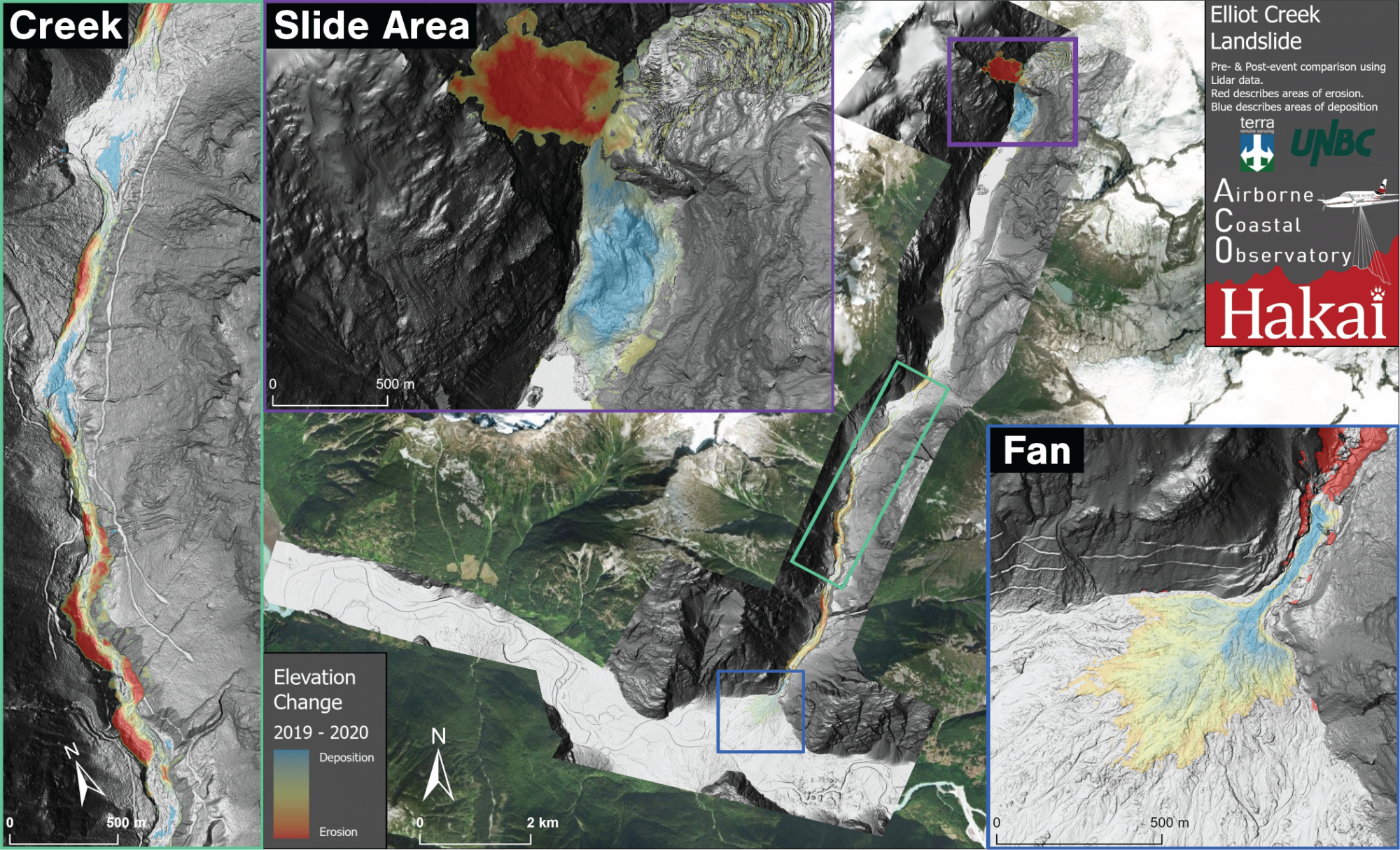
Looks like BC had a big one in 2020, great article from the Hakai institute here
Part two of the hazard cascade is sudden, short, and dramatic.
When the landslide slammed into two-kilometer-long Elliot Lake, it was traveling around 170 kilometers per hour. The impact displaced a huge amount of water and kicked up a 100-meter tsunami wave
https://hakai.org/getting-to-know-a-landslide/
-
08-02-2024, 10:41 PM #60
i had heard about this slide, but i had no idea how fuckin' hudge it actually is... dirt slid so damned deep, most of the trees are still standing upright ontop of the debris pile. this is gonna be a big mess when the river finally overtops that pile and starts flowing again.
-
08-02-2024, 11:40 PM #61
-
08-03-2024, 08:25 AM #62
 Registered User
- Join Date
- Mar 2008
- Location
- northern BC
- Posts
- 33,599
A guy was camping right at that slide almost got taken and his dog is missing,
you can see some burnt stems so an FF probably destabilized the land
the fish are coming pretty quick and they will have nowhere to goLee Lau - xxx-er is the laziest Asian canuck I know
-
08-03-2024, 01:23 PM #63
 Registered User
- Join Date
- Aug 2013
- Location
- shadow of HS butte
- Posts
- 6,721
See Quake Lake along the Madison, will probably end up very similar to that.
Sent from my iPhone using TGR Forums
-
08-03-2024, 08:18 PM #64
 Registered User
- Join Date
- Feb 2018
- Posts
- 313
-
08-03-2024, 08:27 PM #65
good. that'd be a really shitty way for a dog to go...
-
08-05-2024, 08:32 PM #66
Lake Chilcotin turning back into teh Chilcotin River…
Didn’t take long to go from this…
Ta this…


 Reply With Quote


Bookmarks