
Get the party started
Waiting to see the ESAC report
Results 1 to 25 of 346
-
01-08-2018, 10:10 AM #1
 Registered User
- Join Date
- Jul 2007
- Location
- Lakeside California
- Posts
- 545
Eastside Conditions/ Trip Report Thread 2018
-
01-08-2018, 03:00 PM #2
 Not on IR. For now.
- Join Date
- Jun 2006
- Location
- Couloirfornia
- Posts
- 8,874
Definitely looks like game on for pretty much the entire High Sierra.
 Originally Posted by Ernest_Hemingway

-
01-08-2018, 03:30 PM #3
 Old Man and the Ski
- Join Date
- Apr 2007
- Location
- Tahoe
- Posts
- 16,325
winter shoes are going on the van as i type.
powdork.com - new and improved, with 20% more dork.
-
01-10-2018, 09:36 AM #4
 Swimsuit Edition
- Join Date
- Oct 2006
- Location
- Uber Alles California
- Posts
- 3,955
Where are you going? Im ready to drive somewhere
Hello darkness my old friend
-
01-10-2018, 09:56 AM #5
Old Man and the Ski
- Join Date
- Apr 2007
- Location
- Tahoe
- Posts
- 16,325
im sitting at base of mcgee creek trying to figure out if its worth driving up. not sure where we'll end up.
suggestions?powdork.com - new and improved, with 20% more dork.
-
01-10-2018, 10:11 AM #6
 Rod9301
- Join Date
- Jan 2009
- Location
- Squaw valley
- Posts
- 4,960
Careful with the buried facets.
Sent from my Moto G (5) Plus using TGR Forums mobile app
-
01-10-2018, 10:23 AM #7
Registered User
- Join Date
- Jul 2007
- Location
- Lakeside California
- Posts
- 545
I think you should head up the trail and give us our after storm snow report
I was hoping to make this the weekend to open the season
Not so sure now
-
01-10-2018, 01:27 PM #8
Swimsuit Edition
- Join Date
- Oct 2006
- Location
- Uber Alles California
- Posts
- 3,955
Strong work Rod, thanks for the warning
Ski something with snow on it!! I'm eager to hear what you find.Hello darkness my old friend
-
01-10-2018, 01:33 PM #9
 can fly!
- Join Date
- Jan 2004
- Posts
- 18,825
I didn't believe in reincarnation when I was your age either.
-
01-10-2018, 01:38 PM #10
Registered User
- Join Date
- Jul 2007
- Location
- Lakeside California
- Posts
- 545
The Conway Summit Cam tells a bleak story
-
01-10-2018, 02:30 PM #11
Registered User
- Join Date
- Jan 2006
- Posts
- 407
Bleak.
thanks for posting the Bridgeport avi site. I didn't know they have a Bridgeport Winter Recreation Area and a permitting system in place.
Not sure what thread should take precedence for the eastside.
a bit of light at the end of the tunnel - Reno NWS forecast discussion
There are strong signals that region will return to a wet, and
potentially colder, pattern by the end of next week. A large scale
low pressure anomaly is forecast to develop along the west coast
for the first time this winter. This is a very different pattern
than we have spent most of the 2017/18 winter season in, with most
of the winter so far dominated by a strong high pressure anomaly
along the west coast. Atmospheric River tools are forecasting high
likelihood of 1 or 2 ARs reaching the west coast in the 15-18th
time period with the highest chances from Northern California into
the Pacific Northwest. The best chance for winter weather to
return to the Sierra would most likely be near the end, or after
that. The strengthening jet stream along the west coast is
forecast to slide south by the end of the week, finally allowing
cold air to move into the Sierra.
By midweek there is a chance we could see an initial wave of
precipitation as the nose of the strengthening jet stream reaches
the west coast with the EC is much more bullish for midweek. This
will still be early in the evolution of the large scale pattern,
with the best chances to see storms making it into the Sierra
during the end of the week.
This is the best signal for a winter weather pattern setting up in
the long range forecast this season. Of course, that doesn`t
guarantee a wet, snowy pattern, but considering all the signals it
raises the possibility to "more likely than not". Or another way
way to put it is that at least 3 out of 5 times we see signals
this strong 7-10 days away, the Sierra will end up in a stormy
weather pattern. -Zach
-
01-10-2018, 03:04 PM #12
Registered User
- Join Date
- Jul 2007
- Location
- Lakeside California
- Posts
- 545
GET BACK TO WORK
-
01-10-2018, 11:41 PM #13
Old Man and the Ski
- Join Date
- Apr 2007
- Location
- Tahoe
- Posts
- 16,325
so yesterday we parked off the scenic loop next to the 700' hump there and i went up in the morning. when we parked at about 2 in the morning it was snowing and 32 degrees. when i woke up it was in the dreaded 36 degree fog that eats snow. there's enough snow at the top for good turns but it runs out quickly.
about midway up in the barely mediocre section. it was okay above and heinous below
so we decided to head somewhere else but visibility was still crap, the snow levels were still high, avie danger was unknown but seemed high in the high country so we headed toward mammoth lakes basin with a 1:00 start. at about 9,200' we crossed into a more north facing zone and the snow immediately got much deeper and pole pits were sketchy. we were in a great spot to dig a pit and thought about making that our afternoon when it settled beneath us. so we dug our pit a few meters away (there weren't any cracks so we're not sure if it had already settled here). couldn't get it to collapse from above, but a pull from behind showed it would glide on the bearings below the ice layer. the ice layer was pretty stout there but with low pack variability the only decently filled in line there was a no go.
the next morning we drove up mcgee creek and found nothing inspiring or unbushwacky. same thing for june lake loop so we headed up to virginia lakes. the low angle trees on dunderberg looked good and also looked like a sure thing so we opted for that. there were probably better options but it worked out well
powdork.com - new and improved, with 20% more dork.
-
01-11-2018, 02:19 AM #14
can fly!
- Join Date
- Jan 2004
- Posts
- 18,825
Nice
I didn't believe in reincarnation when I was your age either.
-
01-11-2018, 03:30 AM #15
 Registered User
- Join Date
- Aug 2013
- Posts
- 776
Nice to see this thread back up and running finally.
-
01-11-2018, 07:42 AM #16
Registered User
- Join Date
- Jul 2007
- Location
- Lakeside California
- Posts
- 545
Thanks Powdork. Looks like a good weekend to stay at home
-
01-11-2018, 08:14 PM #17
registered abuser
- Join Date
- Oct 2003
- Location
- tahoe
- Posts
- 3,428
Yeah court! Thanx for sharing
-
01-12-2018, 12:31 AM #18
 ISO Shrubbery
- Join Date
- Dec 2004
- Location
- SoCal
- Posts
- 6,770
Awesome.
-
01-15-2018, 10:06 AM #19
 MDW SKPR extraordinaire
- Join Date
- Sep 2011
- Location
- here & there
- Posts
- 1,411
Was up in VL, Dunderberg then South peak & a shot of Black Mtn


-
01-15-2018, 12:38 PM #20
Registered Useless
- Join Date
- Oct 2016
- Location
- tahoe de chingao
- Posts
- 846
Looks like you made the most of it! Hoping to get down there in between storms this weekend. Thanks for posting Originally Posted by PowerWhore7
-
01-15-2018, 12:43 PM #21
Rod9301
- Join Date
- Jan 2009
- Location
- Squaw valley
- Posts
- 4,960
Did you dig a pit by any chance? There are supposed to be facets under a layer of snow.
Sent from my Moto G (5) Plus using TGR Forums mobile app
-
01-15-2018, 05:14 PM #22
can fly!
- Join Date
- Jan 2004
- Posts
- 18,825
Eastern Sierra Avalanche Center is looking for citizen observers.
I didn't believe in reincarnation when I was your age either.
-
01-15-2018, 09:33 PM #23
 Registered User
- Join Date
- Dec 2006
- Posts
- 3,710
Nice, PW7.
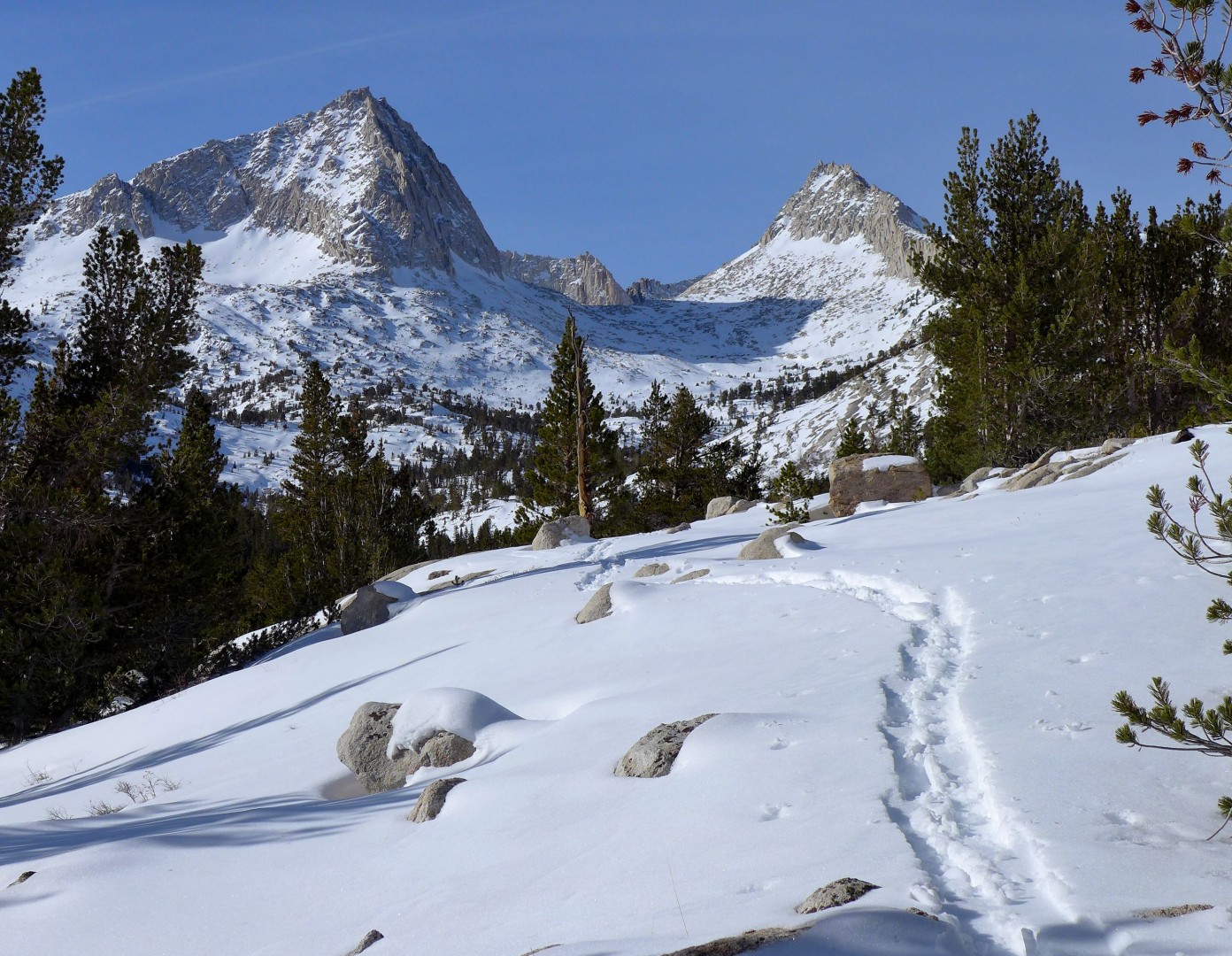
Bored of crap skiing in Tahoe, I made a last-minute decision to try the crap skiing in the Eastern Sierra.
Here's what this looks like.
January 2017.
January 2018.
Nothing in Pine Creek goes without scrambling up waterfalls and boulders for the first 1,000 feet. Pratt's Crack, on the other hand, is good to go.
Feather Peak was the goal. Advice: There's a fire road that meanders at an easy grade across the Tungstar gullies and eventually leads west into the right drainage. Don't do what I did which was abandon the fire road for 90 minutes of heavy-pack scree and bush scrambling because (a) your map doesn't show the fire road and (b) the fire road appears to go too far east (and is hard to see from below). Anyhow, take the fire road.
Much needed tent time.
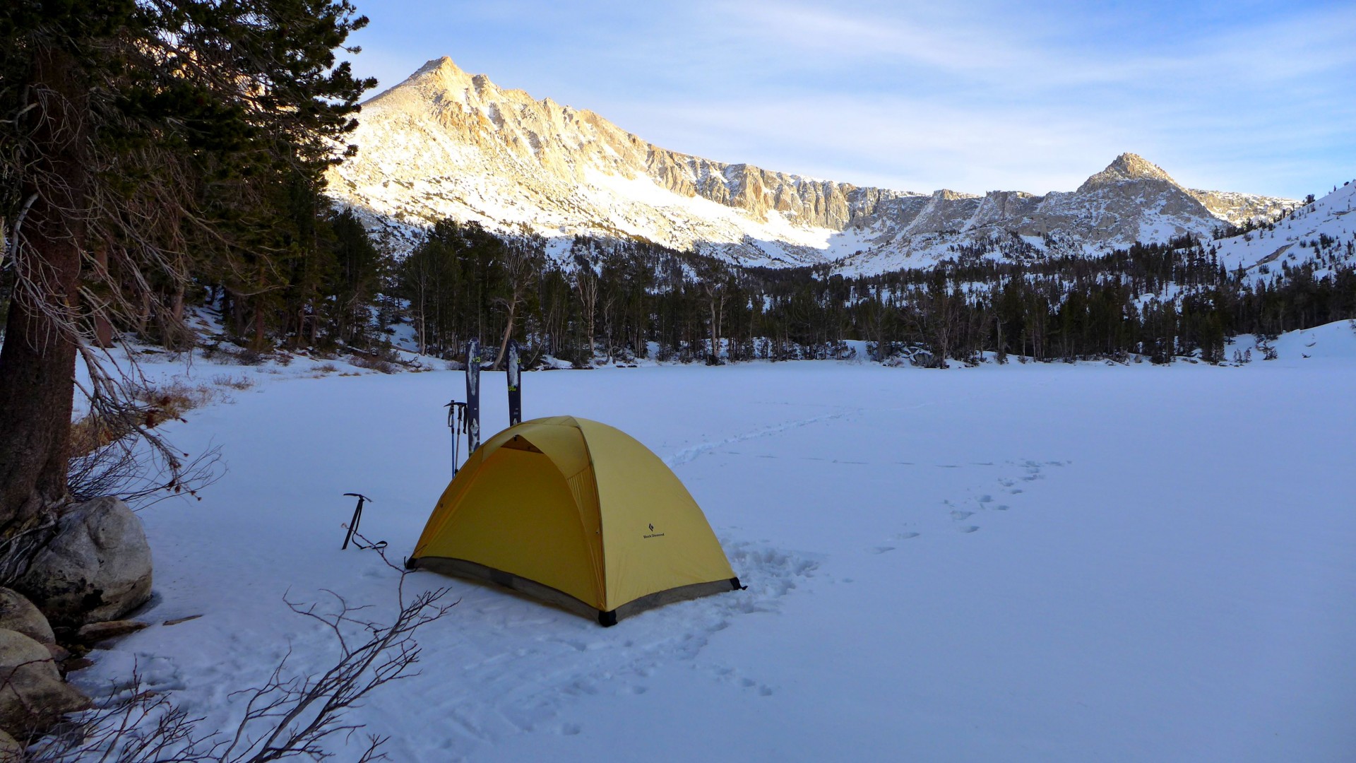
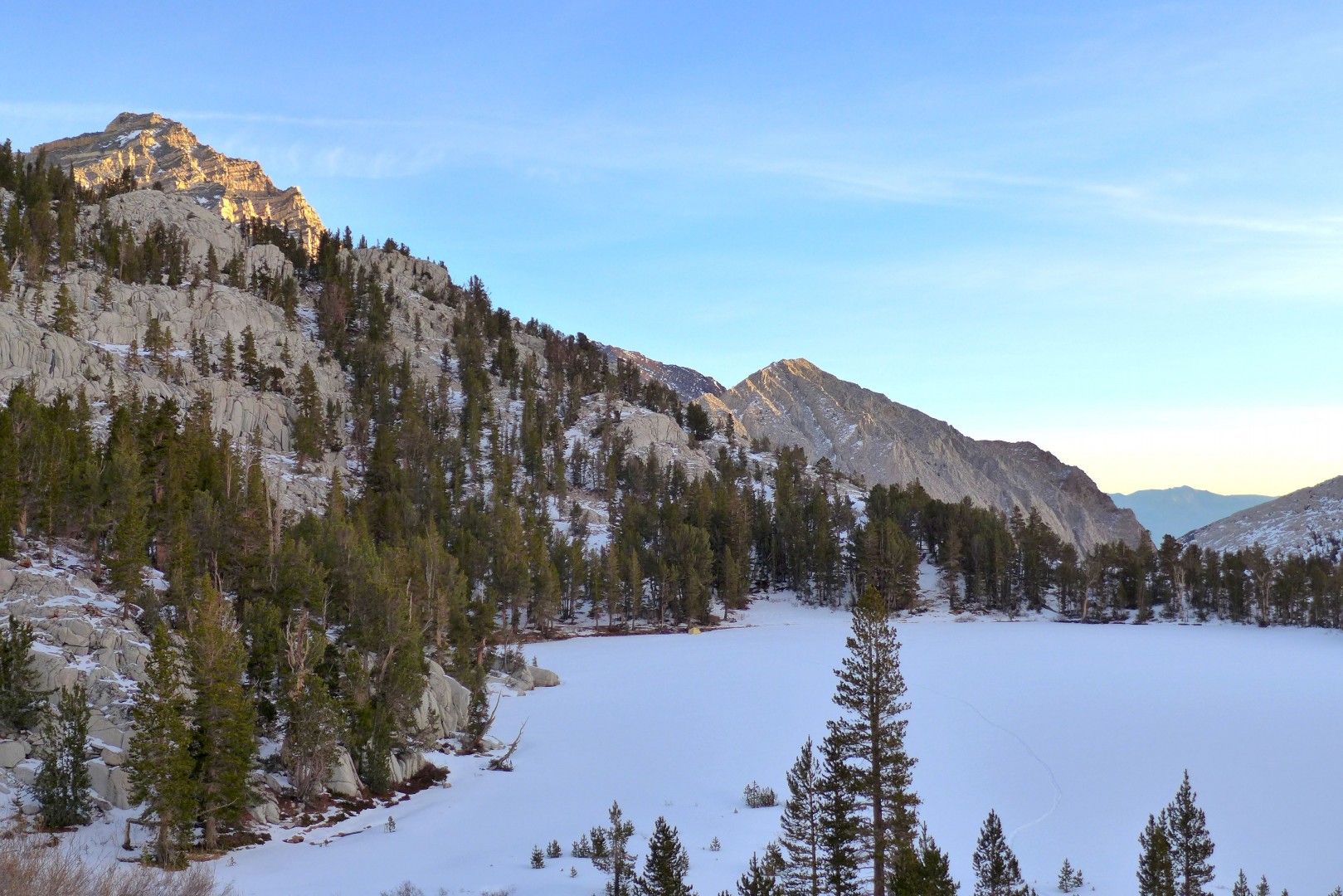
Sadly, I didn't make it to Feather or even Royce Lakes. Around 10,800, everything was whomping and fracturing no matter which way I went. It was unnerving. There was a facet layer about 12-16" below surprisingly decent powder. So, I cut my losses and turned tail. My campsite is below.
-
01-15-2018, 09:41 PM #24
Rod9301
- Join Date
- Jan 2009
- Location
- Squaw valley
- Posts
- 4,960
Thanks for the update.
Feather peak is on my list for this year.
Sent from my Moto G (5) Plus using TGR Forums mobile app
-
01-15-2018, 09:54 PM #25
Registered User
- Join Date
- Nov 2009
- Posts
- 860
Eastside Conditions/ Trip Report Thread 2018
I dug a pit at about 9,300 feet this past weekend above Lake George on the Crest. North facing, about a 30 degree slope. There was just over a foot of newer snow on top of an inch thick rain layer/very firm crust, with maybe 2 inches of facets underneath that. Compression test failed pretty dramatically at 25.
Last edited by Skeeze; 01-15-2018 at 10:43 PM.

 Reply With Quote
Bookmarks