
... Am I allowed to make it official?
A shade on the early side I know, but I picked up my pass today and I can't wait any longer.
Support Mag Projects First:
Ski Logs
Unofficial Squaw
Unofficial Squaw Weather Beta ~Freshies~
I don't know if it's a Mag Project, but I do think it fits here:
Unofficial Alpine
About Lake Tahoe ~powdork~
Liftopia ~Evmo~
Teh Weatha ~21tres~
The Back Country dedicated thread by BC Rider
*** Those who are interested can pour over the maps below, or you can get the NOAA Radio version of the weather forecast while you pinch your morning loaf! *** ~guermo~
Ed Berry's Atmospheric Insights. A good read if you really want to be more informed. ~SCUTSKI~
Resort Info:
** The "New Info" link is a site I recently became aware of where "current" conditions of specific resorts are located. I'm hoping that since the site is independent of the individual marketing teams that the reported conditions will be more accurate. [/hopefulness]**
Squaw: Lift Schedule and Snow Totals or New Info, WebCam
Alpine: Snow Totals and Lift Schedule or New Info, WebCam
Kirkwood: Snow Totals and Lift Schedule or New Info, WebCam
Mt. Rose: Snow Totals and Lift Schedule or The Straight Line, New Info, WebCam
Sugar Bowl: Lift Schedule and Current Conditions or New Info, WebCam
Heavenly: I could't find a grooming report or snow page so this is all I've got for mountain info... Heave Info or New Info, WebCam
Northstar: Snow Report and Lift Schedule and Season to Date Snow Totals or New Info, WebCam
Misc Travel/Weather Info:
Comprehensive Tahoe/Sierra Links: Weather, Snowfall, Traffic, Accidents, Webcams ~Skis4Fun~ <-- Snow conditions located here too!
WebCam Quick Links:
Sierra Vision You Pick 'ems
Tahoetopiea You Pick 'ems
Truckee I-80 You Pick 'ems
Sunnyside Resort
Tahoe City
Links:
SNOTEL Data: ~ja_surf~
Carson Pass
Heavenly
Echo Peak
Fallen Leaf Lake
Squaw Granite Chief
Mt. Rose
Loops:
University of Washington Maps
What's coming:
Powder Watch
NOAA Satellite IR Images (These are HUDGE pics so I just linked them): ~POWPIG~
1) 00Z GOES IR Satellite Image, Near Pacific
2) 00Z GOES IR Satellite Image, Broad Pacific
Maps:
Infrared Loop:
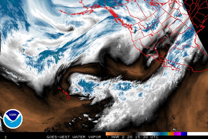
Water Vapor Loop:
(click images for the pages you can see these maps in motion... and the stills should update themselves too!)
Precipitation Forecast:
5 Day Precip Forecast:
~SCUTSKI~
Temperature Forecast:
Inches of Water Expected:
~woodsskier~
okbye
Results 1 to 25 of 4599
-
08-27-2008, 09:19 PM #1

 THE MOON RULZ #1
- Join Date
- Nov 2006
- Location
- Reno, NV
- Posts
- 2,244
 The "OFFICIAL" 08/09 Tahoe Conditions/Weather Tracking And What's Happening Thread
Last edited by RaccoonFace; 04-27-2009 at 03:51 PM.
TELL YOUR BOOBS TO QUIT STARING AT MY EYES!!!1!
Here, I'll help you out:
RENO SUPERMOTO Originally Posted by Nobody Famous

-
08-27-2008, 09:23 PM #2
Registered User
- Join Date
- Aug 2006
- Location
- Sierra
- Posts
- 42
That is rad. I'll be viewing this a whole lot.
-
08-27-2008, 09:35 PM #3
 misplaced transient
- Join Date
- Dec 2004
- Location
- wherever my car takes me
- Posts
- 1,718
In another 3 months if I remember the thread... Originally Posted by ecobrad
Originally Posted by wintermittent
Originally Posted by snowsprite
-
08-27-2008, 09:46 PM #4
glocal
- Join Date
- May 2002
- Posts
- 33,437
Wow. Kill effort.
That template could make for a forum of stickies for everywhere.
Going somewhere - click and drop right into all the conditions.
Got cumulative snow totals in there?
-
08-27-2008, 11:33 PM #5
 Registered User
- Join Date
- Jan 2006
- Location
- Alpine Meadows, CA
- Posts
- 4,461
Sweet work with all the maps. Should be super handy this winter.
**
I'm a cougar, not a MILF! I have to protect my rep! - bklyn
In any case, if you're ever really in this situation make sure you at least bargain in a couple of fluffers.
-snowsprite
-
08-28-2008, 12:31 AM #6
 wooooooohoooooooooooooo
- Join Date
- Dec 2003
- Location
- funland
- Posts
- 5,255
that's awesome. great work.

-
08-28-2008, 01:01 AM #7
Registered User
- Join Date
- Oct 2003
- Location
- Tahoe
- Posts
- 2,730
Tonsa cool maps/satellite shots here:
http://www.hffax.de/html/e_pacific.html
http://www.ssd.noaa.gov/PS/TROP/trop-epac.html
I love this one too:
http://www.ssd.noaa.gov/PS/TROP/DATA...-ir4-loop.html"The mind, once expanded to the dimensions of larger ideas, never returns to its original size."
-
08-28-2008, 02:55 AM #8
 Old Man and the Ski
- Join Date
- Apr 2007
- Location
- Tahoe
- Posts
- 16,321
the one i miss is the weather channel radar history. i used to be able to look at it in the morning and see what got hit over the previous 24 hours. can't find it anymore.
powdork.com - new and improved, with 20% more dork.
-
08-28-2008, 07:25 AM #9

 Deepo days
- Join Date
- Jun 2007
- Location
- Cruzing
- Posts
- 12,153
Nice work. Not so Tahoe specific, and not that accurate after 3-5 days, but 16 day precipitation forecast every 12 hours - http://ggweather.com/loops/eta_12z_slp_1-5.htm
And 10 day
http://weather.unisys.com/gfsx/9pane...es_9panel.html
-
08-28-2008, 07:33 AM #10
 The Wizard

- Join Date
- Dec 2007
- Location
- Time2clmbistan
- Posts
- 1,754
Nice work.
You know its august when... Originally Posted by Eldo
-
08-28-2008, 08:18 AM #11
click click boom
- Join Date
- Nov 2001
- Posts
- 11,326
SPECIAL WEATHER STATEMENT
NATIONAL WEATHER SERVICE SALT LAKE CITY UT
311 AM MDT THU AUG 28 2008
UTZ001>016-019>021-517-518-WYZ021-282200-
CACHE VALLEY/UTAH PORTION-NORTHERN WASATCH FRONT-
SALT LAKE AND TOOELE VALLEYS-SOUTHERN WASATCH FRONT-
GREAT SALT LAKE DESERT AND MOUNTAINS-WASATCH MOUNTAIN VALLEYS-
WASATCH MOUNTAINS I-80 NORTH-WASATCH MOUNTAINS SOUTH OF I-80-
WESTERN UINTA MOUNTAINS-WASATCH PLATEAU/BOOK CLIFFS-
WESTERN UINTA BASIN-CASTLE COUNTRY-SAN RAFAEL SWELL-
SANPETE/SEVIER VALLEYS-WEST CENTRAL UTAH-SOUTHWEST UTAH-
UTAHS DIXIE AND ZION NATIONAL PARK-SOUTH CENTRAL UTAH-
GLEN CANYON RECREATION AREA/LAKE POWELL-CENTRAL MOUNTAINS-
SOUTHERN MOUNTAINS-SOUTHWEST WYOMING-
311 AM MDT THU AUG 28 2008
...BECOMING WET AND UNSEASONABLY COOL DURING THE UPCOMING HOLIDAY
WEEKEND..
A MOIST AND UNSEASONABLY COOL PACIFIC STORM SYSTEM WILL MOVE INTO
THE GREAT BASIN DURING THE LATTER HALF OF THE UPCOMING HOLIDAY
WEEKEND. WIDESPREAD SHOWERS AND THUNDERSTORMS CAN BE EXPECTED
BEGINNING SATURDAY AFTERNOON ACROSS SOUTHERN UTAH...AS MONSOONAL
MOISTURE SPREADS NORTHWARD INTO THE AREA. THIS MOISTURE WILL
CONTINUE NORTH SATURDAY NIGHT...AND ENCOMPASS ALL OF UTAH AND
SOUTHWEST WYOMING BY EARLY SUNDAY.
AS THE PACIFIC STORM SYSTEM INTERACTS WITH THIS MOISTURE...SHOWERS
AND THUNDERSTORMS ARE EXPECTED TO BECOME FAIRLY WIDESPREAD ACROSS
THE REGION BY SUNDAY. SOME OF THESE STORMS MAY BECOME STRONG AT
TIMES...AND BE CAPABLE OF PRODUCING LOCALLY HEAVY RAINFALL.
MUCH COOLER AIR WILL FILTER INTO NORTHERN AND CENTRAL UTAH...ALONG
WITH SOUTHWEST WYOMING DURING LABOR DAY...DROPPING SNOW LEVELS TO
NEAR 10000 FEET. SOME ACCUMULATING SNOW CAN BE EXPECTED ABOVE THIS
ELEVATION ACROSS THE HIGHER TERRAIN OF NORTHERN UTAH. AS THIS
SYSTEM MOVES EAST OF THE REGION MONDAY NIGHT...CLEAR SKIES MAY
ALLOW TEMPERATURES TO FALL BELOW FREEZING ACROSS SOME NORTHERN
UTAH VALLEYS.
THOSE PLANNING OUTDOOR ACTIVITIES ACROSS NORTHERN UTAH DURING THE
UPCOMING LABOR DAY WEEKEND ARE STRONGLY ENCOURAGED TO MONITOR THE
WEATHER...AND BE PREPARED FOR WET CONDITIONS BEGINNING
SUNDAY...AS WELL AS MUCH COOLER TEMPERATURES BY LABOR
DAY...PARTICULARLY ACROSS THE HIGHER TERRAIN.
ANYONE PLANNING OUTDOOR ACTIVITIES ACROSS SOUTHERN
UTAH...PARTICULARLY LOCATIONS PRONE TO FLASH FLOODING SUCH AS
SLOT CANYONS AND SLICK ROCK AREAS...SHOULD BE AWARE THAT THE
THREAT FOR FLASH FLOODING WILL BE ELEVATED THROUGHOUT THE WEEKEND.
BE PREPARED TO TAKE ACTION SHOULD FLASH FLOODING DEVELOP.
$$
-
08-28-2008, 12:57 PM #12
THE MOON RULZ #1
- Join Date
- Nov 2006
- Location
- Reno, NV
- Posts
- 2,244
I can't get the NOAA maps to load, my computer just hangs with the java logo on the screen... That sucks because those are some of the best maps! Originally Posted by powpig
okbyeTELL YOUR BOOBS TO QUIT STARING AT MY EYES!!!1!
Here, I'll help you out:
RENO SUPERMOTO Originally Posted by Nobody Famous
-
08-28-2008, 01:17 PM #13
 Registered User
- Join Date
- Feb 2005
- Location
- the most beautiful place in the whole wide world
- Posts
- 2,719
sticky please?
-
08-28-2008, 03:22 PM #14
 ...darkness is beautiful
- Join Date
- Nov 2003
- Location
- P-tex, CA
- Posts
- 8,748
I was going to yell at you but then I saw all the nice animated weather maps in one sweet place...thanks.
-
08-28-2008, 03:30 PM #15
 Troll
Troll
- Join Date
- May 2002
- Location
- SF
- Posts
- 3,627
yeah this is sick. if there was one of these for every region in the "Snow Conditions and Weather" room it might actually get some traffique.
-
08-28-2008, 03:36 PM #16
 Registered User
- Join Date
- Dec 2003
- Location
- truckee
- Posts
- 3,137
the fine lads at unofficalsquaw put all this together for you last year. just bookmark this site, and then check it as needed.
http://unofficialsquaw.com/beta/weather/
-
08-28-2008, 04:39 PM #17
Registered User
- Join Date
- Jan 2006
- Location
- NorCal
- Posts
- 100
 Useful Tahoe/Sierra Links: Weather, Snowfall, Traffic, Accidents, Webcams
Useful Tahoe/Sierra Links: Weather, Snowfall, Traffic, Accidents, Webcams
WEATHER
Sierra Avalanche Center - Today's Advisory often includes percent water content during storms 530-587-2158 www.sierraavalanchecenter.org/advisory.html
Dweeb Report (Howard Sheckter) includes long term forecast http://izotz.com/dweebreport/
Atmospheric Insights blog (detailed discussion by Ed Berry, Science Officer NWS Dodge City, KS office) includes long term forecast http://weatherclimatelink.blogspot.com/
NWS - Area Forecast Discussion (Reno) http://www.wrh.noaa.gov/forecasts/di...id=rev&pil=afd
NWS Reno Tahoe forecast 775-673-8130
NWS - Area Forecast Discussion (Sacramento) http://www.wrh.noaa.gov/forecasts/di...id=sto&pil=afd
NWS - HPC Hydrometric Prediction Center - 5 day precipitation qpf www.hpc.ncep.noaa.gov/qpf/p120i00.gif
NRCS National Resources Conservation Service - National Weather & Climate Center - California SNOTEL Sites http://www.wcc.nrcs.usda.gov/snotel/...nia-inset.html
MesoWest Station Interface - (data varies by sensor but may include precipitation accumulated; snow water in; Max & min - wind speed, wind gust, temp; etc.) Nearby Stations (Sensors - usually hourly readings) by radius Univ UT Dept Meteorology (50 mile radius from Squaw Valley, choose preferred Region & then Product - Station Locations, select station from map & then select Nearby Stations) http://www.met.utah.edu/cgi-bin/drom...0.26&radius=50
Squaw Valley SQWC1 8200 ft http://www.met.utah.edu/cgi-bin/drom....cgi?stn=SqWC1
Carson Pass CXSC1 8500 ft http://www.met.utah.edu/cgi-bin/drom....cgi?stn=CXSC1
RESORT LEVEL WEATHER (change selection to preferred resort)
Snow-Forecast.com 6 day by elevation (top/mid/bot) with freezing level (morning/afternoon/night). Select Imper button in left middle of page to switch to English measurements (ft). Many other resorts from around the world also available.
Kirkwood top 2986m/9797ft http://www.snow-forecast.com/resorts...ntain/6day/top
Squaw Valley top 2743m/9000ft http://www.snow-forecast.com/resorts...y-USA/6day/top
Sugar Bowl top 2555m/8383ft http://www.snow-forecast.com/resorts...-Bowl/6day/top
Mt Rose top 2956m/9699ft http://www.snow-forecast.com/resorts...Tahoe/6day/top
Alpine Meadows top 2632m/8636ft http://www.snow-forecast.com/resorts...adows/6day/top
Mammoth Mountain top 3368m/11050ft http://www.snow-forecast.com/resorts...ntain/6day/top
Snowforecast.com 6 day plus long term forecast. Many other North American resorts also available.
Kirkwood www.snowforecast.com/KirkwoodMountainResort
Squaw Valley www.snowforecast.com/SquawValleyUSA
Sugar Bowl www.snowforecast.com/SugarBowlResort
Mt Rose www.snowforecast.com/MtRoseSkiTahoe
Alpine Meadows www.snowforecast.com/AlpineMeadowsSkiArea
Mammoth Mountain www.snowforecast.com/MammothMountain
SNOWFALL
Snow Stats - California Snow Report www.snowstats.com/statereport.cfm/ca.htm
On The Snow - California Ski Report www.onthesnow.com/california/skireport.htm
SKiBonk - Tahoe http://www.skibonk.com/ski/index.jsp...ser.SkiRequest
SnoCountry - New Snow http://www.snocountry.com/snowclient...w&from=newsnow
Top 25 Most New Snow - U.S. http://www.weather.com/activities/re...fdomestic.html
Top 25 Most New Snow - Around The World http://www.weather.com/activities/re..._deepstuff_new
TRAFFIC / ROAD CONDITIONS
California DOT 800-427-7623 (800-GAS-ROAD) or 916-445-7623 www.dot.ca.gov/hq/roadinfo/
Nevada DOT - Highway Controls Summary 511 or 877-687-6237 (877-NVROADS)
http://safetravelusa.com/nv/text.pl?file=controls
CalTrans California Highway Condition Report hourly all highways summarized (California DOT) www.dot.ca.gov/hq/roadinfo/Hourly
CalTrans - Lake Tahoe Region Conditions www.dot.ca.gov/cgi-bin/roadlt
CalTrans Chain Control - Chain On/Off Areas CalTrans D3 Maintenance (location, elevation, distance) http://www.dot.ca.gov/dist3/departme...ChainOnOff.pdf
www.dot.ca.gov/dist3/departments/mtce/
ACCIDENTS
California Highway Patrol - Traffic Incident Page (select area - Truckee, Sacramento, Bishop, etc.) http://cad.chp.ca.gov/
Nevada Highway Patrol - Current Road Closures and Incidents
www.nvdpspub.gov/nhp/roadhazard.aspx
WEBCAMS
Magnifeye CalTrans & Resort cams www.magnifeye.com/
SierraVisions - Sierra Nevada Webcams http://www.sierravisionsstock.com/si...evada-webcams/
Tahoetopia - Lake Tahoe Web Cams www.tahoetopia.com/html/webcams.htmlLast edited by Skis4Fun; 12-04-2008 at 03:25 PM.
Are we having fun yet?
-
08-28-2008, 04:52 PM #18
...darkness is beautiful
- Join Date
- Nov 2003
- Location
- P-tex, CA
- Posts
- 8,748
^^^^^
LOL
-
08-28-2008, 07:18 PM #19
 Rollin with the Tide
- Join Date
- May 2006
- Location
- Eagle County
- Posts
- 12,637
snow conditions JONG
ROLL TIDE ROLL
-
09-10-2008, 11:41 AM #20
THE MOON RULZ #1
- Join Date
- Nov 2006
- Location
- Reno, NV
- Posts
- 2,244
Woke up this morning and the temp at my house was below 50 degrees for the first time in 4 months. It's getting colder and I added a few more maps so I thought this thread needed a bump!
okbyeTELL YOUR BOOBS TO QUIT STARING AT MY EYES!!!1!
Here, I'll help you out:
RENO SUPERMOTO Originally Posted by Nobody Famous
-
09-10-2008, 12:47 PM #21
misplaced transient
- Join Date
- Dec 2004
- Location
- wherever my car takes me
- Posts
- 1,718
Yea, it was a bit chilly on the run this morning. Good to know it's not far away though
Originally Posted by wintermittent
Originally Posted by snowsprite
-
10-30-2008, 11:56 AM #22
 Registered User
- Join Date
- Mar 2006
- Location
- Truckee, Ca
- Posts
- 366
Bump for a kick ass weather thread and our first potential base storm coming in this weekend.
-
10-30-2008, 12:33 PM #23
 First Chair. Last Call.


- Join Date
- Aug 2008
- Location
- Eastside Til I Die
- Posts
- 2,236
I very much appreciate this thread. Will be using it many times this year.
((. The joy I get from skiing...
.))
((. That's worth living for.
.))
-
10-30-2008, 01:05 PM #24
 Entering the Frankle-Zone
- Join Date
- Feb 2007
- Location
- Lurking, Right Behind You.
- Posts
- 199
Wow... just wow.
-
10-30-2008, 01:20 PM #25
 Registered User
- Join Date
- Aug 2006
- Location
- Truckee
- Posts
- 333
http://1.bp.blogspot.com/_IQLvcpWBM9...h/untitled.bmp
That's inches of water!!!!


 Reply With Quote

Bookmarks