
Utah Finally Turns On, Northern Resorts Measuring Snow in Feet
Popular Stories

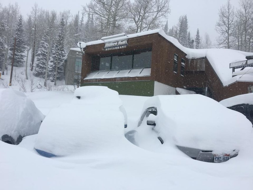 The Alta Marshal's Office was buried Sunday morning. Powderchaser Steve photo.
As we reported last week, Utah is in the midst of a historically bad winter. But, luckily for the beleaguered skiers and snowboarders in the Beehive State, Sunday night the snow gods were kind and delivered a storm system that has many northern resorts measuring in feet with snow still coming down across parts of the state.
Powderhounds in Utah woke up Sunday morning to 18 inches of blower pow in the Cottonwoods, and nearly a foot at Park City. Most notably, every resort in northern Utah pulled down double digit snow totals over the past 24 hours. And given the fact that, as noted, snow is still falling, it's likely storm totals at some resorts will end at around two feet.
The storm was incredibly kind to resorts throughout the state, with some unexpected gems scoring. Sundance near Provo reported 10 inches Sunday morning while Beaver Mountain near the Idaho border got nailed with 19 inches on Sunday. Cold air and moisture moved very slowly from the Tetons Saturday night into northern Utah on Sunday. This set up for intense snow bands and some thunder with the passage of the cold front working from Montana, into Wyoming and eventually Utah on Monday.
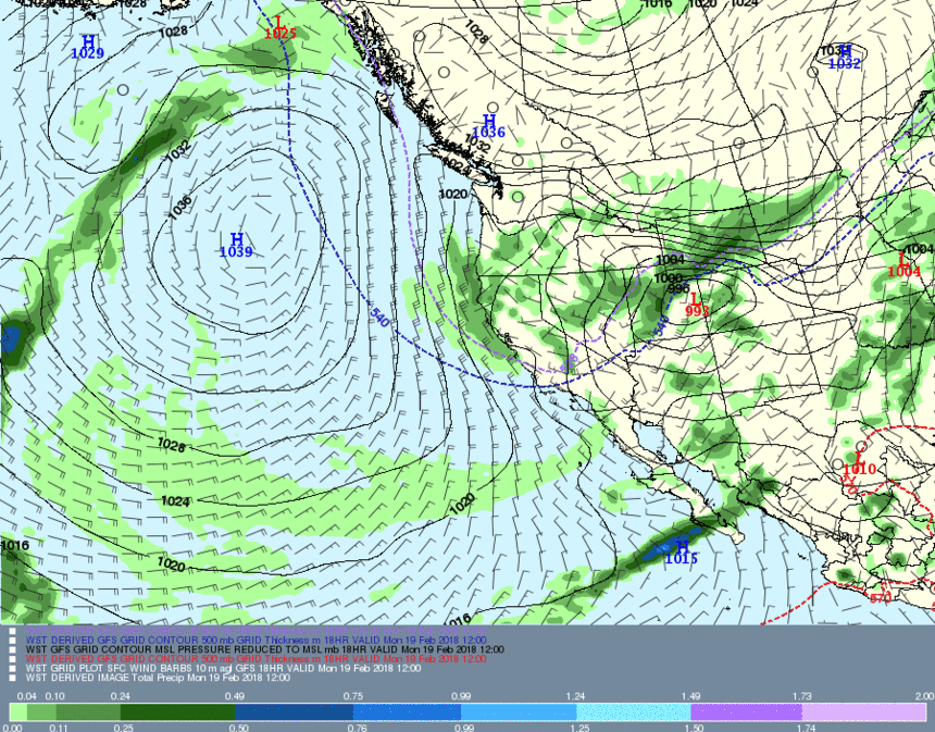 The cold front that came to Utah late Sunday night with heavy snow moving from north to south. Meteostar photo.
The storm front blessed the Tetons with 12-15 inches Sunday morning at both Grand Targhee and Jackson Hole Mountain Resort and by the time it rolled into Utah it was firing. Sunday evening it starting puking powder in the northern and and central Wasatch, and at one point an incredible three to four inches fell in just one hour at Alta between 9-10 PM. Intense snow cranked all night, which closed Little Cottonwood Canyon Monday morning at 6AM for avalanche control. I beat the closure by just two minutes, and crept into my secret spot at the Cliff Lodge where I closed my eyes dreaming of first tram at Snowbird, which I was lucky enough to catch.
 My 5:55 AM drive up Little Cottonwood Wood Canyon. Powderchaser Steve photo.
Sign Up for the TGR Gravity Check Newsletter Now
The snow seems to be coming late season at many resorts across the West. Last week brought deep snow to many Colorado resorts, with Wolf Creek nabbing 38 inches in seven days. Aspen was blessed with some white stuff, with Snowmass now totaling 62 inches in February. I was at Highlands on Thursday hiking the bowl where over 50 inches fell in seven days; those may have been my best runs of the season.
Las week, I reported that many areas in Utah were only 50 percent of water average for the season. I also forecasted a decent storm in the third week of February preceded by some smaller events. Well, Park City and surrounding mountains nabbed a surprise 12-15 inch dump last week, followed by the 12-20 inches that fell Sunday into Monday. When I asked the folks at the National Weather Service in Salt Lake City if this will push up our averages, they stated, “We need several more deep storms, but this storm will certainly help.”
In looking at weather models, it's unlikely that the Rockies will get stuck in a ridge of high pressure in the next 7-14 days. There are signs that some weak or moderate systems will return to the Rockies late this week and again the following week. It’s likely that low pressure will drop further south even making its way into the Sierra late this week and early next week. The trend is for additional areas of low pressure with less confidence on who will see the best snow. My confidence is high that we will not see a return of a high pressure ridge in the mid term.
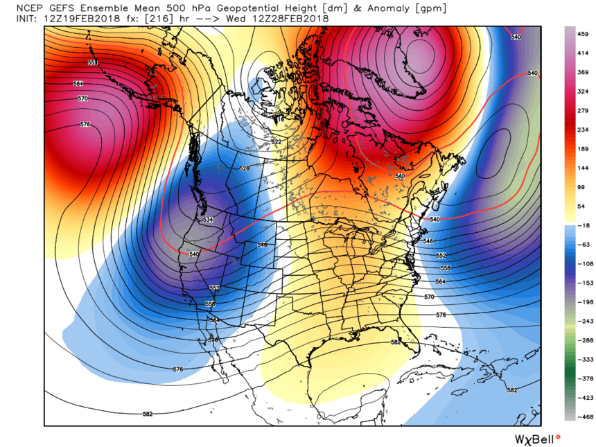 GFS ensembles for February 28th continuing a pattern of unsettled weather for the west, hinting at the Sierra? WeatherBell photo.
As I said in my last story, keep optimistic as we have several more months to reap the rewards that hopefully continue to help the snowpack in Utah. The Sierra may get some much needed love especially next week.