The PNW Could Get Hammered With 4 Feet of Snow This Week
Popular Stories

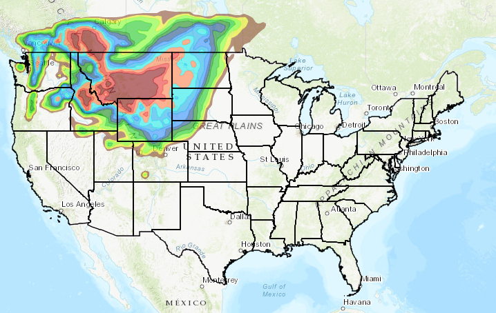
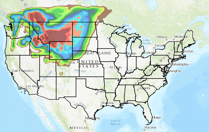 NOAA shows big colorful blobs over the northwestern corner of the country - that means SNOW. NOAA graphic.
A storm system moving into the Pacific Northwest and Montana could leave up to 4 feet of snow in the Cascades by the middle of this week. This means the second round of heavy snowfall this season for mountains like Crystal, Stevens Pass, and Mt. Baker. A few weeks ago, the Cascades received historic amounts of early season snow. This time, NOAA again forecasts high winds, temps well below freezing, and a 100 percent chance of precipitation.
The storm will likely continue into areas of Northern Idaho and Montana, adding to the already significant accumulation on the ground there. Bridger Bowl and Big Sky have 13-15 inches in the forecast by the middle of the week, and Red Lodge is expected to see up to 21 inches.
Sign Up for the TGR Gravity Check Newsletter Now