Mountain Hub’s Latest Free App is a Must-Have For Any Backcountry Traveler
Popular Stories

While some of us see technology as something to escape from in the backcountry, that phone in your pocket may be one of the most powerful tools you can pack. It can provide everything from maps and beta to real-time activity tracking and weather data. Sounds good, but what if that was all found in one free app?
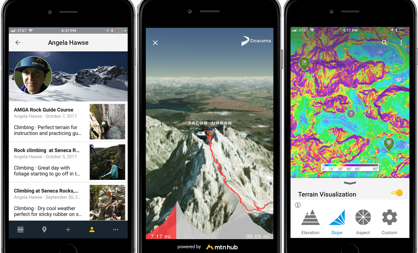
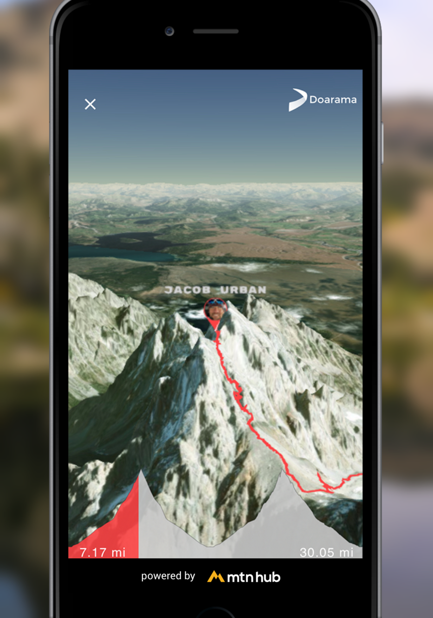
This Wednesday, Mountain Hub will release the latest update to their mobile app MTN HUB. Among several new improvements and additions, the most revolutionary is a feature that allows for users to track their routes on high-resolution 3D maps directly in the app.
Using 3D tools from Doarama, the app now features the ability to follow user tracks on a worldwide 3D map. Topographic maps are cool (and useful: The app should not substitute common sense in bringing an old-fashioned topo map with you in the backcountry), but 3D mapping is simply a much more powerful tool for trip planning. MTN HUB’s version of this technology allows users to see these tracks in-app, and completely control the view through simple maneuvers on their screens. This tool could prove incredibly useful in planning trips into unknown areas, and allows users to get a better feel for the terrain they will travel through.
This summer, endurance athletes Jake Urban, Meredith June Edwards and Jason Schlarb used the app to track their progress on their attempt to climb the Grand Teton twice in day. Check out their path as tracked by MTN HUB.
Formerly known as Avanet, an online network built to share snow safety and professionally sourced avalanche data in a central location, MTN HUB has evolved into a community where any kind of adventurer can share trip data. It can track everything from mountain bike rides to hikes, rock climbing routes and ski tours. Beyond tracking, it allows users to create comprehensive trip reports, including reporting on conditions and highlighting any safety concerns or red flags encountered in the backcountry. Thanks to partnerships with brands like Backcountry.com, Black Diamond, Stio, and Patagonia, the app is free to download and use.
Sign Up for the TGR Gravity Check Newsletter Now
So who is this app for, you may ask? While Avanet was largely meant for professional use, MTN HUB is for everyone. Mountain Hub’s CEO Brint Markle puts it simply: “Treat it like a guidebook and map for anywhere in the world that gets updated in real time.”
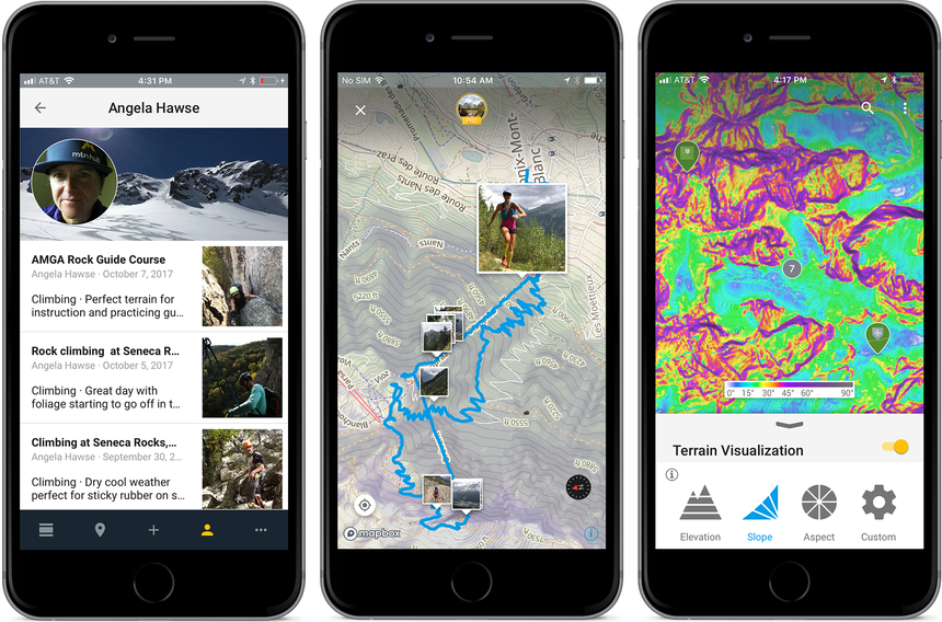
Maps are available for download offline and are sourced from mapmakers all over the world, allowing for true global coverage. No more blank spots internationally. Users can track their adventures through their phone’s built in GPS, geotag photos, and comment on or share these conditions reports the way they would share a Tweet or Instagram post. These reports show up in a user’s global feed, and can be filtered by various parameters.
Data collected from this app will be used in Mountain Hub’s Data for Good initiative, an attempt to share relevant anonymous data with research, safety, and rescue organizations. This will allow information such as avalanche or snowpit reporting to go directly to organizations like the Bridger-Teton, Utah, and Eastern Sierra Avalanche Centers, search-and-rescue organizations and to long-term climate research efforts like an ongoing NASA and University of Alaska project studying water flow through the snowpack.
The new version of the app is available for download for iOS via the app store.