Whistler Blackcomb with new snow and more on the way!
Popular Stories


Weather Update - November 8th
Temperature Outlook - Freezing levels are currently hovering near 1200m (mid mountain) and are expected to remain steady throughout the week.
Forecasted Snow - A small storm is expected to move in tomorrow bringing 5-10cm (2-4 inches) followed by sunny breaks Wednesday before another storm rolls in on Thursday bringing upwards of 20cm (8 inches) by the end of this week.
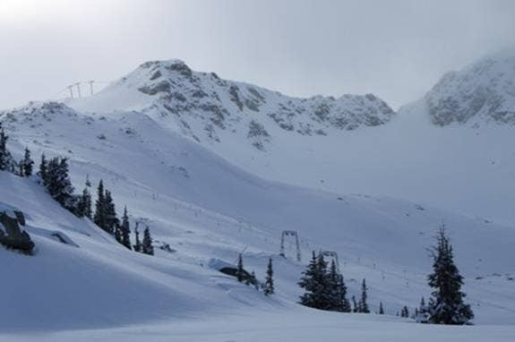
Current Snow Line - accumulations to near the middle of Wizard Express on Blackcomb or Fitzsimmons Express on Whistler
New Snow / Base - A storm delivered around 15cm (6 inches) of new snow over the last couple of days with a current snow base of 68cm (27 inches) as measured at the Pig Alley weather station at 1650m on Whistler Mountain. In the high alpine accumulations are sitting at over 100cm+ (40 inches)
Picture of the Week- Photo - Doug MacFarlane, snowy blanket covering the Glacier Bowl on Whistler Mountain on November 8, 2010
Sign Up for the TGR Gravity Check Newsletter Now


