The Map is Back: Google Maps Re-Adds Ski Lifts and Trails for Winter
Popular Stories

The collective sigh of relief from the ski and snowboard community is almost audible. Google Maps has officially brought back the feature that displays ski lifts and runs, a crucial tool that had been removed near the end of 2024. The return of this overlay is a beneficial change for anyone who lives for the mountains and meticulously plans their trips.
The Problem with Disappearing Maps
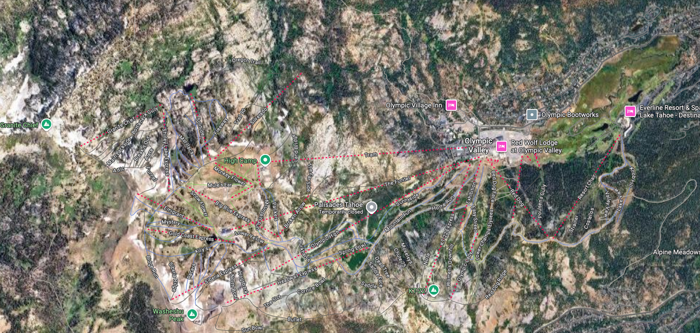
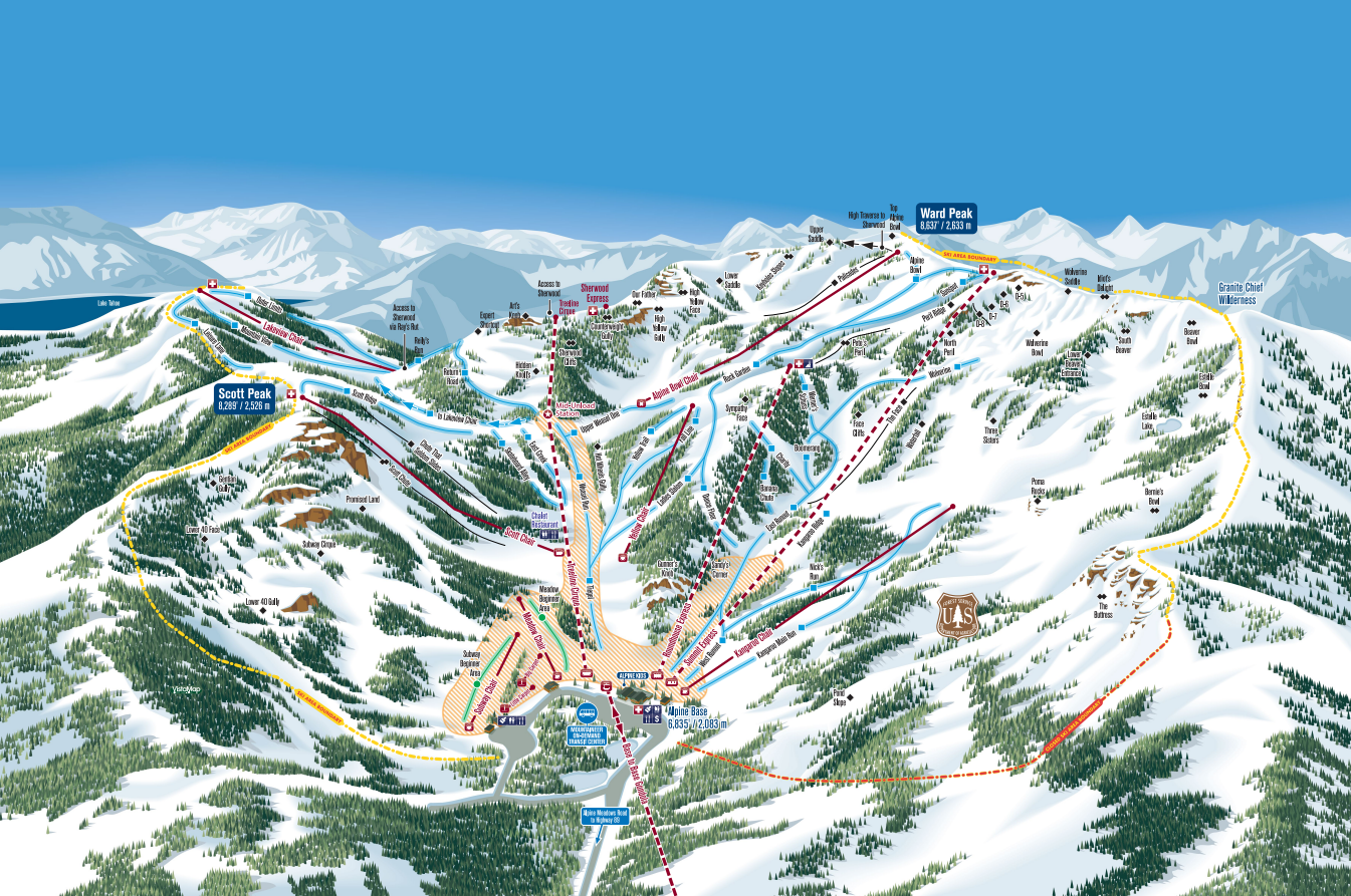
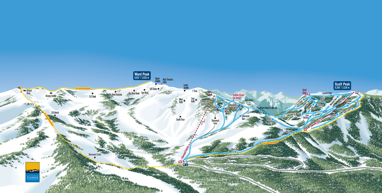
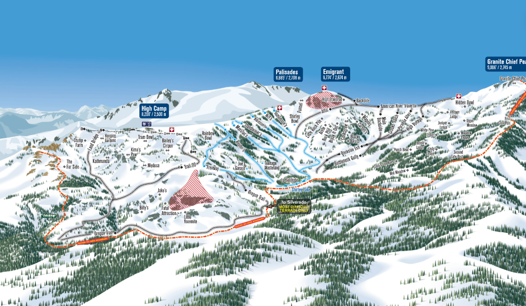
Google Maps began an experiment showing ski trails and lifts back in 2013. However, over time, the data became outdated and inaccurate at many resorts. Google eventually chose to remove the feature globally, citing low user engagement and a preference for resort-provided maps. This decision, however, caused widespread frustration. For many users, the Google Maps overlay was invaluable. It was particularly useful for grounding a resort's often-distorted trail map to the real-world, top-down satellite view. For instance, a first-timer at a massive resort like Palisades Tahoe, which has four separate trail maps, could struggle to grasp the full layout without an accurate, scaled, aerial view.

Why This Return is a Game-Changer
Having a precise, scaled view of the terrain on Google Maps is immensely helpful for a few key reasons.
Sign Up for the TGR Gravity Check Newsletter Now
- Accommodation Planning: The feature allows guests to find lodging and restaurants with perfect accuracy in relation to the nearest lift or trail, which is especially vital in European villages.
- Pre-Trip Scouting: Many seasoned riders spend time "line-scoping" from the valley deck. This digital tool allows meticulous planners to study a mountain before they even arrive, maximizing their time on the snow. It helps visualize the actual topography—not the artist-rendered trail map—a critical difference when evaluating a line.
- Updated Data: Early reports indicate that the reinstated maps are not just old data but are actually updated, with new lifts and pistes implemented at several resorts worldwide. This means the information is now more reliable than it was before the removal.
Look Ahead
The enthusiasm from the community is clear: this is a vital tool for winter travelers. We anticipate Google will commit resources to keep this information accurate and up-to-date. For now, it’s time to start virtually scouting those deep, fresh lines and planning your next trip.