Playgrounds: How To Ski Smart On Rogers Pass
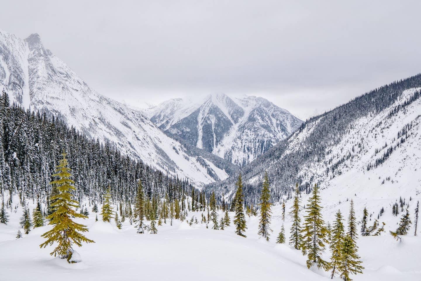
 A view of Mt. Cheops from Bonne trees. Travis Rousseau photo.
Canada is vast and in the winter it can be cold and snowy - which is why so many people love it here. But as big as the country is, there just aren’t many roads. If you want to travel from one part of the country to another, you are going to have the take the Trans Canada Highway (TCH) aka Highway 1 which is the 7,821-km-long artery of Canada connecting East and West.
Highway 1 makes its way laterally, crossing all of Canada’s 10 provinces sans the northern territories. It is also the same road that runs through a corridor known as Rogers Pass in British Columbia’s Glacier National Park (not to be confused with the one in the US), which is also home to some of the best and most complicated ski touring in the world.
A Brief History
Named for the American surveyor A. B. Rogers, Rogers Pass is the narrow valley and a “shortcut” through the Selkirk Mountains that was first developed for the CP Railway in order to avoid the “Big Bend” of the Columbia River.
In 1910, Canadian Pacific Railway experienced an avalanche that killed 58 rail workers who were in the midst of clearing the railway from another avalanche. Nearly 100 years later, during the 2003 winter season, back-to-back avalanches took 14 people’s lives in areas close by. One of those avalanche accidents occurred in Glacier National Park in an area known as the Connaught Creek drainage in Rogers Pass. These incidents contributed to one of the most deadly backcountry seasons in Canada’s history in which 29 people total lost their lives in avalanches in the mountains.
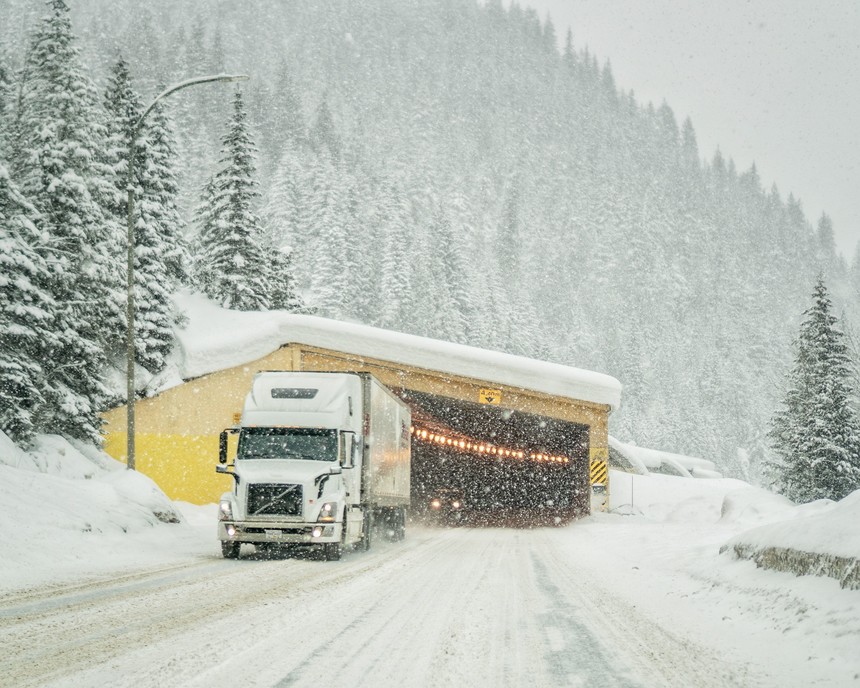 One of the many snow sheds in the RP and one of the many semis. Travis Rousseau photo.
Needless to say, Rogers Pass is a very serious place, but these incidents were not in vain. Since these incidents, many positive changes like the creation of the Avalanche Terrain Exposure Scale (ATES) scale, have been made by Parks Canada to inform backcountry users of the avalanche risks.
Like many mountain passes, Rogers Pass gets shut down for avalanche control. You may have seen the videos of the massive results that Parks gets from their howitzer cannons.
Like this size 4 from last year. Parks Canada and the Canadian Armed Forces, under Operation PALACI, operate the largest live ammunition mobile avalanche control program in the world. They are responsible for keeping a 40-km stretch of the Trans-Canada Highway and the CP rail corridors open and safe from avalanche hazards during the winter months. This section of highway interfaces with 134 different avalanche paths. Prior to 1995, all the slopes that faced the Trans Canada were closed to skiers and backcountry users. Now underThe Winter Permit System(WPS), they are accessible. Yet, Parks Canada’s number one job is to keep the highway safe. The avalanche control is not done for the safety of the recreationalists.
Still, some people, whether unknowingly or on purpose, take this access for granted. The winter permit system is put in place to help ensure that people aren’t in areas where avalanche control work is being done. It is a pretty simple system - go to the Rogers Pass Discovery Centre, pick up your day pass, check in to see which areas are closed and comply. But there are a few issues that make the process convoluted.
Play By the Rules
For starts the Roger’s Pass terrain is just complex.
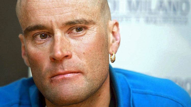
“It is basically all complex terrain,” says Douglas Sproul, author of Rogers Pass Up Tracks, Bootpacks & Bushwhacks,the definitive guidebook for the area. “This isn't like most mountain passes in North America. When I first got here, it was too much mountain for me and I moved down to Nelson for four years to get a better understanding of ski touring before I returned,” Sproul continues. “But everyone wants to come here because it is THE Rogers Pass, I get it. I love it, I have dedicated my life to this place, but don’t want to lose my life to it and I don’t want the privilege of skiing there to be taken away.”
This is coming from the godfather of Rogers Pass whose former cognizant dissonance was the bane of Parks Canada, who has seen decades of use of the WPS and is a strong proponent of 100% compliance.
The second issue is that while backcountry use is up, experience is down, and Rogers Pass is really easy to get to.
“We have definitely seen an increase of inexperienced backcountry users,” says Parks Public Safety Specialist Mark Herbison, “people come to Rogers Pass, they hear it is an amazing place to come skiing, they have the guide book (which is a fantastic resource, great photos, advice, etc), but Rogers Pass is a very serious place to come skiing.” Herbison continues, “It is not beginner terrain. You are in complex, class 3 avalanche terrain, full on, multiple overlapping avalanche paths. Balu Pass is seen as an easy green ski run, but you have to walk through huge avalanche paths all the way up that valley.”
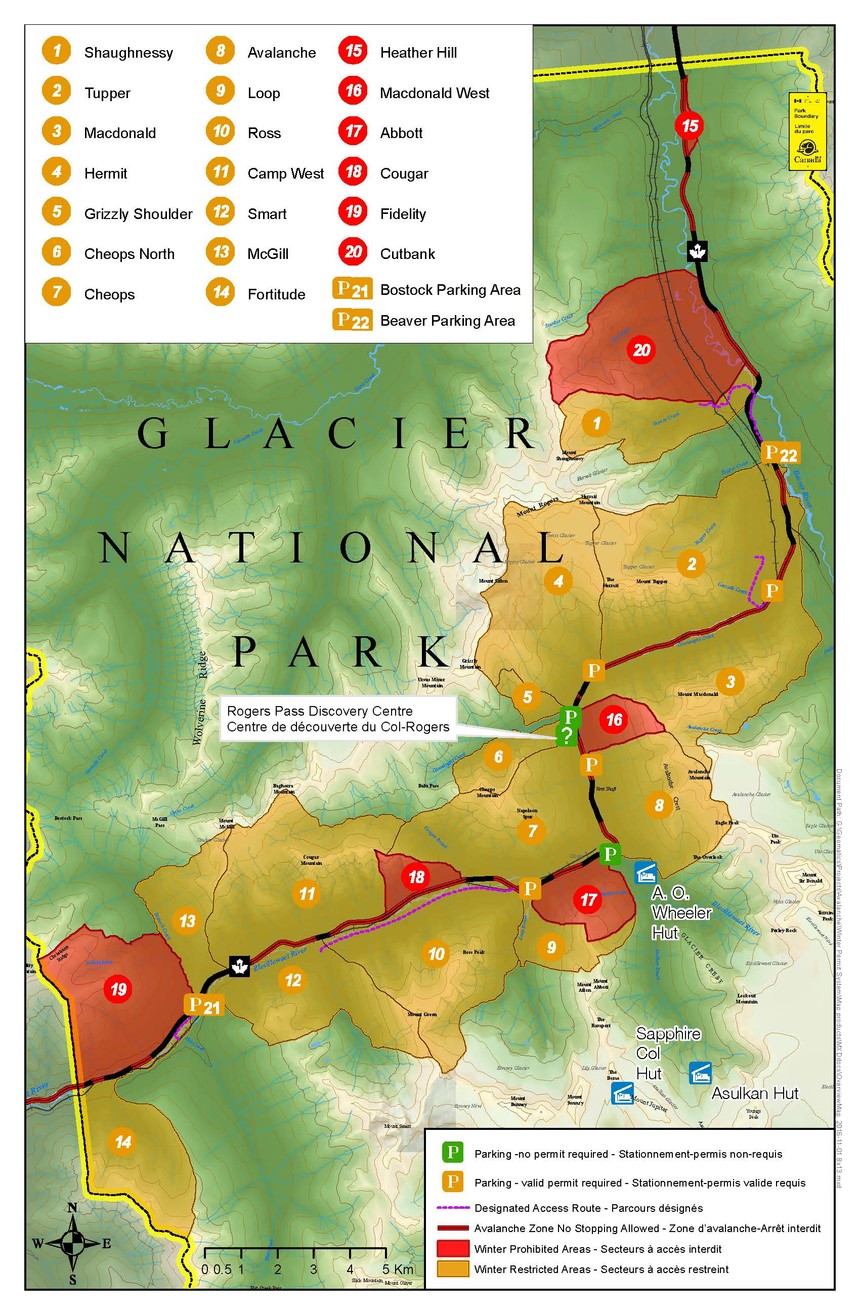 An overview of the many zones at Rogers Pass.
The third issue is that the Winter Permit System is different than anywhere else.
The safety of the people commuting the TCH through Roger’s Pass comes first.
Parks Canada conducts avalanche control to reduce the risk of large avalanches hitting the highway. Access to slopes along the highway corridor is determined by the avalanche control program. Parks Canada created the Winter Permit System to allow people into certain Winter Restricted Areas (WRA) when no avalanche mitigation is planned. The other areas are Winter Prohibited Areas (WPA) and are never open in the winter.
Parks has added many new avalanche mitigation tools (AvaGuard, Wyssen towers, snow sheds, fences, etc) that make avalanche control more efficient, but they still have to manually mitigate. With an average 140 days of snowfall and snow accumulations in the Selkirk Mountains averaging 12 meters or more, Avalanche Control Service staff records approximately 2000 avalanche events each year along the corridor.
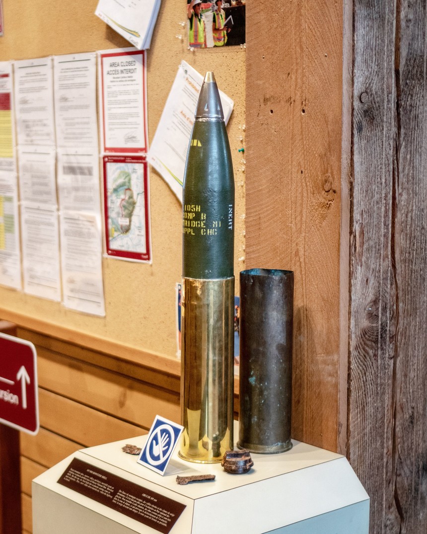 A 105mm Howitzer shell used in avalanche control work. Travis Rousseau photo.
Their strategy is rather simple: reduce the amount of snow in the start zones in order to reduce the probability of having larger avalanches hit the road. This strategy results in a high number of short closures, which results in shorter overall closure times over the course of the winter. According to a TransCanada reliability study, the economic loss in a 24-hour road closure is approximately 20 million dollars. It is pretty rare for Roger’s Pass to be closed for more than 24 hours, but it does happen. An average closure is 4 hours, which is rather remarkable. When actively firing, all areas will be closed to backcountry users. However, they are able to open areas when there is no plan to use explosives – rather than the previous system of keeping all slopes closed all winter.
Why You Should Care
Of course, this is what makes Rogers Pass so unique, but it can be confusing to those not familiar with the area since most other backcountry ski areas close down completely during mitigations. The safety of the highway and railway is the priority, access for backcountry users is a bonus. It is often a cliche that Canadians are nice, but this just backs up that stereotype. This type of system is pretty much non-existent anywhere else. The easy thing to do would be to keep these areas closed, instead Parks goes above and beyond to work with backcountry users to find a solution.
Sign Up For Our Newsletter
The WRA boundaries were determined based on the targets (of which there are roughly 270) and the distance that shrapnel can travel (a 1 km or .6 mile radius from the target.)
“For the Canadian military to have faith in Parks Canada to allow us to ski in the Rogers Pass is pretty huge,” says Joey Vosburgh, ACMG Ski guide, “It is a special and amazing thing that we are allowed to do. But you have to know where you are going.” Vosburgh continues, “We aren’t at a ski hill so it is not like we have boundary lines strung across avalanche slopes.”
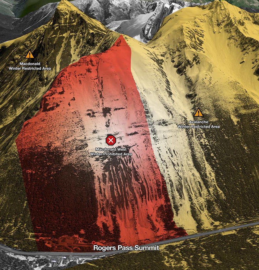 The permanently closed area of Macdonald West WPA that typically gets poached. Do not ski here please.
One closed area that gets poached the most is the Macdonald West WPA, the area is usually accessed by people skiing in the Avalanche Winter restricted Area (the part people are allowed to ski when open).
“The imaginary line goes down a well defined trimline (swath of trees on the edge of the avy path), says Sproul. “It's been said a lot that this is a vague line, it's not in my mind. You can easily tell which path is #4 and which path is #3 when you're skiing up and down.”
Yet, whether the poachers are just not paying attention or don’t know how to properly read a map, this non-compliance jeopardizes access.
On February 28th, Parks closed the Avalanche Winter Restricted Area (Avalanche is the name of the mountain and area). This happened because there were illegal tracks in the Macdonald West Shoulder, which is a Winter Prohibited Area, which is essential for avalanche forecasting. Parks closed the area until snowfall could cover the tracks. The Avalanche area was reopened, but with the warning that if there were any further violations, the area would be closed for the rest of the season.
A Set of Tools To Help You
In an effort to quell poaching, Parks has created an app that geo-references your location, clearly showing you where you are on relation to closed areas. Although some see reliance on phones in the backcountry as an unreliable crutch, public shaming on the internet of those who poach, create unsafe skin tracks and generally make uneducated decisions, whether innocently or maliciously are helping encourage the message that compliance is cool.
“I don’t think anyone should think it is a right that they get to ski in closed areas,” says Vosburgh, “Parks shell that stuff quite frequently with artillery, so anyone that doesn’t comply isn’t in my good books. I think that is a pretty widespread attitude now.”
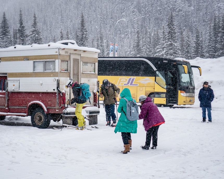 Tourists and tourers - a typical scene. Travis Rousseau photo.
Reminiscent of the older forums on TGR, the
REVELSTOKE SKI TOURERS Facebook page and Backcountry YYC are localized groups that give advice and also quarterback people’s decision making on Rogers Pass.
“I think there is a change in stigma,” says Herbison, “We are seeing more - ‘It is cool that I turned around and didn't ski that slope, I made a decision that keeps me safe and my group safe’ rather than taking a chance and skiing this rad gnarly line - maybe it went ok, but maybe it didn't.”
Herbison, like the rest of the Public Safety staff, have witnessed the aftermath of those whose gnarly lines didn’t work out so well.
“We aren’t Air Zermatt, we don’t have helicopters staged at Roger’s Pass to respond to backcountry emergencies,” Herbison continues. “We will call our rescue machines in Golden or Revelstoke and if they are available, they will fly up. It is a minimum half an hour flight time for them to get ready and fly up and for us to get our gear ready. Realistically, if you make that call to dispatch or you press your SOS button on your inReach or your SPOT device you are going to be waiting an hour, and that is if you were lucky enough that we had a machine in the park. This is not a place where you want to be hanging your neck out. A rescue could take hours.”
In short, if you go to Rogers Pass, learn the Winter Permit System, have the skills and if you don’t - just hire guide.