
Popular Stories


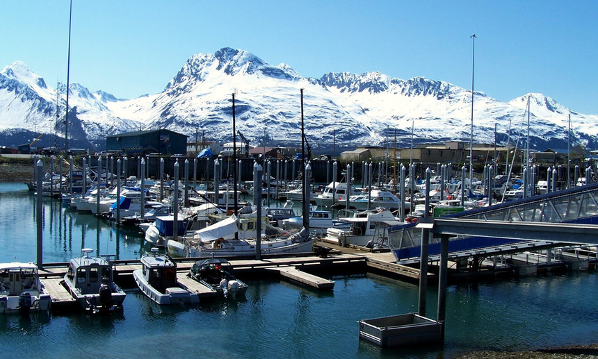
The picturesque city of Valdez, Alaska just hauled in a ridiculous amount of snowfall. Photo: Courtesy of Eric/Flickr
Imagine waking up to 52 inches of powder in just 24 hours. According to measurements taken by the National Weather Service, that's exactly what happened at Thompson Pass, Alaska on Wednesday, where an astounding 83 inches of snow fell over three days, with 52 inches piling up during the final 24 hours of a massive storm front.
While those numbers alone are staggering, perhaps the most mind-numbing statistic to consider is this: Per the SNOTEL gauges that sit 2,000 feet above pass level, at one point during the storm Thompson Pass saw 15 inches of snowfall in just 90 minutes! And that number is close to the highest hourly rate ever recorded,
“It' possible even higher amounts fell due to the compaction of the snow on the weather stakes,” National Weather Service Forecaster Andy Dixon told me. When I asked Dixon if 15 inches in 90 minutes set any records, Dixon stated, “It's pretty darn close, but it's likely some spots in the Great Lakes have reaped higher hourly totals with lake effect snow.”
The Washington Post examined snowfall records and found an instance where 12 inches in fell one hour in Copenhagen, New York in 1966, and another instance in 1972 where 17.5 inches fell in two hours in nearby Oswego, New York. That puts the hourly rate of 10 inches that Thompson Pass just witnessed among the most extreme in recorded history.
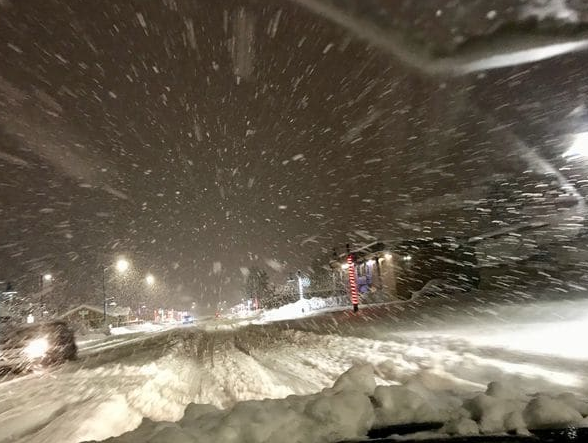
The storm dumped an astounding 15 inches in 90 minutes. Photo: Courtesy of Alaska DOT
Per the Weather Underground, the record for the most snow recorded in 24 hours in any one spot is 75.8 inches in Silver Lake, Colorado in April of 1921.
While all that might sound heavenly to an intrepid powderhound, and though Thompson Pass and the neighboring city of Valdez are used to huge amounts of annual snowfall (552 and 300 inches annually, respectively), all that snowfall caused major issues for the city.
Per the Alaska Department of Highways, an avalanche occurred at 3:30 AM Wednesday on Thompson Pass measuring 20 feet deep and 200 feet long. Given that Thompson Pass is the only means into the city, Valdez was essentially cut off from the rest of the state until Richardson Highway (which runs over the pass) was reopened Friday.
I asked meteorologist Andy Dixon what factors led up to this epic event. Dixon stated, “The blocking high pressure on the West Coast is forcing significant pacific moisture into the northern Latitudes. Moisture that normally runs east is being forced north.”
Other factors that contributed to the intense snowfall was an Atmospheric River event that Dixon defined as copious moisture in a long narrow band that is aimed at the Prince William Sound. That moisture funneled directly into the complex terrain at Thompson Pass. I asked what wind direction favors Thompson Pass and he replied “south to southeast” which is exactly what happened.
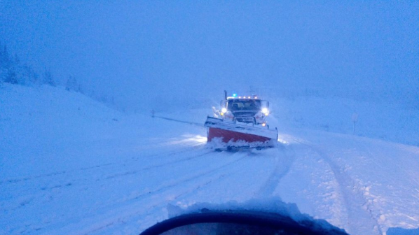
Crews had to work tirelessly throughout Thursday to reopen Richardson Highway by Friday. Photo: Courtesy of Alaska DOT
Join Our Newsletter
Unfortunately for much of the rest of the state, the phenomenon was mostly contained to the Valdez region, as Alyeska Resort located about 100 miles west opened today with only 12 inches of new snow at the summit.
For an update, I called up to Valdez Heli Ski Guides today looking for updates. They plan on opening in February. The Caretaker was apparently out shoveling near the pass but rain is being reported in town. In looking at the latest snow telemetry it appears another 10 inches has fallen since 4:00 PM yesterday (as of 9:00 AM this morning) at Thompson Pass adding to the epic amounts this week.
EXTENDED FORECAST High pressure is expected to remain over the West until at least December 16th. This may keep certain areas of Alaska in a wet pattern while the west coast stays dry. Temperatures will be on the warm side.
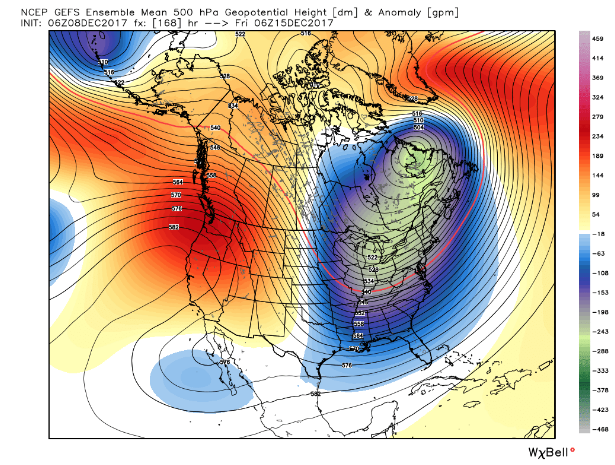 High pressure ridge over the west and low pressure in the east (time stamp December 15th). Photo: Courtesy of Weatherbell
The East Coast will be active in the short term with moderate snow for southern New England this weekend. A decent event for most of New England may happen by the middle of next week. The current storm track favors coastal New England. It’s likely Boston sees four to nine inches this weekend with the mountains seeing less. The midweek storm may land four to nine inches over much of New Hampshire and Maine with Vermont as a wildcard.
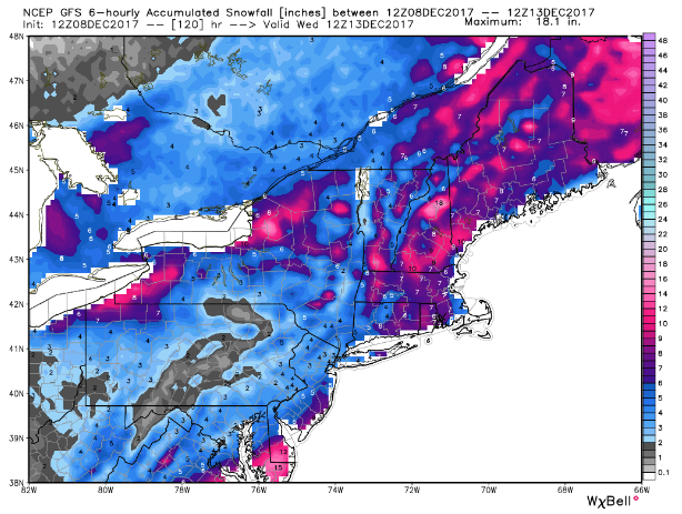
Total snowfall for the East through next Wednesday (two-part storm). Photo: Courtesy of Weatherbell
The west will likely see the ridge break down at some point around December 17th. It's impossible to tell where the storm track will line up but it’s likely that moisture returns to some spots of the Northwest and Rockies. Confidence is high on the ridge breaking down in the west. My confidence is less on how much snow or areas that will be favored. Let's only hope for an event similar to Thompson Pass or at least keep it in your dreams.

Ridge is weakening over the west (time stamp Dec 18). Photo: Courtesy of Weatherbell


