It’s Probably Going To Snow on the Summer Solstice
Popular Stories

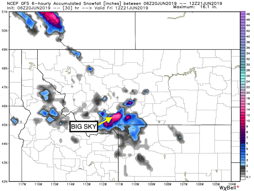
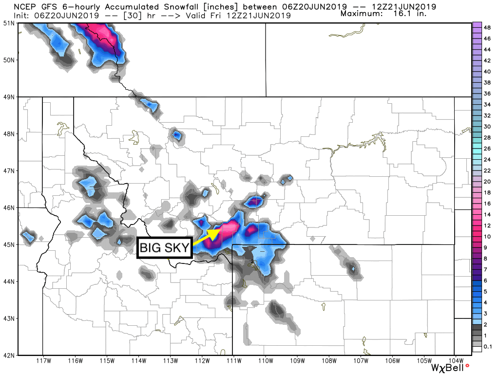
Snow is heading right into the Big Sky and Yellowstone area. NWS image.
A weather pattern with potential for up to a foot of snow is heading right for Idaho, Montana, and the Yellowstone region. Just in time for summer! With the summer solstice on Friday night, the National Weather Service is calling for accumulations as low as 6,500 feet and significant accumulations up high.
Powderchasers has more details below:
Sign Up for the TGR Gravity Check Newsletter Now
THE FIRST OFFICIAL DAY OF SUMMER IS THIS FRIDAY! WHO'S READY FOR SOME SNOW?
High elevation snow will push into Montana beginning on Thursday morning. Snow may continue into Friday with up to 7- 12 inches above 8,000 feet. NW winds may bring decent amounts the summit of
Bridger Bowl and the Big Sky ski area.
Moisture will filter into the
Tetons by Friday (Light snow) before it takes aim at Colorado Friday/Saturday. Amounts will be light in the Tetons. Light snow will be falling above 9,000 feet in Colorado favoring areas north of I-70. Rocky Mountain National Park, the Flattops, Summit of Steamboat (Mixed precip on Rabbit Ears Pass) will all see some teasing snowfall Friday/Saturday.