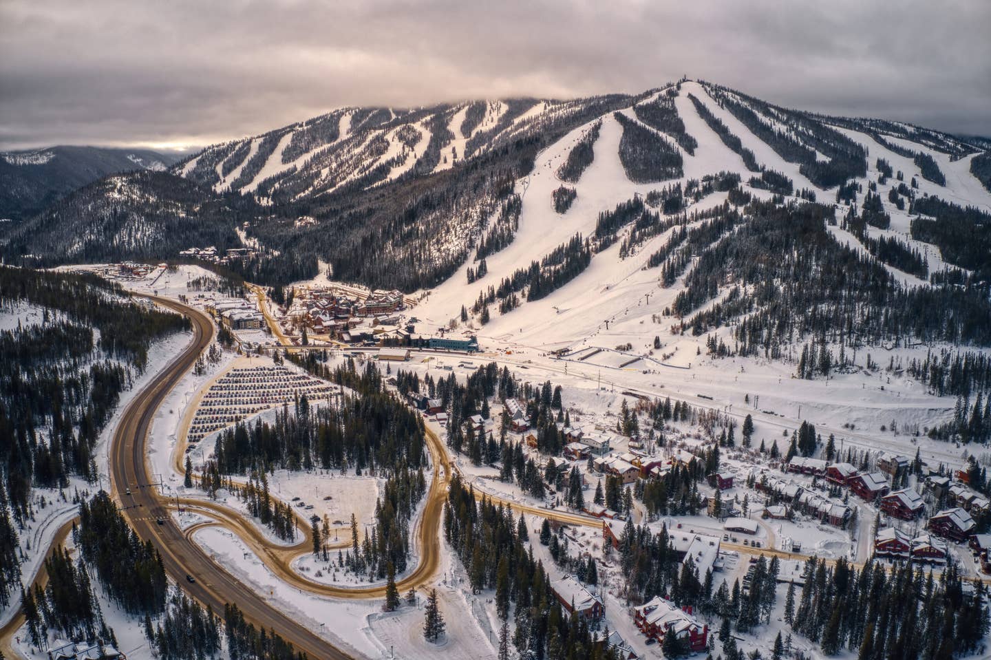
Popular Stories


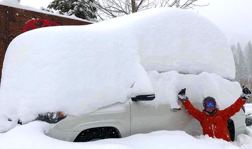 It's been DEEP this month in the Sierra. Luke Stone photo.
This past weekend, you might have tuned your television to the NCAA Basketball Tournament to enjoy any of the numerous Cinderella stories that were unfolding. However, if you were really looking for March Madness, you eyes shouldn't have been turned to television screens but rather to the Sierra Nevada, where California resorts were recording ungodly snow totals.
Squaw Valley and many areas of the Tahoe Basin have now scored the third snowiest March in 46 years, and there are still 10 days left in the month add to these numbers. According to Sam Kieckhefer, the Public Relations Director at Squaw-Alpine, “191 inches have fallen in March.” That number is not that far off the all-time record set by the 2010/11 season, where 241 fell at Squaw-Alpine.
The term “Miracle March” was coined by locals in the 1990-91 season when the Tahoe Basin was experiencing the worst drought on record. Ski areas that year were suffering significant losses with 10-15% of normal snowpack. In that season, many resorts scored over 200 inches in March snowing nearly every day, putting a significant dent in the drought. Miracle March was being thrown out on the lifts last week, however the reality is that we still have a ways to go to catch those numbers (250 inches fell at Sugar Bowl that during Miracle March in 1991).
Snowpack is measured in the amount of water in the snow. This would correlate to the total water runoff when the snow melts and runs into nearby streams and river basins. The Snow Water Equivalent (SWE) prior to last week's storm was nearly 25-30 percent of average. Currently that number has risen to nearly 65 percent of normal. Last weeks' storm came in with low density snow (roughly 5 percent water) with 15:1 ratios on average (1 inch of water equals 15 inches of snow).
According to Chris Johnston at the National Weather Service in Reno snow totals exceeded 50 inches in many areas around the lake. The Sierra Crest above 8,000 feet saw roughly 6.4 inches of water and 90-105 inches of snowfall.
“It's a bit unusual to see such a deep cold storm in March where usually this would have fallen earlier in the season,” Johnston told me.
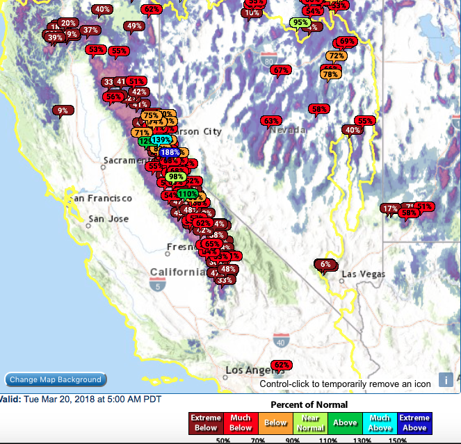 Current snow water equivalent shown by percentage of historical average for California. California/Nevada River Forecast Center photo.
I chased from Salt Lake City to Truckee and rode double digits of powder for four days straight from Wednesday to Saturday. Here is a brief recap below.
Day 1: 9-17 inches at Squaw Valley with low crowd factor. As a bonus: It snowed all day.
Day 2: I chased to Mammoth with upper mountain closed the prior day. Skies cleared by 10 a.m. with patrol working hard to open upper lifts, allowing us a bluebird powder day. Patrol completed all work at 1 p.m. and announced some bad news: Visibility was deteriorating and the upper mountain would remain closed.You could hear a pin drop with the line up of over 100 folks going silent. But not all was negative: I met three diehard Hawaiians who chase regularly to Mammoth from Oahu that never miss deep days who were stoked on the insane snow totals.
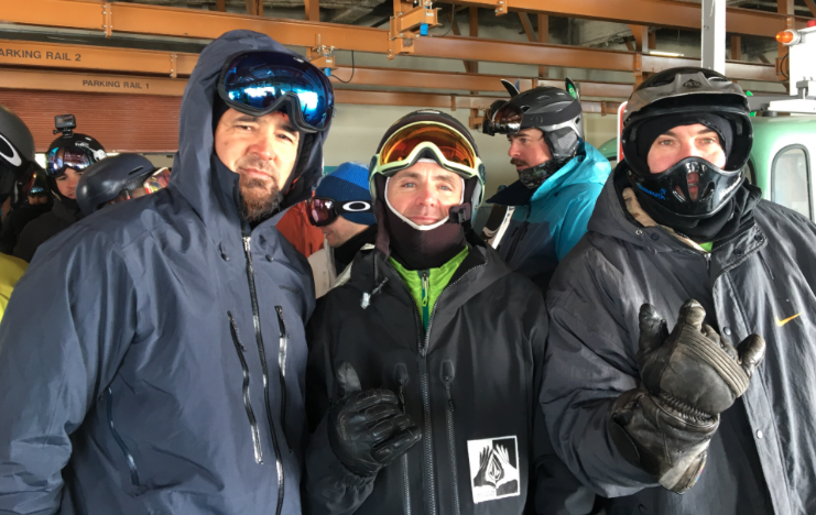 The trio of Hawaiian powerchasers–Jason, Alika and Mark. They say they chase the storms from Oahu about eight times a year. Powderchaser Steve photo.
Day 3: Squaw Valley reports 20 inches overnight, so I got line for second chair at KT-22. The snow was falling at a rate of 2-3 inches per hour, with another 13 inches accumulating by the end of the morning. The roads were closed surrounding the resort and I-80 keeping crowds to a minimum. It's likely 24-hour totals exceeded 40 inches by last chair Friday. One of those days to ride until closing and a memory not to be forgotten.
Day 4: Squaw Valley reports another 17 inches overnight and still snowing heavily. My wake up call was 4:30 a.m. and I finally nabbed first chair that day on KT after arriving around 5:45 a.m.. Another 5-7 inches fell prior to the lifts opening at 9:30 a.m. for a total of 22 inches overnight.
Join Our Newsletter
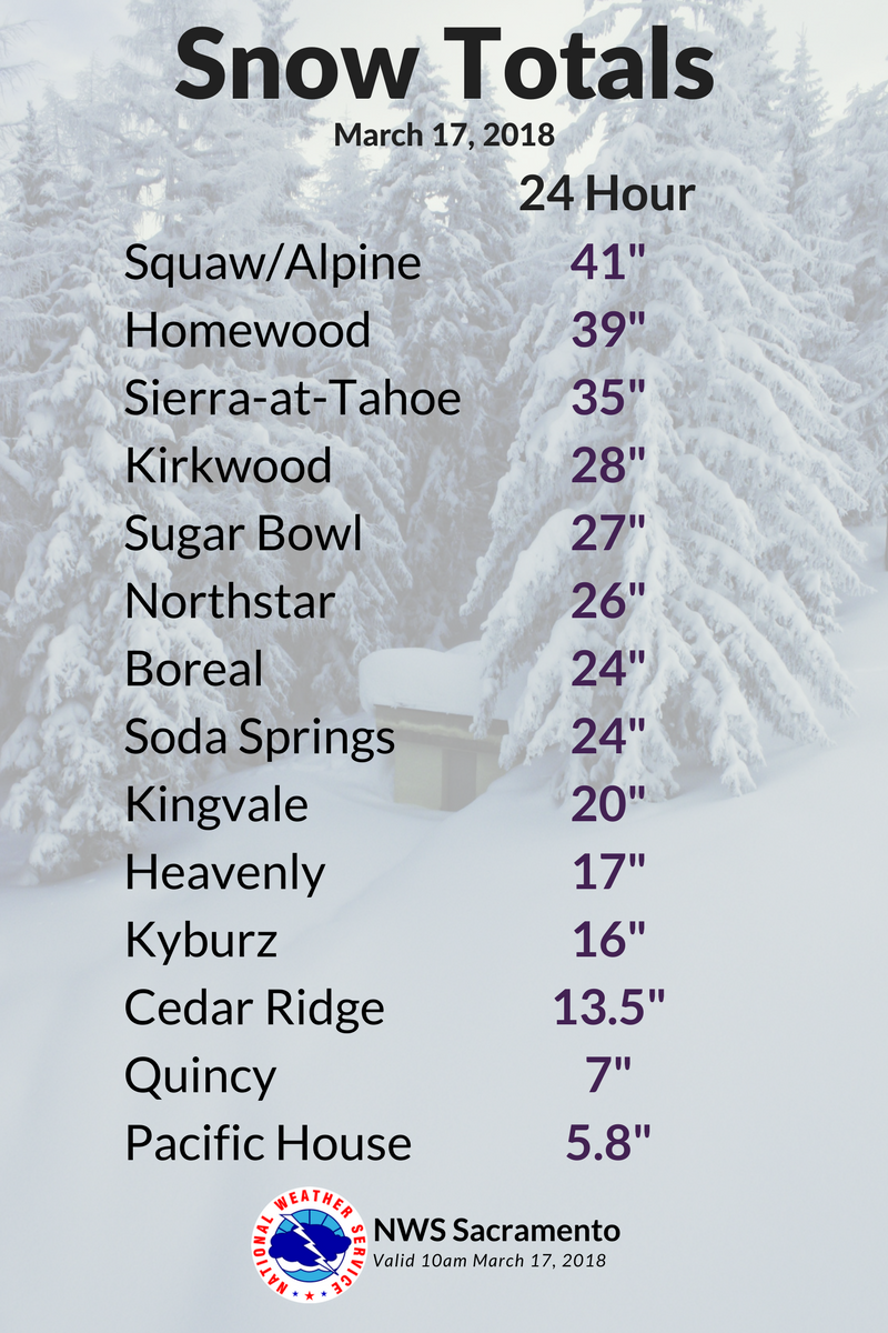
Here is a look at snow totals published by the National Weather Service in Sacramento on Saturday morning for the previous 24 hours. Most areas picked up between 75-105 inches for the week.
Days 4-5: I chased to Snowbird Sunday for upper mountain openings (20 inches plus) and ended up at Steamboat for my final day with 16 inches of freshies on Monday morning. My six days of chasing netted me over 150 inches of powder.
According to Sam Kieckhefer at Squaw last week's storm totals topped out at 105 inches. There were two periods of 42 inches in 24 hours which ties the an all-time record. The next closest dump was in 1983 with 40 inches in 24 hours. And here's the kicker: The week ahead looks extremely wet.
An atmospheric river of moisture is aimed at the Sierra Wednesday through Saturday. Significant rain below 7,500 feet is likely for the Sierra through Thursday. Wet snow will be falling at upper elevations, with 4-7 feet of accumulation possible in areas–particularly the Mammoth Summit. Rain at the bases will turn to snow in most areas by Friday morning.
1-2 feet of better density snow is possible late this week moving into the weekend with a cooling trend. Will March of 2018 go out tipping the scales of earlier years records?
“I don’t personally think it will happen at mid-mountain elevations," said Kieckhefer. "But it’s certainly possible at the summits”.
One thing is for sure, the water charts will be climbing significantly this week and thats a good thing. Significant snowfall will be seen this week at the summits of the Sierra.
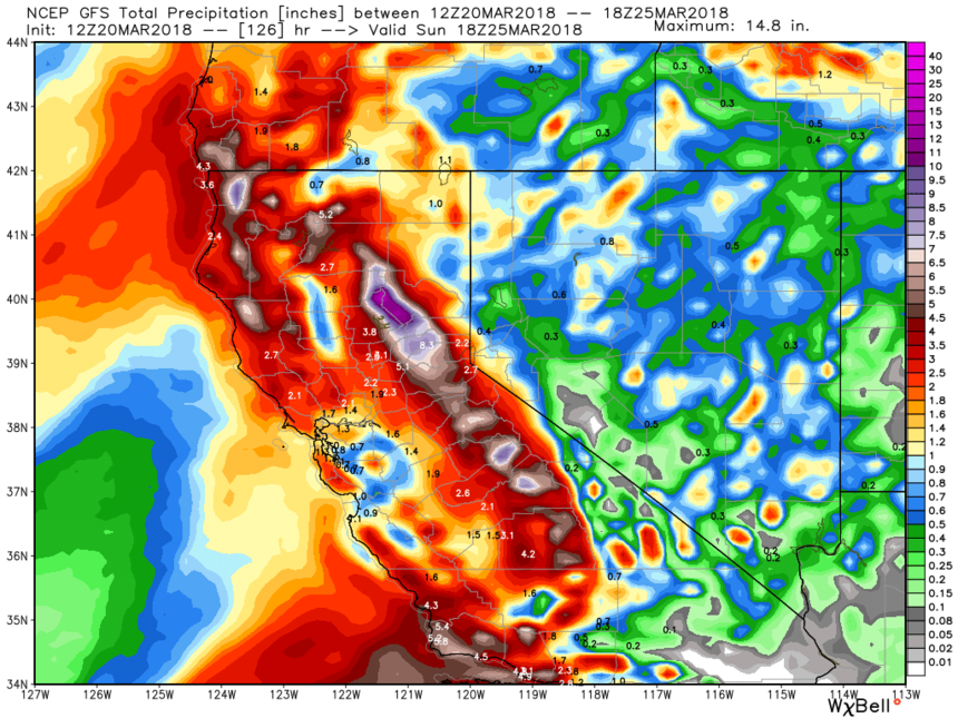 This upcoming week shows no signs of letting up for California. Weather Bell photo.