Xavier De le Rue Trusts FATMAP’s New Global Map
Popular Stories


As one of the best big mountain snowboarders in the world, Xavier De Le Rue relies on a very specific set of tools to stay safe in the mountains. In that toolbox, or rather on his smartphone, lives an app unlike any other: FATMAP, a powerful free 3D mapping tool that quite literally puts the world as his fingertips.
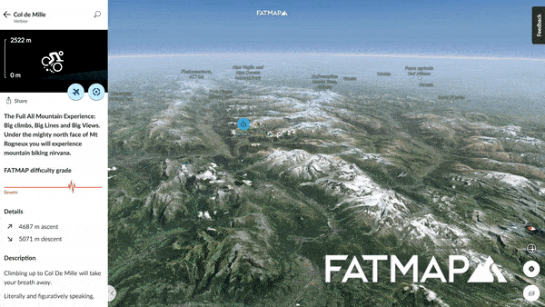
Formerly limited to select mountain areas, FATMAP has now migrated to a global 3D map, using aerospace-grade satellite imagery and GPS data to create a map accurate down to several meters. That allows for real-time routefinding to navigate to your line and help get you out of hairy situations when conditions change.
With their new 3D world map, FATMAP aims to push deep into the backcountry mountain biking world, bringing their technology into the hands of singletrack-hungry riders who seek out remote trails. In a world where literacy with a paper map has been replaced by the ability to simply consult the computer in your pocket, FATMAP has taken it upon themselves to make sure that smartphone is a tool worth using.
FATMAP’s Adam Robinson sums it up: “We’re living in an increasingly urbanised world and it feels like a lot of us are losing our familiarity with the outdoors. By making the information we need to explore more intuitive and accessible, we hope more people can get out there and enjoy outdoors”.
Compared to similar services like Strava, MTN Hub, or even Trailforks, FATMAP’s approach is slightly different. Robinson explains that while crowdsourcing route information may be a great way to build a community, there is no good way to ensure that the information is accurate. When it comes to accessing big snowy lines in the mountains, or getting lost in the backcountry on your bike, accuracy matters.
Join Our Newsletter
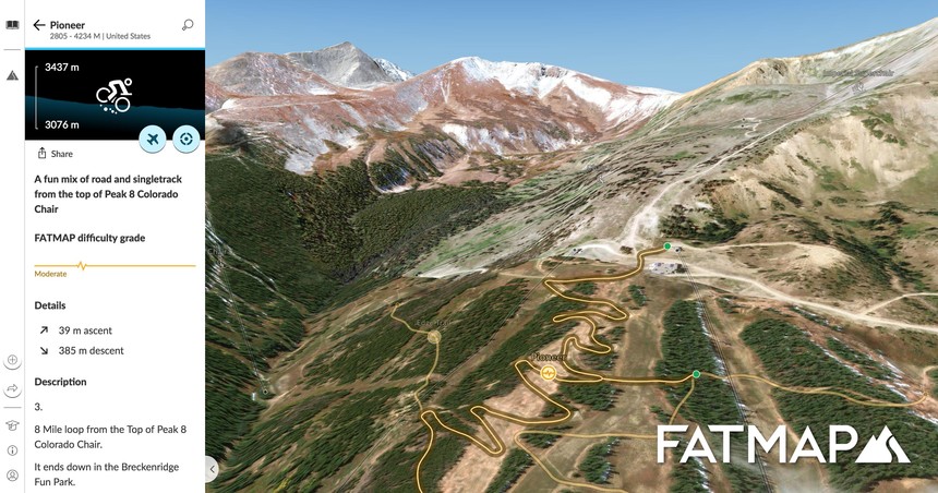
Their answer? Form a team of local experts that include highly experienced professional athletes and mountain guides like Xavier De le Rue, Liv Sansoz and Vivian Bruchez, to share their favorite trails and routes. FATMAP claims their resolution is over five times better than Google Earth, allowing you exactly pinpoint your line and navigate in complicated terrain.

Within the app, users can track themselves, draw new routes, and even highlight dangerous avalanche and crevasse areas to avoid, all in 3D. This allows users to explore a potential route before setting out, familiarizing themselves with terrain traps and danger zones as well as where to expect the best snow. The mobile app is free, but offline map use is subscription-based at either a monthly or yearly rate.


