La Niña Awakens: Major Snowfall Hitting the West


After weeks of stubborn high pressure dominating the West, La Niña is finally stepping up, delivering a much-needed storm cycle to skiers and riders. A significant system will bring fresh powder to the Pacific Northwest, Western British Columbia, and the northern Rockies by the weekend. Forecast models suggest that many areas could see between 12 and 20 inches of new snow by Saturday, February 1, with the Tetons, Idaho, and Montana in prime position to benefit. The big question: How far south will the storm track?
The northern Rockies, including Idaho and Montana, are looking at some of the highest accumulations, with snow spreading into Wyoming by Saturday morning. The Wasatch and Colorado Rockies remain on the fringe of the system, with some models indicating light to moderate snowfall, while others suggest Utah could sneak into the storm’s flow. Meanwhile, a separate system will impact the Four Corners region earlier in the week, with northern Arizona, southern Colorado, and northern New Mexico expecting 3-6 inches of snowfall, with localized areas—like Taos—potentially seeing higher totals.
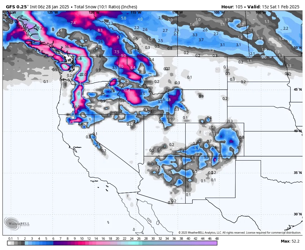
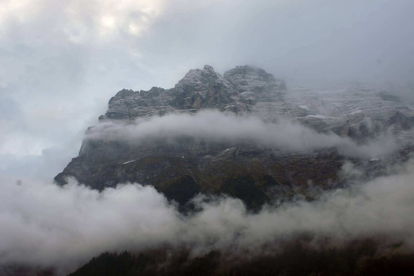
Photo: Powderchasers.
The storm is set to intensify Friday as it slams into the Pacific Northwest. Resorts in Washington, Oregon, and Southern British Columbia should brace for heavy snow, though initially warm temperatures (snow levels around 3,500-4,000 feet) could make for denser conditions early on. Despite the slightly heavier snow, this base-building refresh will be welcome after several dry weeks. Snowfall will extend into interior BC and northern Idaho by late Friday, setting up prime conditions leading into the weekend.
By Saturday morning, the Tetons should be in the heart of the action, with snowfall continuing through Sunday. Forecast models vary on how much snow will make it south into Utah’s Wasatch Range, but if conditions align, areas around Alta, Snowbird, and Brighton could see a solid refresh. Colorado remains a wildcard, with the heaviest snow likely staying north, but parts of the state—especially the San Juan Mountains—could see modest accumulations.
Sign Up For Our Newsletter
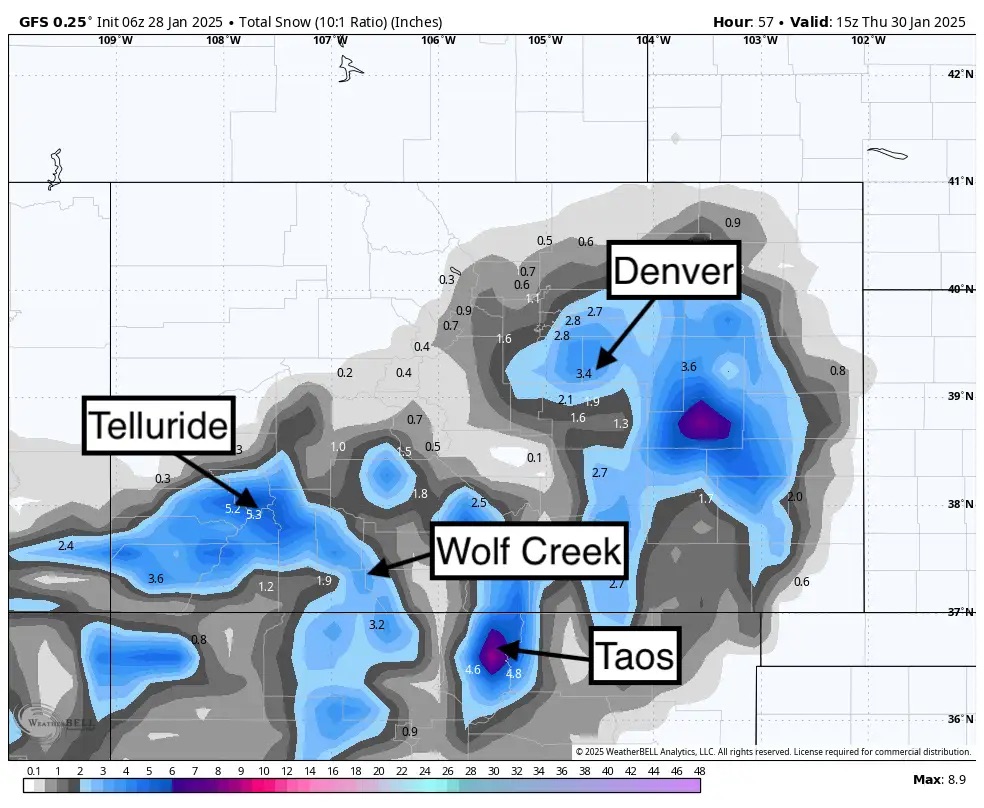
Total snowfall through Thursday morning from the American GFS keeps most mountains in the moderate ranges of the southern San Juan Range, with perhaps a tad higher amount for northern New Mexico near Taos. The European model (Not shown) shows less snow for New Mexico and higher totals for southern Colorado. Photo: WeatherBell/Powderchasers
Looking ahead, the storm train might not be done. Forecast models suggest additional systems could drop farther south into Oregon and the Sierra Nevada by early next week. With storm tracks shifting, it's too early to call exact totals, but February is shaping up to be a month to watch for powder seekers. After weeks of high pressure keeping the West dry, it looks like La Niña is could be bringing winter back in full force.