POW ALERT: The West is Getting Hammered With Snow Right Now!
Popular Stories


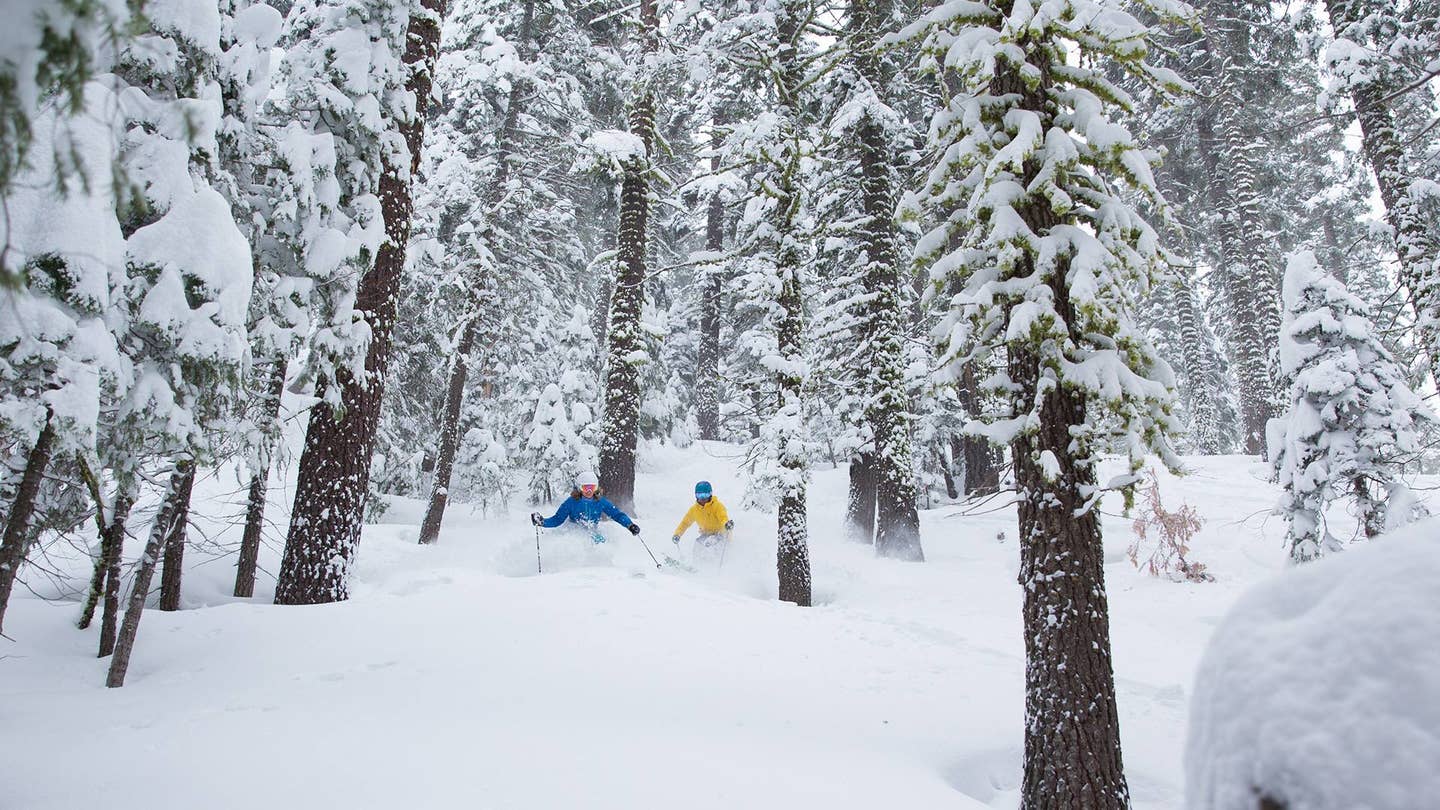
 Squaw Valley & Alpine Meadows picked up 18" in the past 24 hours. Much more is on the way across the west! Squaw Valley photo.
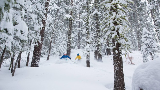
Significant moisture is aimed at many regions over the next several days! Chases will be abundant with many options. Winds will be a factor initially with much of the moisture so expect lift issues at many locations through Monday.
Cascades - 12-16" by End of Today
Action began yesterday with general snow levels just at the bases. Light to moderate snow last night migrated to heavy snow today (7-11"). Winds will be very strong, so upper mountain at spots like Crystal and perhaps Baker will likely see some holds today. Total snowfall by Sunday evening will be in the 12-16 inch range.
Colder air filters in late Sunday/Monday keeping snow showers cranking through early next week. Additional amounts of 4-8" are likely Monday night with a 2500 foot snow level. The best time might be early Monday morning, as areas that were closed Sunday open up (12-20" in many locations).
Interior Washington will also fare well with this storm (Spokane area resorts and Tri Cities). Oregon will see even higher amounts! Upper elevations of Mount Hood are forecasted to see up to 50". Oregon is going to get nailed!
A Mixed Bag in the Sierra
The Sierra is going to be a mixed bag. Strong winds this weekend and light to moderate snow cranked all yesterday. Sunday grabs additional wet snow (6500 foot snow levels) of 4-10" with 8-16" at upper peaks by late today. Much less snow will be found at lower elevations until Monday morning. Northern areas will be favored!
Mammoth's snow will increase into Monday (6-12" with much less early today). Winds will be gusty with upper mountain lift holds likely. Northern areas of the Sierra will see upper mountain gusts in excess of 80 MPH.
On Monday, winds are strong in the morning and may decrease somewhat by late AM or afternoon (Likely openings from closures on Sunday?). Cold air Sunday night will lower snow levels to 5500 feet. Significant better density snow Is likely late Sunday though Monday (8-16"). Total snowfall by late Monday should be in the 15-30" range in the northern Sierra and 12-18 inches in the south. Monday will likely be the best day to ski, depending on winds.
The Northern Rockies Are About to Get Deep!
The Rockies are going to get deep Sunday-Tuesday. Central Idaho, including Sun Valley, is in the path for significant snowfall Sunday-Monday. Light snow will be falling tonight and turn heavy on Sunday. Snow levels are initially 6500-7,000 feet. Cold air will lower these significantly late Sunday morning. There may be a brief lull in the action late today before heavier snow moves in by the evening. Total snowfall in central Idaho will be in the 12-17" range (Higher amounts at the summit of Brundage).
The Tetons got light snow last night which will turn moderate at times Sunday (3-6"). Heavy snow and colder temperatures will be falling over the Tetons late Sunday-Monday. Expect 11-18" or more by early Monday morning. WOO HOO! finally some double digits after 2 weeks of steady 2-4" snowfalls at the summits.
Sign Up for the TGR Gravity Check Newsletter Now
Big Snow Through Tuesday in the Wasatch
The Wasatch grabs light snow that turns heavier by Monday morning. Cold air and a westerly flow should generate 7-11" during the day Monday in upper northern and central Wasatch (Strong westerly winds could impact the Tram at the Bird). Park City resorts should de well Monda,y with steady moderate snowfall (6-10") continuing into Tuesday.
Winds shift to the NW late Monday- Tuesday that could generate another 4-8" of freshies for Tuesday morning, especially in the Cottonwoods. Regardless of winds, the Wasatch will be generating appreciable snow from late Sunday night through Tuesday (9-17"), especially at upper elevations.
Northwest flow takes aim at southern Montana on Saturday and again Monday. Moderate snow is likely at many resorts, including Bridger Bowl who could grab some surprises.
Most of Colorado to Get The Goods This Week
Colorado grabs moderate to heavy snow Monday mid-AM through Tuesday. Westerly flow should generate 8-14" or more by Tuesday morning (Storm ski Monday PM or first chair Tuesday). Areas from Steamboat to Aspen through the entire I-70 corridor including Monarch and Crested Butte should do very well with this storm. The four corners might come up shorter but still grabs action (Statewide event with lower amounts in the south).
-Powderchaser Steve
Please consider a donation to Powderchasers – it's our only source of revenue! 10% of all donations go to Avalanche centers in the West for education. We do our best to keep the powder buzz alive. All donations of $50 or more get a swag Phunkshun balaclava from Powderchasers. Thanks to those that have donated; we hope to see you on the slopes!