OnX Backcountry Drops New Avalanche Terrain Exposure Scale Coverage
Popular Stories

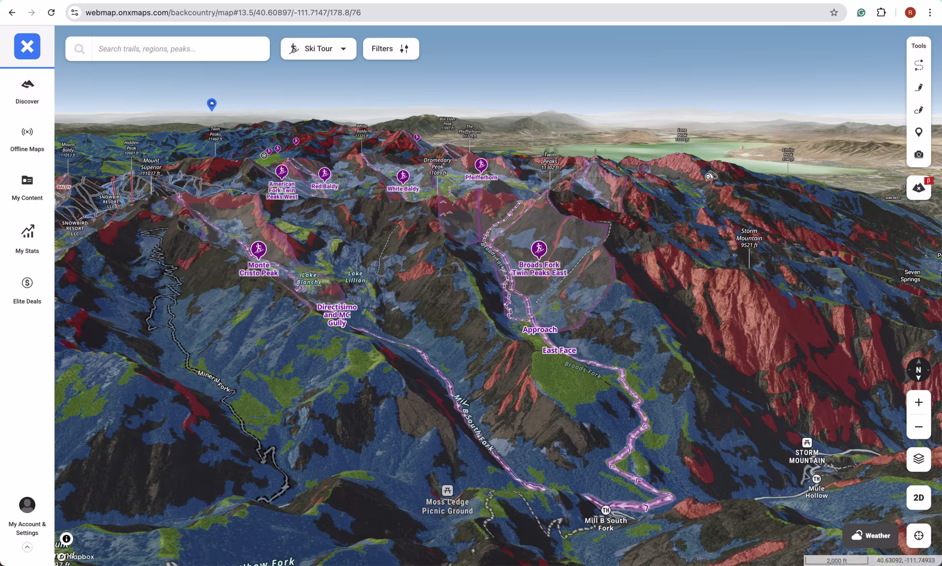
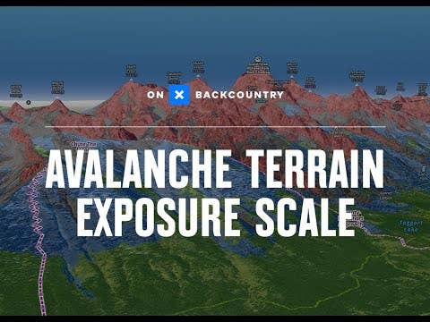
The world of backcountry skiing and riding is growing rapidly. With this growth comes an increasing need for intuitive, reliable tools to navigate high-consequence terrain. Enter onX Backcountry, which has just rolled out a monumental update to its Avalanche Terrain Exposure Scale (ATES) mapping layer.
This isn't just a minor refresh; it's a game-changer for anyone heading beyond the ropes. The app is now mapping 23 million total acres across ten US states, effectively tripling its ATES coverage.
Why the Avalanche Terrain Exposure Scale Matters
It is important to realize that the ATES system is not the same as a daily avalanche forecast. Instead, it is a static map that classifies terrain based on its potential exposure to avalanches. Developed by Parks Canada, the ATES scale uses 11 different terrain variables to classify risk. These variables include slope angle, runout paths, terrain complexity, and forest density, offering a much more comprehensive view than simple slope angle shading.
The scale organizes terrain into five color-coded categories:
- Level 0: Non-avalanche terrain (Grey/White)
- Level 1: Simple Terrain (Green)
- Level 2: Challenging Terrain (Blue)
- Level 3: Complex Terrain (Red)
- Level 4: Extreme Terrain (Black)
A Bold New Feature: Level 0 "Safe Zones"
Perhaps the most significant addition in this update is the inclusion of Level 0—Non-Avalanche Terrain. For the first time, onX Backcountry is using the map to literally draw a line, identifying areas where you will not be exposed to an avalanche hazard, regardless of snow conditions.
Andy Sovick, the Senior Content Manager at onX Backcountry, called this a "bold move". He noted that it provides a critical reassurance for those who want to experience the mountains in winter while avoiding avalanche terrain at all costs. This makes planning much simpler, giving users a clear refuge or an appropriate place to tour when the snowpack is spicy.
Our Newsletter
More Ground Covered
The expansion adds nearly 15 million acres in 18 new zones. For TGR viewers knowing your route’s ATES rating is essential.
Major new zones include:
- Washington: North Cascades, Mount St. Helens, Rainier, and Leavenworth.
- Colorado: Western San Juan Mountains, Leadville, and Aspen.
- Montana: Whitefish, Bitterroots, and Seeley Lake.
- Wyoming: Togwotee Pass and the Alpine/Afton area.
- California: Sonora Pass and the Eastern Sierra.
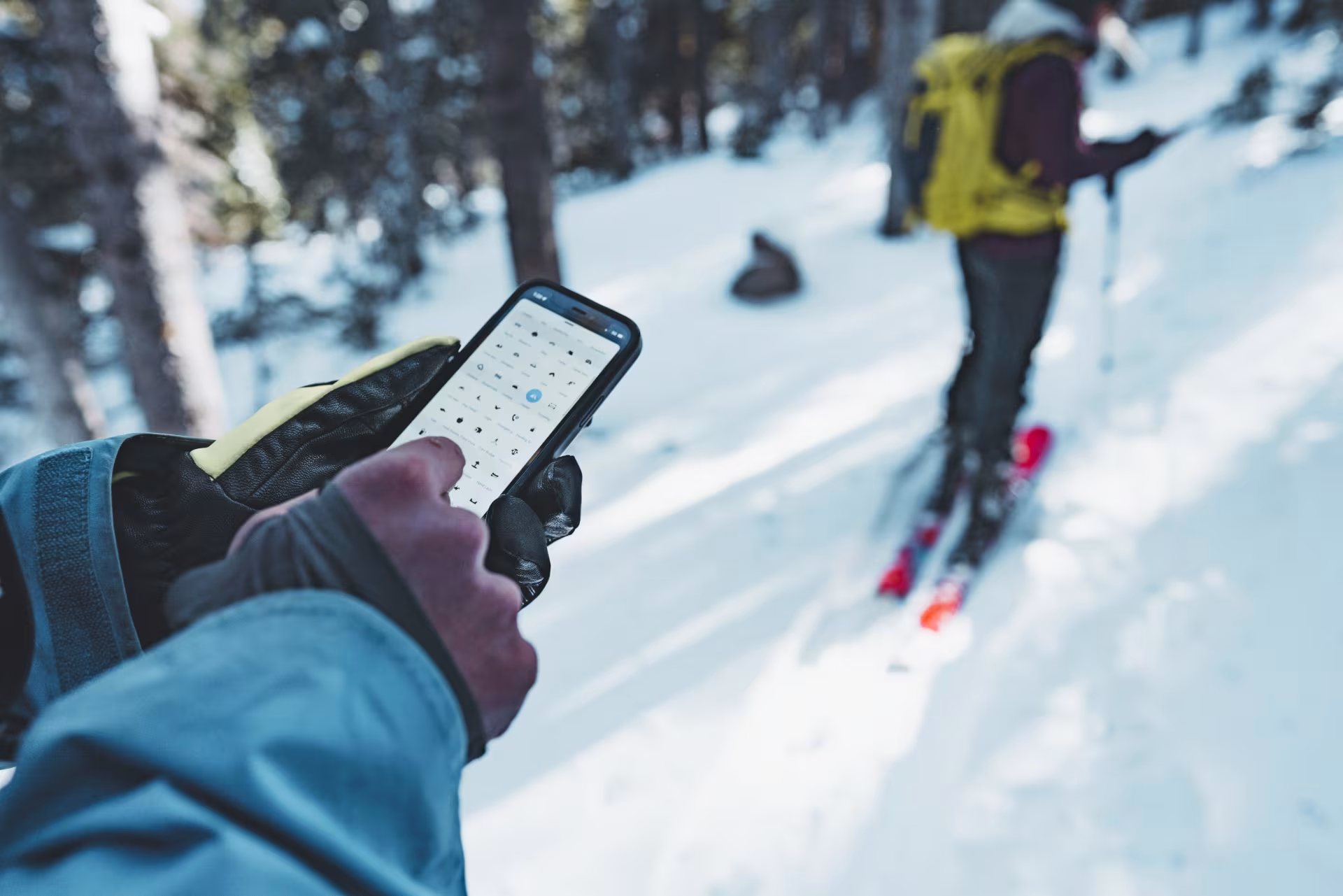
The app calculates and integrates this data using a third-party algorithm called autoATES. Crucially, onX also works directly with local avalanche forecasters to verify these ratings with on-the-ground human input, ensuring accuracy you can trust.
TGR's Takeaway
Terrain is the ultimate co-conspirator or challenger in the mountains. Tools like this massive ATES expansion from onX Backcountry will not replace your avalanche education or reading the local forecast.
Instead, this new layer acts as a powerful companion for your pre-tour planning. It provides a deeper, visual understanding of the mountain environment and the consequences of your chosen line. When you are standing on a boot pack, getting ready to drop in, you want every piece of information possible to ensure it's a day worth living for. This update is a huge step in the right direction for backcountry safety.