NOAA Issues La Niña Watch: What Skiers Can Expect Winter 2025–26
Shop Now

Grateful Dead x TGR "Uncle Sam" Tee by Peter Forsythe Tie Dye
Price unavailable

PS Chainstitch x Grateful Dead - Smile Embroidered Western Shirt
$200.00

Grateful Dead x TGR Summerland Dancing Bears Tee
Price unavailable
Popular Stories

The Latest
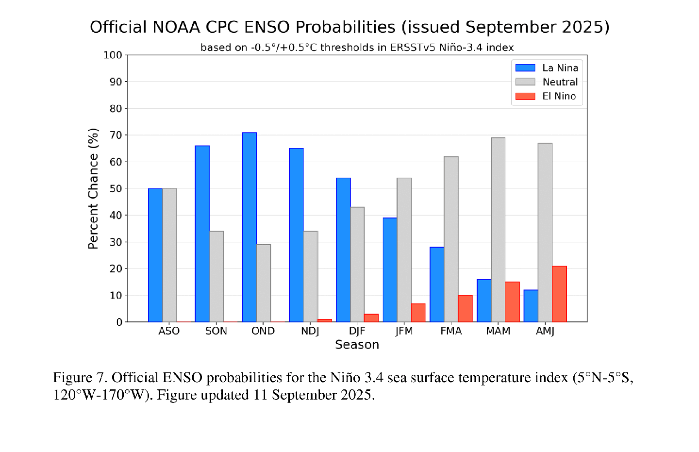
NOAA dropped another winter outlook recently, which means it's time to lock in. On September 11, the Climate Prediction Center issued a La Niña Watch. While weather predictions are just that-- predictions-- the forecast could shed light on where the powder is likely to pile up in North America this winter. Pay attention now to reap the rewards all season long.
The Call From NOAA
Here’s the quick version of the official Synopsis:
- Transition coming: Conditions are neutral now, but La Niña is likely in the next couple of months.
- Odds: 71% chance La Niña develops by October–December 2025.
- Winter window: Through December–February 2026, La Niña is still favored, but confidence drops to 54%.
- Strength: Expected to be weak to moderate.
Translation: La Niña is more likely than not, but it won’t be a grand slam.
What Do “El Niño” and “La Niña” Actually Mean?
NOAA defines these conditions based on both ocean temperatures and atmospheric response:
- El Niño conditions exist when:
- A one-month positive sea surface temperature anomaly of +0.5°C or greater is observed in the Niño-3.4 region of the equatorial Pacific (5° N – 5° S, 120° W – 170° W), and
- There’s an expectation the 3-month Oceanic Niño Index (ONI) threshold will be met, and
- The typical atmospheric response associated with El Niño shows up over the equatorial Pacific.
- La Niña conditions exist when:
- A one-month negative sea surface temperature anomaly of –0.5°C or less is observed in the Niño-3.4 region, and
- There’s an expectation the 3-month ONI threshold will be met, and
- The atmospheric response typically linked to La Niña is present in the equatorial Pacific.
- Occurs every 3 to 5 years or so
Put simply: El Niño = warmer equatorial Pacific + atmospheric changes. La Niña = cooler Pacific + opposite atmospheric changes.
What Skiers should expect
Historically, La Niña storms tend to roll through from the North, meaning some areas of the continent will be buried while others run dry.
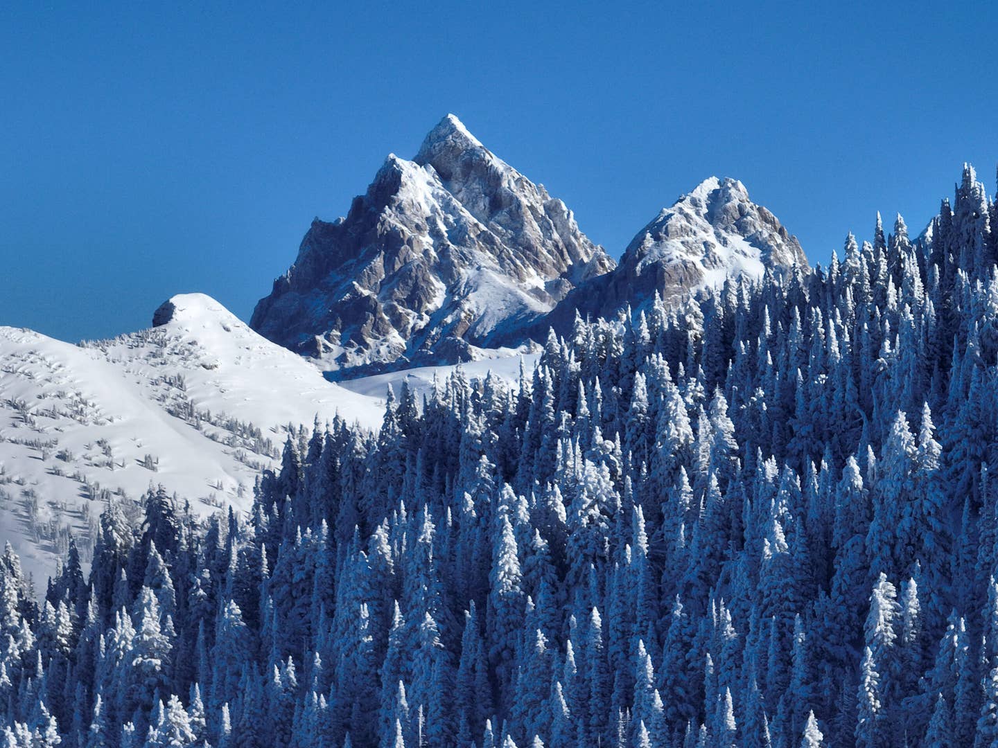
- Winners → Pacific Northwest, Northern Rockies (Washington, Oregon, Idaho, Montana, northern Wyoming): More storms, colder temps, and better odds of above-average snowfall.
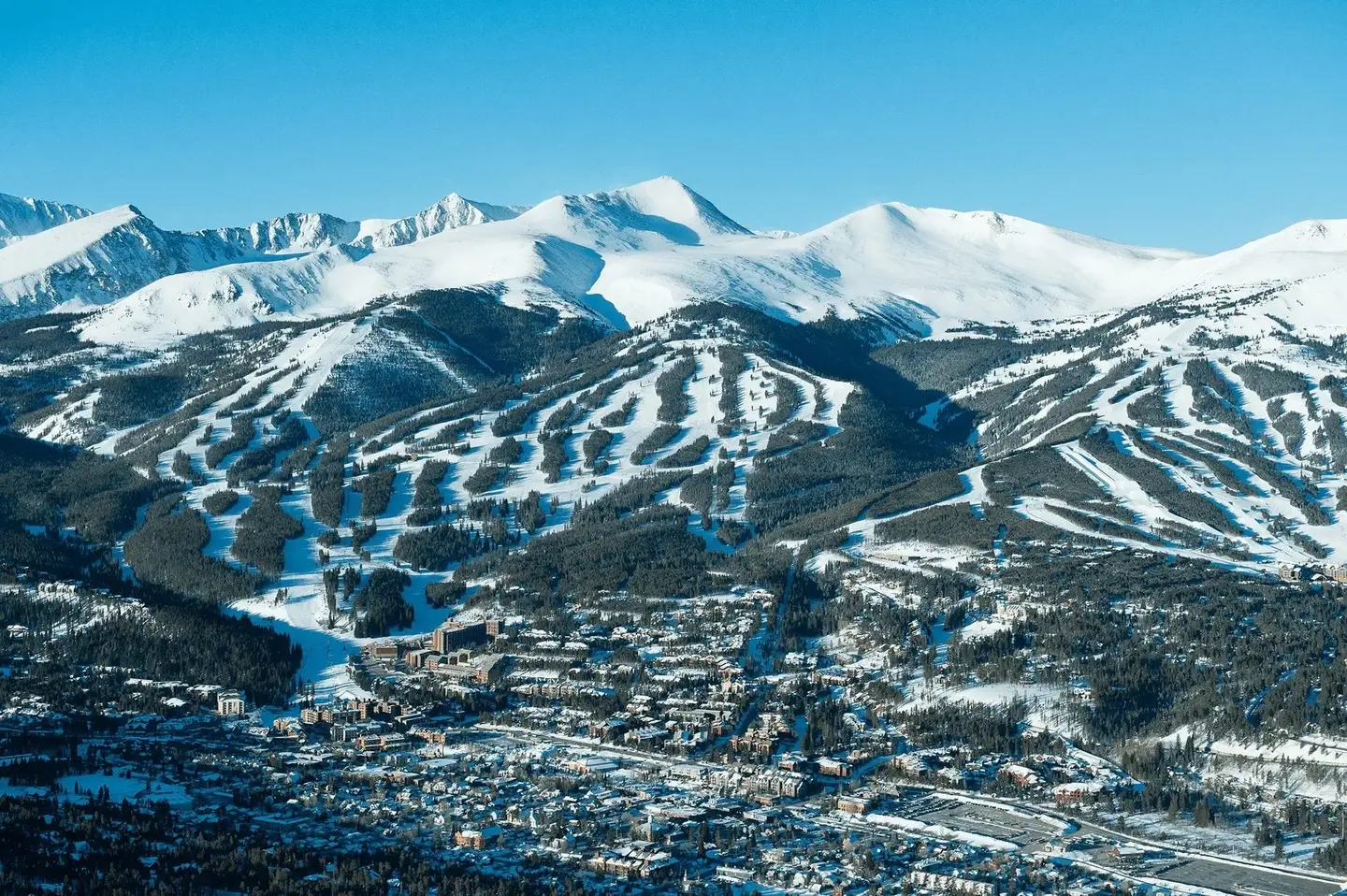
- Toss Ups → Colorado’s northern resorts, northern Utah: Storm chances look decent but not guaranteed.
- Losers → Southern Rockies, Sierra Nevada, Southwest: Drier and warmer conditions are more common in La Niña winters.
- East Coast: Harder to call: local storm tracks matter more than ENSO phases that come in from the Pacific.
Sign Up for the TGR Gravity Check Newsletter Now
Why This La Niña is Unique
Because this La Niña looks weak, the typical storm patterns may not lock in as strongly. Other factors, like short-term jet stream wiggles or the warm “Blob” in the North Pacific, could steer storms in or away from key regions.
Bottom Line
La Niña is likely, but not guaranteed. NOAA’s September outlook is promising, but there's no free lunch here. If you want powder and you aren't lucky enough to live in the PNW, you may have to travel for it. Skiers chasing storms should look north, think the Cascades and northern Rockies, while southern ranges may be in for a tough year.
It’s shaping up to be one of those winters where being nimble, watching storm tracks, and jumping on windows could make all the difference. If you care to get into the nitty gritty, check out the full report here.