Light to Moderate Snow Teases Rockies & NW This Weekend
Popular Stories


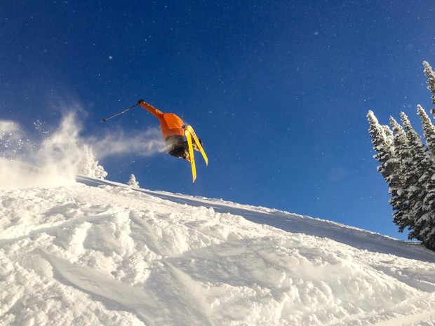 Austin Hopkins airs it out during this high pressure system in the Tetons. Sydney Hopkins photo.
High pressure and warmer temps have taken hold on the Western US over the past several days. This is the first real break we have seen in the weather cave for some time this winter. The next 7 days shows a return to some activity for many areas starting with “teasing” snow amounts this weekend in the PNW, and Northern Rockies.
Snow and rain will be falling in the PNW and coastal BC late this week and into early next. Colder air filters in Friday night creating our best odds of 3-7 inches in most of the Cascades before warmer air moves in late Saturday. The northern mountains near Mount Baker may see higher amounts at upper elevations. Snow levels “flip flop” early next week with continued moisture but low confidence on any single deep dump. High elevation snow is likely to continue with valley rain. The interior Washington Cascades and areas in Northern Idaho may fare better as colder air skirts down from Canada Friday night through Sunday (Highest peaks).
The Rockies grab moisture Saturday into western Montana and northern Idaho (Cold front edges into Idaho late Friday bringing light to moderate snowfall). The Tetons grab light moisture on Saturday turning moderate by Sunday morning. Light to moderate snow (3-6) will accumulate through Sunday in the Tetons (Grand Targhee and areas on the West side of the pass may be favored under NW flow). Colorado will reap light to moderate rewards Sunday morning through Monday favoring resorts along I-70 and north (3-5) under NW flow (Vail may deserve a watch). PM Sunday or AM Monday will be your best bet. While snow in the Rockies will not be heavy this light freshening will should improve conditions in the northern Rockies. Beware of the frozen mank below the new snow surface.
Next week shows a better disturbance moving into the PNW and Sierra mid week and moving over a wide area of the Rockies Wednesday /Thursday. This will likely produce moderate snowfall however unwilling to forecast amounts just yet.. Lets hope the models hold up. The long range pattern shows another temporary ridge over the Rockies and an uptick in moisture for the Northwest.
The Good: Snow will be falling again the West favoring area in the northern Rockies.
Sign Up for the TGR Gravity Check Newsletter Now
The Bad: Some warmer temperatures will keep areas in the PNW flip flopping between rain and fluff.
The Extended: Moderate storm might be on tap for mid to late next week.
Powderchaser Steve