
Results 126 to 150 of 175
Thread: Ski Chile 2020, one rider down
-
09-28-2020, 05:12 PM #126
 In awe
- Join Date
- May 2014
- Location
- Santiago Chile
- Posts
- 1,728
Haven´t made it out of Stgo yet. Not the reason, but the map of the pandemic is changing, with outbreaks in the Lake District, including Lonquimay and Panguipulli. Santiago now looks good, comparatively. The worst now is the far south, mainly Punta Arenas, with 870 active cases/100,000.
Red - quarantine
Yellow - phase two (quarantine weekends, no restaurants etc)
Orange - phase three, yeh! weekends and restaurants outdoors, no bars or gyms
Blue - phase four (pre total open)
No fives yet
-
09-30-2020, 07:34 AM #127
In awe
- Join Date
- May 2014
- Location
- Santiago Chile
- Posts
- 1,728
With snow on the wane, other boarding venues come to mind. Try Iquique, driest desert in the world with a view to the sea!
-
10-01-2020, 06:26 AM #128
In awe
- Join Date
- May 2014
- Location
- Santiago Chile
- Posts
- 1,728
Ski Chile 2020, one rider down
Corralco will officially stay open in October. Looks like the daily limit is 700 tickets, online only, and that is plenty for this time of year.
https://www.nevasport.com/chilenoski...nes-a-domingo/
-
10-01-2020, 06:09 PM #129
In awe
- Join Date
- May 2014
- Location
- Santiago Chile
- Posts
- 1,728
I have been meaning to post this for a year now, Better late than never. I love Lonquimay and environs, and this post is about that and my last visit in September/19.
The upper Bio Bio basin is a remote, mountainous, undeveloped area of Chile which is accessed from a long (mostly dirt) road that winds up the Bio Bio river from Los Angeles. Faster and easier, is the paved international highway from Victoria through Curacautin, Malalcahuello and the 5km-long Las Raices tunnel. In the summer, you can also take the Las Raices pass to Lonquimay (which passes the Arenales ghost ski area), but it closes for about 6 months in the winter. The only other access is from Cunco, on the south side of V Llaima, to Icalma, the source of the Bio Bio, and the pass to Villa Pehuenia in Argentina, which also has snow and must be plowed.
Having been relatively isolated until the late 19th century, the area is populated with indigenous communities known as the “Pehuenche” peoples, a subset of the Mapuche. The tribes are mostly self-sufficient, in that they continue to herd their animals, hunt and fish, and collect the pine nuts (piñones) from their sacred tree, the Pehuen (monkey puzzle trees). Being snowbound during the winter in much of the area, the high mountain pastures and forests are only used from December to April.
After the 300-year “War of the Araucania”, a messy period of “pacification” began, and with it disease and displacement. In 1860, Orélie-Antoine de Tounens, a French lawyer and adventurer with the support of the local Lonkos (chiefs), claimed that the regions of Araucanía and eastern Patagonia were not dependent on any other states and he decreed himself the “King of Araucania and Patagonia”. He was arrested, declared insane, and expelled to France. This was followed by increasing presence of Chilean and Argentine military, and in 1880 an uprising began that was promptly and bloodily put down by Chilean soldiers, many of whom were returning from the War of the Pacific (with Peru and Bolivia). With the Argentinian persecution of Pehuenches into Chile, the Chileans were forced to occupy border areas to defend the frontiers of the new territory.
From an early date the Pehuenches were mixing with “colonos” (or colonists) from other parts of Chile, however it remained poor and wild-west-like until well into the 20th century. Starting around 1900, the local tribes were awarded “Mercy” titles to their ancestral property, which ended up being a precarious and partial solution to their lack of legal ownership, as the deeds did not consider their nomadic way of life. These areas were known as “Reducciones” (or “reductions”, as they drastically reduced the area they were actually using), somewhat like the North American reserves, but as the historical land usage was not recognized, by 1911 most of the territory was auctioned off by the state for a pittance to private interests. Illiterate and with no understanding of western notions of property, the Pehuenches continued to occupy the lands occasionally providing forestry and ranching interests with manual labor.
The 20th century brought certain forms of progress to the area, notably greater connectivity with the Curacautin-Lonquimay railroad (including a 5km tunnel under the Las Raices range), the installation of government services, schools, an airport, etc. The progress, however, was slow and had dark episodes, such as the Ranquil Massacre of 1934.
Some public square symbols
From the early 1900’s to the 1970’s the forests were heavily logged, but little, if any, development ensued. By 1990, the indigenous demands for proper titles reached a break point, with the Quinquen tribe vowing to “never leave their lands alive”, when the owner attempted cutting down their sacred Pehuenes and evicting them. This led to a PR disaster for the first democratically elected government in 15 years and ended in thousands of hectares being bought by the government to normalize the ownership.
Today, peace reigns in the area, in contrast to the Central Valley of the Araucania, which has frequent violent attacks by radical Mapuches on forestry companies, evangelical churches, and other “Huinca” (white man) properties. Being isolated and poor as it is, recent governments have made significant, if sometimes ineffective, measures to provide education and services. Once isolated communities now have good roads which are plowed in the winter.
In this current map of the larger Pehuenche territories, from the Public Works website, the Alto Bio Bio I refer to is at the bottom, southern part of the upper BioBio basin, which is in the Araucania region. The northern part is in the BioBio Region.
Some photos of the local lifestyle in winter, Quinquen and the Icalma-Galletue road under the haze of V Caulle in 2011.
Local snowshoes, the milk cart, and a classic Ruca, or rustic house.
-
10-01-2020, 06:16 PM #130
In awe
- Join Date
- May 2014
- Location
- Santiago Chile
- Posts
- 1,728
Various groups of mountains dot the lee side of the front range of volcanoes, including Lolco, Rahue, Ranquil, Arenales, Huemules, and China Muerta, and about 100km of the continental divide. Going east, the rainfall drops, leaving behind the moist mixed forests and opening into pampa-like steppes, remote valleys, and scattered Araucaria, Lenga and Ñirre trees.
This area is part of the greater Unesco Kütralkura Geo-Park, where the geology is mash-up of ancient and current volcanic activity. For more, see http://geachile.sernageomin.cl/geosi...lonquimay.html
-
10-01-2020, 06:23 PM #131
In awe
- Join Date
- May 2014
- Location
- Santiago Chile
- Posts
- 1,728
Choosing where to go in the winter is no small task, given road maintenance gets worse the more it snows, and info is often hard to come by. Here are some:
V Batea Mahuida
A rather boring peak as far as epic runs go, but I still had a nice experience last year. This is a Pleistocene flat- topped affair with a lake, on the border near Icalma. Going up alone on a threatening day, the man at the base eyed me a bit suspiciously, but nonetheless let me park and use his access, with a smile.
A fallen Araucaria on the way, perhaps 500 years old.
Those chunks of bark are probably where the puzzle comes into the English Monkey Puzzle tree.
They burn really good, but not as good as the joint of the branches, know as picoyo which sinks in water and is know as a "salamandra buster" (small wood heater).
The clouds where trying hard to make it over the front range, and a few flakes were falling when I got out of the forest
On the way down, I got on the wrong side of the creek, and while searching for a forge, stumbled on a man praying at the base of an Araucaria. I tried to pass inconspicuously, but he nodded at me, eventually finished his prayer, and gave me a hand finding a way across, waving profusely and shouting as I trudged up the volcanic sand on the other side.
-
10-01-2020, 06:31 PM #132
In awe
- Join Date
- May 2014
- Location
- Santiago Chile
- Posts
- 1,728
Cordillera Huemules
Accessed from several sides, the Huemules range stands alone east of V Sierra Nevada, between Lago Galletue and the town of Sierra Nevada, which are joined by the La Fusta road. As seen from the south side of Galletue
This can be accessed from the Quinquen indigenous community
Or from the east via a private ranch.
I managed to get up once back in Oct/2011, on reconnaissance for a backcountry lodge (which failed), and got these shots of the range:
-
10-02-2020, 10:10 AM #133
In awe
- Join Date
- May 2014
- Location
- Santiago Chile
- Posts
- 1,728
A couple of shots of the top of La Fusta road.
-
10-02-2020, 12:07 PM #134
 Registered User
- Join Date
- Mar 2012
- Location
- West Side WA
- Posts
- 486
Thanks for those couple posts, Casey!
So much awesome terrain out there. Would be an amazing area to have more access/tourism. My taste being for the non-mechanized or minimally mechanized variety.
We were very excited last fall to see the Arenales lodge being renovated into what the Pehuenche women said were hoping to create a ski touring spot. The bunks were still pretty crappy and under-construction (we stayed in Malalca), but the food they served was some of the best Chilean home cooking I've ever had. Amazing empanadas.
Back in 2010 when I worked in Chile and had an orientation at the US embassy, they mentioned continuing unrest of indigenous Mapuche groups as maybe our only terrorism concern, but that it was quite unlikely. In retrospect, I was in a lot more danger from minefields in the border region near San Pedro de Atacama when I went and hiked Volcan Licancabur via the ruta chilena.
Hopefully, tasteful development that involves indigenous communities and respects nature and their way of life can continue. More heli-ski lodges para los cuicos: no thanks.
-
10-02-2020, 02:22 PM #135

 Registered User
- Join Date
- Feb 2008
- Location
- XXX
- Posts
- 610
Just dropping a line to say awesome posts - love the history and the stoke. My brother is adopted from Chile and, we think, of Mapuche descent. It's always trippy to read something about the Mapuche and imagine how different things might have been.
Everybody's gotta have parkas. I'm talking custom parkas. Two words: "client development." They see all of you out there cutting the powder in your matching Schweikart & Cokely parkas, you'll make an impression. You will thank me later.
-
10-02-2020, 02:23 PM #136
In awe
- Join Date
- May 2014
- Location
- Santiago Chile
- Posts
- 1,728
An update on the Araucanía parks open. Of note are the limits to 20 Randoneé skiers and 100 "free" guests (non-lift ticket holders) at the Corralco entrance to Reserva Nacional Malalcahuello. I hope to head to Las Araucarias on Llaima for a couple nights next week, and am now scouring the web for lodging...
Región de La Araucanía
Parque Nacional Conguillío:
abierto con restricciones de personas (200 por sector) de 8:30 a 17:00 hrs. Sectores Captrén y Truful Truful miércoles a domingo, sector Los Paraguas martes a domingo.
Parque Nacional Villarrica:
abierto con restricción de personas (200 personas diarias). Sector Rucapillán abierto lunes a domingo de 7:30 a 18:00 hrs, sector Puesco abierto miércoles a domingo de 8:30 a 18:00 hrs. Sectores Quetrupillán y Huincacara cerrados por acumulación de nieve.
Ascensos al volcán solo cuando no existe restricción por clima, de acuerdo a lo instruido por la Ordenanza del Municipio de Pucón.
Reserva Nacional Malalcahuello: sector El Colorado abierto lunes a domingo. Aforo Centro de Ski Corralco: 700 esquiadores con ticket comprado con anticipación, 20 esquiadores de actividad Randoneé y 100 personas libres.
https://www.conaf.cl/situacion-de-parques-nacionales/
-
10-02-2020, 04:40 PM #137
Registered User
- Join Date
- Mar 2012
- Location
- West Side WA
- Posts
- 486
We stayed at the refugio at the ski area without lifts on Llaima. Had the whole place to ourselves, with the one host.
-
10-03-2020, 08:06 PM #138
In awe
- Join Date
- May 2014
- Location
- Santiago Chile
- Posts
- 1,728
Ski Chile 2020, one rider down
A rundown of active volcanoes in Chile, north to south, with photos and data, is downloadable here: https://www.sernageomin.cl/chile-territorio-volcanico/
Inactive and long-dead volcanoes are also numerous. I live in a 20 million year old caldera.Last edited by Casey E; 10-04-2020 at 10:30 AM.
-
10-04-2020, 08:33 AM #139
 Registered User
- Join Date
- Jun 2010
- Location
- Powder Mountain
- Posts
- 841
Thanks for all the local info and indiginous lessons Casey. My lady is from PM/PV area and when we're down there we always try to support the local mapuche markets. She does fiber art up north and the quality of the local wools is amazing in the south. Originally Posted by Casey E

Have you ever heard of abalones/machas/locos/cholgas in the states? I would pay an arm and a leg to have a parilla de mariscos up here
-
10-04-2020, 10:29 AM #140
In awe
- Join Date
- May 2014
- Location
- Santiago Chile
- Posts
- 1,728
Another free book with great Patagonia Photos
https://www.chileindomito.cl/wp-cont...onia-def-1.pdf
-
10-05-2020, 05:39 PM #141
In awe
- Join Date
- May 2014
- Location
- Santiago Chile
- Posts
- 1,728
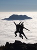
Made it at last!

-
10-06-2020, 07:13 PM #142
In awe
- Join Date
- May 2014
- Location
- Santiago Chile
- Posts
- 1,728
Ski Chile 2020, one rider down
Virus warning: Friday Villarrica was in phase 4, the most open possible at the time. Saturday it was declared phase 2 and yesterday quarantine starting Thursday. The feared post-18 bump: since I last checked Sep 30, active cases are now up almost 50%, confirming the 2 week delay in the spike of detection from date of exposure.
So, being that this thing means special permits to be out of your home, I guess skiing is off the cards, cuz cops are out at the choke points like the Tolten river bridge into Villarrica.

Now things are weird around here, masks almost everywhere, line ups, furtive glances, and holed ups, like us, stocked up with groceries and holed up.

Enjoying the greenery and birdsong. Spot the “quincho” in the trees, gives perspective on the size of the trees.
-
10-07-2020, 10:44 AM #143
Registered User
- Join Date
- Sep 2016
- Posts
- 141
Better late than never, our colleague Maxi Viale has released some new forecast products:
Río Atmosphérico forecast tools for South America!


Note the site is bilingual, so we gringos can learn some meteorology terms in Spanish.
Thanks, Casey for providing the stoke once again this year. Psyched to make it back down for the next Austral snow season.
-
10-07-2020, 03:24 PM #144
In awe
- Join Date
- May 2014
- Location
- Santiago Chile
- Posts
- 1,728
Speaking of seafood, here is a chorito, choro malton, almeja, merluza austral, chorizo-white wine injundia we just cooked from the spoils of our Villarrica whirlwind. Originally Posted by BeardedClam

I will leave you to attempt a translation.
-
10-07-2020, 05:56 PM #145
In awe
- Join Date
- May 2014
- Location
- Santiago Chile
- Posts
- 1,728

Reineta, congrio, and merluza austral, fresh in from Mehuín.
-
10-08-2020, 08:58 AM #146
In awe
- Join Date
- May 2014
- Location
- Santiago Chile
- Posts
- 1,728
Ski Chile 2020, one rider down
https://iarc-symposium.com/ Originally Posted by 2_1_3

So it is actually virtually in Chile now.Last edited by Casey E; 10-10-2020 at 10:07 AM.
-
10-11-2020, 09:16 PM #147
In awe
- Join Date
- May 2014
- Location
- Santiago Chile
- Posts
- 1,728
Now Pucón shot up from 1 case to 35 in a week. Getting ugly out there so no skiing for the time being, and maybe for the year. Corralco closes the 18th, and the heat is on.

-
10-11-2020, 09:24 PM #148
In awe
- Join Date
- May 2014
- Location
- Santiago Chile
- Posts
- 1,728
The 30km south coast of Lago Villarrica, from Pucón and the Trancura river entrance on the left, to Villarrica and the Tolten River on the far right. As quiet as it gets today. Not much more than 1 person per sq km here.

Old Ice age moraines delimit the lake.
-
10-13-2020, 07:33 AM #149
In awe
- Join Date
- May 2014
- Location
- Santiago Chile
- Posts
- 1,728
I have bad internet possibilities where I am, so the continuation of my Lonquimay posts (from my pc) will be delayed. Meantime, Villarrica huffs and puffs. Oct 4

This has left the north side dirty.

Copahue has wrecked it’s snow.

And Chillan has done its number on the it’s slopes

Lord Vulcan reigns
-
10-20-2020, 09:18 AM #150
In awe
- Join Date
- May 2014
- Location
- Santiago Chile
- Posts
- 1,728
Sierra Nevada is a 2.500m stratovolcano which was once the largest in the region. What remains of the caldera has been eroded by glaciation, and it drains into 3 different watersheds. The BioBio side (north) looks like this (from near the town of Sierra Nevada):
The east side from Lago Galletue, with explosive V Llaima on the left.
The approaches are long and can involve stuff like this on the Conguillio (west) side
Thanks to https://blog.andesgear.cl/rumbo-al-v...i-de-travesia/
Andes handbook has 4 routes up it https://www.andeshandbook.org/montan.../Sierra_Nevada
A map of different routes can be found at Andes Profundo https://en.andesprofundo.com/sierranevada

 Reply With Quote
Bookmarks