
Results 1,626 to 1,650 of 1920
Thread: Eastside Conditions Thread
-
05-07-2019, 12:36 PM #1626

 Registered User
- Join Date
- Mar 2011
- Location
- Tahoe
- Posts
- 1,106
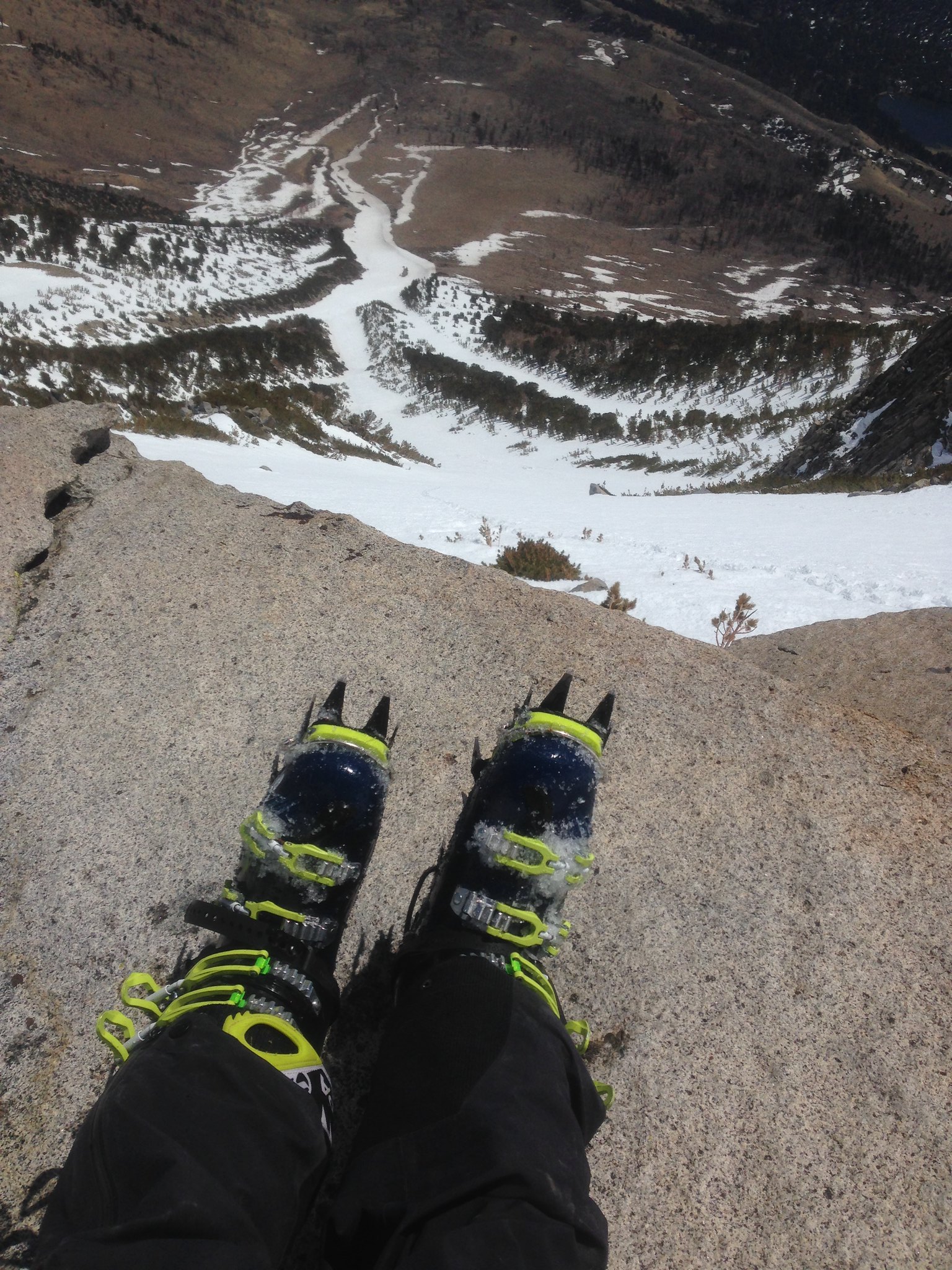
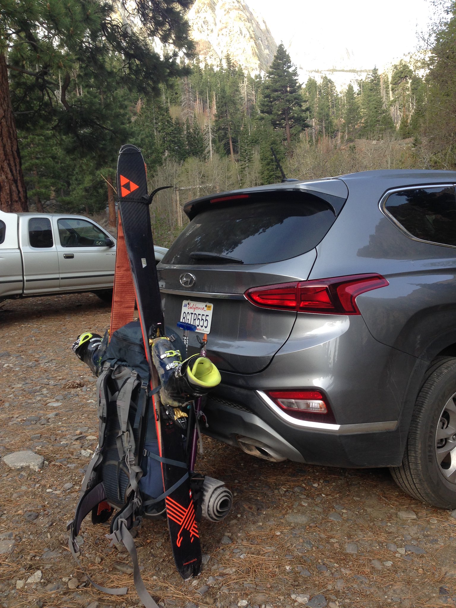
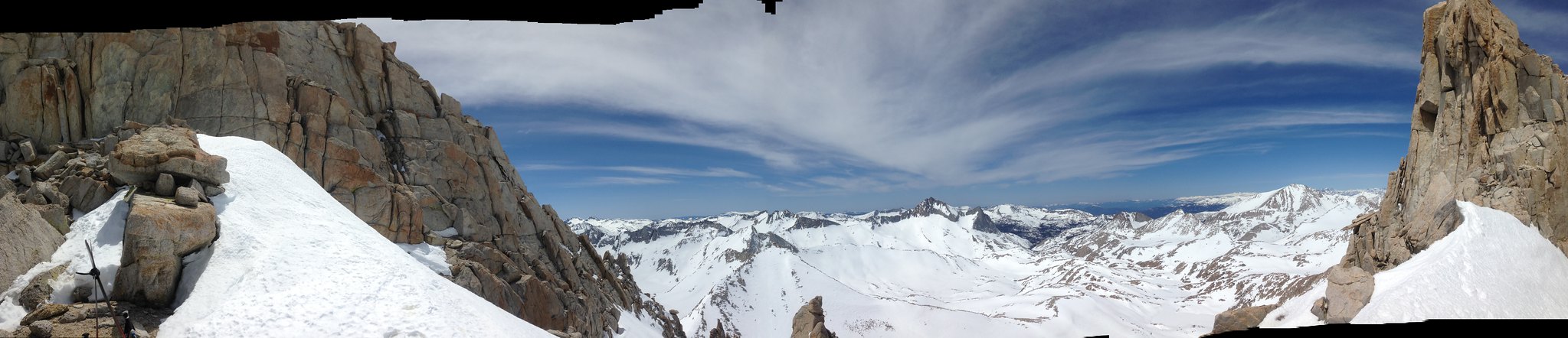
Sunday was our last day. We decided to ski Mt. Irvine. It was a fantastic day. Pretty much money corn the entire way. A great way to end the trip.
Another sunrise on the way to Irvine:
Dry hiking:
Skinning high above Lone Pine:
A cool tree along the way:
Getting higher:
Finally in view of the line:
-
05-07-2019, 12:42 PM #1627
Registered User
- Join Date
- Mar 2011
- Location
- Tahoe
- Posts
- 1,106
Getting closer:
Topping out the booter:
Sweet views of Whitney from the top of the couloir:
Clouds rolled in as we started skiing. Corn was awesome.
Skiing:
All smiles after another great trip:
-
05-07-2019, 03:41 PM #1628

 Registered User
- Join Date
- Dec 2006
- Posts
- 3,711
This thread is blowing up!
I wish I took the quality photos that whatsupdoc consistently does.
Outstanding pictures, trog, JackBurton, mbc, and bobz!
-
05-07-2019, 04:48 PM #1629
Registered User
- Join Date
- Apr 2006
- Location
- Tahoe City
- Posts
- 722
Wow Doc & AKB Mt Irvine looks like an incredible ski! AK, Doc & TROG - yall are throwing down for days out there - cheers!
Like I told my last wife, I never drive faster than I can see, besides it's all in the reflexes.
-
05-07-2019, 06:43 PM #1630
 Registered User
- Join Date
- Jan 2015
- Posts
- 2,374
Whoa, amazing stuff!! Pals and Whitney's north face AND other stuff in one week.
I saw you guys on Wood, and descended a couple hours later (and via the next snow line to the north). Glad you had good snow; looks like the decent snow window was relatively brief that day.
-
05-07-2019, 10:18 PM #1631
 far from my next whomp
- Join Date
- Aug 2006
- Posts
- 8,992
Great stoke thread!!
-
05-07-2019, 11:11 PM #1632
registered abuser
- Join Date
- Oct 2003
- Location
- tahoe
- Posts
- 3,428
wow next level stuff trog n doc++++
-
05-07-2019, 11:49 PM #1633
Registered User
- Join Date
- Nov 2006
- Posts
- 15
Thurs May 2- Sun May 5
Finally, my one pass for a solo 4-day east side safari. My goal was two single days sandwiched around a 2-day mini-expedition to a more distant coveted jewel of a line, agonized over in guidebooks for months prior. Which to choose? The caveats being that the first day would be on 4-hrs sleep in the car at the trailhead after leaving SF post-kids bedtime and the last day would need to end by lunch in order to be back in SF by bedtime. At least a solid stable weather window with warm temps and clear, cool nights -- finally the gods abide.
Mt Gibbs East Face on Day 1. So tantalizingly close to 395, with those tendrils of snow seeming so close. But still a sandbag of a 1.5-hr hike/schwack to get to the boniest finger of snow.


The great thing about these big-vert front range peaks with uninterrupted drop to the valley floor is the feeling of being up in space or looking out over the earth from an airplane. Never gets old to hang out over a 4,500' drop.

Everything must come to an end

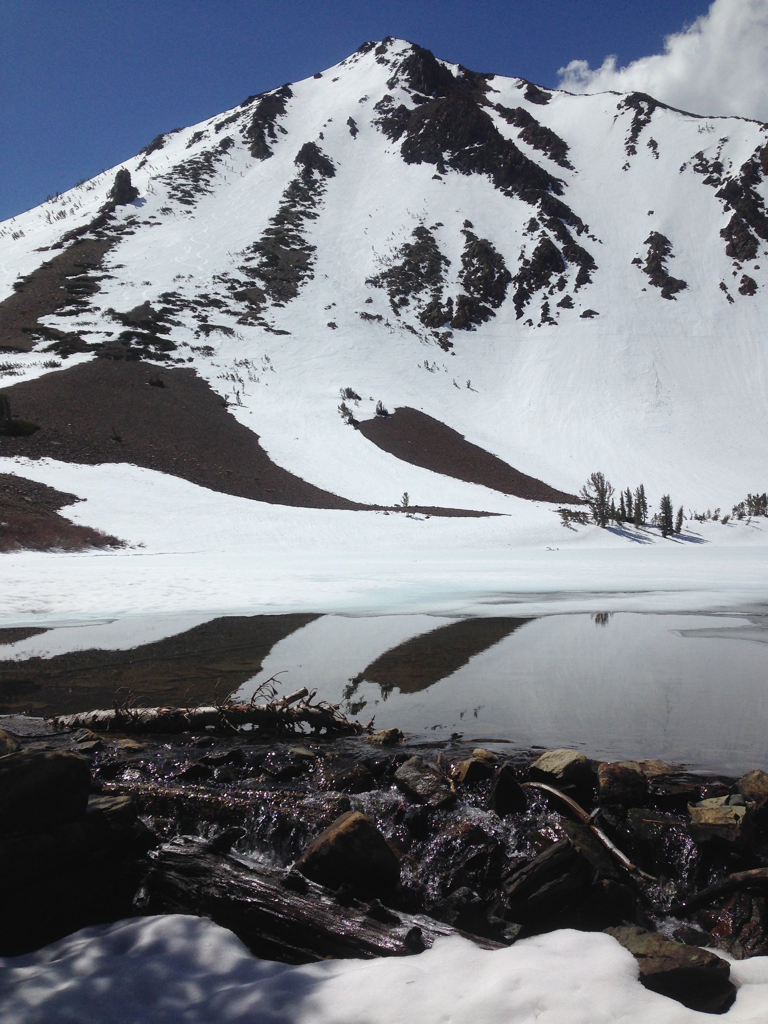
Days 2-3. Feather Peak North Couloir, with basecamp at Golden Lake.
Not exactly loaded for fast and light.

One other car at the trailhead, but I saw no sign of anyone else for two days, except for two lone ski tracks in several square miles. However, I was soon rethinking my decision to leave the bear canister behind and my dismissive response to the USFS permit ranger suggesting that I bring one, even to the high alpine. Fresh bear tracks heading in my same direction at about 9,000', accompanied by fresh scat (sorry no photo of that):

The morning traverse following the firm snow clinging to the steep sidehills and plunging gullies above Pine Creek involved shoes, then ski boots, then ski crampons, then boot crampons until finally transitioning to the relief of skins at about 9,500' where the route becomes easy touring from lake to lake deeper into the hills.

Upper Pine Lake
Looking north over Honeymoon Lake

First glimpse of Feather Peak, through the perfectly framed CoCoLa pass.

Golden Lake camp, around 10,800'. Beautiful spot. Lots of great terrain around here. I decided to sleep a little lower than up at Royce Lakes. A great spot for maximizing ski potential without the fully-loaded pack. On the first afternoon after setting up camp, I toured up thru the pass to Royce Lakes and then circumambulated Treasure Peak (the one on looker's left of the pass) and dropped off the plateau directly fall line back to Golden Lake camp.

Royce Lakes basin. Breathtakingly spectacular. Like being on another planet.
Merriam, Royce, Feather Peaks (left to right).


Merriam and Royce.

Proof I was there.

Feather. The objective, North Couloir out of view. I didn't even go check it out until the next day.

The next morning.
Aha. Photo doesn't do it justice.

I got a relatively lazy morning start, thinking that I didn't want the north facing line to be too firm. However even at 10:30am the steepening apron was already almost unsupportive mush without skis on. Kind of disconcerting when your axe shaft easily sinks fully straight in up to the pick. Hmmm. Being out there alone, miles in and no one for miles around, makes one do a lot of conservative hesitating, especially a father of two. But, perseverance or stubbornness finally paid off to keep assessing a bit higher, and as I ascended the snow surface changed dramatically to a consistent and almost perfect wintery firmer smooth surface alongside the rock buttress in the lower part of the main couloir. A big relief, so it was a go. Sorry, no pics of climbing up or skiing down from within the couloir. Climbing up I just wasn't about to whip out my phone and skiing down I just didn't want to break the flow to take a picture. Suffice it to say, a very satisfying climb and descent.
Views from then notch, looking southwest. (sorry for the glitchy pano)
Looking back north from whence I'd come.

Summit to the upper right in the photo. I did not try to scramble up in ski boots.

Heading back toward the pass.

Scenery on the tour out. Upper Pine Lake.

A very satisfying two days.
Day 4. Easy day at Virginia Lakes. No more dry hiking, easy access and able to bang out two peaks before lunch. First Dunderberg South Gully. I didn't even bring my skins. Just threw on my crampons and jammed up before it got cooked, descended at 9:45, perfect snow surface.

Epic view from Dunderberg summit.

That direct line down the north face of South Peak to the lake just absolutely beckoned for lap two.

A quick stop at the car to switch crampons for skins, eat an apple, and head back out:
Similarly awesome view south from top of South Peak

The run down the north face chute on South Peak just before noon was probably the best skiing of the trip. Untracked surfy mush, big GS turns with turbo fully engaged.
Right when I got to the car the clouds folded in and rain drops started to spit. I recommend the Dunderberg sandwich at the High Sierra Bakery in Bridgeport.
Until next year. Have a great spring!Last edited by sfskier; 05-08-2019 at 12:32 AM.
-
05-08-2019, 10:14 AM #1634
Registered User
- Join Date
- Mar 2008
- Location
- Boulder
- Posts
- 332
Pretty rad how big the E Sierra is, that all these folks can be out there shredding, yet the only time we ever saw another soul on our ski days was back at the road, or from a distance on Esha.
-
05-08-2019, 03:33 PM #1635
Registered User
- Join Date
- May 2018
- Posts
- 296
Got out for a quick little work out today. Hit far looker's left on the Wahoo Gullies. It felt nice to just go out for a mellow day. Man, I'm gonna miss this place when I jam in June.
Keep the shred alive, y'all.
-
05-08-2019, 06:54 PM #1636
Registered User
- Join Date
- Dec 2012
- Location
- Probably Rose
- Posts
- 73
Any beta on Mt. Tom snow conditions? A buddy and I have wanted to bag it for a while now, but are concerned we may have missed the window for this season...
Sent from my moto g(6) using TGR Forums mobile app
-
05-08-2019, 07:25 PM #1637
 can fly!
- Join Date
- Jan 2004
- Location
- the Low Sierra
- Posts
- 17,820
FYI
TPR bought SLR
update on FBI didn't believe in reincarnation when I was your age either.
-
05-09-2019, 10:15 AM #1638
Rod9301
- Join Date
- Jan 2009
- Location
- Squaw valley
- Posts
- 4,667
Not the right thread, but i wanted to spread info on Oregon volcanoes.
My wife and i skied mt. Jefferson in Thursday, after a long approach in Wednesday and camping at 6,000 ft.
4 leisurely hours in dirt then two hours of skinning in the trees and route finding.
Check out the summit Pinnacle, which we wanted to climb, but were discouraged by the 5.7 rock covered with rime, and lack of any pro.
Anyway, 3,000 of 45-40 degrees, South facing, almost perfect corn.
Not sure where the exit went, probably 20 miles from any road, so we bailed to the right for another 2,000 ft to our tent.
And check out this avalanche path, about 2,000 ft, big trees up rooted.
Thursday was a big day, 13 hours from tent to the top to the car, including 40 minutes of adjusting crampons.


Sent from my Armor_3 using Tapatalk
-
05-09-2019, 02:15 PM #1639
Registered User
- Join Date
- Mar 2011
- Location
- Tahoe
- Posts
- 1,106
Probably not worth it at this point with better higher elevation options out there. Depends on your willingness to suffer and bushwhack but I think you may have missed the window for a snow line that makes it worth the effort. Originally Posted by spaulding24

-
05-09-2019, 09:44 PM #1640
 Looking 4 fresh en France
- Join Date
- Sep 2006
- Location
- Marin born -> Chico State -> CH -> France -> Truckee
- Posts
- 470
"Can switching to Geico really save you 15% or more on car insurance?"
"Do people really call 911 thinking they will get seen faster in the ER?"
-
05-10-2019, 08:20 AM #1641
Banned
- Join Date
- Jan 2009
- Location
- Reno
- Posts
- 1,344
Great. Nothing like wet mank to screw up the corn. Looks like I'll be mountain biking for a while.
-
05-10-2019, 10:14 PM #1642
 Registered User
- Join Date
- Oct 2004
- Location
- Jackson
- Posts
- 341
Does anyone have a report on how much snow the upper elevations got? I was planning on driving from WY and skiing Mon-Thurs this week but I could postpone a week if there's going to be a bunch of glop. Weather isn't looking awesome this week, either. Any advice from folks who are in the know?
-
05-11-2019, 11:14 AM #1643
Registered User
- Join Date
- Mar 2011
- Location
- Tahoe
- Posts
- 1,106
I saw reports of 5-10 inches in the southern Sierra. Probably 1/2 of that further north. Mammoth is reporting 1-2". I can't verify any of this. I imagine high N aspects will ski well. Solar aspects transition to corn very quickly this time of year. Tough call as to this week or next. Some of the long term forecasts I'm seeing show unsettled weather next week as well. Originally Posted by phattypowpow
-
05-11-2019, 06:42 PM #1644
 Registered User
- Join Date
- Sep 2009
- Posts
- 1,633
Virginia lakes skied well
Sent from my iPhone using TGR Forums
-
05-11-2019, 07:24 PM #1645
Registered User
- Join Date
- Oct 2004
- Location
- Jackson
- Posts
- 341
Thanks for the updates, doc & splitter. I'm going to go for it and make the drive tomorrow. I have M, T, W (maybe Th AM but weather looks iffy) to ski and figured I'd started north at Virginia Lake, due to the high elevation TH, good report from splitter, and less new snow up north. It also gives me options for different aspects - Dundeburg, Black, etc.
Depending on how things go, I'm might move south and here are a couple ideas on my radar:
- Park at lower gate on 120 and hike up Gibbs Canyon to the Kidney Chute or Gibbs N Face. Any idea how painful Gibbs Canyon is right now? Or maybe PP road to East Peak/The End/Dana Plateau?
- I'm assuming the Mendenhall is kind of a PITA for access and/or hammered by now?
- Mt Wood off June Lake Road. TH is at 7000 - sounds like there will be a lot of dirt walking.
- Low Hanging fruit at Big Pine Campground - Kidd Mtn, Mt Alice, etc
- Onion Valley - Had some friends how just came back, raving about the skiing right from the TH which, I think, opened recently.
Of course, weather might steer me one way or another. Thoughts? Thanks!
Just skied 4000' of nice corn in the Tetons this morning so it's hard to leave but I'm pretty stoked for new terrain. I've done a bunch of hiking and backpacking the eastern Sierras but this is will my first trip ski trip. Thanks to everyone who has been providing awesome beta and stoke the last couple weeks (months?) - really invaluable.
-
05-11-2019, 09:28 PM #1646
Registered User
- Join Date
- Oct 2004
- Location
- Jackson
- Posts
- 341
Also, is it cool to park overnight at VA Lakes?
-
05-11-2019, 09:28 PM #1647
registered abuser
- Join Date
- Oct 2003
- Location
- tahoe
- Posts
- 3,428
Enough snow for a reset and solar Should be fully cycled in a few days where it’s not already. More snow fell south of bishop. Full pow in some n couloirs in that zone
Sent from my iPhone using TGR Forums
-
05-11-2019, 09:41 PM #1648
Rod9301
- Join Date
- Jan 2009
- Location
- Squaw valley
- Posts
- 4,667
Sure Originally Posted by phattypowpow
Sent from my Armor_3 using Tapatalk
-
05-11-2019, 09:49 PM #1649
registered abuser
- Join Date
- Oct 2003
- Location
- tahoe
- Posts
- 3,428
Love this panel backside dundy
..... but you have to either slog out the drainage to a shuttle car at gcreek (f that) or just walk back up
And back down from where u came
N couloir/kavanaugh ridge beta shot for gc shuttle tour
Sent from my iPhone using TGR Forums
-
05-13-2019, 09:39 AM #1650
 Registered User
- Join Date
- May 2015
- Location
- mammoth lakes, ca
- Posts
- 113
shout out to everyone posting on this thread for keeping the stoke up during the work week! awesome photos and skiing by AKbruin, whatsupdoc, trogdortheburninator, mbc712, and Best Mexican Skier.
onion valley is still skin-ski to the car, but melting out fast. found nice pow above 11.5k north-facing, but below that it was supportable crust or heinous super-grabby concrete. needs a few more days of melt freeze to cycle, but with another system incoming it might be all about chasing the ephemeral cold north-facing for a bit.
north face university 5/13:

 Reply With Quote
Bookmarks