
Results 1,101 to 1,125 of 1453
-
12-24-2022, 11:29 AM #1101

 Registered User
- Join Date
- May 2012
- Location
- People's Republic of OB
- Posts
- 4,445
I was stoked to get up the hill and work on some re-routes, but when I saw the dirt still had moisture I dropped that plan and worked on drainage instead. It's usually rock hard with loose sand on top, so you can't work on it when dry. Was able to re-establish drains down about half of the trail. Will take a few more hours to finish it, so fingers crossed we get another storm soon. Trail has held up pretty well despite lack of maintenance. I filled in or widened the ruts as well. The trail we used to climb up was obliterated by the fire and subsequent storms so this trail will now be climbed and descended.
Drain to the right with a dirt roller to make sure water goes off the side
Before
After:
Removing material that had filled drains and using it to fill ruts instead
In a few spots where there is room to ride above the rut I opened up access to that rather than filling the rut.
More drains. Before:
After
-
12-28-2022, 01:21 AM #1102
Registered User
- Join Date
- May 2012
- Location
- People's Republic of OB
- Posts
- 4,445
Headed back to the mountains this weekend for more work on the restoration project. Dirt had dried out a bit but could still be worked in some areas.
Only had a couple hours the first day, so I finished digging drains on the lower part of the trail I worked on last weekend. You can see the ruts above and below the drains. This trail has always had a nice rut down the steep parts. It's pretty fun surfing over it from side to side, but the drains will keep it from getting worse. In both cases water was continuing straight down the trail.
-
12-28-2022, 01:47 AM #1103
Registered User
- Join Date
- May 2012
- Location
- People's Republic of OB
- Posts
- 4,445
Second day I got into the re-routes I want to do. The goal is to make the trail flow better while also making it climbable and more sustainable.
This is the trail right now, straight down a drainage. Not fun to ride down, eroded and/or full of sand, and too steep/loose/eroded to climb.
So, re-route around it to lessen the grade while adding a nice rock roll as a downhill line
Climbing line on the left, rock roll on the right
A bit of tidy up on a section above the re-route. Needs more work, but dirt here was too hard to do much shaping.
Future rock roll. I brushed out the entrance, just need to clean up the runout
-
12-28-2022, 02:19 AM #1104
Registered User
- Join Date
- May 2012
- Location
- People's Republic of OB
- Posts
- 4,445
Third day
Dug into another re-route not far below the first one. The main goal with this one was to create a climbing route to bypass a couple steep sections that suck to push up. It also removes a couple janky turns and climbs in the downhill direction and replaces with trail that flows better.
This one is twice as long and had a lot more brush to remove.
I got about half the tread done, focusing on the steeper side slope sections first. This section still needs a wider turn but the upslope was rock hard, so I made do for now. The shoulder is very soft as is. Might need to dig down further to widen it.
Entrance to that same section viewed from the other direction. Nice rock pinch. The trail used to turn right where I now have it turning left. After the pic I made a ramp onto the rock on the RHS of the pinch so it can be rolled going downhill.
And a shot from further back. There is a big rock slab to roll down half visible at the bottom of the shot. That will be the downhill A line, which joins up with the original trail middle right. The trail drops down steeply just out of sight beyond that. The climbing re-route will bypass that section.
There are a lot of stumps I still need to dig out of the tread. And beyond that, just a bit of benching to be done.
-
12-29-2022, 12:52 PM #1105
 Irie
Irie
- Join Date
- Dec 2002
- Location
- cow hampshire
- Posts
- 8,390
Nice work Evdog!
Last week when I was in Rincón we apparently had 60+ mph winds up here and our trails got hammered. Huge blowdowns all over the place. Maintenance is so tiring when you're trying to build new, enhance, or reroute sections. Oh well...
-
12-29-2022, 06:12 PM #1106
 Registered User
- Join Date
- Dec 2009
- Location
- Paradise
- Posts
- 5,235
Strong work Evdog, most people don't want to do the drain work. It's definitely not the sexy trail work but it's effective, for a little while anyways.
dirtbag, not a dentist
-
12-29-2022, 06:16 PM #1107
Registered User
- Join Date
- Dec 2009
- Location
- Paradise
- Posts
- 5,235
Ain't that the truth! After doing trail work for years I've developed a strong appreciation for sustainable trail building design/techniques. The trick tho for me is how to build exciting trail but as sustainable as possible or at least the most maintainable as possible in relation to the land managers available resources. That's always a funky and challenging equation to formulate! Originally Posted by jackstraw
 dirtbag, not a dentist
-
12-29-2022, 07:02 PM #1108
Registered User
- Join Date
- Sep 2006
- Location
- Rossland BC
- Posts
- 1,883
Dig stoke, who else likes to play in the dirt???
Usually just use perforated 4” pipe, and don’t bother with the sock. If we have good access I’ll use clean 3/4” drain rock (crushed, but without fines)) that I appropriate from a nearby highways stockpile. Otherwise we just utilize whatever is on site. You’re not wrong, river rock maintains better voids (so drains better), but angular rock provides a more stable base for relatively shallow burial. Originally Posted by altasnob
Blogging at www.kootenayskier.wordpress.com
-
12-29-2022, 08:59 PM #1109
Registered User
- Join Date
- May 2012
- Location
- People's Republic of OB
- Posts
- 4,445
Thanks! Yeah drainage in Socal is super important. Our dirt in most places is very erodable. Trails built by people who don't design well for drainage don't last very long. This trail had gone probably 15 yrs with zero maintenance, and would have been very rideable were it not so overgrown. Originally Posted by raisingarizona13
-
12-31-2022, 07:33 AM #1110
Irie
- Join Date
- Dec 2002
- Location
- cow hampshire
- Posts
- 8,390
Cleaned up a couple yesterday. More to go.


-
01-02-2023, 03:46 PM #1111
Registered User
- Join Date
- Feb 2014
- Location
- NorCal coast
- Posts
- 1,971
Anyone tried using low top gaiters while doing trail work to keep dirt out of your shoes? I've tried on the newer high top / sock Five Tens and didn't like the fit on any, and was thinking I may as well just get a set of low top hiking/trail running gaiters instead. I was thinking it would definitely need a durable strap that goes underneath, and ideally good coverage over the tongue area too.
-
01-04-2023, 12:35 AM #1112
Registered User
- Join Date
- May 2012
- Location
- People's Republic of OB
- Posts
- 4,445
I wear dirty girl gaiters over my riding shoes all the time. 5.10s seemed to just funnel sand and rock into my shoes. With the gaiters I get very little until they start developing holes in the sides. For trail building I usually wear taller boots and long pants if I'm doing tread work. I tend to kick dirt around with my feet a lot and boots hold up to that better than shoes. No need for gaiters when I'm wearing boots and pants. Originally Posted by Andeh
-
01-04-2023, 01:07 AM #1113
Registered User
- Join Date
- May 2012
- Location
- People's Republic of OB
- Posts
- 4,445
More work from this past weekend, I snuck out for a quick overnighter between storms.
Moody day, ghostly quiet out there
Goal for the weekend was to finish the re-route I started last time along with another one just below it.
Wanted to eliminate a couple steep chutes that are eroded and too steep to pedal up. Replace with the rock waterfall on the left, with a bypass for climbing.
Couldn't resist building the runout for this rock roll first though. The line is down the edge of the rock from right to left
The line starts up onto this rock
There is a nice roll off that rock and then through the gap and onto the main rock roll from a couple pics above. Should be a fun line
Another roller on the left, with option to roll the middle. I want to move the rocks in the foreground off to the left and use them to back a berm that will shoot riders onto the rock slab I'm standing on.
This is looking down trail from the same spot. Line will go off the slab to the right, around the bushes and then up onto the big rock behind the bushes.
Roll off that final rock
And the exit of the whole section.
I brushed the whole lower re-route and started digging out 30 or so remaining stumps left from last time. Finished a few sections of bench cut. But ended up calling it early when my boot started disintegrating. Tried to work with it for a while but it was just too annoying, stumbling around like a drunk. Then it started raining.... So I didn't finish all I wanted to do, but still got a lot done.
-
01-07-2023, 12:36 AM #1114
Registered User
- Join Date
- May 2012
- Location
- People's Republic of OB
- Posts
- 4,445
Got out in the local hills a couple times this week between storms.
Cleaned up the runout from this slab
Fixed up some jumps and ramps
This berm gets worn down every year and the space in front of it fills with sediment. It was pretty much flat so I used the sediment to build it back up, and added material to the runout of the slab.
The landing of this drop always feels very flat. To give it a better transition I built the lip up about 18". I'd like to build it up another foot or so, but will see how it feels first. The transition is right below the lip, so those that love the flat landing just need to hit it with a bit of speed.
Ran out of daylight fixing up a rutted section after this. Heard the sound of digging from a nearby ridge as I was packing up. Glad I'm not the only crazy one out there digging in the dark : )
-
01-08-2023, 04:44 PM #1115
Not a skibum
- Join Date
- Aug 2002
- Location
- PA
- Posts
- 2,664
New trail built recently was super loamy today! Optional steep drop/roll off those rocks, whole trail has a bunch of great rock work.

Sent from my iPhone using Tapatalk
-
01-08-2023, 05:56 PM #1116
Registered User
- Join Date
- Dec 2009
- Location
- Paradise
- Posts
- 5,235
It looks like the skiing has sucked out there this winter but I bet it's been killer for trail building. Originally Posted by VTskibum
dirtbag, not a dentist
-
01-08-2023, 06:08 PM #1117
Not a skibum
- Join Date
- Aug 2002
- Location
- PA
- Posts
- 2,664
Bit of hit or miss. It’s been so wet around me in PA that you can just pick big rocks right out of the dirt like it was soup. Hard to do any kind of shaping when it’s that saturated.
Think most of the work on this one was done in Nov, but wasn’t able to make it out to help. Did get out to my local and work on some drainage and clearing a bunch of trees that came down bc of the soup dirt.
Sent from my iPhone using Tapatalk
-
01-11-2023, 03:15 AM #1118
Registered User
- Join Date
- May 2012
- Location
- People's Republic of OB
- Posts
- 4,445
Another break between storms so I headed back to the mountains this weekend
With recent rain there was a new lake not there previous weeks. I've been contemplating re-routing part of the trail that follows a ridge top fire break. Now I know where not to put it : )
Flowing water always shows where a trail's weaknesses are. There is a hole on the far side of this crossing that gets soft when wet....needs a slab rock to bridge it.
Wish I could incorporate this waterfall section in to the trail. Unfortunately there isn't any good way to connect it.
The main goal for the first day was to go through the re-route and remove all the root balls that were left in the tread. A lot of them were the remains of burnt stumps with significant new growth intertwined. A total PITA often with multiple sizable tap roots. Excavate around them, cut the sideways roots and then I was often able to break them off.
With the root balls removed just a bit of tread work was needed to finish most of it
Back the next day to finish two sections
This...with half dozen root balls hidden in the grass
And this turn. The rock on the upper end was worrisome as it wouldn't budge.
It had three big root balls sprouted along its upper edge. Chopped those out and was able to split the rock in half with a gorilla bar. Each half was moved into place to rock in a water crossing above and below the turn
There are still a few embedded rocks that prevent banking the turn more but it is rideable enough and turned out pretty well IMO. Climbs well and descends ok.
Finished up the section below it. The "last spike" contained a couple root balls that took into dark to remove
I'd installed this ramp earlier onto a rock roll. However the split rock below was in the way. The slower line to the right you could go around it to the left. But this ramp would shoot you to the right.
With the gorilla bar I was able to flip the slab and make a diving board jump out of it.
A friend who has lived nearby for a long time did some scouting and sent me this... apparently there used to be a trail dating back to the 90s that bypassed a steep rutted section near the top. I was under the impression this would be a good MTB climbing trail
I tried to find it on the previous trip but failed, so he sent me a waypoint for the beginning. It's definitely not a climbing trail but might make for a good alternate descent. I was able to follow it up to a big granite outcrop then lost it. Will need to look again during daylight.
As for the main trail I have two big re-routes left that I want to do, then the trail will be fully open. Hopefully just a few more trips to finish.
-
01-13-2023, 06:29 AM #1119
Not a skibum
- Join Date
- Aug 2002
- Location
- PA
- Posts
- 2,664
Some lunch digging before it rained again, sprucing up my backyard access trail w a recycling playground bridge

Adding some purposefully janky rocks

Sent from my iPhone using Tapatalk
-
01-14-2023, 02:45 PM #1120
Not a skibum
- Join Date
- Aug 2002
- Location
- PA
- Posts
- 2,664
Dig stoke, who else likes to play in the dirt???
Bit wet so not great for riding, but good for digging.
Getting head start for spring, since that’s what it’s been around here so far. Making tables bit bigger


Sent from my iPhone using TapatalkLast edited by VTskibum; 01-14-2023 at 03:41 PM.
-
01-23-2023, 12:25 AM #1121
Registered User
- Join Date
- May 2012
- Location
- People's Republic of OB
- Posts
- 4,445
Yesterday was tour de storm carnage. Mostly, it was water crossings of variable depth and breakaway bridges that had been pushed out of place. A couple of them were gone completely, snapped off their retaining cables.
Water - too deep to ride across. Breakaway bridge - gone.
Crossing - wide and deepish. Got feet wet.
No crossing here, but the trail on the left keeps getting narrower each time the water gets high. The entire area gets inundated during storms.
Trail (road) is the now the stream
Only a couple spots of notable damage in the whole trail network. Generally areas get flooded and a bunch of sand deposited. Occasionally spots get churned up like this. There's already a path beaten through so it doesn't really need fixing.
Not bad overall, the trails themselves hold up pretty well. And we got off pretty easy down here. The mountains above Santa Barbara got 24" of rain in a few days, and most of the Los Padres NF is under closure order for 2 months due to excessive trail and road damage.
Crossing - wet feet. Breakaway bridge - gone
-
01-23-2023, 01:18 AM #1122
Registered User
- Join Date
- May 2012
- Location
- People's Republic of OB
- Posts
- 4,445
Today was trailwork back on some other local trails
Dirt at the bottom of this rock roll has been worn away making it an almost vertical drop. It's not smooth at all and over half the riders I see walk it.
Paul helped me move a phat rock into place. We buried the base of it then chocked it in against the boulder with some other rocks. Solid. And confirmed a much smoother roll now. Same overall height but people won't freak out thinking it's an automatic OTB
Finished product
Lower trails all held up well to the storms from the last couple weeks. We moved on to the upper trail. Forgot to take pics up here. This trail is a PITA, mostly clay soil full of cobbles and lots of water seeping across it. It is soupy when wet and rock hard when dry, ruts and all.
No after pic, but I dug out the deposited sand and clay on the inside and used that to build a berm back up on the outside.
We dug a bunch of drains and filled them with rock. Hopefully that will work to redirect the seepage off the trail. Nice sunset
Walked out the trail below which heads down the bottom of the canyon. It was a mess. Not my trail, and the builder has been MIA for several years with no maintenance done. I usually don't work on other peoples trails but couldn't help filling this rut. Riders already going around it on the grass. Guy needs to get up here and fix his shitty trail. One he built in the next canyon over is apparently even worse.
Only took a couple mins to fill and stomp down.
Last edited by evdog; 01-23-2023 at 12:19 PM.
-
01-23-2023, 07:20 AM #1123
Registered User
- Join Date
- Nov 2017
- Posts
- 203
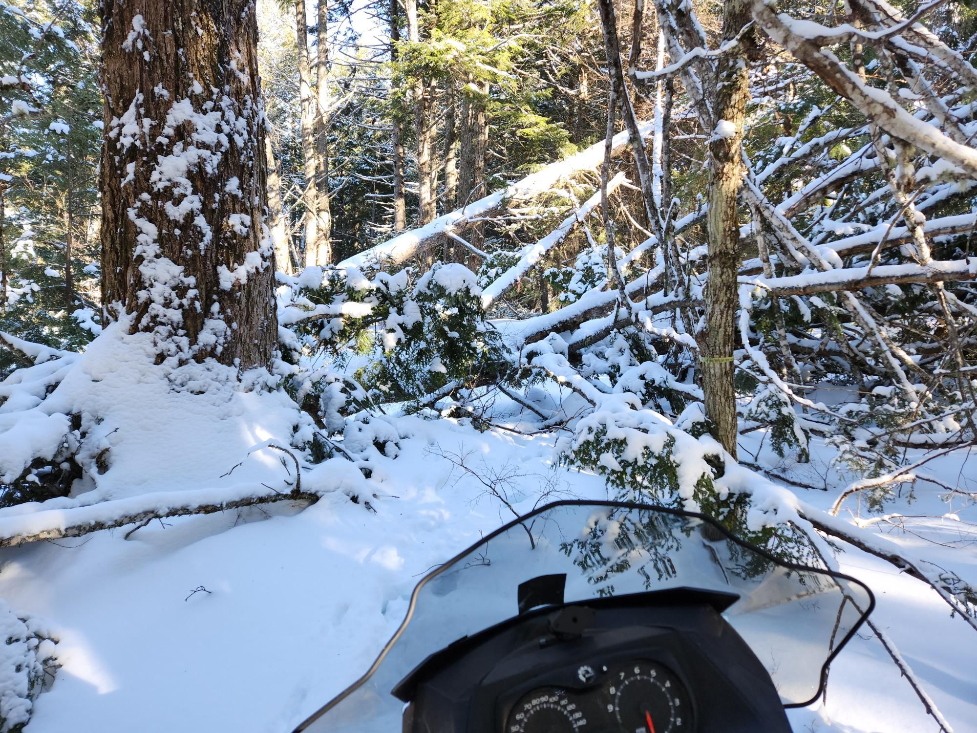
I am not digging in the dirt, but making fat bike trails in the snow.
I got lazy in the fall and neglected some storm clean up, mainly because I couldn't bike due too much snow and I couldn't groom due to too little snow. Now I am paying for it.
This one just section of the trail that took 1.5 hours to clear.
-
01-27-2023, 03:28 AM #1124
Registered User
- Join Date
- May 2012
- Location
- People's Republic of OB
- Posts
- 4,445
Back at it for a bit this afternoon.
This trail gets hammered every time there is a big storm. You might not be able to tell but water can get 6-8 ft higher than the trail here. Lots of sand deposited in spots, lots of debris to clear. Water got up this year, but damage wasn't too bad. Cleared the debris and fixed a bit of tread, good to go.
Yeah, best to walk across that right now
Bank got eroded so much this root mass was exposed. Cut that out to help restore the crossing
Rut was starting to form on this descent
Have to do this every couple years. Don't mind it, the dirt is really nice to work with
This section is a bit of work to maintain. Steep sidehill, sections keep landsliding away. There's a rut next to the upper handle in the pic you can see.
Rut is now fixed
Again most of the trails were in not bad shape and maintenance was more preventative than repairs of bad damage. Can't say the same for the fire roads though, that is where 90% of the worst damage was happening. Like this....
-
01-28-2023, 02:39 AM #1125
Registered User
- Join Date
- May 2012
- Location
- People's Republic of OB
- Posts
- 4,445
A couple projects today at park ranger's request.
Fixed a section that eroded out. Water flows from left to right behind this bit of work. Believe it or not there used to be an eroded channel behind where I did the work. We installed a bridge over that channel around 2011 since the ranger was concerned it would erode further and become impassible. Instead, a huge storm a few weeks later deposited 2 feet deep of sediment, almost filling the channel. Storms the last couple weeks finally filled the channel completely and it spilled over and down the trail, eroding it.
Before pic... There used to be a trail that contoured across the face of this slope that people would climb up. Riders over the years started riding straight down the face of it. Erosion also took its toll and now the disturbance is 25 ft wide, the climbing trail long gone. So I benched a ramp in mostly for hikers and riders climbing up. We'll leave a line open down the steep face for riders to go down. Not bad for an hour's work.

 Reply With Quote
Bookmarks