
California Wakes Up! Sierra to Pull Down 2-3 Feet of POW Next Week
Popular Stories


After a seemingly endless stream of atmospheric rivers pounded the Sierra with snow and drought-busting rain last season, we once again see the volatility of mother nature as an extended dry period has returned to much of the western U.S and skiers across multiple states are wondering where the white stuff is here.
But the first signs of change are here, in the form of a moderate storm this weekend followed by a potentially stronger storm next week. Along with high elevation snow, much needed rains will bring some drought relief to the Southwest and four corners regions, which have been exceptionally dry this season. Late next week will likely bring heavy snow back to the northern Rockies as well with the Wasatch finally getting into the action!
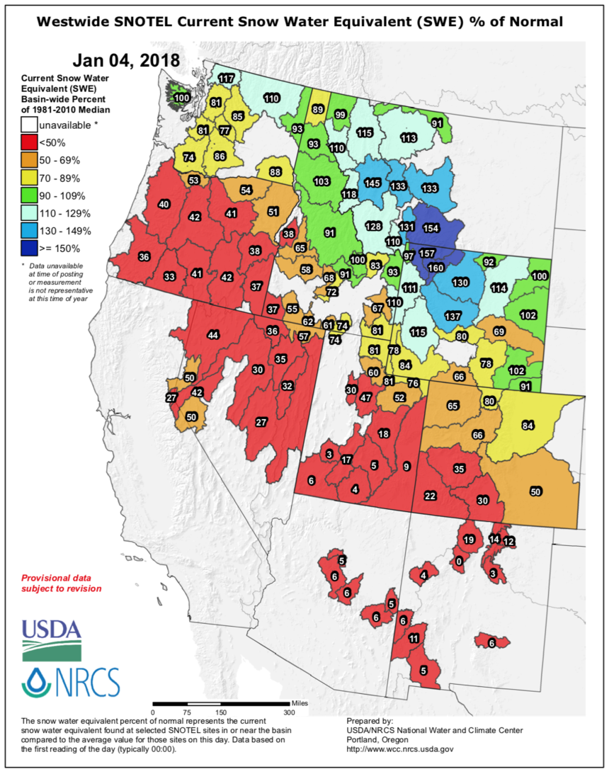 Current snow water equivalent percentages (how much water the snow is holding) as of January 4th, 2018 cast a bleak picture. Photo: USDA
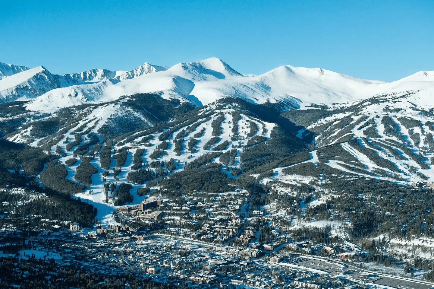
SIERRA SNOW
The good news is that the summits of many Sierra resorts will see a moderate storm this weekend with a significant storm likely on its heels by Monday night/Tuesday. There are a few things not working in our favor with the first storm though, as strong winds and unseasonably warm temperatures may limit snowfall and negatively effect snow quality. Warmer than average temperatures will bring high variability of snow totals depending on elevation. It's likely that on Saturday you will be skiing 3-7 inches of wet snow on the summits with minor amounts at lower elevations. The exception may be Mammoth, with a higher base/summit elevation, however the heaviest moisture may stick around North and South Lake Tahoe. Take the lighter amounts and no rain at Mammoth or gamble on higher amounts further north with a rain/snow mix at the bases. It's possible that some resorts exceed the 3-7 inch mark by late Saturday.
Storm #2
On Monday, snow will start falling by the afternoon with snow levels once again at the dreaded 8,000-foot level (above the bases and even mid mountain at many ski resorts). Snow intensity picks up late Monday night into Tuesday morning with perhaps 7-9 inches at upper elevations and slowly falling snow levels. Heavy snow will continue to fall at upper elevations bringing totals to 10-15 inches by the end of the day. Colder air works in Tuesday improving snow quality and driving snow down to the bases. Models are favoring areas in the central and southern Sierra range. My best guess for the highest amounts are Kirkwood and Mammoth. The Mammoth summit may score in excess of 30 inches by the time the storm exits late Tuesday night. Areas further north, and those at lower elevations, will see lower storm totals. Overall amounts should fall into the 15-20 inch range over most of the Sierra above 7,500 feet by late Tuesday with the summit of Mammoth tipping the scales, perhaps approaching 3 feet. Kirkwood may also see these higher amounts.
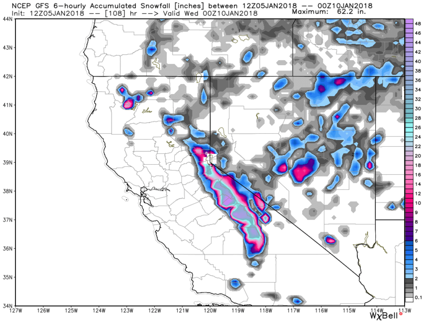 The total predicted precipitation for The Sierra through Tuesday. Photo: Courtesy of Weather Bell
All of this welcome moisture heads towards to the 4 corners mid next week.
Sign Up for the TGR Gravity Check Newsletter Now
The good news for many resorts that have seen little snow this season is that the middle of next week will bring at least a foot of snow to southern Colorado, northern Arizona and southern Utah. Moderate moisture will stream north into the central and southern Wasatch near Salt Lake. A cold front and northern branch of the jet will likely kick off decent snows in the northern Rockies with Idaho, Montana, and Wyoming reporting decent numbers in the middle of next week as well as renewed snowfall along the front range near Denver.
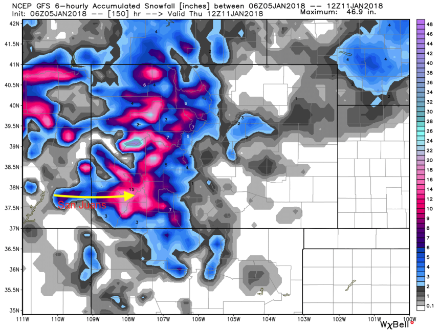 The Four Corners may finally get some relief. Photo: Courtesy of Weather Bell
Long Range:
The ridge returns following the 2-3 storms next week, but then the storm door reopens perhaps focusing on the PNW once again, especially during the January 17-21 period. Whether the storm door stays open after this round of snow remains the biggest unknown at this point, and may go a long way in determining whether winter can really make a comeback in the West.
Powderchaser Steve