
Some friends and I just spent 9 days skiing in the Wind River mountains of Eastern Wyoming (edit - yup, Western, oops). Our trip was made possible in part by my partner's incredible backcountry planning skills, and also thanks to some huge help from Backcountry.com, whose incredibly cool super-employee, who many of you know and may or may not know you know, saw the potential in our trip and supported us with some much needed equipment. Finding someone who doesn't already shop on their site might be tricky, but if you can, tell them to come out of their cave and support this company. Also, lonestar lives in the area and gave me some much needed beta on the then-current snowpack.
UPDATED:
So yeah... it wasn't easy, and it wasn't perfectly executed, but we had the weather, the snowpack, and the right group to go after it.
Here is a short write-up with a few photos, hopefully I can get together with Davide and Tyler and get some more stuff up soon. We went in to Titcomb Basin from the Elkhart trailhead out of Pinedale, WY. In all, Dave stayed only 4 days while Tyler and I stayed 9. On the way to Titcomb, we spent some time under Mt. Lester skiing lines in that area before heading up under the bigger peaks.
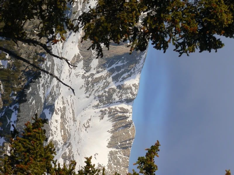
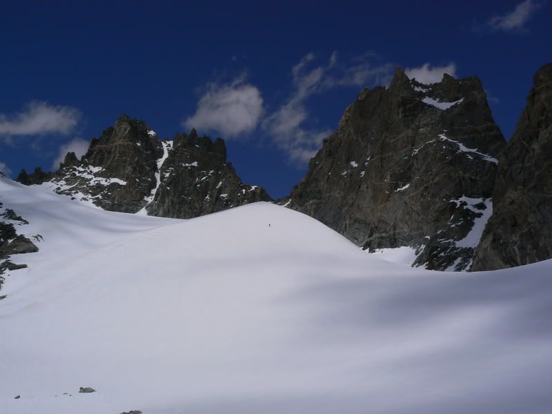
Our slightly improvised approach brought us farther east than the normal summer trail and afforded us some views of the peaks south of Fremont and Jackson. This is looking across the Pole Creek Lakes region towards Angel Peak, although I believe these ridges aren't named on the map:
The next day, we came in high around the east shore of Seneca Lake and were finally given some close up views of Fremont. Notice Tyler's homemade sled, of which we had two for towing the booze and fireworks.
That afternoon, we narrowly escaped, by literally 30 seconds, being in a high pass when lighting came down. We set up base camp right under the NE face of Mt. Lester, which we skied in the morning. On the way up, we had a great view of Woodrow Wilson, and the ice couloir which ascends, or descends, its S Face. This line called to us from miles away, and we would attempt it in a few days. By the way, that's Gannet Peak, highest point in Wyoming, peeking over the right shoulder of Woodrow:
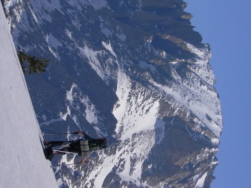
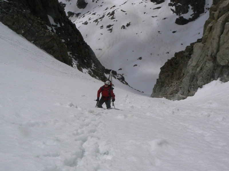
Tyler nearing the summit of Lester:
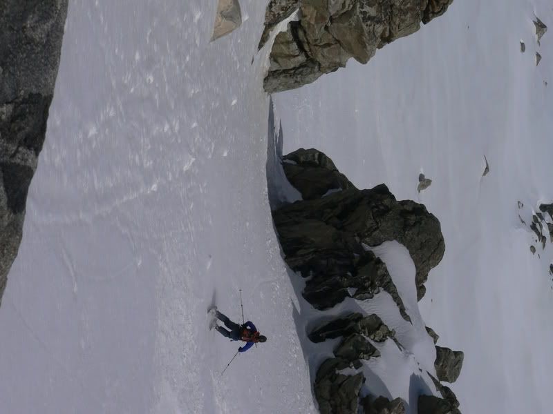
The summit was awesome. The peak stands at only 12,342 ft, but as the guidebook says, its prominence as a peak which stands away from the continental divide makes it seem badass. Or something like that. Davide entering the choke in the bottom of the line:
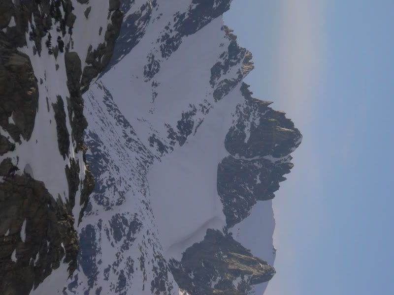
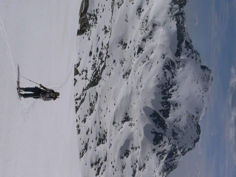
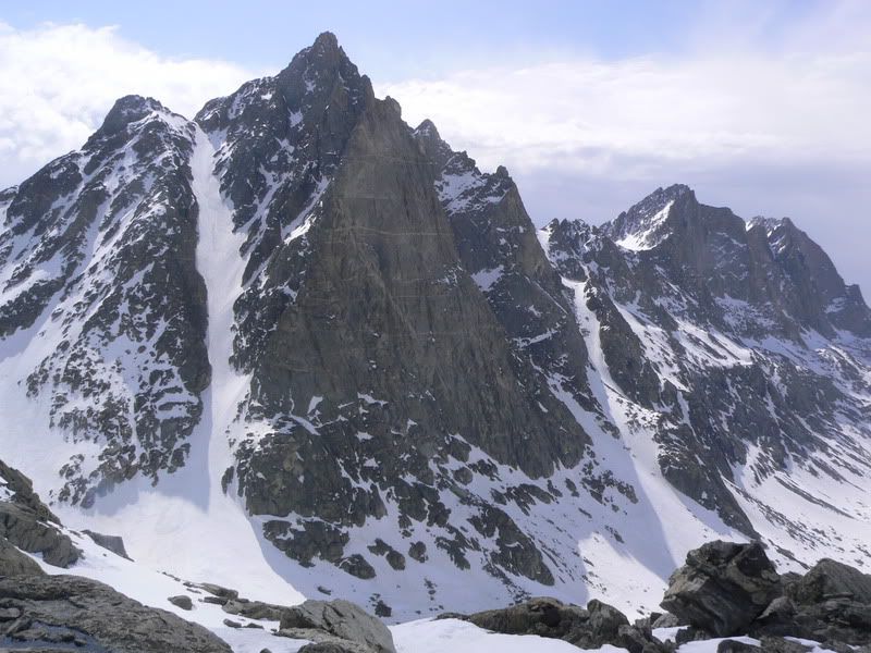
It was a great run which we skied all the way into base camp, and promptly sat down and cooked lunch. Perfect! For all we know it could be a first descent because there is no information out there about skiing in the Winds. After lunch we headed up the other side of the valley towards Elephant's Head, where looking back at our line off Lester gave us better perspective than being parked at the bottom of it. Our line goes from the left summit down the ridge to the right until a more rock-free, open hanging bowl drops down the face. It finishes through the biggest choke in the lower cliff band:
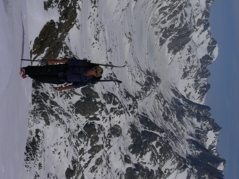
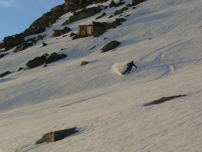
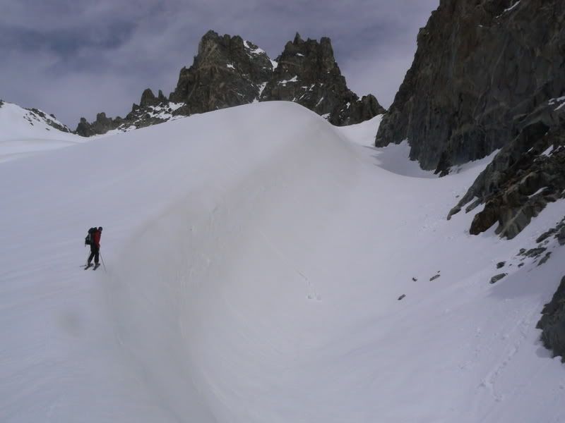
We skied a couple runs near Ellingwood Peak, before having some alpenglow for dinner on the way back to camp. Davide always goes fast:
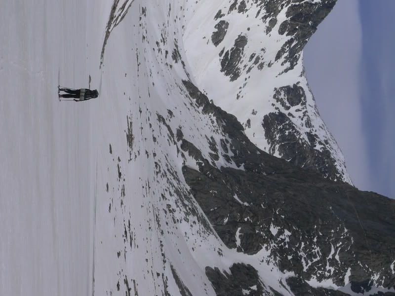
At this point, Davide bailed and exited solo without a map. Quite a feat in itself. Tyler and I headed up into upper Titcomb basin. Here he is crossing the upper lake. Shit looks close. It isn't:
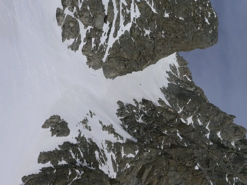
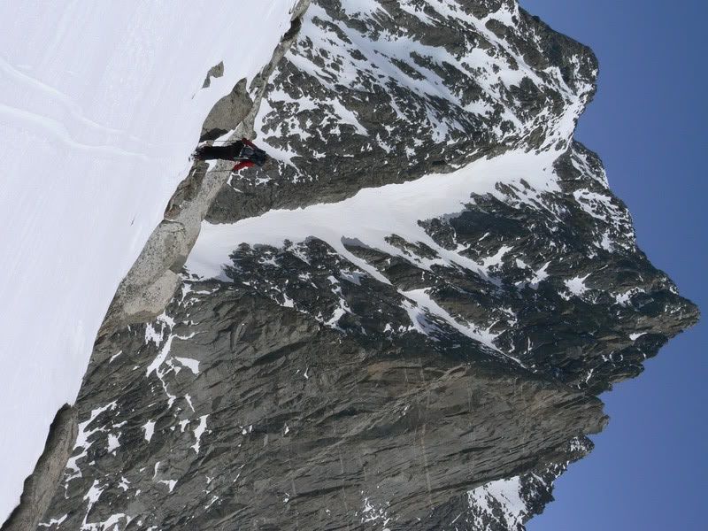
As you finally gain the last basin as far up into the upper east reaches of Titcomb as you can possibly go, the NW couloir of Mt. Helen finally becomes visible. Bitch of a bootpack:
But great snow. Maybe the most incredible line I've ever seen and skied. See Tyler the Ant?
We bivied that night and then finally headed up to try our luck on the couloir of Woodrow Wilson we spotted days before. On the way up we got some great views of how big that coolie on Helen really was, while Mt. Sacagawea and Fremont Peak finish out the ridge to the right:
We then gained the Sphynx Glacier, which is melting faster than a.... well... you better get up there soon before its gone:
Well it turns out, as the guidebook says, and as Davide spitefully predicted days before from miles away; its an ice line. We got a ways up it, but we were front pointing and climbing a little too much rock and water ice to think that sendin' er 16 miles from our car was too good of an idea. So we bailed about a third of the way up:
Big disappointment only lasts so long when you are immediately feasting on glacial corn. Tyler again, posing as the ant:
And one last look over at Helen on our way down, our tracks should be visible if you try real hard:
And then the exit. What a bitch that was. Bumpy, muddy, low snow, manky manky mank mank ma mank. But we made it! And then went to the Wrangler Cafe, a Pinedale-must-visit, for french fries with gravy. And you thought poutine and glaciers were only in Canada.
Results 1 to 25 of 85
-
05-17-2007, 09:23 PM #1

 Skhipster
- Join Date
- Oct 2002
- Posts
- 2,787
9 days in the Wind Rivers, May 2007, TR
Last edited by alto; 05-18-2007 at 12:18 PM.
-
05-17-2007, 09:42 PM #2
 village idiot
- Join Date
- Oct 2006
- Location
- Hokkaido
- Posts
- 1,300
Hot damnation! Tell me you nailed that couloir on Helen. I have drooled over that for decades but never been up there. Give us more!

I boiled my thermometer, and sure enough, this spot, which purported to be two thousand feet higher than the locality of the hotel, turned out to be nine thousand feet LOWER. Thus the fact was clearly demonstrated that, ABOVE A CERTAIN POINT, THE HIGHER A POINT SEEMS TO BE, THE LOWER IT ACTUALLY IS. Our ascent itself was a great achievement, but this contribution to science was an inconceivably greater matter.
--MT--
-
05-17-2007, 09:42 PM #3
Registered User
- Join Date
- Sep 2005
- Posts
- 131
Finally, a good time to mention the fact I'm gonna grab a beer and pop some corn...This is gonna be good!
Is that first pic from Dinwoody Pass? I've wondered how the skiing is in Titcomb and environs; about as far away from a trailhead as you can get in the Winds. Didja go from Elkhart or Green River Lakes? Guess I'll have to stay tuned.
-
05-17-2007, 09:52 PM #4
 poseur extraordinaire
- Join Date
- Sep 2004
- Location
- Ootarded
- Posts
- 4,089
Hey! No fair! You had us all thinking you were just a successful comp monkey from Hawai'i and now you're gonna kick our virtual asses in the backcountry as well??!?


-
05-17-2007, 09:55 PM #5
 derelict ski bum
- Join Date
- Jan 2007
- Location
- eastern sierra
- Posts
- 878
that thar's my chute bub...

-
05-17-2007, 11:04 PM #6
sucks on the internet
- Join Date
- Feb 2004
- Location
- Eurozone
- Posts
- 2,733
The pic keeps me wanting for more, please keep it coming.

-
05-18-2007, 05:00 AM #7

 Princess of Powder
- Join Date
- Nov 2002
- Location
- Cloud City
- Posts
- 9,148
Oh!
...............Live each season as it passes; breathe the air, drink the drink, taste the fruit, and resign yourself to the influences of each.
Henry David Thoreau
-
05-18-2007, 05:11 AM #8
 Satisfied
- Join Date
- Sep 2006
- Location
- Tetons
- Posts
- 6,407
Can't wait to see the rest of the pics. The Winds are an incredible Spring destination. More, more, more!!!
-
05-18-2007, 05:14 AM #9
 Goin' down the Road
- Join Date
- Mar 2007
- Location
- TGR Forum
- Posts
- 523
Best fishing in the world in the Winds! Lower Jean Lake area my favorite spot in the world!
It's got more paprika.
-
05-18-2007, 06:48 AM #10
 Hiding in AK
- Join Date
- Oct 2003
- Location
- Was UT, AK, now MT
- Posts
- 14,544
Looking forward to seeing the rest.
-
05-18-2007, 07:10 AM #11
 Caul Fat Dealer
- Join Date
- Sep 2001
- Location
- Alco-Hall of Fame
- Posts
- 2,997
TEASE! dayum.
"It is not the result that counts! It is not the result but the spirit! Not what - but how. Not what has been attained - but at what price.
- A. Solzhenitsyn
-
05-18-2007, 07:28 AM #12
 pooder hoond
- Join Date
- Jan 2005
- Location
- Camden, innit?
- Posts
- 2,178
Looking forward to seeing some more photos. Met some guys who raved about the place. The two day walk in sounded a bit
 though
fur bearing, drunk, prancing eurosnob
though
fur bearing, drunk, prancing eurosnob
-
05-18-2007, 07:31 AM #13
Goin' down the Road
- Join Date
- Mar 2007
- Location
- TGR Forum
- Posts
- 523
You can, and should do it in one day. Got to get above treeline ASAP.
 Just go light and fast.
It's got more paprika.
Just go light and fast.
It's got more paprika.
-
05-18-2007, 07:38 AM #14
 tjdavidski.com
- Join Date
- Mar 2007
- Location
- The Two-Ten.
- Posts
- 797
Wow - love the winds good stuff
-
05-18-2007, 07:49 AM #15
Lambaster
- Join Date
- Nov 2003
- Location
- My armchair
- Posts
- 4,923
.... ditto there DT!! Bring it buddy ..... Originally Posted by Trackhead
 "... she'll never need a doctor; 'cause I check her out all day"
-
05-18-2007, 07:58 AM #16
 Registered User
- Join Date
- Nov 2004
- Location
- Lander, Wyoming
- Posts
- 481
Super sweet photo and I am looking forward to seeing the rest of the photos. Hate to be picky, but the Winds are in Northwestern Wyoming. Not eastern Wyoming...sorry has been a long week at work and I just want to ski.
-
05-18-2007, 08:50 AM #17
 Como Estan, Bitches!
- Join Date
- Jan 2006
- Location
- Denver, Co.
- Posts
- 1,422
Bognar City!
Look forward to the TR.
-
05-18-2007, 08:58 AM #18
Registered User
- Join Date
- Nov 2003
- Location
- Colorado
- Posts
- 2,096
Yes, I think you are very tired...... And I think you mean Western Wyoming. Originally Posted by alto
"True love is much easier to find with a helicopter"
-
05-18-2007, 09:34 AM #19
 SnowTime
- Join Date
- Jan 2006
- Location
- la la land
- Posts
- 5,816
Or is it central Originally Posted by Hacksaw
`•.¸¸.•´><((((º>`•.¸¸.•´¯`•.¸.? ??´¯`•...¸><((((º>
"Having been Baptized by uller his frosty air now burns my soul with confirmation. I am once again pure." - frozenwater
"once i let go of my material desires many opportunities for playing with the planet emerge. emerge - to come into being through evolution. ok back to work - i gotta pack." - Slaag Master
"As for Flock of Seagulls, everytime that song comes up on my ipod, I turn it up- way up." - goldenboy
-
05-18-2007, 09:44 AM #20
 no bumps, no fat chicks
- Join Date
- Nov 2004
- Location
- fighting cock, ak
- Posts
- 1,631
that shot is taken from bonney pass, correct? good times up in that area of the winds.
-
05-18-2007, 10:04 AM #21
 Registered User
- Join Date
- Oct 2003
- Location
- amidst 5 mountains
- Posts
- 3,854
I thought anything east of Jackson/Tetons is Eastern Wyoming. You know, just like Ohio is the mid west despite it being east of the middle of the US. But that's another story.... Originally Posted by Wysplit_ride
C'mon Alto, bring the stoke! TPOTD (Tease Post of The Day)"In the woods, we return to reason and faith. There I feel that nothing can befall me in life, — no disgrace, no calamity, (leaving me my eyes,) which nature cannot repair." -Emerson
-
05-18-2007, 10:41 AM #22
 Me encanta el país alto
- Join Date
- Dec 2005
- Location
- 山
- Posts
- 16,718
Schwing! Can't wait for more about this.
-
05-18-2007, 11:18 AM #23
 Registered User
- Join Date
- Mar 2007
- Location
- winter park, co
- Posts
- 853
Trust the locals. I'm from lander too. The winds are in western wyoming. People seem to think that the tetons are the only mountain range in Wyo. But you have mountains in many parts of the state. The bighorns for example. There are north central and Cloud Peak sits at 13,175 feet. The Snowy Range west of laramie could be considered eastern wyoming. Originally Posted by powstash
I can't wait till i can get to a computer that shows pictures. Sounds like a great time. I'm very jealous.Wagner Custom Skis
Powder snow skiing is not fun. It’s life, fully lived, life lived in a blaze of reality. What we experience in powder is the original human self, which lies deeply inside each of us, still undamaged in spite of what our present culture tries to do to us. Once experienced, this kind of living is recognized as the only way to live–fully aware of the earth and the sky and the gods and you, the mortal, playing among them. Dolores LaChapelle
-
05-18-2007, 11:24 AM #24
Registered User
- Join Date
- Nov 2003
- Location
- Colorado
- Posts
- 2,096
This photo brings back a lot of "interesting" momories of a trip into the Winds in January 1980. We skied past the bottom of that couloir just before a 3 day storm came in. Skiing back out there was some good size avalanche debris at the bottom of it. Originally Posted by alto

From the looks of this current photo, there should be some great alpine ice climbing in mid july - early August. "True love is much easier to find with a helicopter"
-
05-18-2007, 12:16 PM #25
Skhipster
- Join Date
- Oct 2002
- Posts
- 2,787
Bump bump knock knock.... updated first post.


 Reply With Quote
Similar Threads
-
hills you've ridden the most
By jackstraw in forum General Ski / Snowboard DiscussionReplies: 131Last Post: 07-21-2010, 12:13 PM -
TR - Deepest days in La Grave 24-26 Feb 2007
By Arno in forum General Ski / Snowboard DiscussionReplies: 18Last Post: 02-28-2007, 01:16 PM -
Some Days are about...
By skifishbum in forum General Ski / Snowboard DiscussionReplies: 5Last Post: 03-27-2006, 08:53 PM -
What's your cash to ski days ratio?
By xyz in forum General Ski / Snowboard DiscussionReplies: 97Last Post: 10-04-2005, 07:10 AM -
TR: Silver Fork, Days Fork & Flagstaff 4-30-05 ... pix + vid
By Xover in forum General Ski / Snowboard DiscussionReplies: 3Last Post: 05-04-2005, 10:28 AM

Bookmarks