
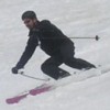
Skiers: Geoff Clarke, Craig Dostie, Nori and UCL
Dates: Saturday, May 2nd – Thursday, May 7th
Photogs: UCL and (where noted) Craig
Synopsis: We were embarking on the Alpine Skills International (“ASI”) 2009 6-day Sierra High Route, from West to East. The trip would be lead by Geoff Clarke, an ASI Guide and former Chief Telemark Examiner for the PSIA.
The planned route crosses the Sierra Nevada over 9 high cols and passes, beginning at old Wolverton Ski Resort on the edge of Sequoia National Park and ending at the valley floor outside Independence (off 395). The planned route starts at approximately 7,200ft., climbs to around 10,000ft. and holds the line between 10,500ft. and 13,000ft., until dropping down on the Eastern side of the Range.
As discussed more in detail below, the night before the trip approximately 8-12” of new snow fell above 8,000ft. On the tail end of our second day, near Copper Mine Pass we encountered High avalanche conditions, forcing us to spend the night. When the conditions had not improved the next morning, we turned around to Table Meadows and set up a base camp – skiing some great lines for the remainder of the trip.
The ASI East to West group lead by Peter Leh was able to make the crossing as conditions had improved by the time they hit Copper Mine Pass.
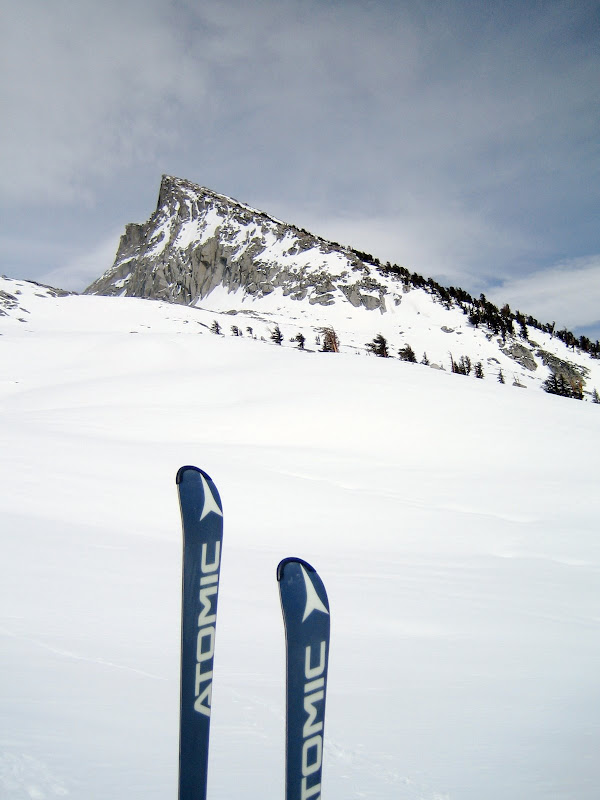
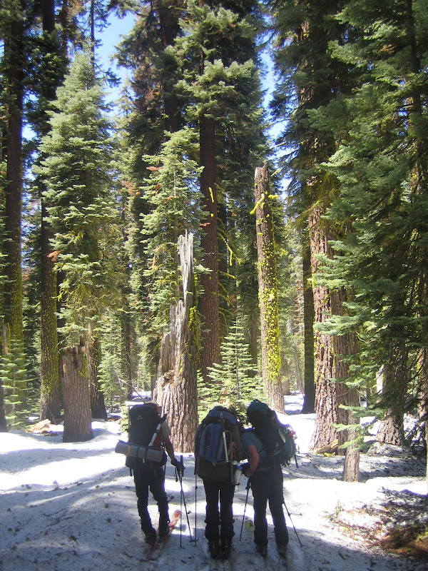
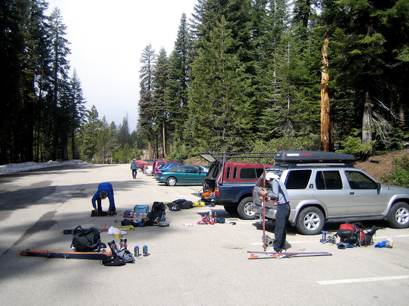
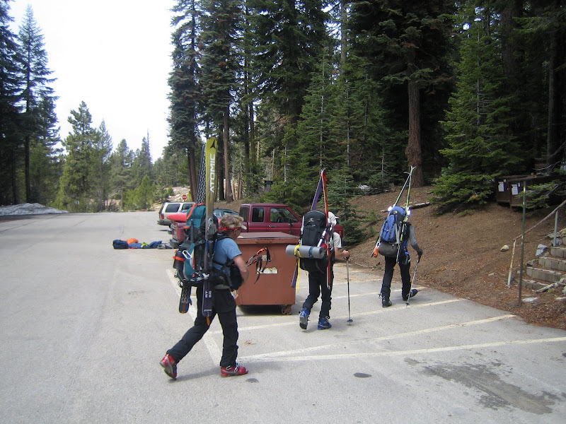
DAY 1 – Wolverton Ski Bowl to Table Meadows
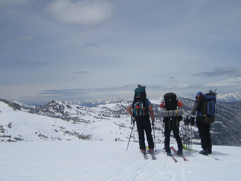
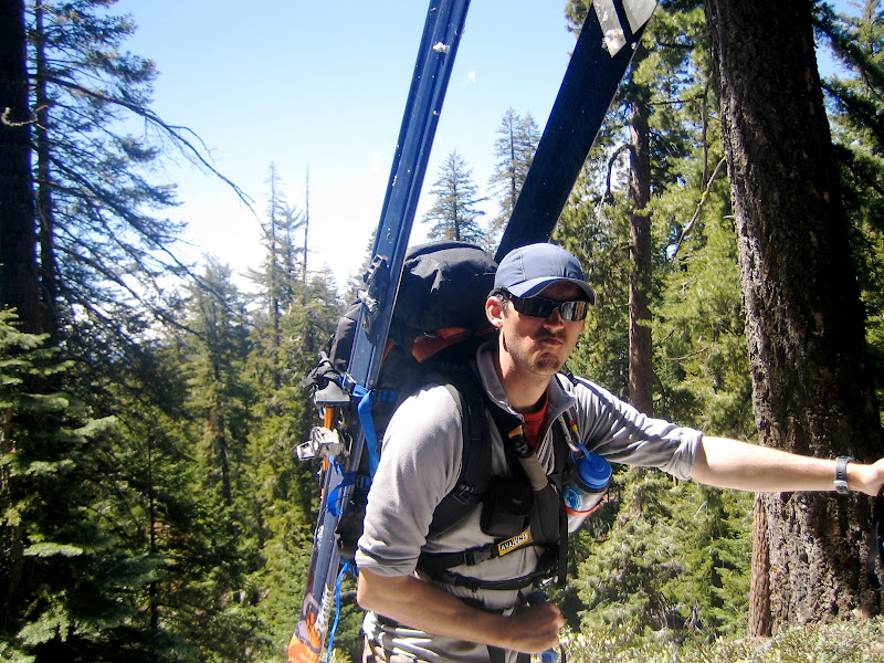
Packing the gear in the parking lot. ASI’s recommended gear list was spot on in my opinion, although Craig “Reg Flag” Dostie would later demonstrate that some of his numerous and extravagant items (e.g., spritzer and hazelnut crème) more than made the trip
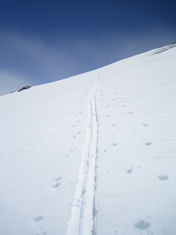
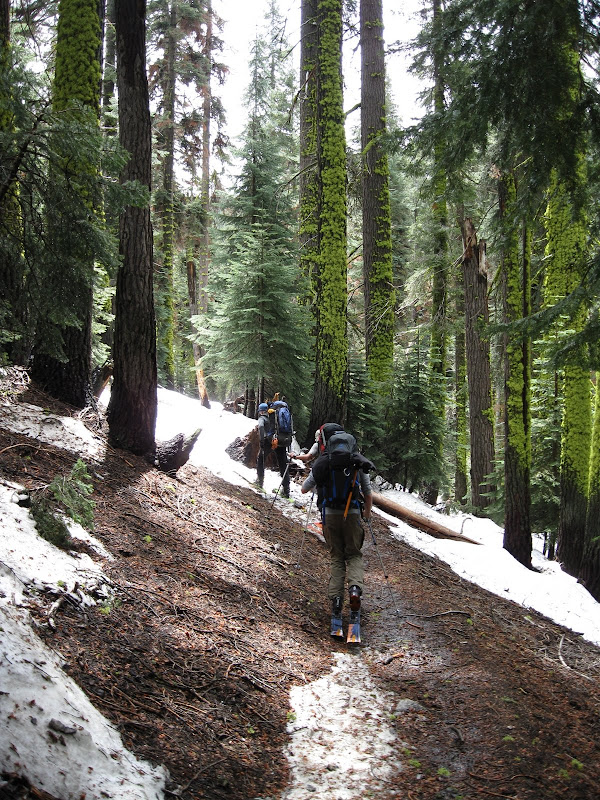
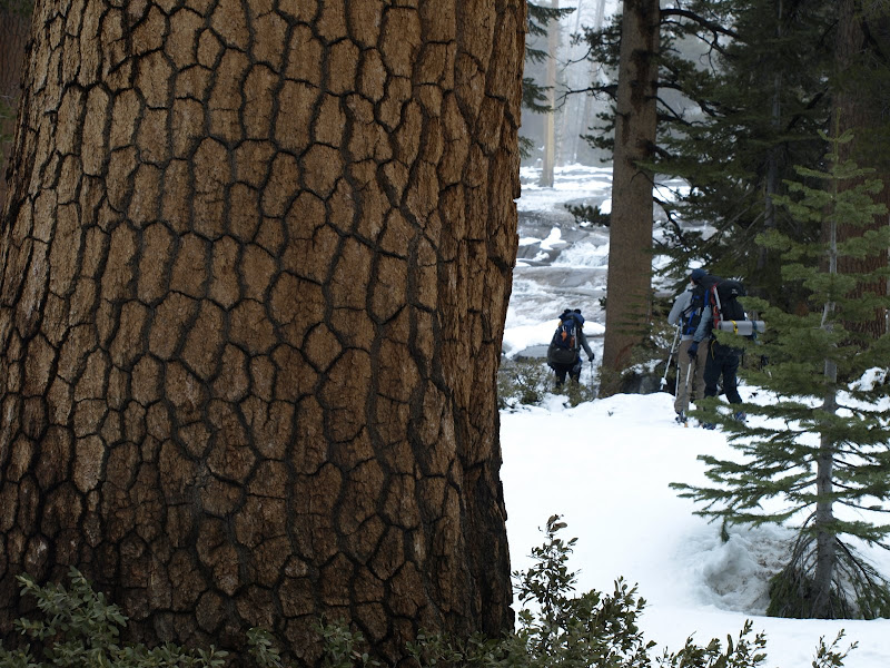
Starting the boot. We booted up dry trail for about ½ hour until we hit the snow line.
After we strapped on the skins, we dealt with some spicy dirt skinning off and on for 10 minutes or so, until the snow line was consistent. Photo: Dostie.
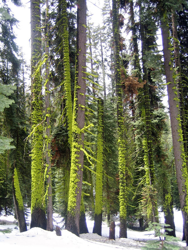
Awesome color on the tree moss:
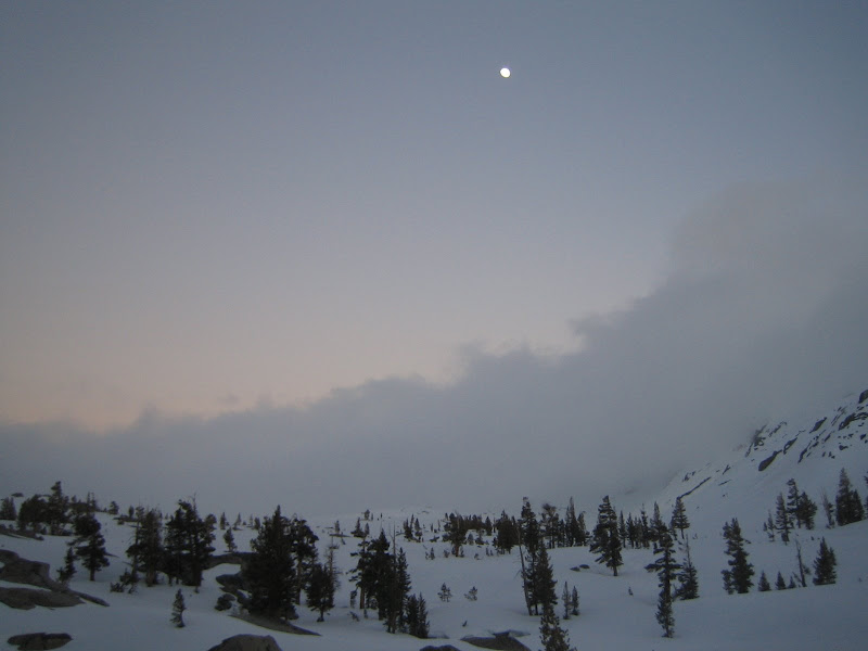
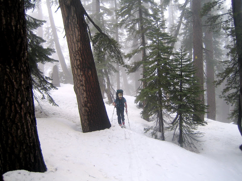
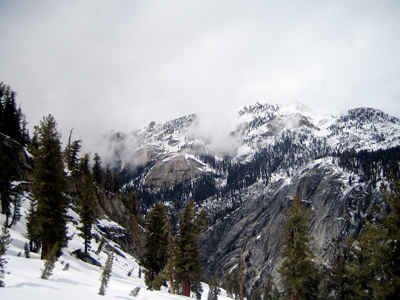
The initial skin approach climbs the “Hump” following the standard route to Pear Lake Hut. I had heard about the fog that rolls in through this area (making route finding difficult). The fog rolled in about ½ up the Hump and stayed off and on until our Day 1 Camp.
Dostie skinning through the rainforest in the fog:
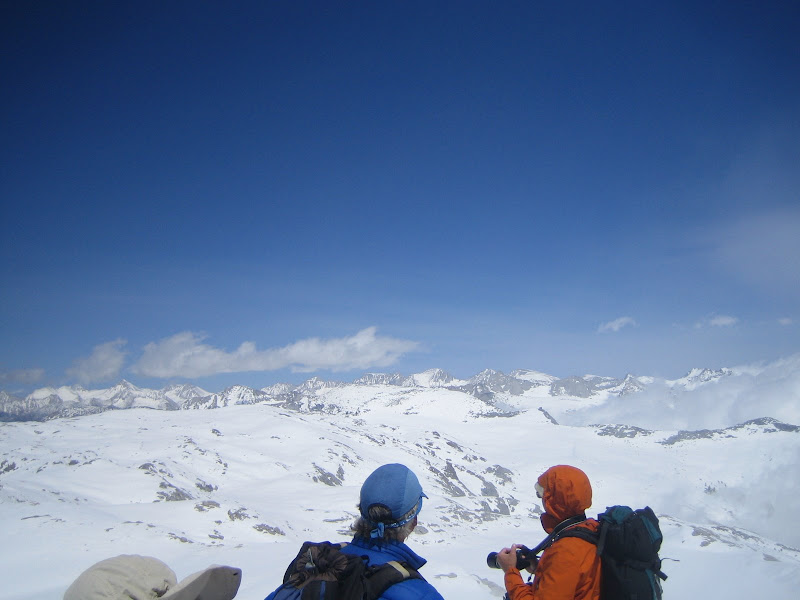
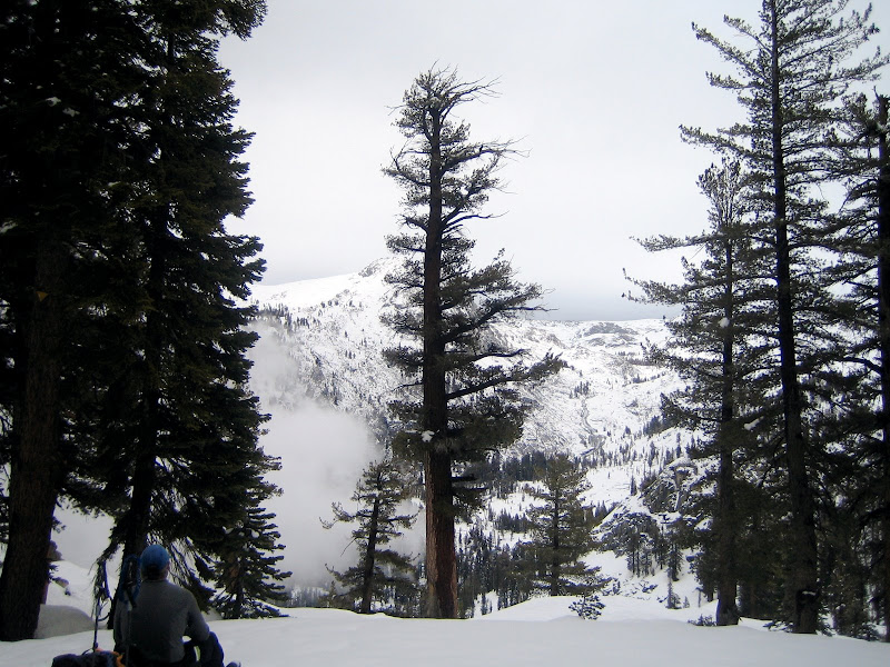
Geoff on top of the Hump, looking out at the waterfalls in the distance:
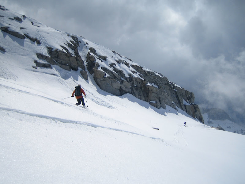
On our descent from the top of the Hump, we encountered some surface instabilities. Due to the new snow (which was very wet and heavy at this altitude), we avoided the steeper aspects.
Geoff descending down. Photo: Dostie.
Scenic:
UCL cutting across the slope. Photo: Dostie.
Dostie dropping the knee.
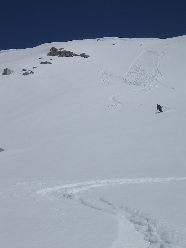
Geoff, on one of the better sustained descents of Day 1. The snow was tricky, though, with some tip grabbing cement.
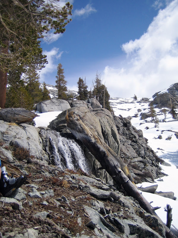
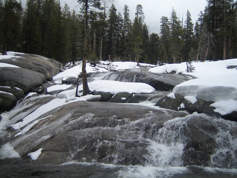
Geoff, Nori and UCL approaching one of the many falls of Wolverton Creek. Photo: Dostie.
Scenic of the Falls and Slides:
Glob Stopper was essential on Day 1. Photo: Dostie.
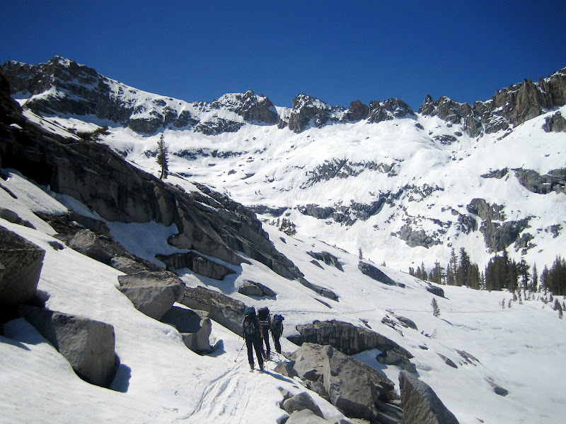
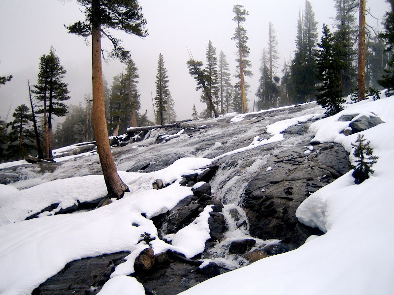
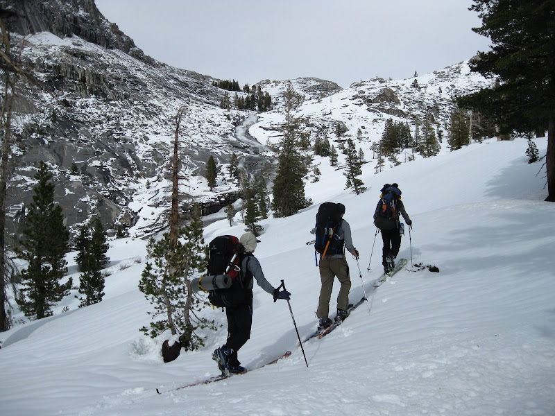
Geoff, Nori and UCL working back up the creek drainage, on the long, steady climb to Table Meadows. We would pass Heather Lake cirque and Pear Lake cirque. Photos: Dostie.
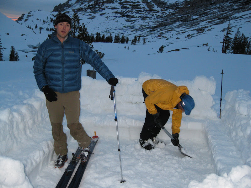
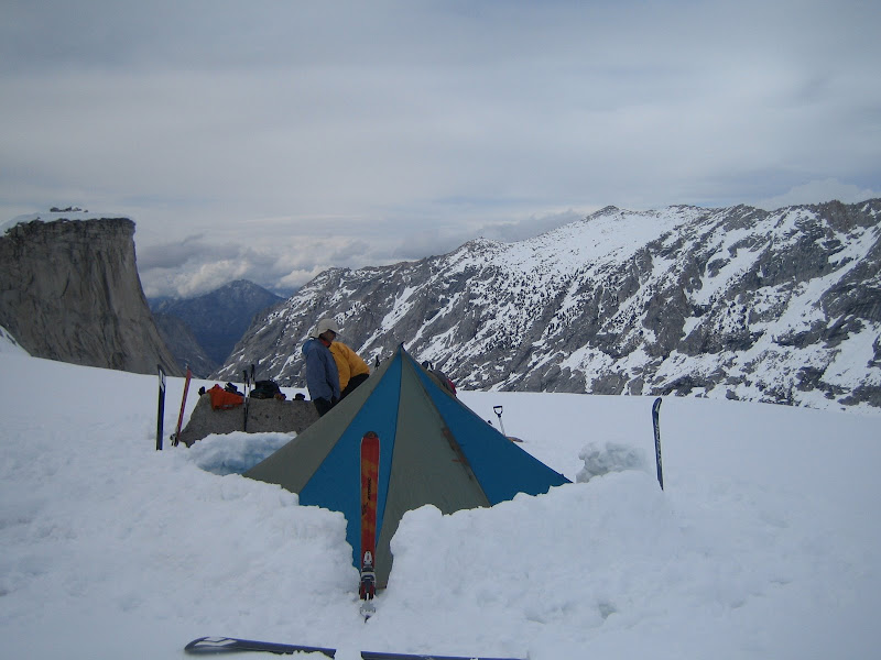
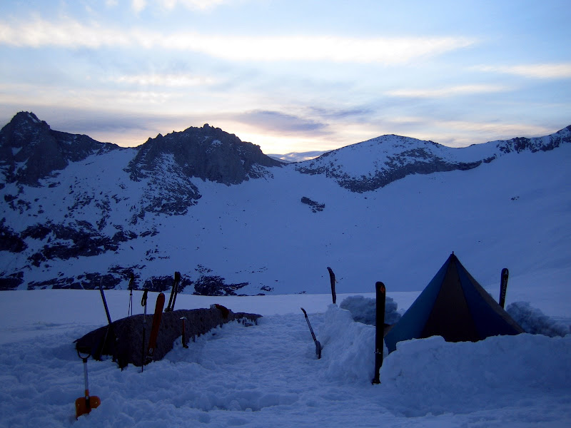
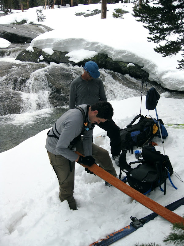
After arriving at Camp 1, UCL about to stomp out the Mid floor, Geoff working on some leveling. The humidity and length of Day 1 can be clearly evidenced by UCL’s tired expression here…Photo: Dostie.
Results 1 to 25 of 40
-
05-21-2009, 01:11 PM #1

 Because I'm a caveman....
- Join Date
- Oct 2008
- Location
- NorCal
- Posts
- 2,569
Mega TR: 6 Days in the High Sierra
Last edited by Unfrozen Caveman Lawyer; 05-21-2009 at 03:55 PM.
-
05-21-2009, 01:12 PM #2
Because I'm a caveman....
- Join Date
- Oct 2008
- Location
- NorCal
- Posts
- 2,569
DAY 2 – Table Meadows to Impromptu Camp in Deadman’s Canyon
Waking up at first light:
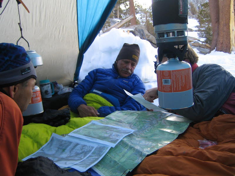
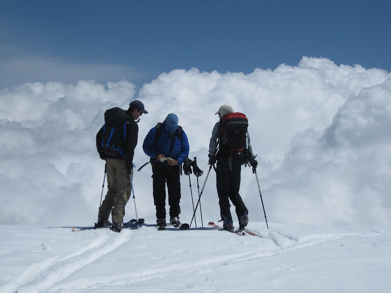
Geoff, Nori and Dostie consulting the topos for the day:
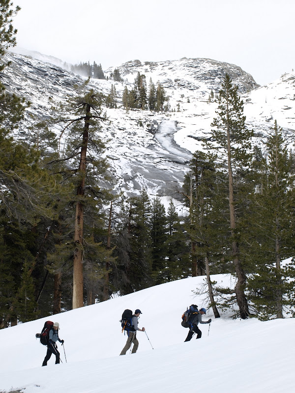
Geoff, Nori and UCL starting up Table Meadows on Day 2, with some natural point release activity in the background. Most of the steeper aspects around Table Meadows had some significant wet slide activity. Photos: Dostie, UCL.
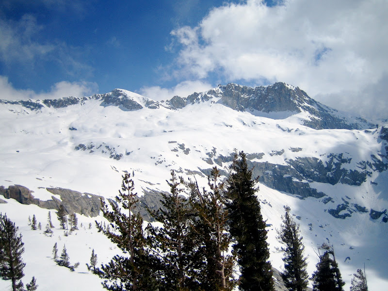
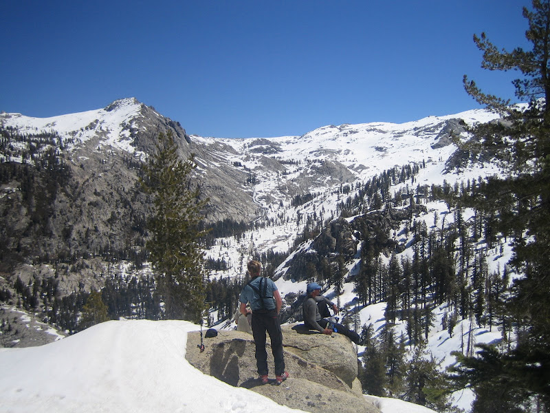
On the top of Lunch Rocks at Table Meadows, the true High Sierra starts to show itself.
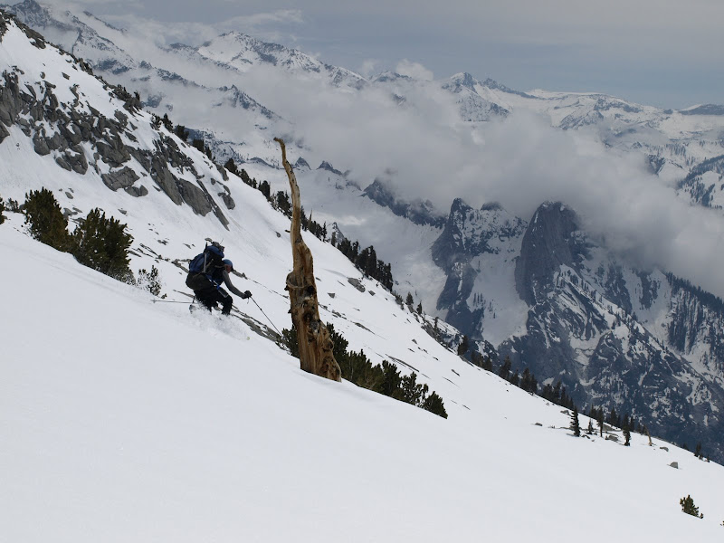
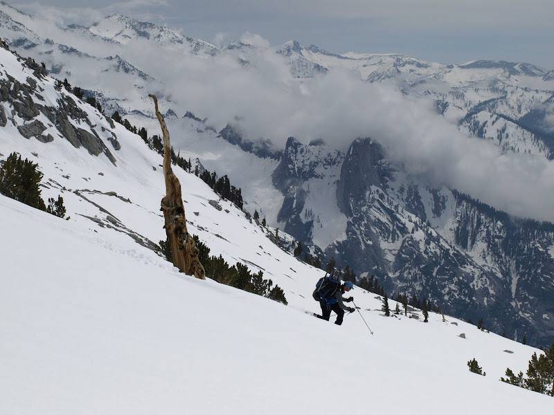
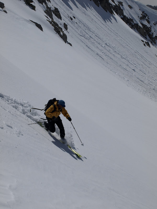
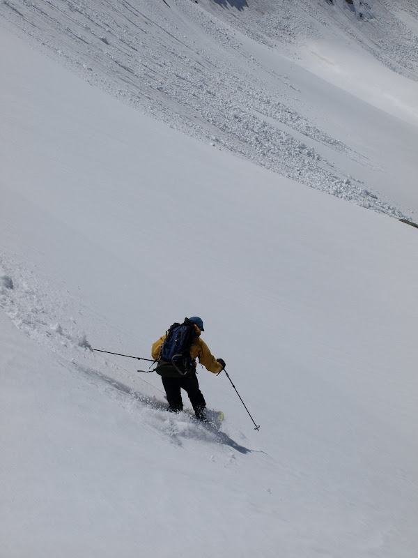
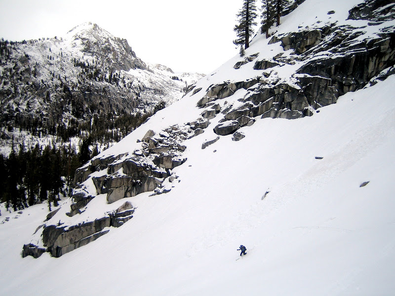
Geoff after a nice traverse to the top of a good pitch to drop down into the next cirque.
Geoff on the descent. Photo: Dostie.
Dostie dropping in.
UCL following suit. Really fun snow. Everyone had smiles after that pitch. Photo: Dostie.
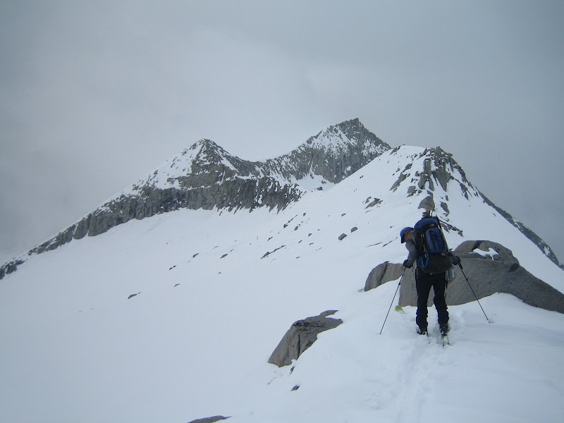
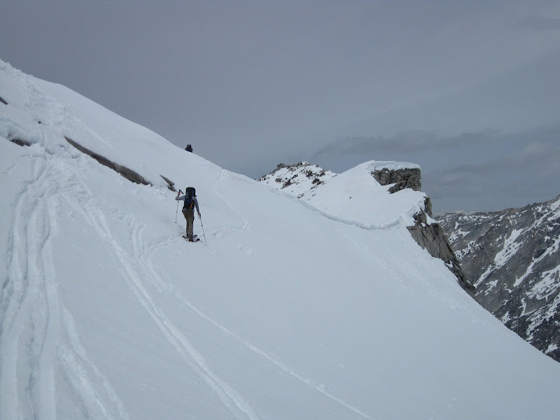
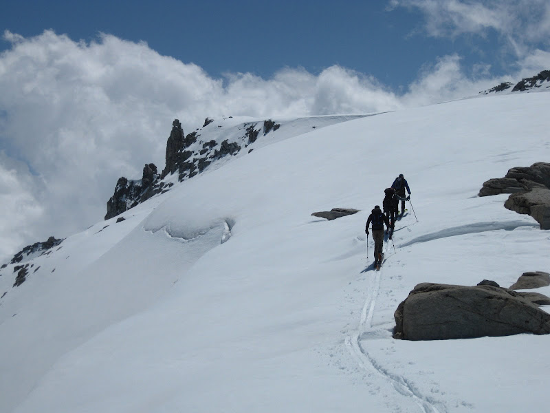
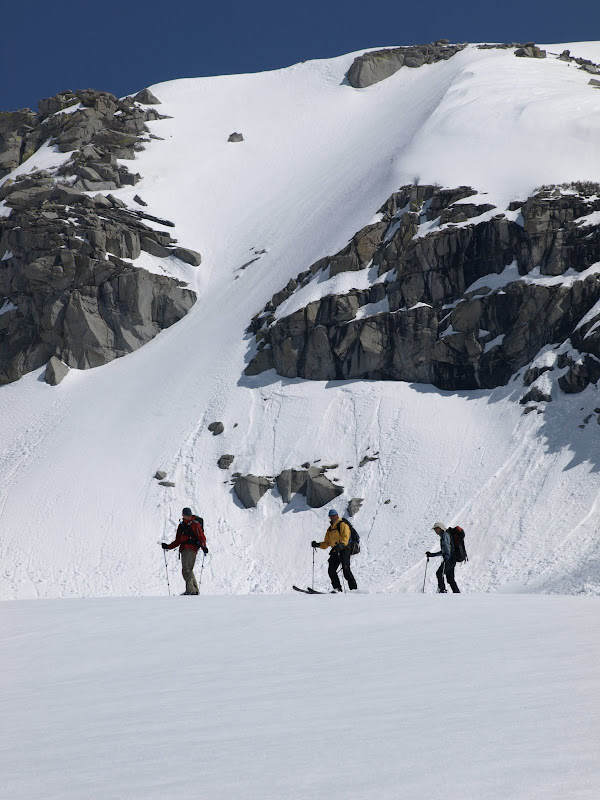
Geoff climbing the knife ridge to our drop in on Deadman’s Canyon.
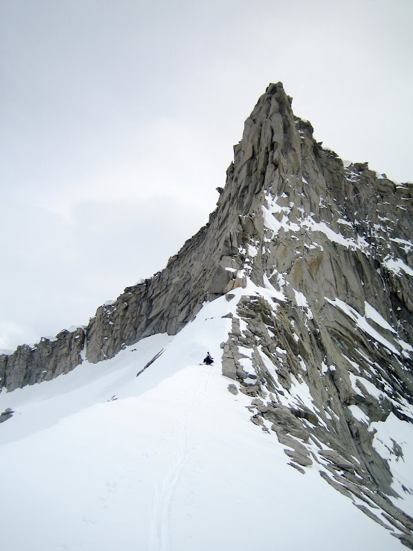
Nori and UCL following up the ridge. Photo: Dostie.
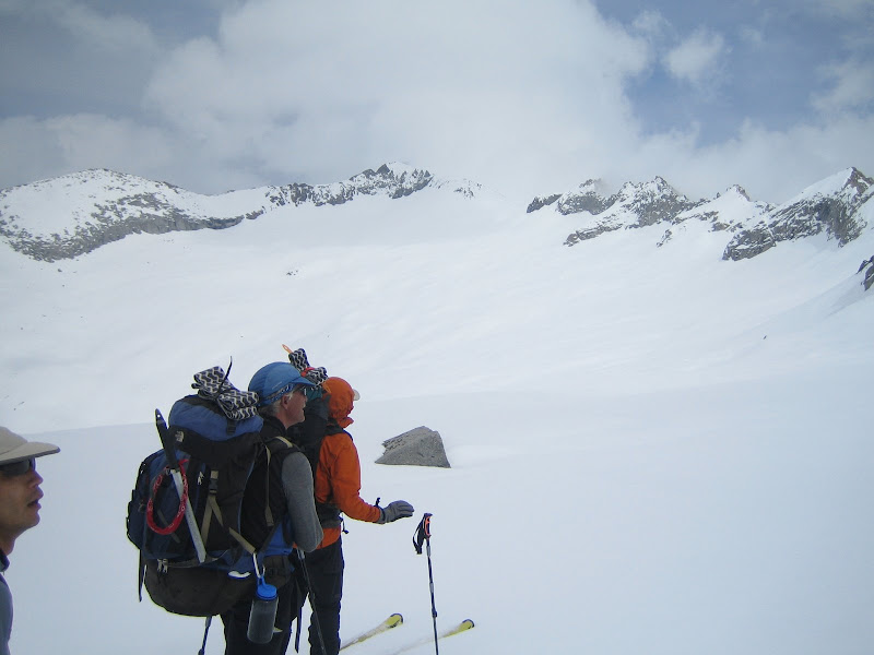
Dostie skinning the ridge above Deadman’s Canyon, with Nori, UCL and Dostie at the top of the climb.
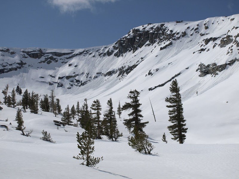
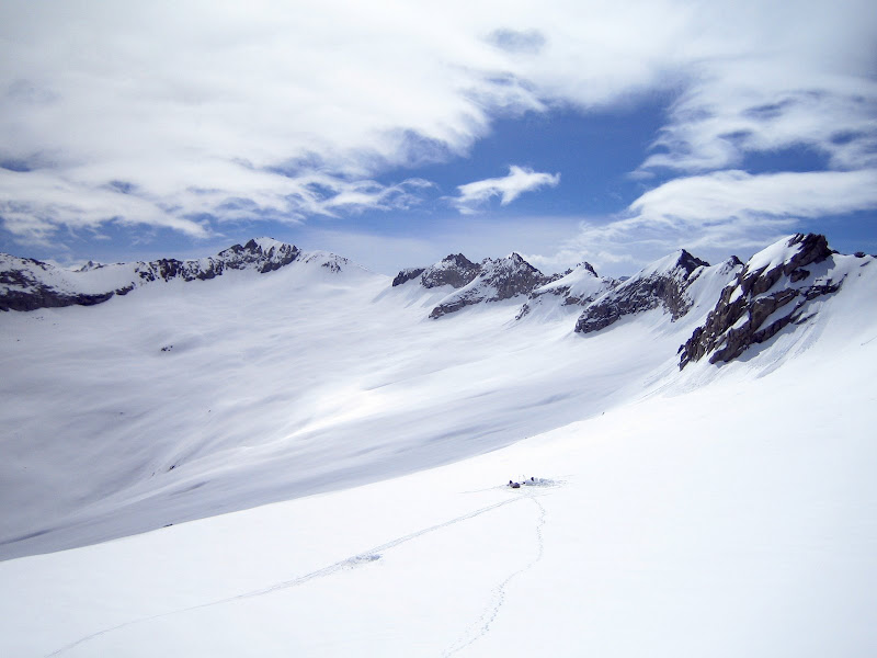
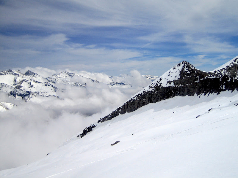
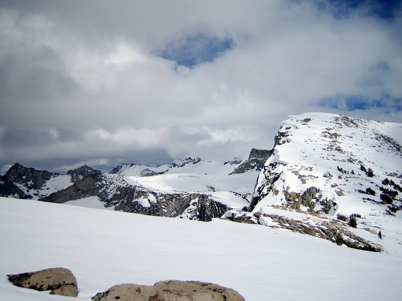
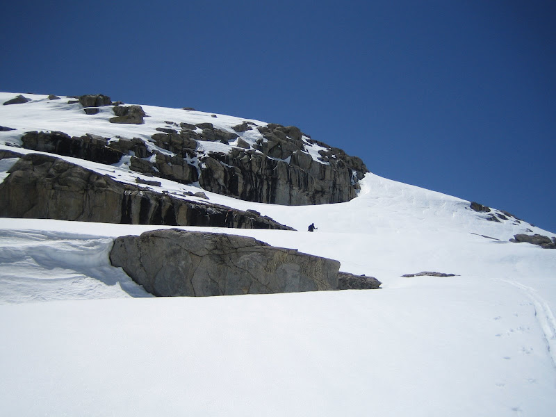
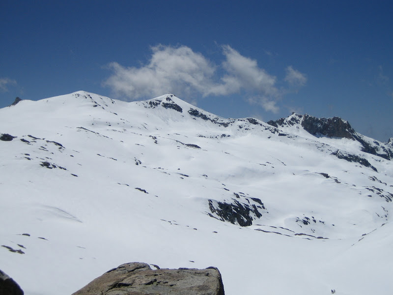
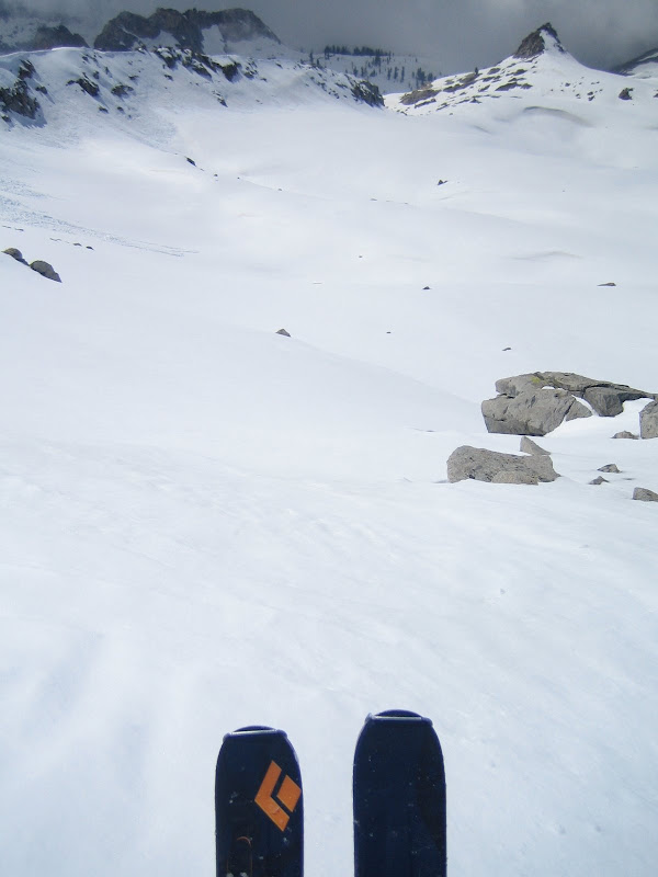
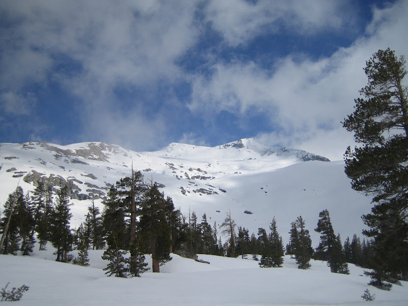
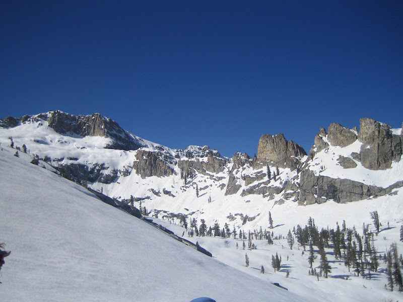
The original plan was to cross the cirque above Deadman’s Canyon to the opposite side, and then climb Copper Mine Pass with the goal to dropping down to our Camp 2. The cirque is pictured below, with the climb to Copper Mine Pass in the hanging snowfield on far lookers left:
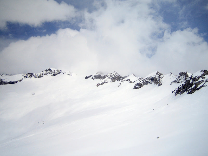
After we dropped in, however, we experienced some very sensitive, yet massive settlements in the snow pack. With each step, we could trigger 2 inch drops in the snow pack, resulting in very loud whoomps. Fortunately we were in a safe spot so nothing could come down from above us, but it was still the type of noise that stops you in your tracks and causes an instinctive look up.
Dostie set off one whoomp that was the loudest any of us (including Geoff who had been leading this route for 12 consecutive years) had ever heard. It propagated down over a rollover to Deadman’s Canyon (eerily named…..) below.
We decided to dig some pits to examine the layers. We were on a NE facing aspect at approximately 10,500 feet.
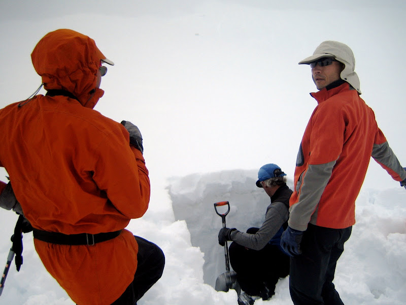
There were several visible layers in the snow pack that could be causing the settlement, but the most likely culprit was a near-surface faceting layer below the new snow.
After further discussion and a good look at what we had to cross, we decided as a group that our best course of action was to set up camp and see if some later afternoon sun and heat, and early morning sun could cause some further settlement in the snow pack. This would result in a very long Day 3 to Milestone Bowl, but none of us were willing to continue given the red flags we were getting.
Despite having to stop, this was not a bad place to camp. The scenery was AMAZING. Photo: Dostie.
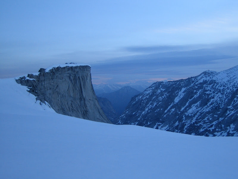
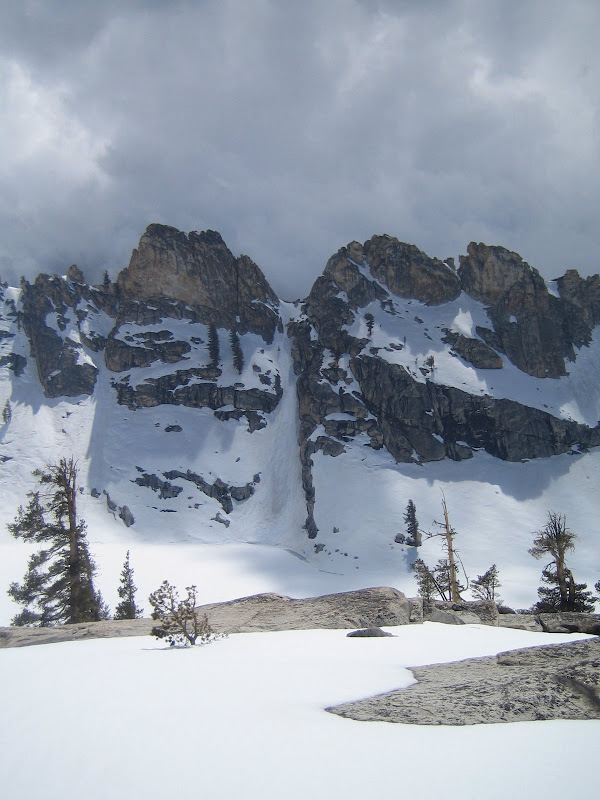
Looking back towards Deadman’s Canyon, with a large El-Cap-esq prow:
Alpenglow hitting the cirque and the sunset on the range, with UCL sitting in the mid enjoying the evening. Photos: Dostie.

To mend the night, we all enjoyed one of Dostie’s most popular red-flag items: an entire zip lock of Hazelnut Crème powder. The true extent of its uses may rival Duct-Tape: (i) coffee sweetener, (ii) tea sweetener, (iii) water-flavorer, (iv) soup-flavorer, etc… basically, you can add it to literally anything you could eat or drink, and it then tastes delicious.
-
05-21-2009, 01:12 PM #3
Because I'm a caveman....
- Join Date
- Oct 2008
- Location
- NorCal
- Posts
- 2,569
DAY 3 – Deadman’s Canyon to Table Meadows
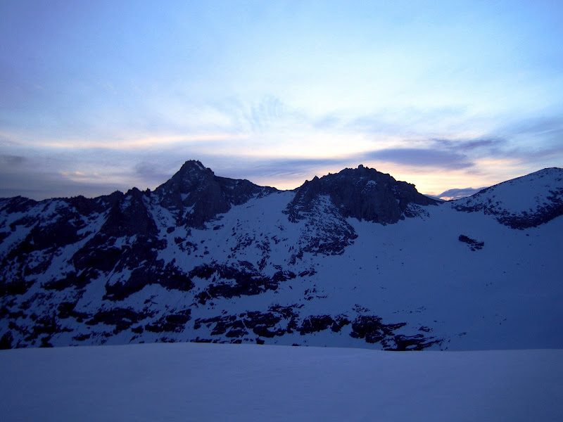
Sunrise at Camp 2 on the early morning of Day 3 was spectacular:
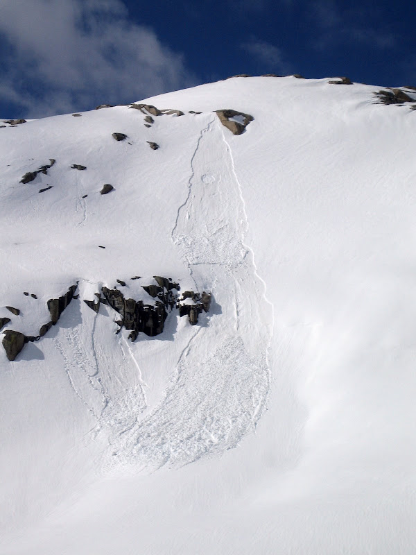
After a quick breakfast and breaking down camp, we let the morning sun bake the snow a bit, hoping for further settlement in the snow pack. After about an hour, Geoff ventured out to the surrounding flats on skis (without his pack). After going about 20 feet from camp, Geoff triggered the largest whoomp we had heard over the course of the two days. It propagated settlements and whoomps around the entire cirque to the opposite side. It was pretty incredible.
As a result, we tried to gather more information about the layer. We booted up a small test slope next to our camp, NE facing, 32 degrees at around 11,000ft. After digging pits, we got easy failures with hand shear tests, a CT2 on a compression test, and some propagation results on a ECT.
The results were clear – it was not safe to continue. To note, we were less concerned about heading over to Copper Mine Pass in the actual cirque, because most of it was different aspects and had safe terrain to work with. However, the opposite side of Copper Mine Pass has a similar, NE facing aspect which is MUCH steeper than our test slope (and obviously the flats around camp). There would be no way to test that slope once on top. Additionally, following that would be another steep descent down Triple Divide Pass with a similar aspect and elevation. Assuming the same conditions were present there, a skier trigger would certainly set off a slide.
Looking back at camp from our snow pit on the test slope:
After consulting the topos for alternatives to get around these areas, we realized it was slightly possible, but we would loose significant elevation (dropping down to around 7K) and travel extensively out of the way. Therefore, we decided to turn around, set up a base camp at our Day 1 Camp, and ski the surrounding peaks of Table Meadows and Pear Lake.
Leaving Deadman’s Canyon was also sketch. We had to climb the pass which was the aspect we were worried about. We traveled one at a time, and very lightly. Fortunately, other than very slight settlement and whoomping, there were no issues (as our prior day descent likely settled the layer.
UCL climbing the suspect pass out of Deadman’s Canyon. Photo: Dostie.
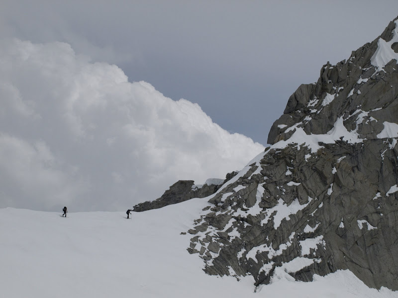
The cloud layering today was awesome. UCL skinning on the other side of the pass. Photo: Dostie.
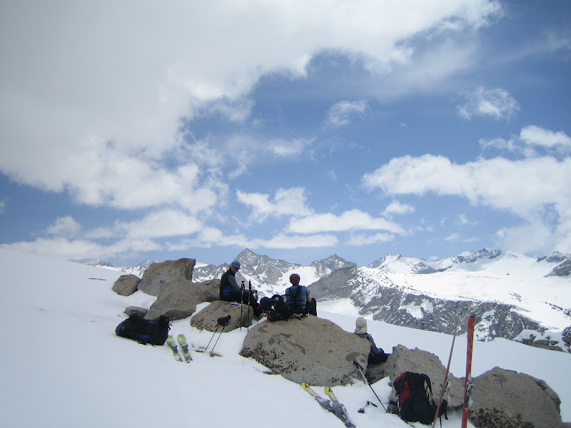
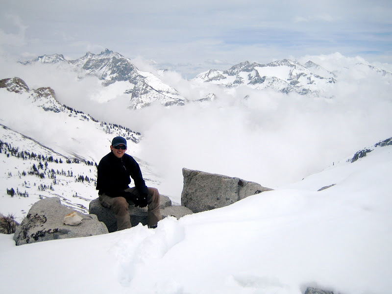
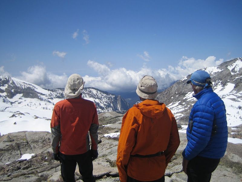
Dostie, Nori and Geoff checking out the range.
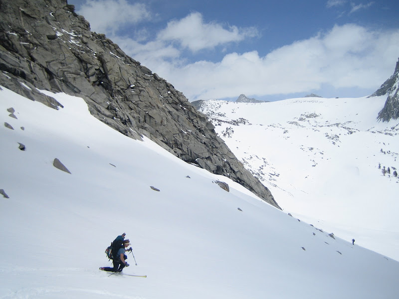
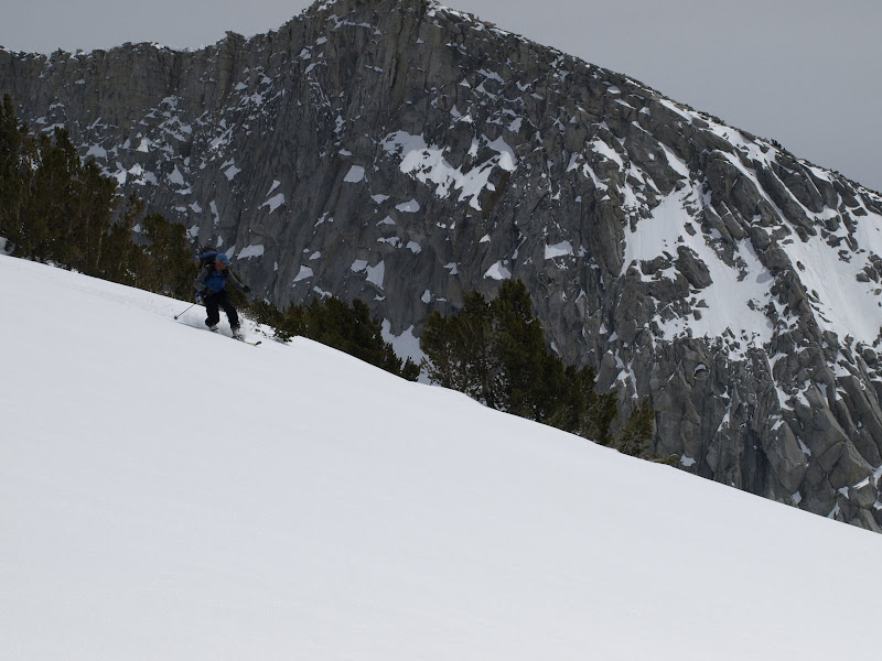
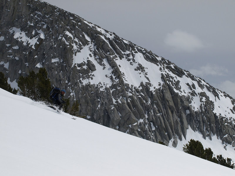
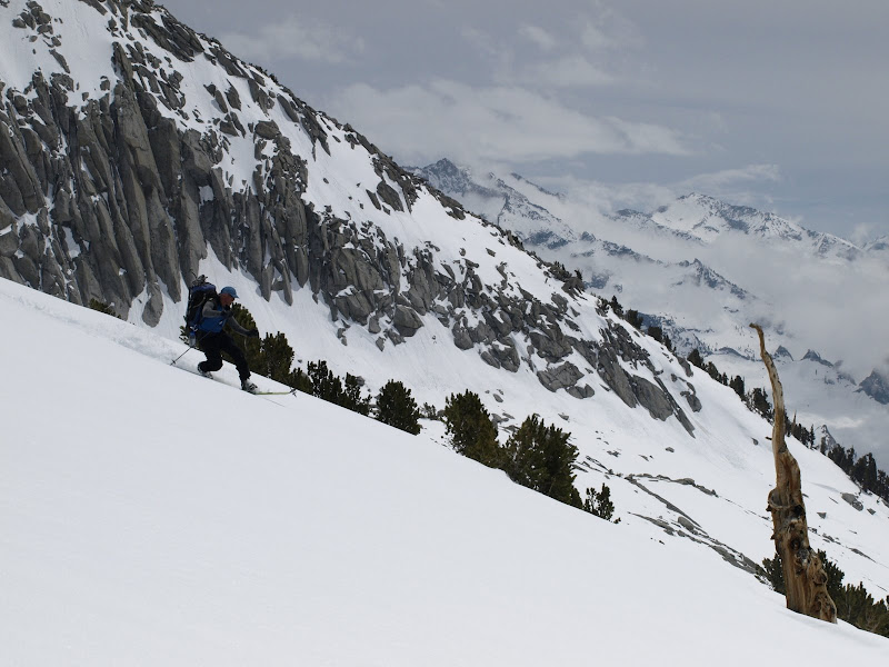
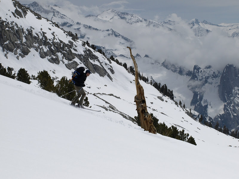
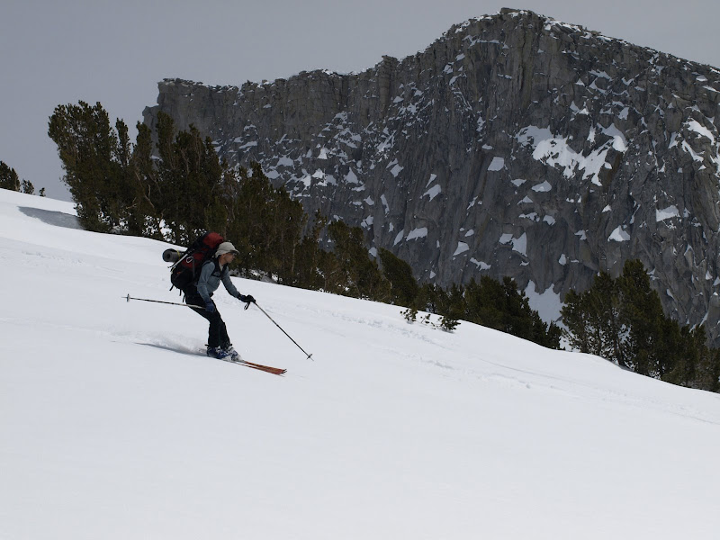
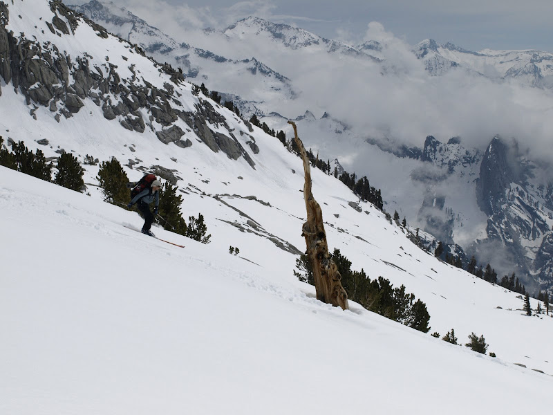
Although we were disappointed by having to turn around, we got some amazing descents on Day 3 heading back to our base camp.
Sequence of Geoff skiing below the Fin. Photos: Dostie.
Couple of UCL. Photos: Dostie.

Couple of Nori. Photos: Dostie.
Dostie finally getting some sweet turns after the photo duties from above!
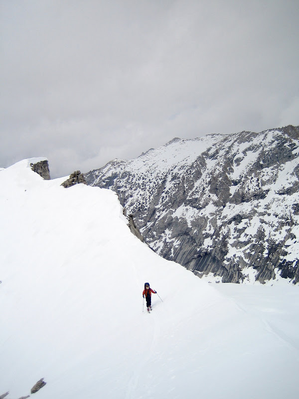
Dostie skinning up the next pass, with some scenics to follow.

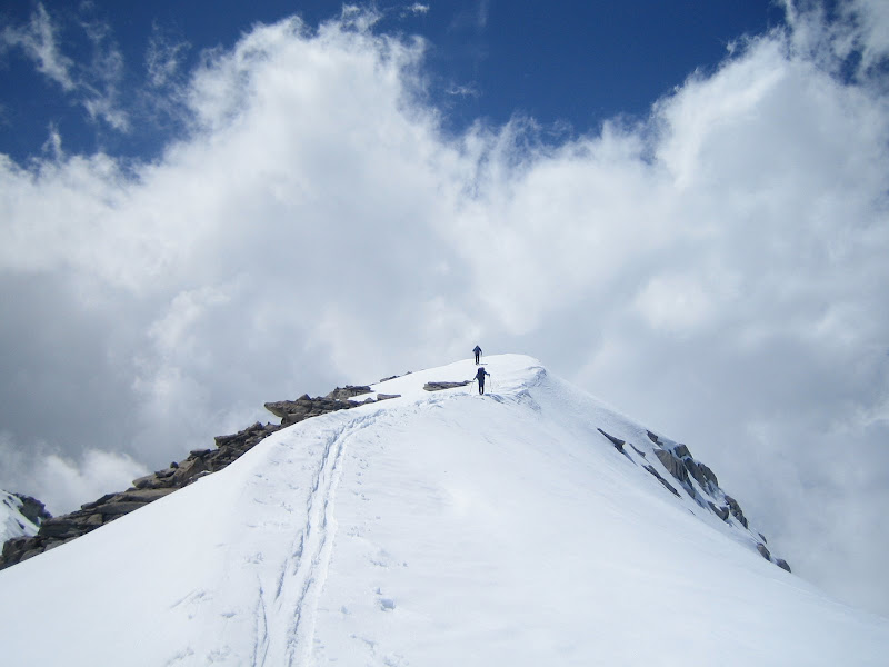
UCL on the perch of the pass after the climb.
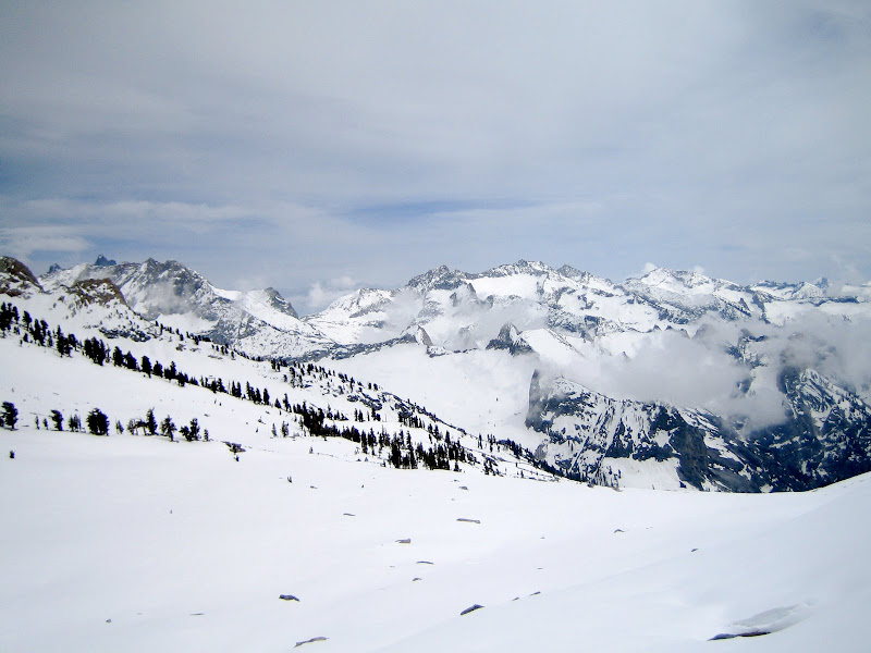
Looking back from the Lunch Rocks on Table Meadows you can see the Copper Mine Pass in the far distance, as well as part of Deadman’s Canyon.
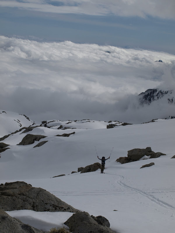
UCL making his way up to the Lunch Rocks, victory! Photos: Dostie.

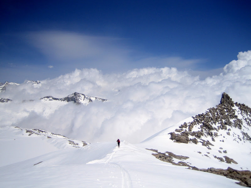
From the Lunch Rocks, there was some mellow downhill traversing, with Dostie in the distance:
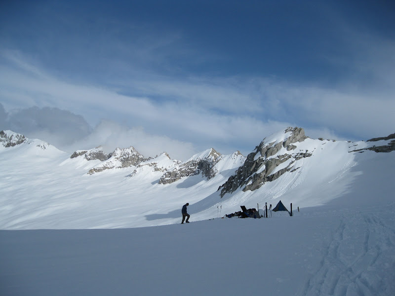
Dostie descending back towards camp:
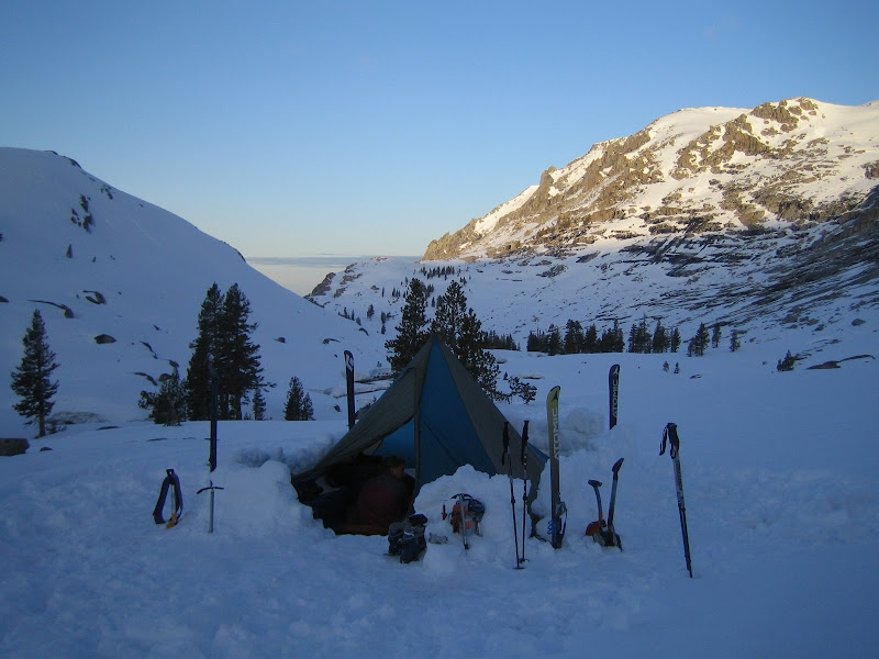
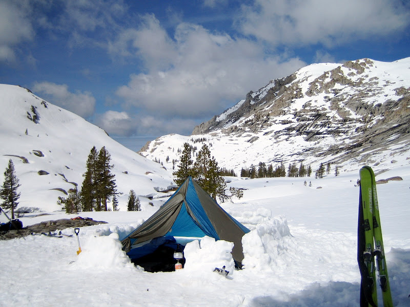
Back to our base camp for the next 2 Days, running water and all!
-
05-21-2009, 01:13 PM #4
Because I'm a caveman....
- Join Date
- Oct 2008
- Location
- NorCal
- Posts
- 2,569
Day 4 – Skiers Alta Peak to Pear Lake
Today was the day. With the base camp we had the light, peak-assaulting day packs on. Felt good to be able to climb and ski with less than 40 lbs on your back!
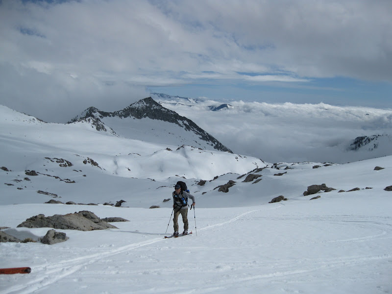
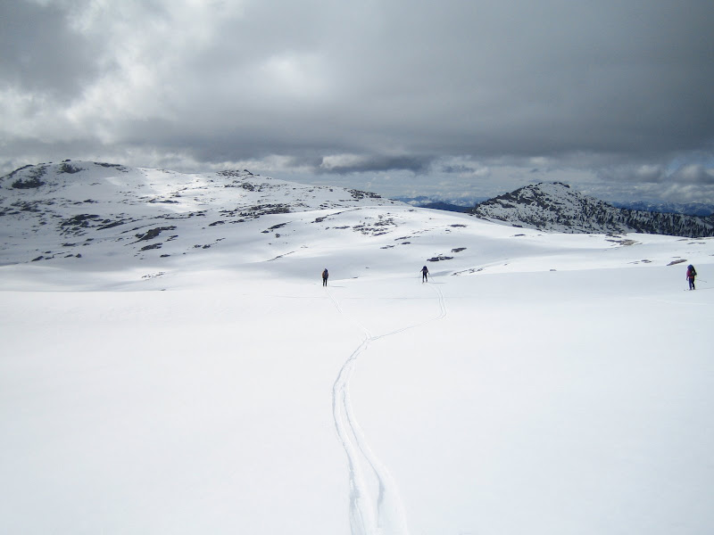
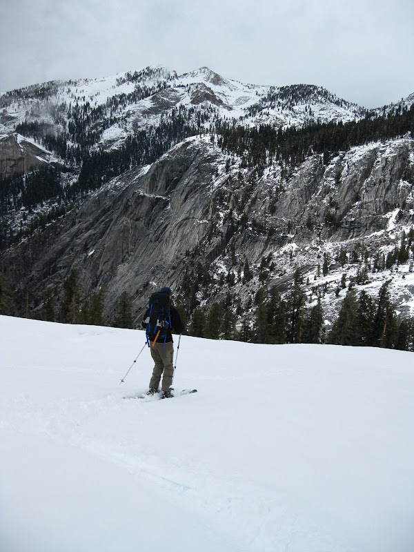
Geoff, Nori and UCL heading up the skin track across from camp. Photos: Dostie.
Skin Track Stoke:
The skin was pretty cool up these series of ramps between boulders on the face across from our camp. Photos: UCL, Dostie.
Nori, Dostie and Geoff at the top of the first hump, looking out towards The Watchtower in the Wolverton Creek Drainage. The “Hump” to get to Pear Lake Hut is on lookers left of The Watchtower.
The Day’s first objective: Skier’s Alta Peak. We would maintain a high traverse across the ridge line to the first of the two peaks, dropping the bowl in between (while also scouting a possible trip down the backside towards Buck Creek
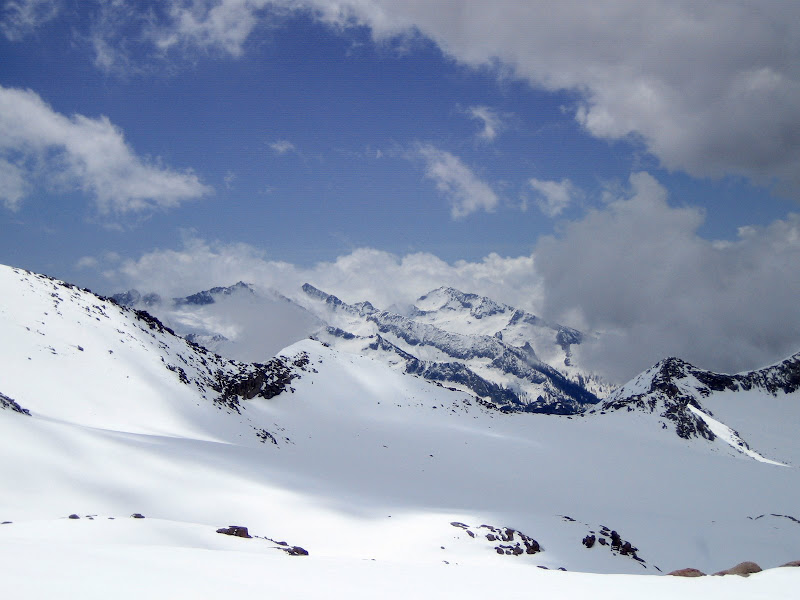
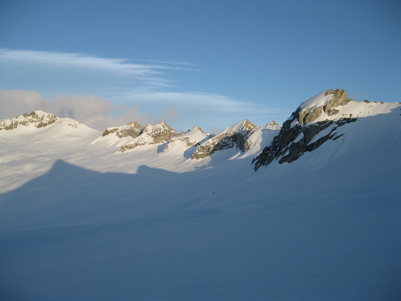
Up on the ridgeline near the summit, the cloud cover was really cool. They were flowing southwest just to the left of Pear Lake and around the back of Alta Peak. That way, we remained in the sun, but got some pretty scenic views of the surrounding peaks shooting through the clouds.
Geoff, Nori and UCL checking the topo, contemplating a descent off the backside of Skiers Alta. Photo: Dostie.
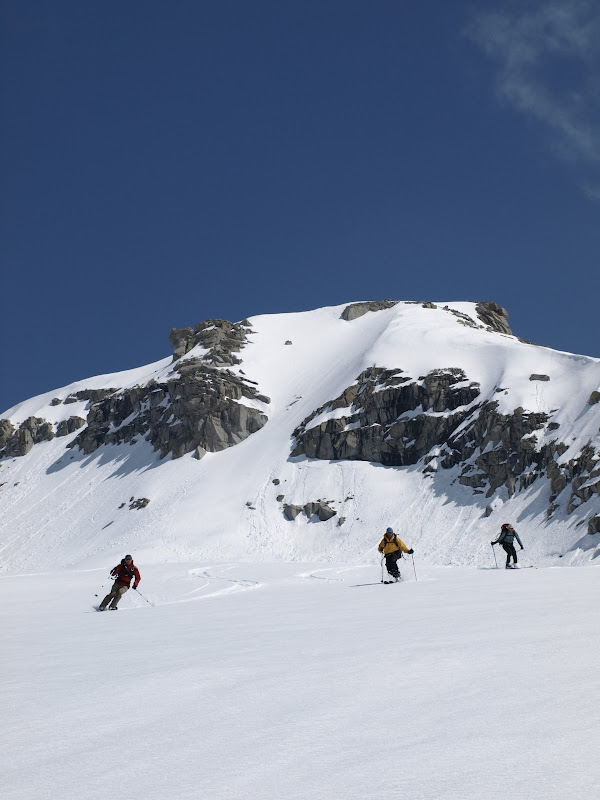
Geoff and Nori skinning the ridgeline towards the summit of Skiers Alta Peak.
Dostie skinning the ridgeline. Spectacular scenery (and skiing) this day!
The Sierras = Win!
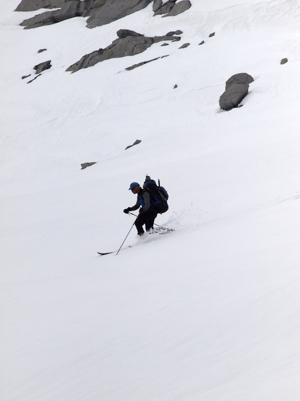
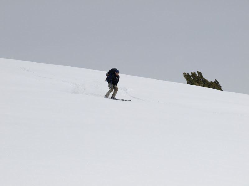
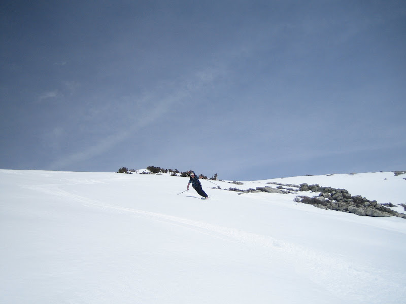
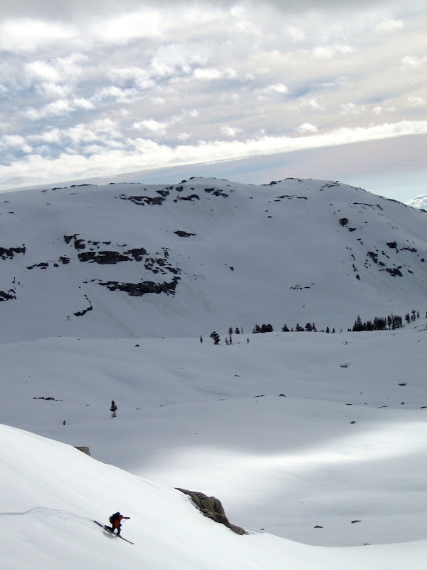
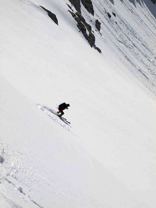
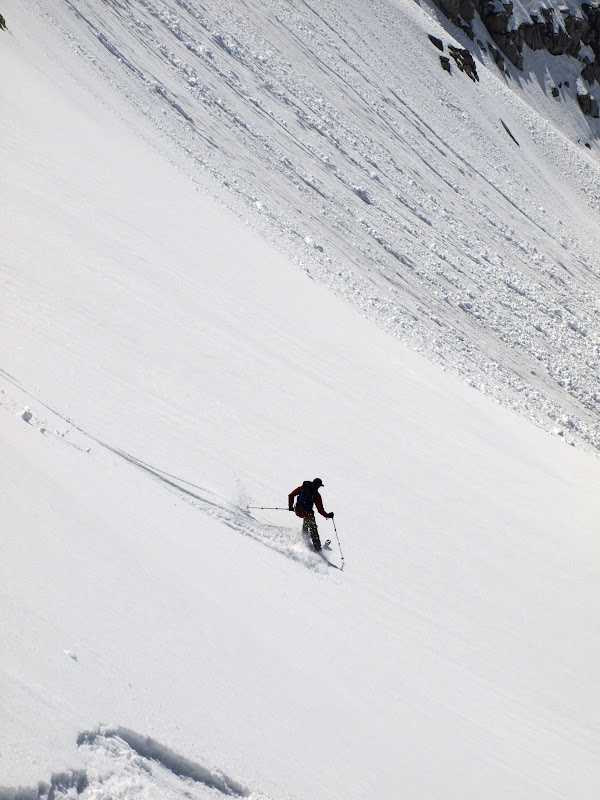
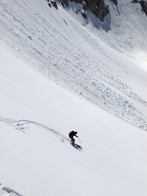
UCL tips over the Skiers Alta bowl.
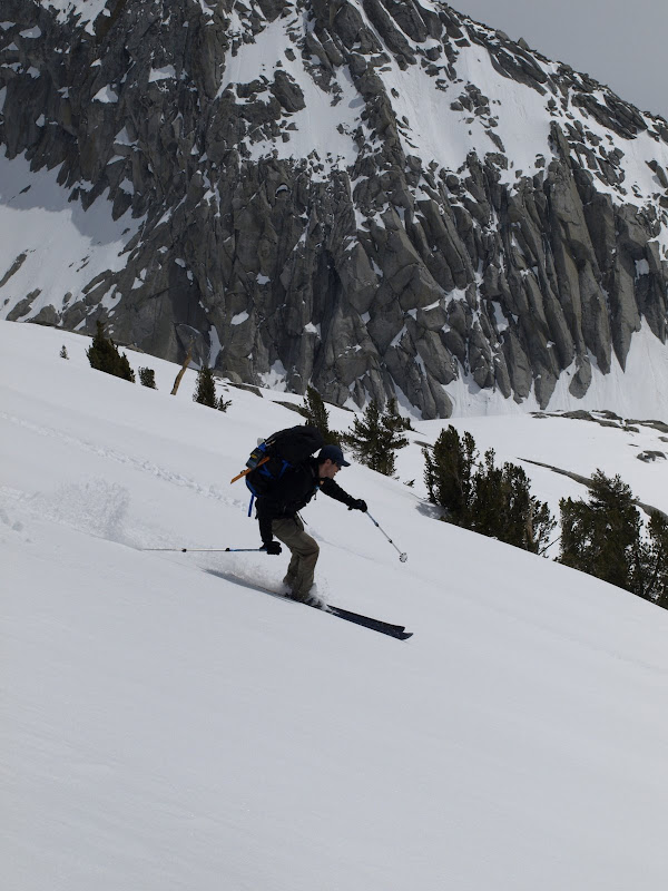
Sequence of Geoff dropping the bowl. Photos: Dostie.

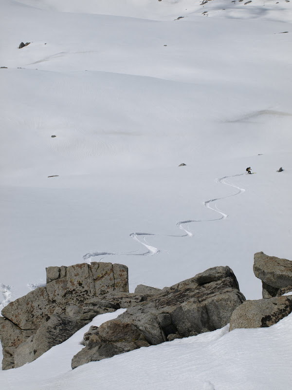
UCL dropping in. Great snow, fun run. Photos: Dostie.
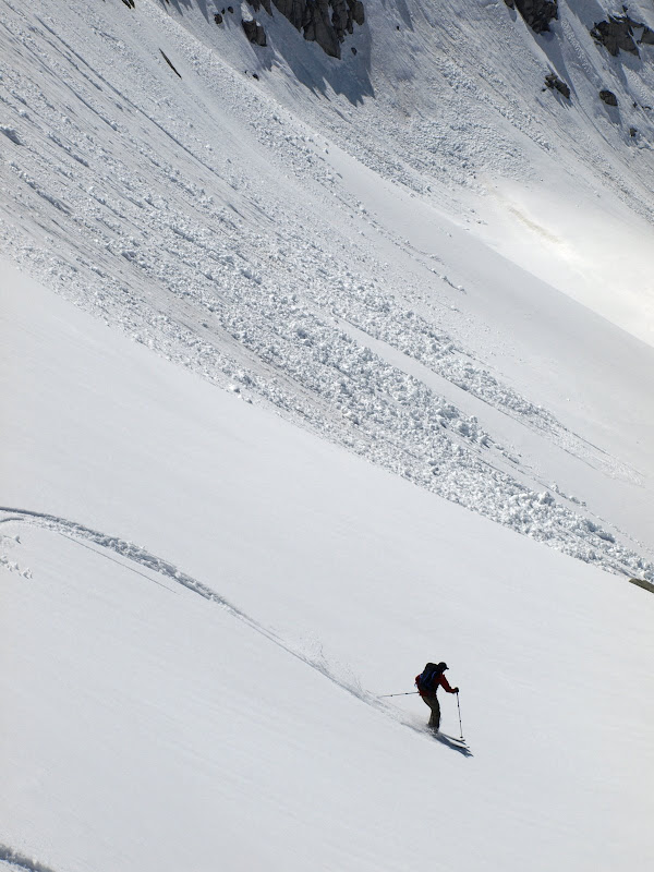
Nori enjoying the bowl. Photos: Dostie.
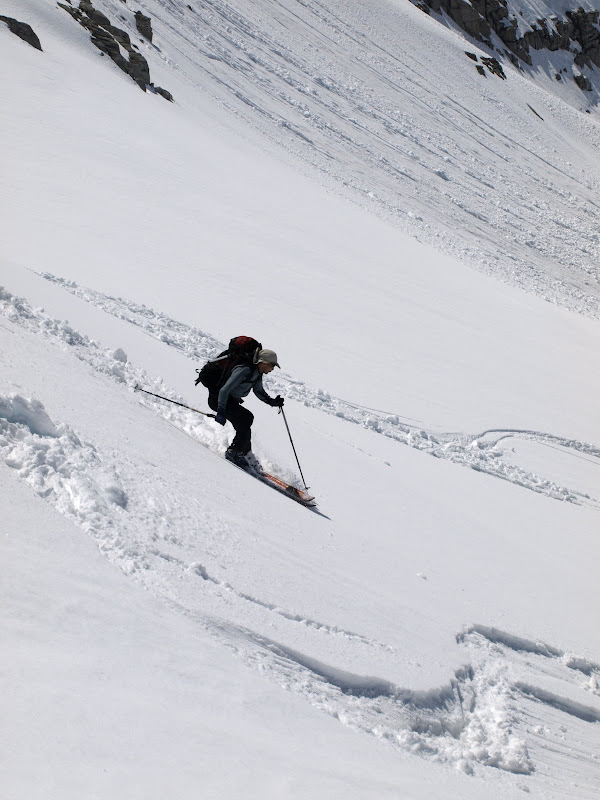
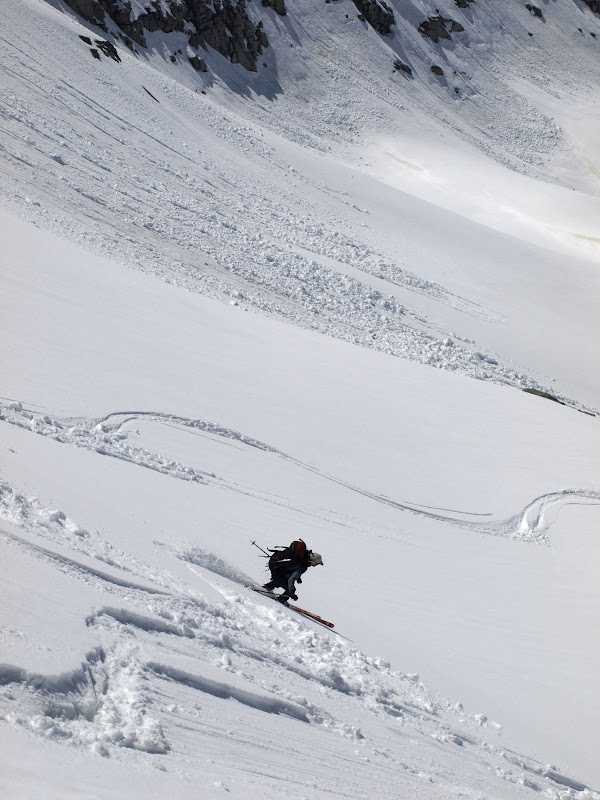
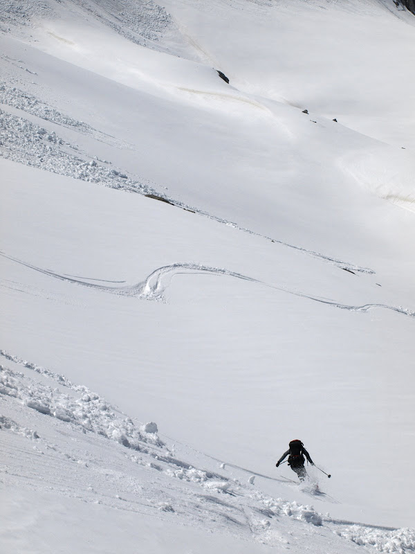
Dostie took a different section of the bowl.
Our initial tracks. Note that at the upper roll, we all set off small surface slides which were easily out-skiable.

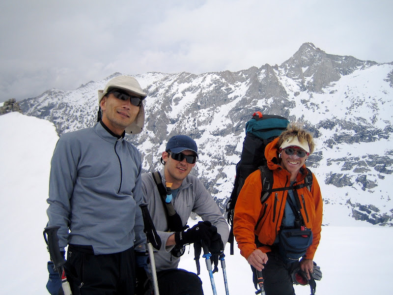
UCL, Geoff and Nori setting up for the next pitch, and the cheese-shot of the trip. Photo: Dostie.
Cheese Shot of the Trip: “Sierra High Route: Come Experience the Magic!” Photo: Dostie.
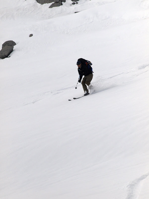
Geoff getting some nice turns. Photo: Dostie.
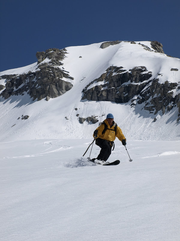
Dostie continuing on, down towards Pear Lake.
Some of the terrain surrounding Pear Lake Hut is legit…. Definitely getting in on the hut lottery next year:
A view back to Skiers Alta – signed up of course.
Day 4 was an awesome day of skiing. The night was cool, but very pleasant, so we cooked outside under the moon and enjoyed reminiscing about the climb, the runs, and Dostie’s spritzer, all while enjoying all meals infused with Hazelnut creamer.

-
05-21-2009, 01:14 PM #5
Because I'm a caveman....
- Join Date
- Oct 2008
- Location
- NorCal
- Posts
- 2,569
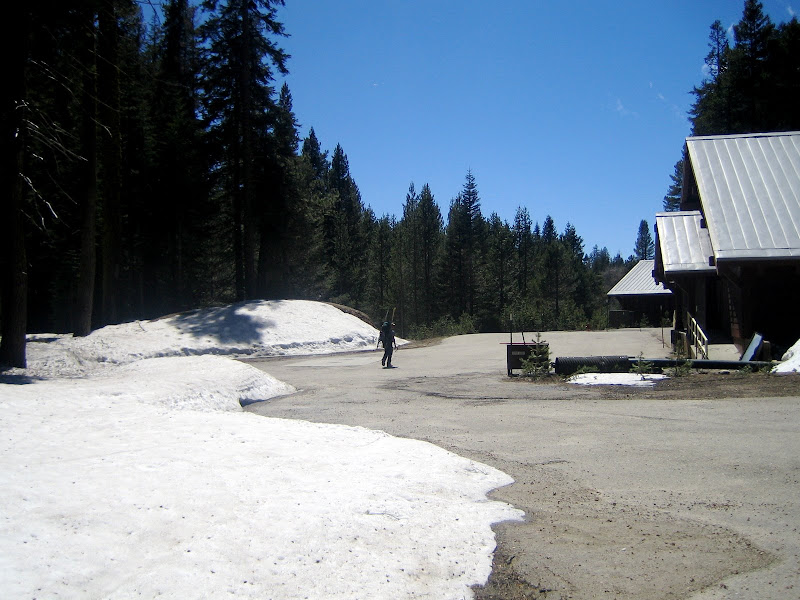
Day 5 – Table Meadows to Wolverton
Although the Sierra High Route was planned as a 6 day trip, we encountered a dilemma – the car shuttle. The East to West Group would be arriving 2 days later to pick up their cars that we had parked in Wolverton. Our cars were over on the East Side by Independence. We realized we would have to head out today (a day early), drive around the south end of the range and pick up our cars. The plan would be to drive to Sacramento for the car switch on Day 6.
Pear Lake Hut, and some more of the surrounding terrain:

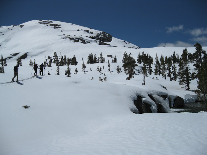
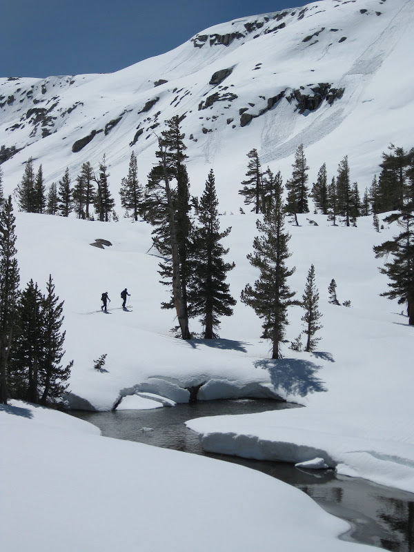
Nori, Geoff and Dostie heading into Heather Lake cirque:
Alta Peak:

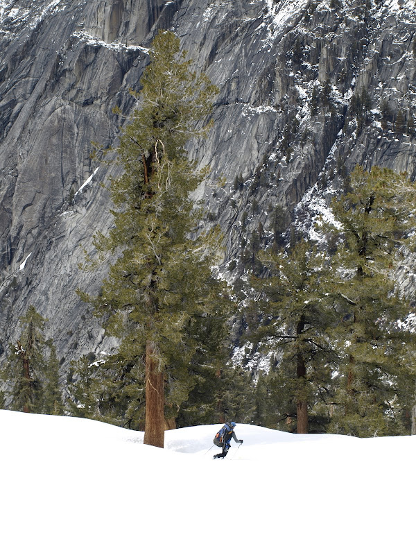
The snow coverage on southerly-aspects from Day 1 to Day 5 had dramatically decreased. From the top of the Hump:
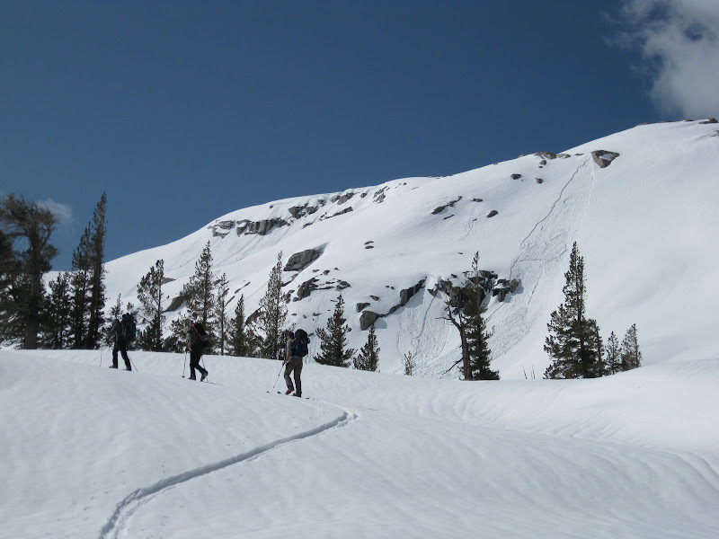
Through some cleaver topo reading and interesting snow/pine needle skiing, we were able to ski almost 75% of the way to the car:
UCL disappointed we had to downhill boot – we were searching for the skiable line to the parking lot!
Dostie hitting pavement.
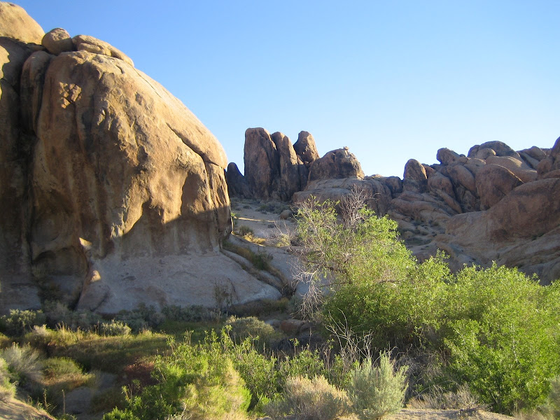
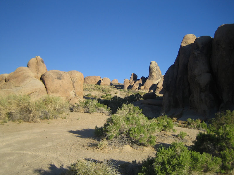
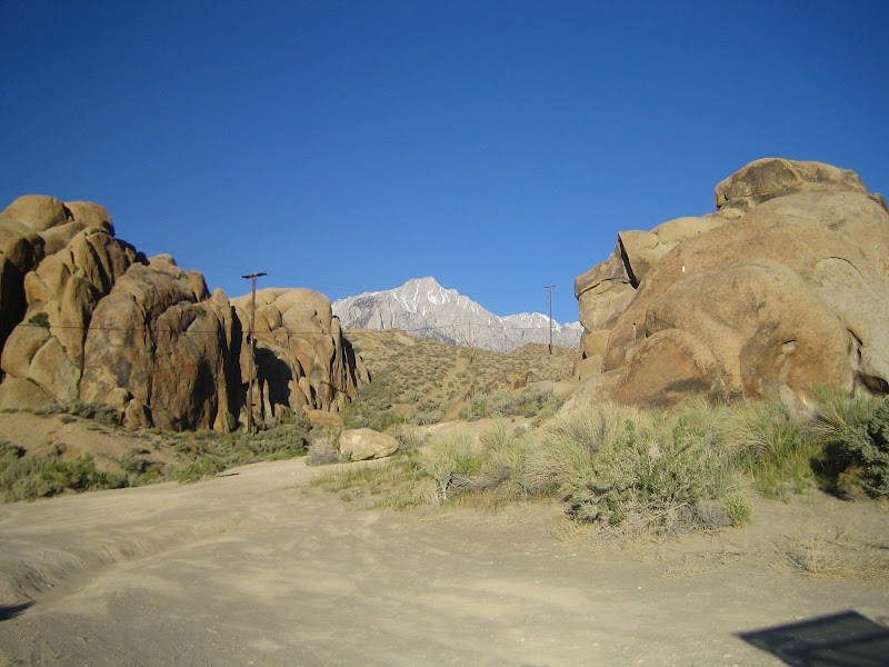
Day 6 – Morning in Alabama Hills
We drove across the southern end of the range on the late afternoon/evening of Day 5 and set up a camp in the Alabama Hills with a great view towards Mt. Whitney. Slept out under the stars in the desert – was one of the best nights of sleep I have gotten in a long time!
Some shots of the Alabama Hills in the morning (with Mt. Williamson) – in the light of a near full moon, it was like Mars.
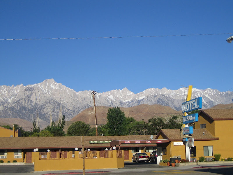
Obligatory Whitney Shot:
All in all, it was an outstanding trip. We got some long slogging days of skinning, some great ski descents, really fun snow and great weather. Geoff was a great guide, Nori was a machine on the skin track and Dostie provided endless hours of entertainment in the mid with his abundance of red-flag items.
Although we had to turn around, I was pleased with our group decision. It was good to avoid the heuristic trap of “summit fever” in the face of turning around a 6-day trans-Sierra traverse. The warning signs were clear – whoomping, settlement, new snow, bad layers and bad test results – and we followed our gut.
Will have to do it next year and make it across!
-
05-21-2009, 01:17 PM #6
Registered User
- Join Date
- May 2005
- Location
- mlca
- Posts
- 1,591
BAD ASS trip. Solid work
-
05-21-2009, 01:18 PM #7
 Brick Lotion
- Join Date
- Oct 2003
- Location
- Near Perimetr.
- Posts
- 3,857
That is some big backpack tourfest right there...
Amazing looking terrain there.
The floggings will continue until morale improves.
-
05-21-2009, 01:27 PM #8
 Registered User

- Join Date
- Oct 2006
- Posts
- 227
sweet photos, and the snow there looks so...... white
-
05-21-2009, 01:44 PM #9
 rootabreaka
- Join Date
- May 2004
- Location
- Santa Barbara
- Posts
- 993
Hell yeah! Looked like a ton of fun.
-
05-21-2009, 01:45 PM #10
 Die Living
- Join Date
- Oct 2007
- Location
- Summer: US & UK, Winter: Canada
- Posts
- 368
The way it should be done.
-
05-21-2009, 02:31 PM #11
 Registered User
- Join Date
- Jan 2008
- Location
- Paper St. Soap Co.
- Posts
- 3,616
nice stuff.
-
05-21-2009, 02:39 PM #12
 Not on IR. For now.
- Join Date
- Jun 2006
- Location
- Couloirfornia
- Posts
- 8,874
FINALLY!!!
(Now I gotta go back and read it... )
)
Edit: Done. Great stuff!Last edited by SCUTSKI; 05-21-2009 at 03:00 PM.
 Originally Posted by Ernest_Hemingway

-
05-21-2009, 03:02 PM #13
 Registered User
- Join Date
- Oct 2003
- Location
- WI
- Posts
- 4,425
Very Nice. Though I'm a little disappointed there were not obligatory pictures of someone pointing.
-
05-21-2009, 03:04 PM #14
 Win-win
- Join Date
- Nov 2007
- Location
- San Jose Cuervo
- Posts
- 747
wow, thanks for putting this together. been thinking about doing this trip myself at some point..
I will have to try some of this Hazelnut Crème stuff.
-
05-21-2009, 03:15 PM #15
 Registered User
- Join Date
- Jan 2006
- Location
- Alpine Meadows, CA
- Posts
- 4,461
Truly an epic TR. Nice job UCL.
**
I'm a cougar, not a MILF! I have to protect my rep! - bklyn
In any case, if you're ever really in this situation make sure you at least bargain in a couple of fluffers.
-snowsprite
-
05-21-2009, 03:31 PM #16
 defines PSIA level 11
- Join Date
- Nov 2005
- Location
- Redwood City and Alpine Meadows, CA
- Posts
- 8,276
Puts the "F" in FKNA.
Nicely played, sir.not counting days 2016-17
-
05-21-2009, 03:33 PM #17
 Registered Abuser
- Join Date
- Jul 2007
- Location
- 93108
- Posts
- 2,856
Great looking trip.
-
05-21-2009, 05:10 PM #18
 our science is tight
- Join Date
- Nov 2004
- Location
- Lyon
- Posts
- 2,103
NICE!
Good to see Geoff on here, he was my Avy 1 instructor at the Kirkwood course a little while back..
-
05-21-2009, 05:54 PM #19
 That's like, your opinion
- Join Date
- Oct 2008
- Location
- JH
- Posts
- 468
Looks incredible. Need to get over there. . .
-
05-21-2009, 06:36 PM #20
 Don't Panic
- Join Date
- Jun 2006
- Location
- Ventura Highway in the Sunshine
- Posts
- 22,445
You didn't use your gut to make decisions, you used your head, and made some very wise decisions. The signs said don't do it, and you didn't. Very smart.
Excellent TR, thanks for putting that up.
I agree it is a constitutional right for Americans to be assholes...its just too bad that so many take the opportunity...iscariot
-
05-21-2009, 06:43 PM #21
 First Chair. Last Call.


- Join Date
- Aug 2008
- Location
- Eastside Til I Die
- Posts
- 2,236
Holy FKNA TR!

Nicely done man.((. The joy I get from skiing...
.))
((. That's worth living for.
.))
-
05-21-2009, 09:04 PM #22
 it's true, my name sucks
- Join Date
- Jan 2007
- Posts
- 586
I like this pitcher
Originally Posted by Unfrozen Caveman Lawyer
-
05-21-2009, 09:08 PM #23
 Me encanta el país alto
- Join Date
- Dec 2005
- Location
- 山
- Posts
- 16,736
Now that was a trip report. Cool.
-
05-22-2009, 10:47 AM #24
Because I'm a caveman....
- Join Date
- Oct 2008
- Location
- NorCal
- Posts
- 2,569
Actually, I am pretty sure I have some of those floating around.... Originally Posted by Grange
-
05-22-2009, 02:00 PM #25
custom user title?
- Join Date
- Oct 2005
- Location
- gone
- Posts
- 1,134
way to go!
freak~[ &
& ]
]


 Reply With Quote
Bookmarks