
Well with all the stoke comming from adimmen I was jonesing to get out and make up for the brutal rock thrashing that I took my board through earlier this year. I decided to go take a look around as I had a few ideas in mind. My first idea was to go up to take a look at the stanley headwall as it's easily viewable from the road, it was not the best looking but some lines seemed to be on the verge of filled in. So we (my brother and I) decided to get a closer look. once we got up above the trees we decided our options were limited and the lines we were hoping for weren't quite filled in.
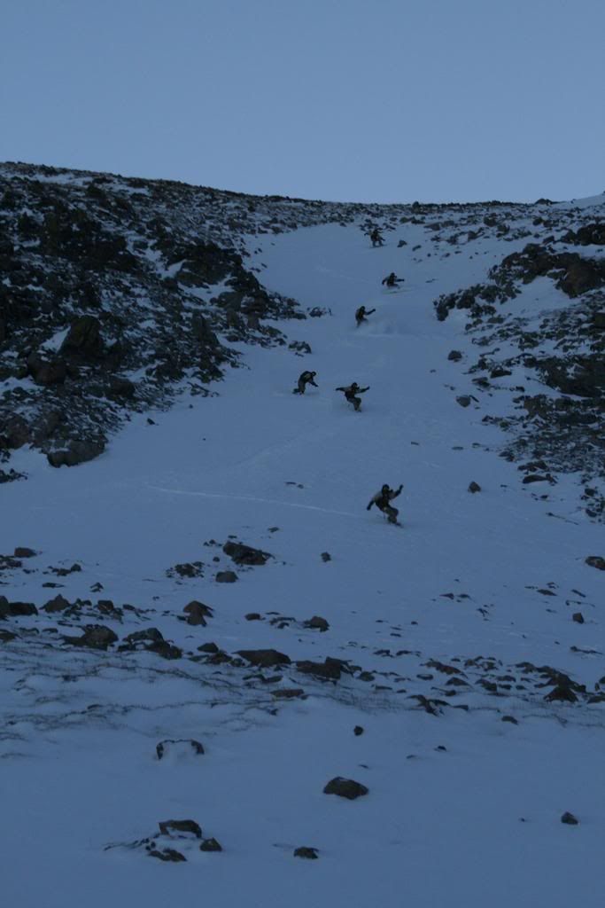
So we took what we could get and went for these:
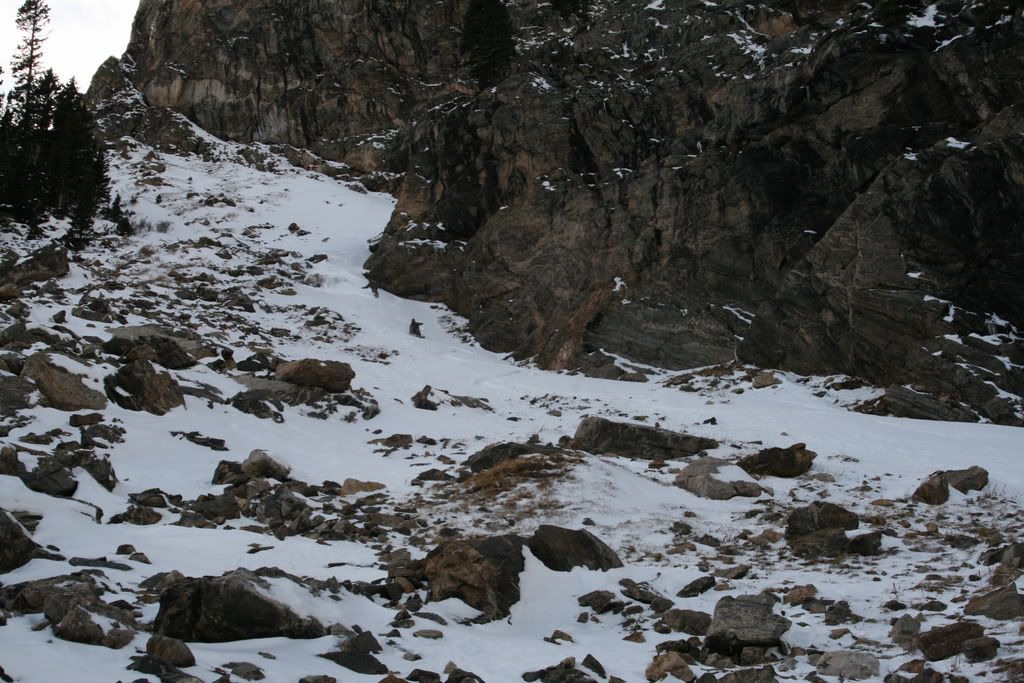
My brother (in the pic) got the one directly above him and I got the one on the right.
It was interesting I will just say that, the pitch was fairly steep (30-35* im guessing) and we were struggeling to move and especially turn.
My run was like ski cuts it seemed. My brother did a little better :
Our rock boards were so thrashed is was like a waste of time. So we walked back out, not that there was enough coverage to do otherwise.
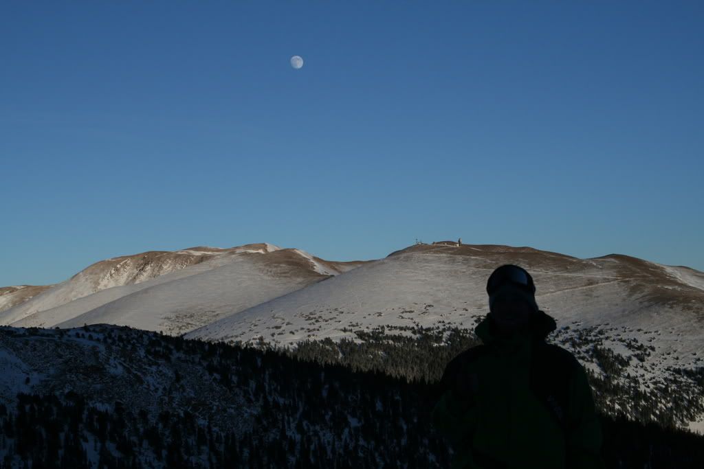
Parting shot:
BETA:
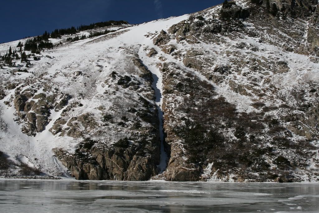
maybe a couple more storms and this might look better.
Well yesterday I went and bought some P-Tex and started work on the board, I used almost 4 sticks just fixing the core shots and really bad edge scratches. It was scary riding with that thing, when you tried to turn it acted like you had sand paper on the bottom and tried to throw you over and catch your edge. Once I got the major P-Texing done I gave her a quick wax.
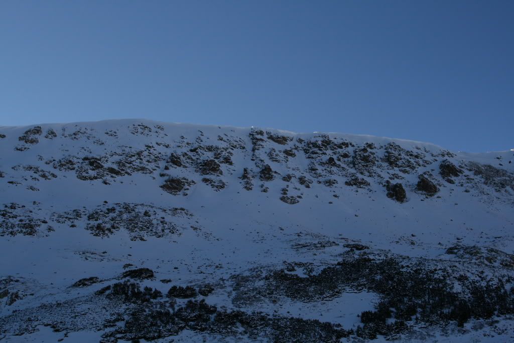
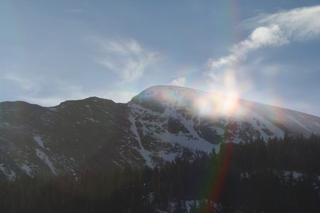
So today I woke up fairly early and made an attempt on James. I was hoping it might be filled in a bit as there is usually a bit of wind moving snow around up there. Hiking up towards st. mary's glacier I saw this:
I think once we get a couple move storms that line might be sick but if you wait too long it will get burried for the most part.
So we are hiking up the glacier (my friend nathan and I)and there are all these ice wave type things to negotiate all over the place not to mention the wind was howling. I was hiking and this big gust of wind caught me off guard and blew me backwards. My foot slipped on an ice wave and slid into the trough of the wave sideways as the wind continued to blow me backwards. My foot remained sideways but caught traction which forced my weight to buckle my knee as I fell back on it like some messed up skateboarding accident. I quickly got my weight off it and lied mostly face down for a min. or two untill I felt good enough to move it and eventually sit up. I then walked on it a bit but decided since we were only 2/3 up the glacier and I would have to ride james and then hike back out and ride back down the mess of a glacier that I might not make it with out jeapordizing my whistler trip this x-mas (might have anyway). So as hard as it was we decided to bail. I rode down the glacier with out bad pain through some kinda tight low angle shots. Some drifting has occured but mostly wind buff and ice was the case.
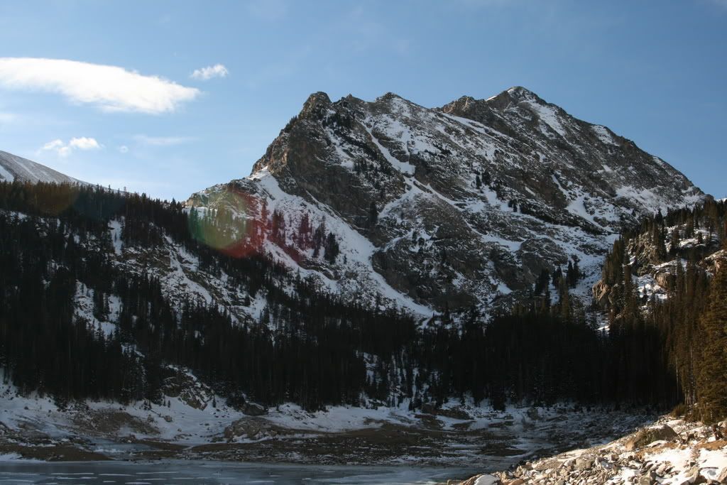
On the way out I was bumming so we decided to do a little exploring as we still had the good portion of the day left. There is a peak that I have seen a bunch of times now on the way up to the glacier and I have always wondered about access. I know there is a private road that goes towards it so I got ballsy and decided to drive up it. Apparently the road is not private but it crosses 3 miles of private land to get to some resovoirs and trails.
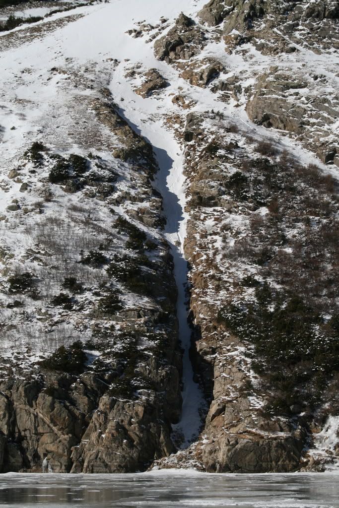
The road was a bit rough in places for a suburu sedan but I only scraped minimally and nothing critical. The drifts were also a little deep for the car but with a couple attempts I got through all of them. I was so excited to be checking this out and we just kept pushing on and pushing on. Eventually there was a split and we went right. After a while we ended up here:
Wow I never expected that!
I wonder where the other fork goes ?
Probly here:
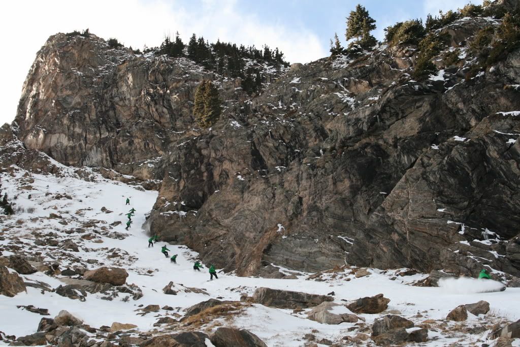
I was so excited we decided to take a walk and see what was to be had hopefully get some beta pics. We decided to bring the boards just in case.
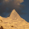
on the way up higher we found this and decided it was up to par since we both had slightly bum knees:
I went first and made it through nicely linking all my turns and not hitting rocks, the snow was pretty soft compared to what we rode on st. mary's but a bit buffed.
My friend nathan went next and str8 lined through the end of the choke:
Pretty good day all in all besides injuring myself, the riding didn't hurt much atleast, that's probly a good sign but I'm still gonna take it easy for a couple weeks atleast.
Can anyone guess or tell me where these last few shots were taken and any beta to where the left fork of the road goes? I have an idea of what peak it was but I want to see if it's super obvious.
Oh and there was a pretty filled in gully east across the valley from the peak we rode on. maybe 1000 vert or so and good coverage consistent width of maybe 15-25 feet. somewhat steep and probly less then 2 miles from where you park. unfortunately the shots didn't show up on the memory card so you might just have to go see if for yourself.
Results 1 to 10 of 10
-
11-25-2007, 09:54 PM #1
 Hated far and wide
- Join Date
- Mar 2007
- Location
- evergreen
- Posts
- 239
Front Range Tr. 11.22.07 & 11.25.07
-
11-26-2007, 08:32 AM #2
Hated far and wide
- Join Date
- Mar 2007
- Location
- evergreen
- Posts
- 239
well no replies so far. Bump for current conditions. Also the last mountain we were on was NEVA Im pretty sure.
-
11-26-2007, 08:41 AM #3
 Princess of Powder
- Join Date
- Nov 2002
- Location
- Cloud City
- Posts
- 9,148
Thanks for posting pics.
Live each season as it passes; breathe the air, drink the drink, taste the fruit, and resign yourself to the influences of each.
Henry David Thoreau
-
11-26-2007, 08:51 AM #4
 wooooooohoooooooooooooo
- Join Date
- Dec 2003
- Location
- funland
- Posts
- 5,255
This looks like a really sweet spot regardless of the season and conditions.
-
11-26-2007, 09:26 AM #5
 is back at it
- Join Date
- May 2004
- Location
- Colorado
- Posts
- 5,917
Thanks for the beta
"Can't vouch for him, though he seems normal via email."
-
11-26-2007, 09:31 AM #6
 Denverd
- Join Date
- Oct 2007
- Location
- working or playing
- Posts
- 1,720
The mountain you see south from James is Bancroft. I was looking at a couple cool looking lines down the north face of it when I went up there several weeks ago. There are a couple of good TRs here I found when I searched Bancroft, but most people just ride down to the East towards Loch Lomond (not the couloirs down the north side). I watched a buddy ski that little coulouir next to St. Mary's Lake a long time ago. It's pretty narrow--he took the elevator most of the way down. Judging by your pic it looks like someone's already done it this year!
be careful with that knee, dorking around on St Mary's is not worth spoiling a whistler trip!The killer awoke before dawn.
He put his boots on.
-
11-26-2007, 09:40 AM #7
Hated far and wide
- Join Date
- Mar 2007
- Location
- evergreen
- Posts
- 239
yea I deffinately have to take it easy on the knee, I might not get out again untill whistler. Hopefully all will be well. it's ironic though cause I had reminded myself that it's not worth blowing the up comming trip and to take it easy. Little did I know a little ice and some gusty wind would get the best of me.
 it is still pretty sore today and im not sure of the extent of the damage but with no insurance im just gonna have to suck it up.
oh and that really skinny chute had been climbed but not skiied, as it get's really skinny(too skinny to turn probly) and there is a dry runout.
-
11-26-2007, 11:03 AM #8
 Think snow
- Join Date
- Oct 2006
- Location
- Zurich, Switzerland
- Posts
- 1,322
Thanks for the pics..... but yes we really need some snow!!!
-
11-26-2007, 11:31 AM #9
 You Rang
- Join Date
- Oct 2004
- Location
- Boulder, CO
- Posts
- 2,270
Nice TR.
I'd stay away from this one. Getting slid into a body of water is not cool.
-
11-27-2007, 08:00 PM #10
Hated far and wide
- Join Date
- Mar 2007
- Location
- evergreen
- Posts
- 239
Yea that seems like a no brainer, I would not hit that unless it had been really cold for a week or so and no slide potential.
Oh and I realized I fucked up it's not neva but EVA.
Also apon inspecting my copy of front range decents the other peak must be witter and yes the left fork of the road does go to that valley and ends at chinns lake. Anyone know what the skiing is like on witter? (the south side looks nice and steep and rocky)
the nice line I saw was probly on the south side of bancroft possibly near the saddle where it meets parry.

 Reply With Quote
Similar Threads
-
Front Range Cliff Jumping Spots?
By Dside11-11 in forum General Ski / Snowboard DiscussionReplies: 67Last Post: 05-28-2013, 10:20 AM -
Need front range help checking out a snowmobile
By funkendrenchman in forum General Ski / Snowboard DiscussionReplies: 7Last Post: 08-30-2006, 10:23 AM -
front range avy classes?
By Crinkle in forum TGR Forum ArchivesReplies: 6Last Post: 11-19-2003, 05:23 PM

Bookmarks