
Results 226 to 250 of 2427
Thread: SNOW IN THE PNW 2011/2012!
-
11-08-2011, 01:35 PM #226

 Registered User
- Join Date
- Jun 2010
- Location
- Powder Mountain
- Posts
- 841
Worth a try, but you could probably drop the "I work at BCE" if it fails and get in by the inherent radfactor Originally Posted by samthaman

-
11-08-2011, 02:56 PM #227
Registered User
- Join Date
- Nov 2006
- Location
- Bellingham
- Posts
- 740
For those in Bellingham that are looking for something to do before the 'Art of Flight' WWU showing on Thursday, Jessie Lu Galbraith, the Creative Director for frequency The Snowboarder's Journal will be doing a photo recap of the past ten years of frequency TSJ at the Bellingham REI. Thursday, 6-6:45. Free.
http://www.rei.com/event/31339/session/39152
-
11-08-2011, 11:28 PM #228
 Excitable Boy
- Join Date
- Dec 2005
- Location
- Seattle
- Posts
- 6,012
From the NWS forecast discussion today:
.LONG TERM...THE SYSTEM ON FRIDAY...DESPITE BEING WEAK...SETS UP A
PERSISTENT AND COOL NORTHWESTERLY FLOW ALOFT THAT LASTS AT LEAST
THROUGH TUESDAY. A SERIES OF WEATHER SYSTEMS WILL MOVE THROUGH THIS
NORTHWESTERLY FLOW. TIMING THE SYSTEMS AT THIS POINT IS PROBABLY
POINTLESS. HOWEVER SOME THINGS STAND OUT ABOUT THIS PATTERN.
ONE THING IS THAT TEMPERATURES WILL BE ON THE LOW SIDE. HIGHS MAY NOT
GET OUT OF THE 40S ON SOME OF THE DAYS. THE SNOW LEVEL WILL BEGIN
AROUND 5500 FEET ON FRIDAY AND FALL TO 2500 FEET BY THE END OF THE
PERIOD.
ANOTHER POINT IS THAT EACH WEATHER SYSTEM WILL BRING SOME WIND. THE
FORECASTS AND GRIDS ARE FULL OF BREEZY AND WINDY PERIODS...ESPECIALLY
OVER THE COAST AND NORTHERN SECTIONS...AND ALSO IN THE CASCADES.
THE FINAL POINT IS THAT SNOW WILL FALL IN THE MOUNTAINS THROUGH MUCH OF
THE PERIOD SATURDAY THROUGH TUESDAY. THERE MAY NOT BE ANY ONE PERIOD
WITH HEAVY SNOW...BUT EACH WEATHER SYSTEM WILL BRING SNOW...AND THE
MOIST NORTHWESTERLY FLOW WILL ENCOURAGE SNOWFALL WHETHER OR NOT THERE
IS A SHORT WAVE MOVING THROUGH IT. BY THE MIDDLE OF NEXT WEEK THE
CASCADES AND OLYMPICS SHOULD HAVE PLENTY OF SNOW...WITH LITTLE OR NO
PROSPECT OF IT MELTING UNTIL LATE SPRING. WILL ISSUE AN OUTLOOK TO
HIGHLIGHT ALL THESE WEATHER FACTORS. BURKE...Some will fall in love with life and drink it from a fountain that is pouring like an avalanche coming down the mountain...
"I enjoy skinny skiing, bullfights on acid..." - Lacy Underalls
The problems we face will not be solved by the minds that created them.
-
11-08-2011, 11:34 PM #229

 Don't take no jive.
- Join Date
- Oct 2003
- Location
- be here now
- Posts
- 5,371
Damn that gets me hot
-
11-08-2011, 11:47 PM #230
 thisisyourbrainonSONAR
- Join Date
- Oct 2003
- Location
- Everybody Knows This Is Nowhere
- Posts
- 6,587
Shitshitshit. Oh well, at least by the time I get there the base will be deeper than "rocks and shrubs".
Putting the "core" in corporate, one turn at a time.
Metalmücil 2010 - 2013 "Go Home" album is now a free download
The Bonin Petrels
-
11-09-2011, 12:15 AM #231
 Get it.

- Join Date
- Sep 2010
- Location
- Bellingham
- Posts
- 272
"A few feet by the end of the week" Quoted from noaa's special weather statement...
-
11-09-2011, 12:28 AM #232
 Bugs
Bugs
- Join Date
- Oct 2003
- Location
- Seattle
- Posts
- 27,372
I agree. Hall and Oates never sounded so good. Originally Posted by ck800
-
11-09-2011, 12:49 AM #233
 Registered User
- Join Date
- Sep 2009
- Location
- PNW -> MSO
- Posts
- 7,915
On another note... the skifishbum Stokefest plans are in the works. Maggot POV contest with rad prizes, and a good way to meet some fellow mountain folk.
See this post for most up-to-date overall scheme.
See this thread for PNW specifics.
It's an evolving thing so changes are likely. Disregard if you don't care.
/spamLast edited by Norseman; 11-09-2011 at 10:35 PM. Reason: NOAA link was evolving.
-
11-09-2011, 01:32 AM #234
Registered User
- Join Date
- Apr 2009
- Location
- NOYFB
- Posts
- 258
pure poetry right there Originally Posted by Chainsaw_Willie
-
11-09-2011, 09:07 AM #235
 born again skier
- Join Date
- Jul 2005
- Location
- PNWET
- Posts
- 4,747
It's here..............

-
11-09-2011, 03:03 PM #236
Registered User
- Join Date
- Dec 2010
- Location
- whitefish
- Posts
- 1,242
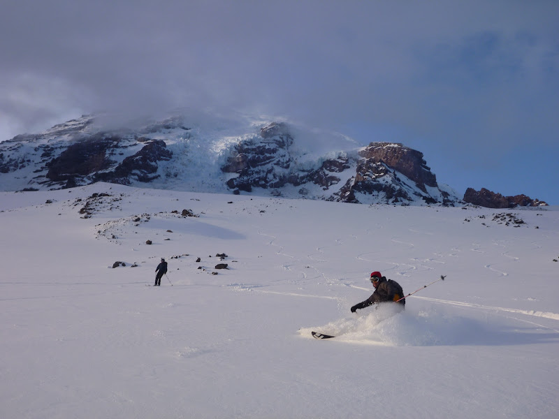
Hit a great weather/snow conditions window up at muir yesterday. Between pebble creek and 9.1k had 6-8" of fairly dry powder. Made for some for some reaaally smooth skiing.


-
11-09-2011, 03:15 PM #237
 registered peruser
- Join Date
- May 2009
- Location
- inpdx
- Posts
- 20,254
holy crap! i'm so jealous of you folks with the MRNP "season pass", especially gettin it midweek
nice photos!
-
11-10-2011, 01:05 AM #238
 Registered Lurker
- Join Date
- Oct 2006
- Location
- Bellevue
- Posts
- 7,449
I'm thinking of regluing my skis and going for a tour this weekend. Where should I go? I have no knowledge of where to tour around here other than around Baker and paradise, anyone want to tour? Do have gear and some avy knowledge.
-
11-10-2011, 06:29 AM #239
 Registered User
- Join Date
- Nov 2007
- Posts
- 144
Originally Posted by AlpenChronicHabitual
-
11-10-2011, 11:50 AM #240
 animal noise
- Join Date
- Dec 2002
- Location
- Uptown
- Posts
- 6,208
**this message censored by the antijinx squad**
Living vicariously through myself.
-
11-10-2011, 12:08 PM #241
 mere tourist
- Join Date
- Nov 2007
- Location
- Eburg
- Posts
- 13,243
Originally Posted by abraham

-
11-10-2011, 12:12 PM #242
 Pow Pow Lothario
- Join Date
- Aug 2008
- Location
- PNW
- Posts
- 1,633
well then, doesnt this mean this thread is due for a Jonesy trip-tastic photo collage? Originally Posted by jonesy
-
11-10-2011, 12:35 PM #243
Registered Lurker
- Join Date
- Oct 2006
- Location
- Bellevue
- Posts
- 7,449
I'm over using skins. Gluing my skis gives me none of the glide on the downhill once I get to the top! Originally Posted by Big Steve
I meant skins
-
11-10-2011, 08:12 PM #244
 usually hungry
- Join Date
- Aug 2006
- Location
- hamsterland
- Posts
- 711

Just a PSA/FYI about some depth hoar as the new snow rolls in this weekend. Reminder to stay safe even though it's early season. New batteries in the beacons, please!
http://www.turns-all-year.com/skiing...?topic=22220.0
-
11-10-2011, 09:16 PM #245
mere tourist
- Join Date
- Nov 2007
- Location
- Eburg
- Posts
- 13,243
Good call ikkin
-
11-11-2011, 09:15 AM #246
born again skier
- Join Date
- Jul 2005
- Location
- PNWET
- Posts
- 4,747
In time.......... Originally Posted by SeatownSlackey

-
11-11-2011, 10:07 AM #247
Registered User
- Join Date
- Jun 2010
- Location
- Powder Mountain
- Posts
- 841
I should've added that when I wrote up our story. There were large surface hoar crystals on almost all aspects above 5000' and lower on shaded north slopes. Crystals were on the order of 1/2" to 3/4" on shaded north slopes, and slightly smaller on ridges and southerly faces. The snowpack looked like and inch of hard rain crust as a base layer, 8-12in of dry, light, high quality snow, and then surface hoar. I would not be surprised if loading causes natural slides down to the crust layer. Be safe and watch out for terrain traps this weekend. Originally Posted by ikkin
-
11-11-2011, 11:36 AM #248
animal noise
- Join Date
- Dec 2002
- Location
- Uptown
- Posts
- 6,208
Possible Baker opening on Thursday. Stay tuned.
Living vicariously through myself.
-
11-11-2011, 12:05 PM #249
Registered User
- Join Date
- Jun 2006
- Location
- Seattle
- Posts
- 1,992
A newsletter I get, I take it with a grain of salt, put it together with about 5 other weather sites, and it helps validate my excitement level:
Powder Alert
issued 10:12pm Thursday
Dumpage to pile up in the Cascades
This is it. It's really going feel like fall and winter coming up. Blustery, wet and chilly. The weather pattern developing over the North Pacific is conducive to consistent snow accumulation for the Cascades. We are starting a 10 day (possibly more) period of cool & snowy weather. It will be chilly and rainy in the lowlands, but the snow will get deeper in the Cascades every day. There will be occasional dry sunny periods - but cool and wet (mountain snow) will be the character of the upcoming weather pattern.
I see a west northwesterly incoming flow, with one storm after another. Snow level will be low: 2000-3000ft. Expect 4-12" new by late Friday and more snow over the weekend and early next week. Snow level may occasionally bounce upward to 4000ft in the next week, but that will be brief. Overall snow levels will stay low. Next Tuesday and Wednesday show good snowfall with 1-2ft possible. In the next 7-10 days expect a minimum of 2-3ft , but 3-5ft or more is a good possibility.
If the computer weather models aren't too far off, expect the real possibility of some ski slopes opening before or near Thanksgiving weekend.
Get ready - the skiing and boarding will be here before you know it.
Let the 2011-2012 season begin!
Larry
Grand Pubah of Powder
-
11-11-2011, 12:27 PM #250
 Average on a good day
- Join Date
- Sep 2010
- Location
- WA
- Posts
- 1,131
Great reminder. I always think of "The Flett Incident" this time of year: http://mtnphil.com/ORock3/ORock3.html Originally Posted by ikkin


 Reply With Quote

Bookmarks